|
Mainstone
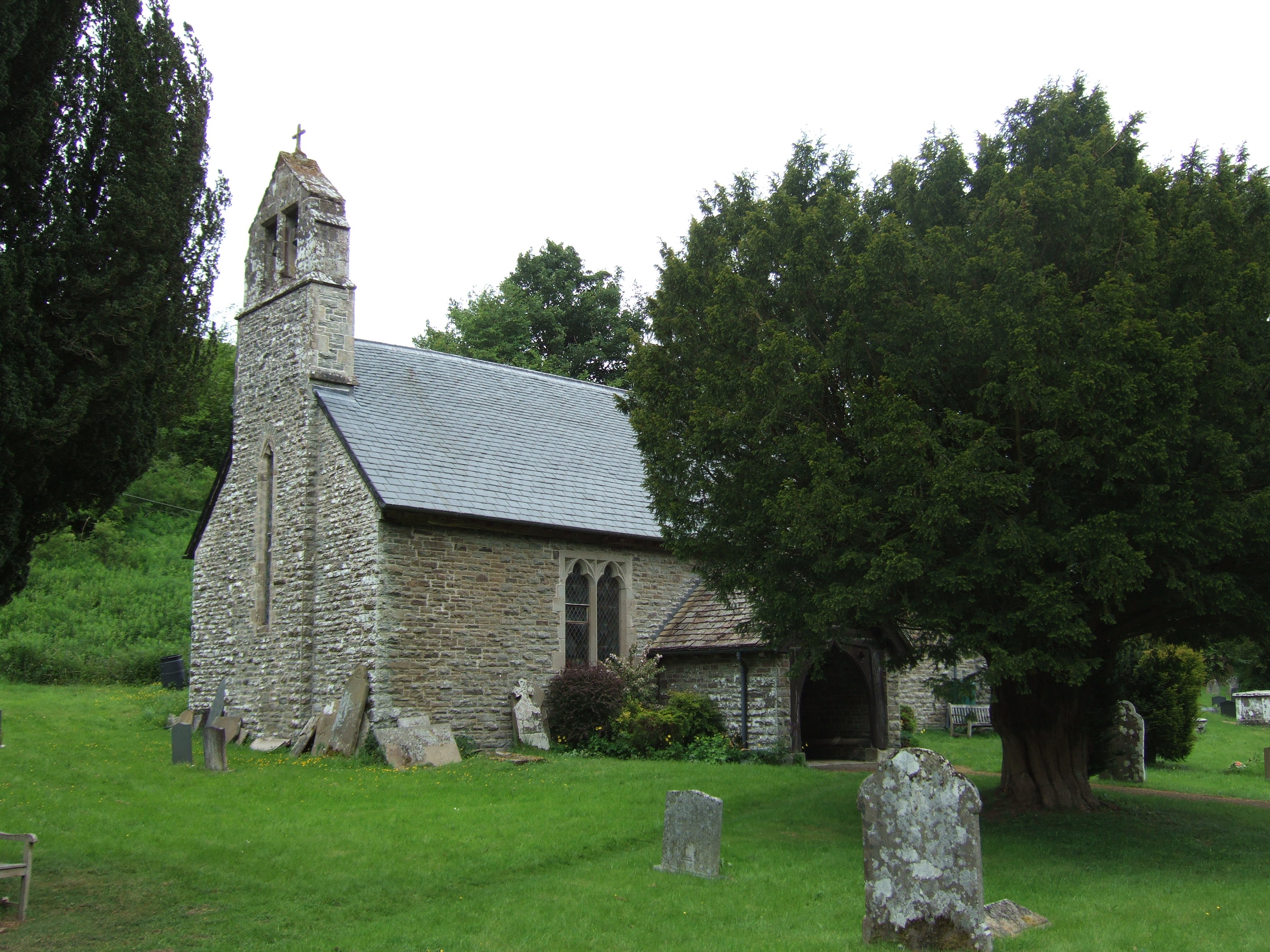
Mainstone is a small village and civil parish in southwest Shropshire, England, near the border with Powys, Wales. The village lies approximately 1 mile northwest of the small village of Cefn Einion. The market town of Bishop's Castle lies some 3 miles to the east, while the small town of Clun is about 5 miles away to the south. It lies in the Clun Forest, a large remote and very rural area which is semi-forested and rather hilly. The Church of England parish church, dedicated to St John the Baptist, lies in the hamlet of Churchtown (alternatively written as "Church Town") a mile west of Mainstone, though the village itself contains a Primitive Methodist chapel, built in 1892 and still in use in the mid-2000s.Mainstone Shropshire's Nonconformist Chapels The [...More Info...] [...Related Items...] OR: [Wikipedia] [Google] [Baidu] |
Listed Buildings In Mainstone
Mainstone is a civil parish in Shropshire, England. It contains nine listed buildings that are recorded in the National Heritage List for England The National Heritage List for England (NHLE) is England's official database of protected heritage assets. It includes details of all English listed buildings, scheduled monuments, register of historic parks and gardens, protected shipwrecks, a .... Of these, one is at Grade II*, the middle of the three grades, and the others are at Grade II, the lowest grade. The parish contains the small village of Mainstone and the surrounding countryside, and the listed buildings are scattered around the parish. Most of them are farmhouses and farm buildings, and the other listed buildings are a house, a church, and a memorial in the churchyard. __NOTOC__ Key Buildings References Citations Sources * * * * * * * * * * * {{DEFAULTSORT:Mainstone Lists of buildings and structures in Shropshire ... [...More Info...] [...Related Items...] OR: [Wikipedia] [Google] [Baidu] |
Cefn Einion
Cefn Einion is a dispersed hamlet in southwest Shropshire, England. It is located two miles southwest of the village of Colebatch, and lies between the small villages of Bryn and Mainstone. Cefn Einion in Welsh means Einion's Ridge; the name 'Einion' could refer to any of several Einions in recorded history. The nearest towns are Clun and Bishop's Castle Bishop's Castle is a market town in the south west of Shropshire, England. According to the 2011 Census it had a population of 1,893. Bishop's Castle is east of the Wales-England border, about north-west of Ludlow and about south-west of Sh ... (both small). The village lies at 280m above sea level. The minor River Unk runs to the west of the village. External links Hamlets in Shropshire {{Shropshire-geo-stub ... [...More Info...] [...Related Items...] OR: [Wikipedia] [Google] [Baidu] |
River Unk
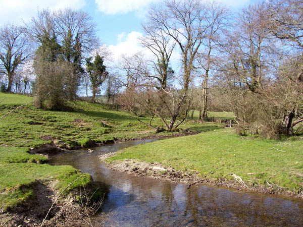
The River Unk is a small river in Shropshire, England that runs for before flowing into the River Clun. Course It rises close to the site of the Bronze Age cross dyke known as the Lower Short Ditch on the Shropshire - Powys border in the north of Clun Forest and flows in a generally easterly direction for around before turning southward near Lower Edenhope and heading past Mainstone, Cefn Einion, and Bicton for and joining the River Clun near the Castle in the town of Clun. Nature The river is one of the few remaining sites in the United Kingdom where freshwater pearl mussel The freshwater pearl mussel (''Margaritifera margaritifera'') is an endangered species of freshwater mussel, an aquatic bivalve mollusc in the family Margaritiferidae. Although the name "freshwater pearl mussel" is often used for this species, ...s are found. The Environment Agency has taken land next to the banks of the river to prevent cattle entering the water and silting up the riverbed. ... [...More Info...] [...Related Items...] OR: [Wikipedia] [Google] [Baidu] |
Clun
Clun ( cy, Colunwy) is a town in south west Shropshire, England, and the Shropshire Hills Area of Outstanding Natural Beauty. The 2011 census recorded 680 people living in the town.Combined populations for the two output areas covering the towan/ref> Research by the Campaign for the Protection of Rural England suggests that Clun is one of the most tranquil locations in England. History Clun takes its name from the river upon whose banks it stands. Deriving from the Welsh , it shares its very early Brythonic root with the two rivers Colne, in Lancashire and Essex, each of which has a town of the same name on its banks. Clun grew up around the site of an Anglo-Saxon church towards the end of the 7th century AD. However, in the surrounding area there was a scattered population at least as early as the Neolithic period, about 5000 years ago. Clun was on the historic drove road where flocks and herds were driven from Wales to the markets in the Midlands and London. At the time ... [...More Info...] [...Related Items...] OR: [Wikipedia] [Google] [Baidu] |
Primitive Methodist
The Primitive Methodist Church is a Methodist Methodism, also called the Methodist movement, is a group of historically related denominations of Protestant Christianity whose origins, doctrine and practice derive from the life and teachings of John Wesley. George Whitefield and John's ... Christian denomination with the holiness movement. It began in England in the early 19th century, with the influence of American evangelist Lorenzo Dow (1777–1834). In the United States, the Primitive Methodist Church had eighty-three parishes and 8,487 members in 1996. In Great Britain and Australia, the Primitive Methodist Church merged with other denominations, to form the Methodist Church of Great Britain in 1932 and the Methodist Church of Australasia in 1901. The latter subsequently merged into the Uniting Church in Australia in 1977. Beliefs The Primitive Methodist Church recognizes the dominical sacraments of Baptism and Holy Communion, as well as other Rite (Christianity), ri ... [...More Info...] [...Related Items...] OR: [Wikipedia] [Google] [Baidu] |
Church Of England
The Church of England (C of E) is the established Christian church in England and the mother church of the international Anglican Communion. It traces its history to the Christian church recorded as existing in the Roman province of Britain by the 3rd century and to the 6th-century Gregorian mission to Kent led by Augustine of Canterbury. The English church renounced papal authority in 1534 when Henry VIII failed to secure a papal annulment of his marriage to Catherine of Aragon. The English Reformation accelerated under Edward VI's regents, before a brief restoration of papal authority under Queen Mary I and King Philip. The Act of Supremacy 1558 renewed the breach, and the Elizabethan Settlement charted a course enabling the English church to describe itself as both Reformed and Catholic. In the earlier phase of the English Reformation there were both Roman Catholic martyrs and radical Protestant martyrs. The later phases saw the Penal Laws punis ... [...More Info...] [...Related Items...] OR: [Wikipedia] [Google] [Baidu] |
Above Sea Level
Height above mean sea level is a measure of the vertical distance ( height, elevation or altitude) of a location in reference to a historic mean sea level taken as a vertical datum. In geodesy, it is formalized as '' orthometric heights''. The combination of unit of measurement and the physical quantity (height) is called " metres above mean sea level" in the metric system, while in United States customary and imperial units it would be called "feet above mean sea level". Mean sea levels are affected by climate change and other factors and change over time. For this and other reasons, recorded measurements of elevation above sea level at a reference time in history might differ from the actual elevation of a given location over sea level at a given moment. Uses Metres above sea level is the standard measurement of the elevation or altitude of: * Geographic locations such as towns, mountains and other landmarks. * The top of buildings and other structures. * Flying ob ... [...More Info...] [...Related Items...] OR: [Wikipedia] [Google] [Baidu] |
Offa's Dyke Path
Offa's Dyke Path ( cy, Llwybr Clawdd Offa) is a long-distance footpath loosely following the Wales–England border. Officially opened on 10 July 1971, by Lord Hunt, it is one of Britain's National Trails and draws walkers from throughout the world. About of the route either follows, or keeps close company with, the remnants of Offa's Dyke, an earthwork traditionally thought to have been constructed in the late 8th century on the orders of King Offa of Mercia. Walking trail Traveling south to north, starting by the Severn Estuary at Sedbury, near Chepstow, and finishing at Prestatyn on the north coast, the walk will take an average walker roughly 12 days to complete. Roughly following the border in parts, and elsewhere the ancient monument of Offa's Dyke, as well as natural features such as the Hatterrall Ridge, the Dyke Path passes through a variety of landscapes. The route traces the eastern edge of the Black Mountains, traverses Clun Forest, the Eglwyseg moors no ... [...More Info...] [...Related Items...] OR: [Wikipedia] [Google] [Baidu] |
Shropshire Way
The Shropshire Way Main Route is a waymarked long distance footpath running through the English county of Shropshire. It runs around the interior of the county in two loops centred on Shrewsbury, with an additional spur to Whitchurch. The Main Route The Main Route South was launched in 2017. It is divided into Stages 1 to 9, 10a and 10b. The Main Route North was launched in September 2019; this has stages 11 to 15 (stage 12 includes the Whitchurch spur as an alternative ending). This is fully documented in the website of the Shropshire Way Association. Old waymarked route The route when marked on a map of the county used to loosely resemble a 'hangman's noose' with the rope dangling from the northern border of Shropshire at Grindley Brook. The route then runs south to Wem and then to Clive and Grinshill where the circular loop begins, taking you to Shrewsbury, then via Lyth Hill further south into the Shropshire Hills. Old additional loop In the Shropshire Hills Ar ... [...More Info...] [...Related Items...] OR: [Wikipedia] [Google] [Baidu] |
Offa's Dyke
Offa's Dyke ( cy, Clawdd Offa) is a large linear earthwork that roughly follows the border between England and Wales. The structure is named after Offa, the Anglo-Saxon king of Mercia from AD 757 until 796, who is traditionally believed to have ordered its construction. Although its precise original purpose is debated, it delineated the border between Anglian Mercia and the Welsh kingdom of Powys. The earthwork, which was up to wide (including its flanking ditch) and high, traversed low ground, hills and rivers. Today it is protected as a scheduled monument. Some of its route is followed by the Offa's Dyke Path, a long-distance footpath that runs between Liverpool Bay in the north and the Severn Estuary in the south. Although the Dyke has conventionally been dated to the Early Middle Ages of Anglo-Saxon England, research in recent decades – using techniques such as radioactive carbon dating – has challenged the conventional historiography and theories about the e ... [...More Info...] [...Related Items...] OR: [Wikipedia] [Google] [Baidu] |
Clun Forest
Clun Forest is a remote, rural area of open pastures, moorland and mixed deciduous/coniferous woodland in the southwest part of the English county of Shropshire and also just over the border into Powys, Wales. It was once a Royal hunting forest covering an area that stretched from Ludlow up the Clun Valley. Set aside for hunting in mediaeval times, these areas were not necessarily heavily wooded, though in today's landscape there are numerous small woods, such as Radnor Wood, together with larger areas of conifer plantations established by the Forestry Commission along the Wales–England border north of Anchor for example (the planted Ceri Forest), and to the north and southeast of Clun. The ancient Offa's Dyke runs north–south through the area (and can be walked by the Offa's Dyke Path). It gives its name to a deanery of the Church of England's Diocese of Hereford. Geology The Forest is underlain by a succession of mudstones, sandstones and siltstones of Silurian age. ... [...More Info...] [...Related Items...] OR: [Wikipedia] [Google] [Baidu] |
Churchtown Shropshire 2011
Churchtown may refer to: England * Churchtown, Cornwall * Churchtown, Cumbria, a United Kingdom location * Churchtown, Derbyshire, a United Kingdom location * Churchtown, Devon, a United Kingdom location * Churchtown, Lancashire * Churchtown, Lincolnshire, Belton, North Lincolnshire * Churchtown, Merseyside (historically in Lancashire) * Churchtown, Shropshire * Churchtown, Somerset Isle of Man * Churchtown, Isle of Man, a United Kingdom location Northern Ireland * Churchtown, County Tyrone, a townland in County Tyrone, Northern Ireland Republic of Ireland * Churchtown, County Cork * Churchtown, County Kildare, a civil parish of Ireland * Churchtown, County Westmeath (civil parish), a civil parish in the barony of Rathconrath] * Churchtown, County Wexford; see List of shipwrecks in February 1823 * Churchtown, Dublin * Churchtown, Kilmacnevan, a townland in the civil parish of Kilmacnevan, barony of Moygoish, County Westmeath * Churchtown, Rathconrath, a townland ... [...More Info...] [...Related Items...] OR: [Wikipedia] [Google] [Baidu] |


.jpg)


