|
Mahanoy City, Pennsylvania
Mahanoy City (pronounced MAHA-noy, also MA-noy locally) is a borough located southwest of Wilkes-Barre and 13 miles southwest of Hazleton, in northern Schuylkill County, Pennsylvania. It is part of the Coal Region of Pennsylvania and is located entirely within, but is not part of, Mahanoy Township. The name Mahanoy is believed to be a variation of the Native American word ''Maghonioy'', or "the salt deposits". History Mahanoy City, originally a part of Mahanoy township, was settled in 1859 and incorporated as a borough by decree of the Court of Quarter Sessions of Schuylkill County on December 16, 1863. It was served by branches of the Lehigh Valley and the Philadelphia & Reading railways. Mahanoy City lies in a valley in the Pennsylvania Coal Region and was a major center of anthracite production; the area was embroiled in the Molly Maguires incidents. In 2010, the borough erected the Molly Maguire Historic Park, which features a Zenos Frudakis statue of a hooded miner ... [...More Info...] [...Related Items...] OR: [Wikipedia] [Google] [Baidu] |
List Of Sovereign States
The following is a list providing an overview of sovereign states around the world with information on their status and recognition of their sovereignty. The 206 listed states can be divided into three categories based on membership within the United Nations System: 193 member states of the United Nations, UN member states, 2 United Nations General Assembly observers#Present non-member observers, UN General Assembly non-member observer states, and 11 other states. The ''sovereignty dispute'' column indicates states having undisputed sovereignty (188 states, of which there are 187 UN member states and 1 UN General Assembly non-member observer state), states having disputed sovereignty (16 states, of which there are 6 UN member states, 1 UN General Assembly non-member observer state, and 9 de facto states), and states having a political status of the Cook Islands and Niue, special political status (2 states, both in associated state, free association with New Zealand). Compi ... [...More Info...] [...Related Items...] OR: [Wikipedia] [Google] [Baidu] |
Molly Maguires
The Molly Maguires were an Irish 19th-century secret society active in Ireland, Liverpool and parts of the Eastern United States, best known for their activism among Irish-American and Irish immigrant coal miners in Pennsylvania. After a series of often violent conflicts, twenty suspected members of the Molly Maguires were convicted of murder and other crimes and were executed by hanging in 1877 and 1878. This history remains part of local Pennsylvania lore and the actual facts much debated among historians. In Ireland The Molly Maguires originated in Ireland, where secret societies with names such as Whiteboys and Peep o' Day Boys were common beginning in the 18th century and through most of the 19th century. In some areas the terms ''Ribbonmen'' and ''Molly Maguires'' were both used for similar activism but at different times. The main distinction between the two appears to be that the Ribbonmen were regarded as "secular, cosmopolitan, and protonationalist", with the Molly ... [...More Info...] [...Related Items...] OR: [Wikipedia] [Google] [Baidu] |
Tamaqua, Pennsylvania
Tamaqua (pronounced tuh-MAH-qwah, del, tëmakwe) is a borough in eastern Schuylkill County in the Coal Region of Pennsylvania, United States. It had a population of 6,934 as of the 2020 U.S. census. Tamaqua was established from territory from West Penn and Schuylkill Townships. The borough is part of the micropolitan statistical area of Pottsville. Tamaqua is located northwest of Allentown, northwest of Philadelphia, and west of New York City. History 18th century Tamaqua was settled in 1799 by Burkhardt (alternatively Berkhard) Moser, his son Jacob (born 1790) and John Kershner, who built shelters and a sawmill at the confluence of the Little Schuylkill River and Panther Creek, which is downtown Tamaqua today. According to property records, Moser had a partner named Houser, and together they owned 2,000 acres which Moser homesteaded. Moser built a log house at the base of Dutch Hill in 1801 for Mrs. Catherine Moser, who was the first adult to die and receive b ... [...More Info...] [...Related Items...] OR: [Wikipedia] [Google] [Baidu] |
Pennsylvania Route 309
Pennsylvania Route 309 (PA 309) is a state highway that runs for 134 miles (216 km) through eastern Pennsylvania. The route runs from an interchange between PA 611 and Cheltenham Avenue on the border of Philadelphia and Cheltenham Township north to an intersection with PA 29 in Bowman Creek, a village in Monroe Township in Wyoming County. The highway connects Philadelphia and its northern suburbs to Allentown and the Lehigh Valley, and Hazleton and Wilkes-Barre in the Wyoming Valley. PA 309 heads north from Philadelphia and becomes a freeway called the Fort Washington Expressway through suburban areas in Montgomery County, passing through Fort Washington, before becoming a surface road called Bethlehem Pike and running through Montgomeryville. In Bucks County, the route has a freeway section bypassing Sellersville before passing through Quakertown as a surface road. PA 309 then enters the Lehigh Valley, where it joins Interstate 78 (I-78) on a freeway bypassing ... [...More Info...] [...Related Items...] OR: [Wikipedia] [Google] [Baidu] |
Hometown, PA
Hometown is a village (a neighborhood, and now a census-designated place (CDP) once having a post office) in Rush Township, Schuylkill County, Pennsylvania, United States that sits astride a crossing point between important transportation corridors. The population was 1,399 at the 2000 census, and excepting for the area near the east–west PA 54 running mostly parallel to the tracks of the Reading, Blue Mountain, and Northern Railroad — once the important east-west shortline Nesquehoning & Mahanoy Railroad — and the PA 54 junction with PA 309. Geography Hometown is located at (40.822308, -75.983928). According to the United States Census Bureau, the CDP has a total area of , all land. Hometown is located north of Tamaqua and south of Hazleton at the intersections of Route 54 and 309. Hometown's elevation is above sea level. It uses the Tamaqua zip code of 18252. The oldest village in Rush Township, Hometown was founded by Messrs. Duncan of Philadelphia. The ... [...More Info...] [...Related Items...] OR: [Wikipedia] [Google] [Baidu] |
Barnesville, Pennsylvania
Barnesville is an unincorporated community in Ryan Township, Schuylkill County, Pennsylvania, United States. Originally built to support nearby rust belt industries, the hamlet is between the center and eastern thirds of the Southern Anthracite Coal Region. The community is part of a wide-ranging township and is situated atop a summit and drainage divide flanked by two long climbs that are traversed by local transport infrastructure, railways with an important switching junction within the village, and Pennsylvania Route 54, which collects towns like beads on a string along a particular combination of connected valleys in the Ridge-and-Valley Appalachians. John Faust, in 1806, first settled in Barnesville, followed by Abram L. Boughner who located near the same place in 1815.Munsell, W.W., History of Schuylkill County, McNamara, NY (1881), p. 344 This village owes its origin to the building of the Little Schuylkill and Susquehanna - Catawissa Railroad, which was completed in 1854 ... [...More Info...] [...Related Items...] OR: [Wikipedia] [Google] [Baidu] |
Susquehanna Valley
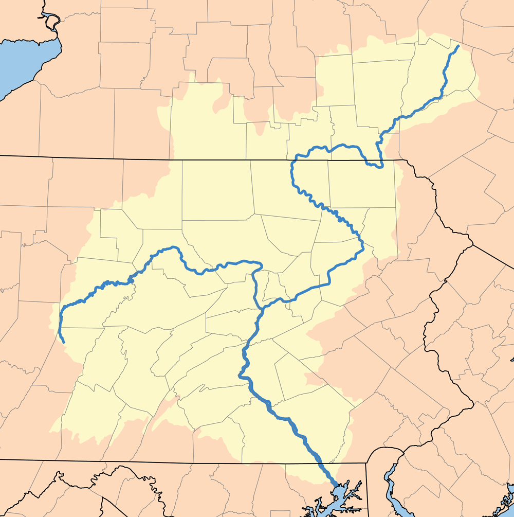
The Susquehanna Valley is a region of low-lying land that borders the Susquehanna River in the U.S. states of New York, Pennsylvania, and Maryland. The valley consists of areas that lie along the main branch of the river, which flows from Upstate New York through Pennsylvania and Maryland into the Chesapeake Bay, as well as areas that lie along the shorter West Branch in Pennsylvania. Communities in the valley Main Branch Cities * Oneonta, New York * Binghamton, New York * Wilkes-Barre, Pennsylvania * Scranton, Pennsylvania * Sunbury, Pennsylvania * Harrisburg, Pennsylvania * York, Pennsylvania * Havre de Grace, Maryland Counties * Otsego County, New York * Delaware County, New York * Chenango County, New York * Broome County, New York * Susquehanna County, Pennsylvania * Tioga County, New York * Bradford County, Pennsylvania * Wyoming County, Pennsylvania * Lackawanna County, Pennsylvania * Luzerne County, Pennsylvania * Columbia County, Pennsylvania * Mo ... [...More Info...] [...Related Items...] OR: [Wikipedia] [Google] [Baidu] |
Shenandoah, PA
Shenandoah is a borough in Schuylkill County in the Coal Region of Pennsylvania. It is distinct from Shenandoah Heights, which is part of West Mahanoy Township immediately to the north. As of 2021, the borough's population was 4,247. Shenandoah is located approximately northwest of Allentown, northwest of Philadelphia, and miles west of New York City. History The area that ultimately became Shenandoah was first settled by a farmer named Peter Kehley in 1835. Kehley cleared a patch of land at the center of the valley and built a log cabin and maintained his farm for about 20 years in total isolation. He sold his claim to the Philadelphia Land Company, which in anticipation of the opening of coal mines in the area, laid out the town in 1862. Booming growth occurred during the Civil War years caused by the development and opening of several anthracite coal mines. The area was incorporated as a borough in 1866 and was a famous hotbed of activity during the era of the Molly Mag ... [...More Info...] [...Related Items...] OR: [Wikipedia] [Google] [Baidu] |
PA 54
Pennsylvania Route 54 (PA 54) is a state highway which runs for in eastern Pennsylvania. It runs from U.S. Route 15 (US 15), which is three miles (5 km) west of Montgomery, Lycoming County, in the west, to US 209 in Nesquehoning, Carbon County, in the east. Route description Montgomery to Danville PA 54 begins at an intersection with US 15 in Clinton Township, Lycoming County, heading east on a two-lane undivided road. The road passes through farmland and woodland with homes as it passes to the south of Bald Eagle Mountain. The route curves southeast before it turns south and runs past businesses. PA 54 enters the borough of Montgomery and becomes Main Street, passing homes. The route passes through the downtown area of Montgomery before it turns northeast onto Montgomery Street, running between residences and businesses to the northwest and Norfolk Southern's Buffalo Line to the southeast. PA 54 comes to an intersection with PA 405, which continues northea ... [...More Info...] [...Related Items...] OR: [Wikipedia] [Google] [Baidu] |
United States Census Bureau
The United States Census Bureau (USCB), officially the Bureau of the Census, is a principal agency of the U.S. Federal Statistical System, responsible for producing data about the American people and economy. The Census Bureau is part of the U.S. Department of Commerce and its director is appointed by the President of the United States. The Census Bureau's primary mission is conducting the U.S. census every ten years, which allocates the seats of the U.S. House of Representatives to the states based on their population. The bureau's various censuses and surveys help allocate over $675 billion in federal funds every year and it assists states, local communities, and businesses make informed decisions. The information provided by the census informs decisions on where to build and maintain schools, hospitals, transportation infrastructure, and police and fire departments. In addition to the decennial census, the Census Bureau continually conducts over 130 surveys and p ... [...More Info...] [...Related Items...] OR: [Wikipedia] [Google] [Baidu] |
Cable TV
Cable television is a system of delivering television programming to consumers via radio frequency (RF) signals transmitted through coaxial cables, or in more recent systems, light pulses through fibre-optic cables. This contrasts with broadcast television (also known as terrestrial television), in which the television signal is transmitted over-the-air by radio waves and received by a television antenna attached to the television; or satellite television, in which the television signal is transmitted over-the-air by radio waves from a communications satellite orbiting the Earth, and received by a satellite dish antenna on the roof. FM radio programming, high-speed Internet, telephone services, and similar non-television services may also be provided through these cables. Analog television was standard in the 20th century, but since the 2000s, cable systems have been upgraded to digital cable operation. A "cable channel" (sometimes known as a "cable network") is a telev ... [...More Info...] [...Related Items...] OR: [Wikipedia] [Google] [Baidu] |
Fire Clay
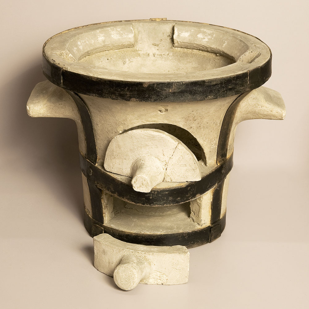
Fire clay is a range of refractory clays used in the manufacture of ceramics, especially fire brick. The United States Environmental Protection Agency defines fire clay very generally as a "mineral aggregate composed of hydrous silicates of aluminium (Al2O3·2SiO2·2H2O) with or without free silica." Properties High-grade fire clays can withstand temperatures of 1,775 °C (3,227 °F), but to be referred to as a "fire clay" the material must withstand a minimum temperature of .Minerals Zone, World Mineral Exchange. Retrieved 2011-6-23. Fire clays range from '' flint clays'' to ''plastic fire clays'', but there are ''semi-flint'' and ''semi-plastic'' fire clays as well. Fire clays consist of natural [...More Info...] [...Related Items...] OR: [Wikipedia] [Google] [Baidu] |


