|
Mack Island (Svalbard)
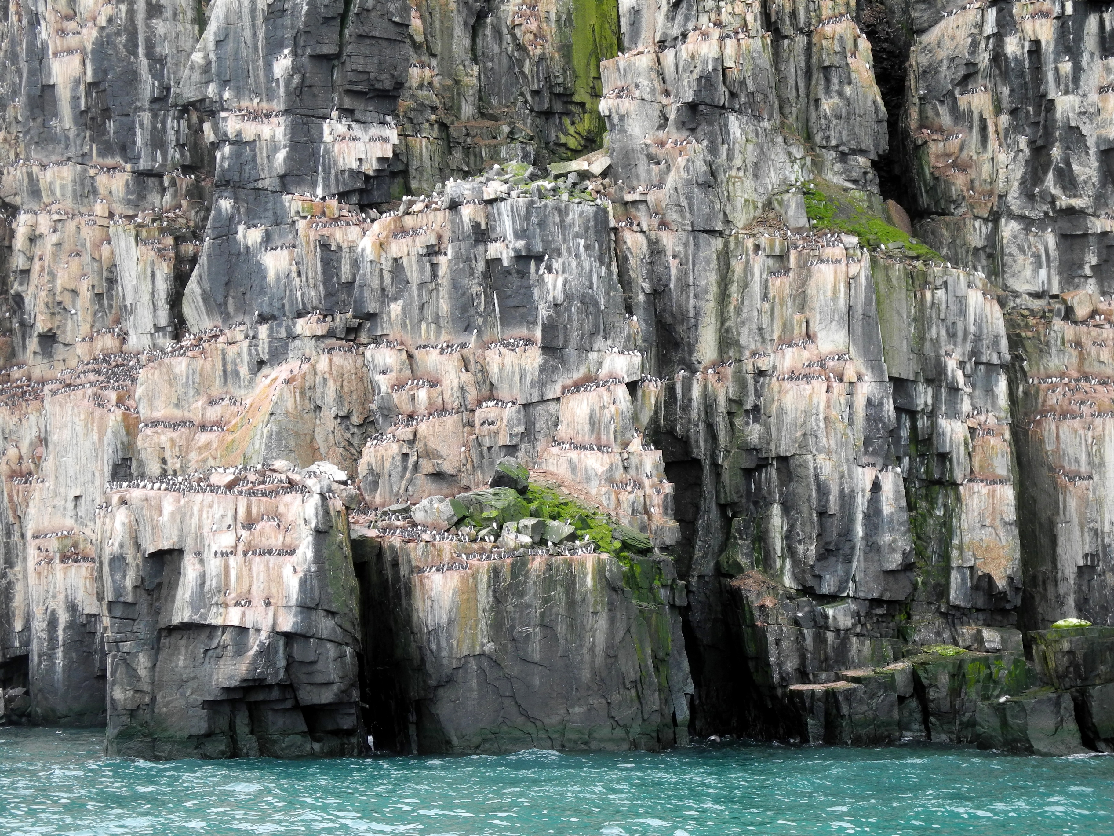
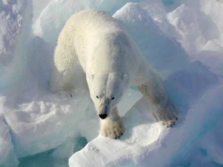
Mack Island ( no, Mackøya) is a small island in Hinlopen Strait. It is part of the Rønnbeck Islands in the Svalbard archipelago. It lies east of Cape Weyprecht on Spitsbergen. The island is a low basalt cliff and its highest point is above sea level. The closest neighboring islands are Torkildsen Island about to the east and Isaksen Island about to the north. The wildlife consists largely of polar bears. The island was discovered in 1867 by the Swedish-Norwegian polar explorer Nils Fredrik Rønnbeck Nils Fredrik Røn(n)beck ( sv, Rönnbäck, March 22, 1820 – January 4, 1891) was a Swedish-Norwegian polar skipper and ice pilot. He discovered Franz Josef Land in 1865. Life Rønnbeck was born Nils Johansson Söderlund in Storön in Kalix, in .... The Rønnbeck Islands are named after Norwegian seal hunters, and this one is named after the Norwegian sealing captain Fridrich "Fritz" Christian Mack (1836–1876), who also made several important discoveries in the Arctic. ... [...More Info...] [...Related Items...] OR: [Wikipedia] [Google] [Baidu] |
Hinlopen Strait
The Hinlopen Strait ( no, Hinlopenstretet) is the strait between Spitsbergen and Nordaustlandet in Svalbard, Norway. It is long and wide. The strait is difficult to pass because of pack ice. It is believed to have been named after Thijmen Jacobsz Hinlopen. The northern part of the strait is called Nordporten, between Storsteinhalvøya and Mosselhalvøya. The southern part, called Sørporten, widens up between Bråsvellbreen and the Bastian Islands The Bastian Islands ( no, Bastianøyane) are a group of islands in Hinlopen Strait, Svalbard. The islands are located southeast of Wilhelm Island Wilhelm Island ( no, Wilhelmøya) is an island in the Svalbard archipelago. It is situated northeast .... References External links * http://www.caplex.no/Web/ArticleView.aspx?id=9314679 (Norwegian) Hinlopen Strait's wildlife Straits of Svalbard {{svalbard-geo-stub ... [...More Info...] [...Related Items...] OR: [Wikipedia] [Google] [Baidu] |
Rønnbeck Islands
The Rønnbeck Islands ( no, Rønnbeckøyane) are a group of islands in Hinlopen Strait, Svalbard. They are located south of the Bastian Islands, southeast of Wilhelm Island. The islands are named after Norwegian sailor and seal hunter Nils Fredrik Rønnbeck Nils Fredrik Røn(n)beck ( sv, Rönnbäck, March 22, 1820 – January 4, 1891) was a Swedish-Norwegian polar skipper and ice pilot. He discovered Franz Josef Land in 1865. Life Rønnbeck was born Nils Johansson Söderlund in Storön in Kalix, in .... References Islands of Svalbard {{svalbard-geo-stub ... [...More Info...] [...Related Items...] OR: [Wikipedia] [Google] [Baidu] |
Svalbard
Svalbard ( , ), also known as Spitsbergen, or Spitzbergen, is a Norwegian archipelago in the Arctic Ocean. North of mainland Europe, it is about midway between the northern coast of Norway and the North Pole. The islands of the group range from 74° to 81° north latitude, and from 10° to 35° east longitude. The largest island is Spitsbergen, followed by Nordaustlandet and . The largest settlement is Longyearbyen. The islands were first used as a base by the whalers who sailed far north in the 17th and 18th centuries, after which they were abandoned. Coal mining started at the beginning of the 20th century, and several permanent communities were established. The Svalbard Treaty of 1920 recognizes Norwegian sovereignty, and the 1925 Svalbard Act made Svalbard a full part of the Kingdom of Norway. They also established Svalbard as a free economic zone and a demilitarized zone. The Norwegian Store Norske and the Russian remain the only mining companies in place. Res ... [...More Info...] [...Related Items...] OR: [Wikipedia] [Google] [Baidu] |
Cape Weyprecht
Cape WeyprechtConway, William Martin. 1897. ''The First Crossing of Spitsbergen''. London: J.M. Dent & Company, p. 288. ( no, Kapp Weyprecht) is a headland in the northeast part of Spitsbergen in Svalbard, in the area known as Olav V Land. The cape is named after Karl Weyprecht, an Austro-Hungarian officer and polar explorer. Together with Julius von Payer, he led the Austro-Hungarian North Pole Expedition that discovered Franz Josef Land in 1873. Weyprecht himself was never on Svalbard. About east of Cape Weyprecht lie Mack Island, Torkildsen Island, and Isaksen Island, all part of the Rønnbeck Islands The Rønnbeck Islands ( no, Rønnbeckøyane) are a group of islands in Hinlopen Strait, Svalbard. They are located south of the Bastian Islands, southeast of Wilhelm Island. The islands are named after Norwegian sailor and seal hunter Nils Fredrik .... References Headlands of Spitsbergen {{Spitsbergen-geo-stub ... [...More Info...] [...Related Items...] OR: [Wikipedia] [Google] [Baidu] |
Spitsbergen
Spitsbergen (; formerly known as West Spitsbergen; Norwegian: ''Vest Spitsbergen'' or ''Vestspitsbergen'' , also sometimes spelled Spitzbergen) is the largest and the only permanently populated island of the Svalbard archipelago in northern Norway. Constituting the westernmost bulk of the archipelago, it borders the Arctic Ocean, the Norwegian Sea, and the Greenland Sea. Spitsbergen covers an area of , making it the largest island in Norway and the 36th-largest in the world. The administrative centre is Longyearbyen. Other settlements, in addition to research outposts, are the Russian mining community of Barentsburg, the research community of Ny-Ålesund, and the mining outpost of Sveagruva. Spitsbergen was covered in of ice in 1999, which was approximately 58.5% of the island's total area. The island was first used as a whaling base in the 17th and 18th centuries, after which it was abandoned. Coal mining started at the end of the 19th century, and several permanent commun ... [...More Info...] [...Related Items...] OR: [Wikipedia] [Google] [Baidu] |
Torkildsen Island
Torkildsen Island ( no, Torkildsenøya) is a small island in Hinlopen Strait. It is part of the Rønnbeck Islands in the Svalbard archipelago. It lies east of Cape Weyprecht on Spitsbergen. The island is a low basalt cliff and its highest point is above sea level. It is elongated and consists of four parts. At its east and west ends there are two small peninsulas. The central part of the island itself is divided into two parts by a narrow area, probably a sandbank like that at Kiepert Island in the nearby Bastian Islands. The closest neighboring islands are Mack Island about to the west and Isaksen Island about to the northwest. The wildlife consists largely of polar bears. The island was discovered in 1867 by the Swedish-Norwegian polar explorer Nils Fredrik Rønnbeck Nils Fredrik Røn(n)beck ( sv, Rönnbäck, March 22, 1820 – January 4, 1891) was a Swedish-Norwegian polar skipper and ice pilot. He discovered Franz Josef Land in 1865. Life Rønnbeck was born Nils Joh ... [...More Info...] [...Related Items...] OR: [Wikipedia] [Google] [Baidu] |
Isaksen Island
Isaksen Island ( no, Isaksenøya) is a small island in Hinlopen Strait. It is part of the Rønnbeck Islands in the Svalbard archipelago. It lies east of Cape Weyprecht on Spitsbergen. The island is a low basalt cliff and its highest point does not exceed above sea level. The closest neighboring islands are Torkildsen Island about to the southeast and Mack Island about to the south. The wildlife consists largely of polar bears. The island was discovered in 1867 by the Swedish-Norwegian polar explorer Nils Fredrik Rønnbeck Nils Fredrik Røn(n)beck ( sv, Rönnbäck, March 22, 1820 – January 4, 1891) was a Swedish-Norwegian polar skipper and ice pilot. He discovered Franz Josef Land in 1865. Life Rønnbeck was born Nils Johansson Söderlund in Storön in Kalix, in .... The island is named after the Norwegian skipper and ice-pilot Isak Nils Isaksen (1842–1920), who participated in several scientific expeditions in the Arctic.Ericsson, Christoffer H., & Nils-Erik Raurala. ... [...More Info...] [...Related Items...] OR: [Wikipedia] [Google] [Baidu] |
Polar Bears
The polar bear (''Ursus maritimus'') is a hypercarnivorous bear whose native range lies largely within the Arctic Circle, encompassing the Arctic Ocean, its surrounding seas and surrounding land masses. It is the largest extant bear species, as well as the largest extant land carnivore. A boar (adult male) weighs around , while a sow (adult female) is about half that size. Although it is the sister species of the brown bear, it has evolved to occupy a narrower ecological niche, with many body characteristics adapted for cold temperatures, for moving across snow, ice and open water, and for hunting seals, which make up most of its diet. Although most polar bears are born on land, they spend most of their time on the sea ice. Their scientific name means "maritime bear" and derives from this fact. Polar bears hunt their preferred food of seals from the edge of sea ice, often living off fat reserves when no sea ice is present. Because of their dependence on the sea ice, polar bea ... [...More Info...] [...Related Items...] OR: [Wikipedia] [Google] [Baidu] |
Nils Fredrik Rønnbeck
Nils Fredrik Røn(n)beck ( sv, Rönnbäck, March 22, 1820 – January 4, 1891) was a Swedish-Norwegian polar skipper and ice pilot. He discovered Franz Josef Land in 1865. Life Rønnbeck was born Nils Johansson Söderlund in Storön in Kalix, in Norrbotten County, Sweden,Sivertsen, Jørgen. 1973. ''Hammerfest: 1789–1914''. Hammerfest: Hammerfest kommune, p. 131. the third child of Johan Olofsson Söderlund and Anna Lisa Olofsdotter. In 1830 the family moved from Storön to Kamlunge, also located in Kalix, and adopted the oeconym ''Rönnbäck'' as the family's surname. At age 17, Rønnbeck made his way to Haparanda and then traveled via Karesuando Karesuando (; fi, Kaaresuvanto or ; Sami: , or ) is the northernmost locality in Sweden. It is situated in Kiruna Municipality, Norrbotten County, Sweden, with 303 inhabitants in 2010 and 350 in 2011. It is a church village, located alongside ..., Kautokeino, and Alta, Norway, Alta to Hammerfest in 1838 by following the old 80- ... [...More Info...] [...Related Items...] OR: [Wikipedia] [Google] [Baidu] |
Islands Of Svalbard
An island (or isle) is an isolated piece of habitat that is surrounded by a dramatically different habitat, such as water. Very small islands such as emergent land features on atolls can be called islets, skerries, cays or keys. An island in a river or a lake island may be called an eyot or ait, and a small island off the coast may be called a holm. Sedimentary islands in the Ganges delta are called chars. A grouping of geographically or geologically related islands, such as the Philippines, is referred to as an archipelago. There are two main types of islands in the sea: continental and oceanic. There are also artificial islands, which are man-made. Etymology The word ''island'' derives from Middle English ''iland'', from Old English ''igland'' (from ''ig'' or ''ieg'', similarly meaning 'island' when used independently, and -land carrying its contemporary meaning; cf. Dutch ''eiland'' ("island"), German ''Eiland'' ("small island")). However, the spelling of the word ... [...More Info...] [...Related Items...] OR: [Wikipedia] [Google] [Baidu] |


