|
Mabgate
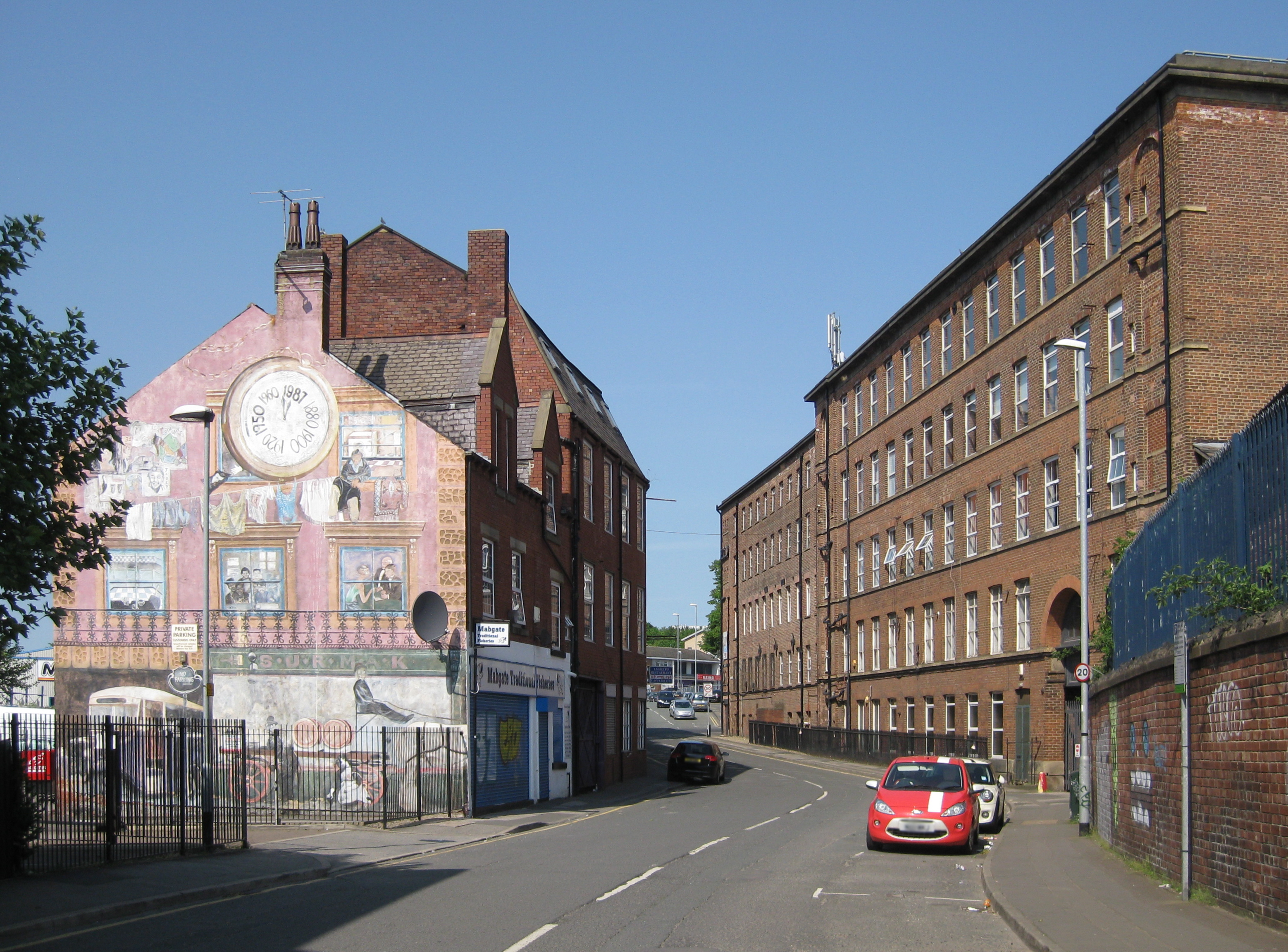
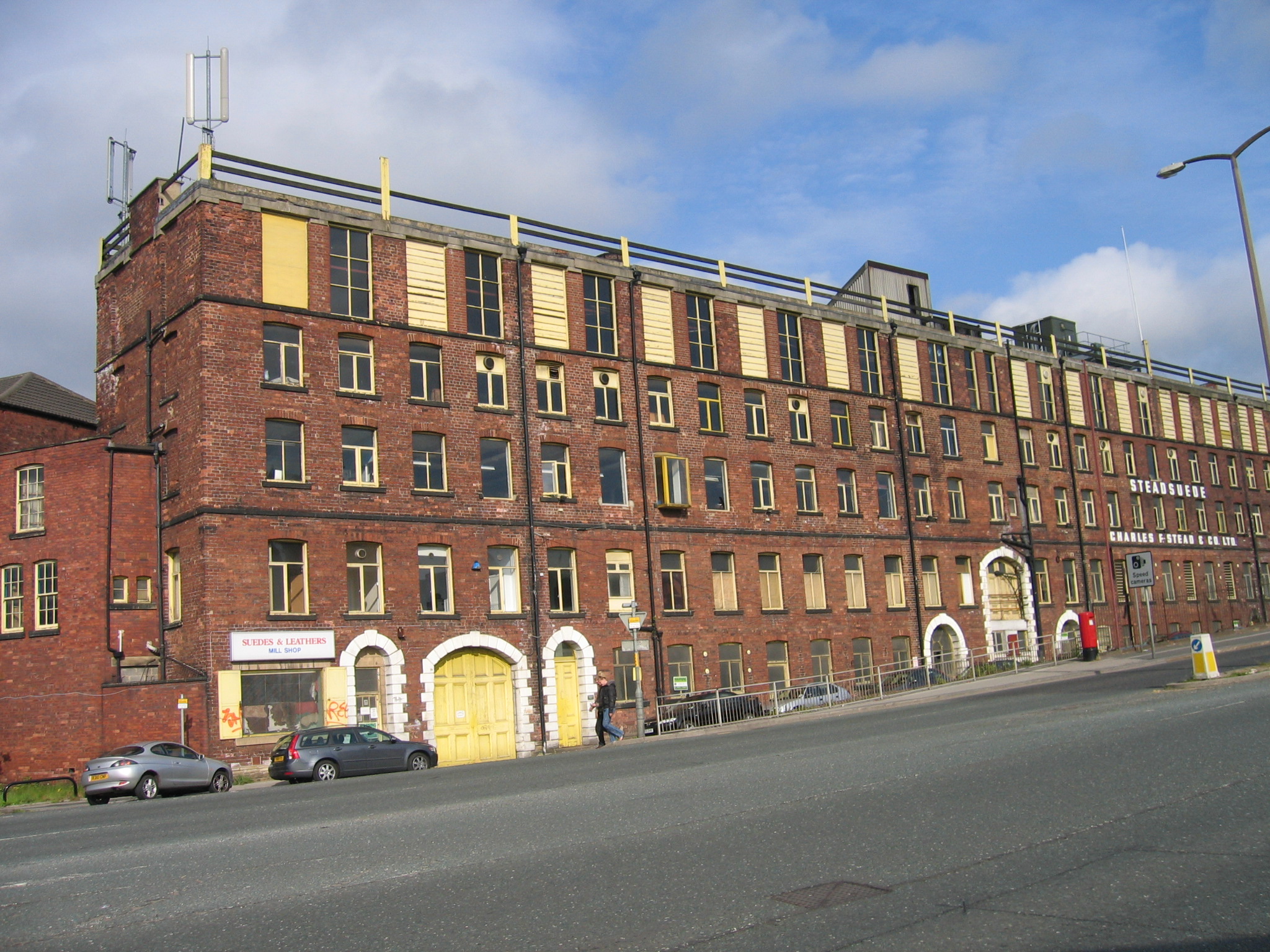
Mabgate is an inner city area of Leeds, West Yorkshire, England and the name of one of its streets. In Leeds City Council's ''Mabgate Development Framework'' (2007), "the area is bounded to the west by North Street; to the east by Macaulay Street; to the north by Mushroom Street and to the south by the New York Road".Leeds City Council (April 2007)Mabgate Development Framework accessed 15 June 2021 Mabgate, the street, continues for a short distance on the south side of New York Road (A64(M)). The area is in the Burmantofts and Richmond Hill ward of Leeds City Council. The area to the west of Regent Street is within the city centre boundary. The name comes from 'Mab', meaning a prostitute (16th to 19th century) and 'gate' meaning a street (common in Yorkshire street names).A. H. Smith (1961) ''The Place-Names of the West Riding of Yorkshire, Part IV'' Cambridge University PressOxford English Dictionary [...More Info...] [...Related Items...] OR: [Wikipedia] [Google] [Baidu] |
Meanwood Beck
The Meanwood Beck is a stream in West Yorkshire, England, which flows southwards through Adel, Meanwood and Sheepscar into the River Aire in central Leeds. Different portions of the same watercourse have been referred to as Adel Beck, Carr Beck, Lady Beck, Mabgate Beck, Sheepscar Beck, Timble Beck or Wortley Beck. Leeds Mercury 19 February 1866 p4 "The Leeds Improvement of Becks Bill" The Meanwood Valley Trail footpath follows the line of the beck for much of its course. The ultimate source of the water is Otley Chevin and the Marsh Beck feeds into what is now the Wildfowl Lake (formerly the Black Hill Dam) in Golden Acre Park.Leodis Cross Stamford Street, Sheepscar Beck According to |
Leylands, Leeds
The Leylands was an area of Leeds, north of the city centre and west of Mabgate. John Cossins' 1726 ''Plan of Leedes'' shows two fields marked ''Ley Lands'' north of Lady Lane and west of the Sheepscar Beck (also later known as Lady Beck) which correspond to the area.Brian Godward (2004) ''The Changing Face of Leeds'' (Sutton Publishing,Stroud) Development An 1881 street map shows the area built up and called The Leylands, and in 1887 the area had a population of 6209.Vision of Britain Leylands West Riding A plan of 1815 shows construction in progress with street names commemorating the victories of , namely [...More Info...] [...Related Items...] OR: [Wikipedia] [Google] [Baidu] |
Quarry Hill, Leeds
Quarry Hill is an area of central Leeds, West Yorkshire, England. It is bounded by the Leeds Inner Ring Road in the east and north and the Leeds – York / Hull railway in the south. The area falls within the City and Hunslet ward of Leeds City Council. History Quarry Hill was originally an inner-city area of Leeds. Three churches have historically been located on Quarry Hill. The Old Boggart House was the first purpose-built Methodist chapel in Leeds. It was demolished following the opening of the adjacent St Peter's Chapel in 1834. The site is marked by a blue plaque on the steps leading to the Leeds Playhouse. Quarry Hill Ebenezer Primitive Methodist chapel, originally called "Chapel Street Chapel", was opened in 1822, new frontage was added in 1846 and the chapel was enlarged in 1874. It closed in 1933. St Mary's Church, a Commissioners' Church, architect Thomas Taylor, was located on St Mary's Street. Located on the top of the hill, looking over New York Road tow ... [...More Info...] [...Related Items...] OR: [Wikipedia] [Google] [Baidu] |
Leeds
Leeds () is a City status in the United Kingdom, city and the administrative centre of the City of Leeds district in West Yorkshire, England. It is built around the River Aire and is in the eastern foothills of the Pennines. It is also the third-largest settlement (by population) in England, after London and Birmingham. The city was a small manorial borough in the 13th century and a market town in the 16th century. It expanded by becoming a major production centre, including of carbonated water where it was invented in the 1760s, and trading centre (mainly with wool) for the 17th and 18th centuries. It was a major mill town during the Industrial Revolution. It was also known for its flax industry, Foundry, iron foundries, engineering and printing, as well as shopping, with several surviving Victorian era arcades, such as Leeds Kirkgate Market, Kirkgate Market. City status was awarded in 1893, a populous urban centre formed in the following century which absorbed surrounding vi ... [...More Info...] [...Related Items...] OR: [Wikipedia] [Google] [Baidu] |
Lincoln Green
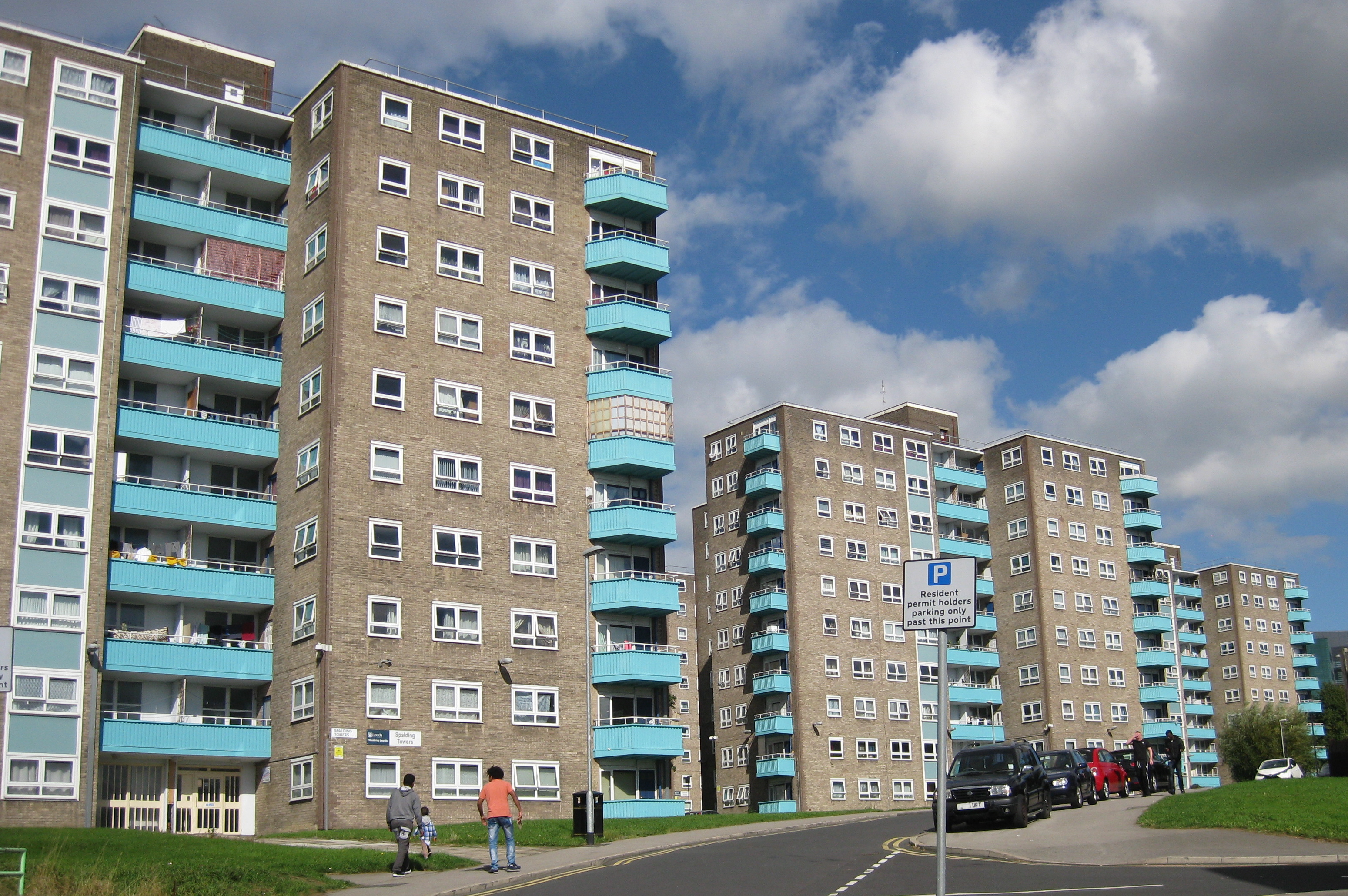
Lincoln Green is a mainly residential area of Leeds, West Yorkshire, England around Lincoln Green Road, and is adjacent to and southwest of St James's University Hospital. It falls within the Burmantofts and Richmond Hill ward of the City of Leeds Council. The area was given this name in 1954, at the start of major redevelopment by the City Council.Steven Burt & Kevin Grady (2002) ''The Illustrated History of Leeds'' 2nd edn (Breedon Books, derby) p241, The Lincoln Green estate on the north side of Lincoln Green Road is mainly tower blocks and low-rise flats, which replaced the terraced houses known as New Town in about 1958, following the 1950s slum clearances.www.leodis.net Lincoln Green Shopping Centre, opened by Pat Phoenix On the south side of Lincoln Green Road is the Lincoln Green Shopping Centr ... [...More Info...] [...Related Items...] OR: [Wikipedia] [Google] [Baidu] |
Sheepscar
Sheepscar is an inner city district of Leeds in West Yorkshire England, lying to the north east of Leeds city centre. The district is in the City of Leeds Metropolitan Council. It is overlooked by the tower blocks of Little London and Lovell Park to the west, and gives way to Meanwood in the north-west, Chapeltown in the north-east and Burmantofts in the east. Clay Pit Lane runs through Sheepscar to the south, while Scott Hall Road makes up the eastern border. The area consists of complex road junctions, Penraevon Industrial Estate and a number of warehouses thanks to the impressive transport links attractive to haulage companies. There are a number of upmarket car showrooms such as Jaguar Land Rover and Volvo. The former public library building survives, and was the Leeds base for the West Yorkshire Archive Service, but closed some years ago. now a Games studio. Throughout the winter months, Sheepscar is notable for its large gasholder. This is completely invisibl ... [...More Info...] [...Related Items...] OR: [Wikipedia] [Google] [Baidu] |
Leeds City Centre
Leeds city centre is the central business district of Leeds, West Yorkshire, England. It is roughly bounded by the Inner Ring Road to the north and the River Aire to the south and can be divided into several quarters. Central districts Arena Quarter The Arena Quarter is a mixed-use area best known for being the home of the First Direct Arena. Its location is directly north of Merrion Street. The Inner Ring Road borders the district on both the east and north boundary, with Woodhouse Lane acting as the district's western boundary. It is mainly made up of high-rise residential properties and developments, including Sky Plaza and Opal 3. Altus House is the tallest building in Yorkshire. Other major institutions are located within the Quarter, including the Yorkshire Bank HQ and also the Merrion Centre. Queen Square is also found here. The Calls The Calls is close to the River Aire. It is directly south of the Retail Quarter and to the west of Crown Point Road. ... [...More Info...] [...Related Items...] OR: [Wikipedia] [Google] [Baidu] |
Harehills
Harehills is an inner-city area of east Leeds, West Yorkshire, England. It is approximately north east of Leeds city centre. Harehills is situated between the A58 road, A58 (towards Wetherby) and the A64 road, A64 (towards York). It sits in the Gipton and Harehills (ward), Gipton & Harehills ward of Leeds City Council and the Leeds East (UK Parliament constituency), Leeds East House of Commons, parliamentary constituency, between Burmantofts and Gipton, and adjacent to Chapeltown, West Yorkshire, Chapeltown. Its boundaries are defined by the city council as "the boundary of Spencer Place to the West, Harehills Avenue to the North, the boundary of Foundry Place to the East and Compton Road and Stanley Road to the South." As the name suggests, it is a hill area, basically a south-facing slope, with many streets of terraced houses on hills. In the middle is Banstead Park, a grassy slope with trees and play areas, giving a view over the city of Leeds. There are two main shoppi ... [...More Info...] [...Related Items...] OR: [Wikipedia] [Google] [Baidu] |
Condé Nast Traveller
''Condé Nast Traveller'' is published by Condé Nast Publications Ltd, from Vogue House in Hanover Square, Mayfair, London. It is a luxury travel magazine aimed at the upmarket, independent traveller. It can be differentiated from the American version of the magazine because of the UK spelling of the word ''Traveller'', and contains mainly original UK content, though some features are used from the US magazine and repackaged for a UK audience. History ''Condé Nast Traveller'' was started in 1997. The magazine runs several industry-recognized awards, the most important being the ''Condé Nast Traveller'' Readers' Awards, which take place every year. Other annual awards include the Readers' Spa Awards, The Gold List (most luxurious hotels) and The Hot List (best new hotels). The latter two are compiled from recommendations from the magazine's editors and writers. The ''Condé Nast Traveller'' Innovation and Design Awards highlight the best in travel, irrigation and design, and ... [...More Info...] [...Related Items...] OR: [Wikipedia] [Google] [Baidu] |
Cholera Pit
A cholera pit was a burial place used in a time of emergency when the disease was prevalent. Such mass graves were often unmarked and were placed in remote or specially selected locations. Public fears of contagion, lack of space within existing churchyards and restrictions placed on the movements of people from location to location also contributed to their establishment and use. Many of the victims were poor and lacked the funds for memorial stones, however memorials were sometimes added at a later date. Burials Often the bodies of cholera victims were wrapped in cotton or linen and doused in coal-tar or pitch before placing into a coffin. Each burial was in a pit deep and liberally sprinkled with quicklime. The bodies were sometimes burnt before interment.Friar's Bush Retrieved : 2012-01-17 ;Long term risks It is considered that the cholera risk p ... [...More Info...] [...Related Items...] OR: [Wikipedia] [Google] [Baidu] |


.jpg)


