|
Low Marnham
Low Marnham is a small village 12 miles east of Edwinstowe, in the civil parish of Marnham, in the Bassetlaw district, in the county of Nottinghamshire Nottinghamshire (; abbreviated Notts.) is a landlocked county in the East Midlands region of England, bordering South Yorkshire to the north-west, Lincolnshire to the east, Leicestershire to the south, and Derbyshire to the west. The trad ..., England. Located in the village is St Wilfrid's Church, a grade I listed building. See also * Listed buildings in Marnham, Nottinghamshire References External links Villages in Nottinghamshire Bassetlaw District {{Nottinghamshire-geo-stub ... [...More Info...] [...Related Items...] OR: [Wikipedia] [Google] [Baidu] |
Marnham, Nottinghamshire
Marnham is a civil parish in the Bassetlaw district, in the county of Nottinghamshire, England. The parish includes the village of Low Marnham and the hamlets of High Marnham and Skegby. In 2011 the parish had a population of 117. The parish lies in the north east of the county, and south east within the district. It is 122 miles north of London, 23 miles north east of the city of Nottingham, and 17 miles north east of the market town of Mansfield. The parish touches Fledborough, Normanton on Trent, South Clifton, Tuxford and Weston. Marnham shares a parish council with Normanton on Trent. There are 7 listed buildings in Marnham. Toponymy The name "Marnham" means 'Mearna's homestead/village', although little knowledge on this owner exists. Geography Location It is surrounded by the following local areas: * Darlton and Fledborough to the north * Normanton-on-Trent to the south * South Clifton to the east * Tuxford to the west. The parish is approximately 4 miles in w ... [...More Info...] [...Related Items...] OR: [Wikipedia] [Google] [Baidu] |
Bassetlaw District
Bassetlaw is a local government district in Nottinghamshire, England. The district has four towns: Worksop, Tuxford, Harworth Bircotes and Retford. It is bounded to the north by the Metropolitan Boroughs of Doncaster and Rotherham, the east by West Lindsey, the west by both the Borough of Chesterfield and North East Derbyshire and the south by Mansfield District and Newark and Sherwood. The district is along with Bolsover District, North East Derbyshire and Borough of Chesterfield is a non-constituent member of the Sheffield City Region. History Bassetlaw was created as a non-metropolitan district in 1974 by the merger of the municipal boroughs of Worksop and East Retford and most of Worksop Rural District and East Retford Rural District following the passage of the Local Government Act 1972. Local Government in Nottinghamshire is organised on a two-tier basis, with local district councils such as Bassetlaw District Council responsible for local services such as housin ... [...More Info...] [...Related Items...] OR: [Wikipedia] [Google] [Baidu] |
Nottinghamshire
Nottinghamshire (; abbreviated Notts.) is a landlocked county in the East Midlands region of England, bordering South Yorkshire to the north-west, Lincolnshire to the east, Leicestershire to the south, and Derbyshire to the west. The traditional county town is Nottingham, though the county council is based at County Hall in West Bridgford in the borough of Rushcliffe, at a site facing Nottingham over the River Trent. The districts of Nottinghamshire are Ashfield, Bassetlaw, Broxtowe, Gedling, Mansfield, Newark and Sherwood, and Rushcliffe. The City of Nottingham was administratively part of Nottinghamshire between 1974 and 1998, but is now a unitary authority, remaining part of Nottinghamshire for ceremonial purposes. The county saw a minor change in its coverage as Finningley was moved from the county into South Yorkshire and is part of the City of Doncaster. This is also where the now-closed Doncaster Sheffield Airport is located (formerly Robin Hood Airport). In 20 ... [...More Info...] [...Related Items...] OR: [Wikipedia] [Google] [Baidu] |
Newark (UK Parliament Constituency)
Newark is a constituency in Nottinghamshire, England. It is currently represented by Robert Jenrick of the Conservative Party who won the seat in a by-election on 5 June 2014, following the resignation of Patrick Mercer in April 2014. Boundaries 1918–1950: The Municipal Borough of Newark, and the Rural Districts of Bingham, Newark, and Southwell. 1950–1983: The Municipal Borough of Newark, the Urban District of Mansfield Woodhouse, and the Rural Districts of Newark and Southwell. 1983–2010: The District of Newark wards of Beacon, Bridge, Bullpit Pinfold, Castle, Caunton, Collingham, Devon, Elston, Farndon, Magnus, Meering, Milton Lowfield, Muskham, Southwell East, Southwell West, Sutton on Trent, Trent, and Winthorpe, and the District of Bassetlaw wards of East Markham, East Retford East, East Retford North, East Retford West, Elkesley, Trent, and Tuxford. 2010–present: The District of Newark and Sherwood wards of Balderton North, Balderton West, Beacon, Bridge, Ca ... [...More Info...] [...Related Items...] OR: [Wikipedia] [Google] [Baidu] |
Newark-on-Trent
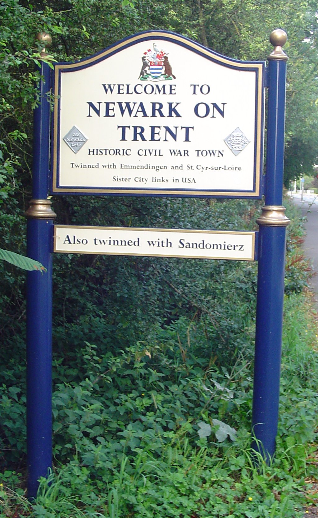
Newark-on-Trent or Newark () is a market town and civil parish in the Newark and Sherwood district in Nottinghamshire, England. It is on the River Trent, and was historically a major inland port. The A1 road (Great Britain), A1 road bypasses the town on the line of the ancient Great North Road (Great Britain), Great North Road. The town's origins are likely to be Roman Britain, Roman, as it lies on a major Roman road, the Fosse Way. It grew up round Newark Castle, Nottinghamshire, Newark Castle and as a centre for the wool and cloth trades. In the English Civil War, it was besieged by Roundheads, Parliamentary forces and Relief of Newark, relieved by Cavaliers, Royalist forces under Prince Rupert. Newark has a market place lined with many historical buildings and one of its most notable landmark is Church of St Mary Magdalene, Newark-on-Trent, St Mary Magdalene church with its towering spire at high and the highest structure in the town. The church is the tallest church in Nott ... [...More Info...] [...Related Items...] OR: [Wikipedia] [Google] [Baidu] |
Edwinstowe
Edwinstowe is a large village and civil parish in the Newark and Sherwood district of Nottinghamshire, England, on the edge of Sherwood Forest. It is associated with the legends of Robin Hood and Maid Marian and known for the proximity of the former Thoresby Colliery. The civil parish population at the 2011 census was 5,188. A 2019 estimate put it at 5,261. Heritage The etymology of the village name, "Edwin's resting place", recalls that the body of Edwin of Northumbria, King and Saint, was hidden in the church after he was killed in the Battle of Hatfield Chase, near Doncaster, probably in AD 633. The battle against King Penda of Mercia occurred near the present-day hamlet of Cuckney, some five miles north-west of modern Edwinstowe. Edwinstowe is referred to twice in the Domesday Book as having five households, in addition to a priest and his four bordars, living in the hamlet in 1086. Legend has it that Robin Hood married Maid Marian in St Mary's Church. Edwinstowe is known ... [...More Info...] [...Related Items...] OR: [Wikipedia] [Google] [Baidu] |
St Wilfrid's Church, Low Marnham
St Wilfrid's Church is a redundant Anglican church in the village of Low Marnham, to the east of Edwinstowe, Nottinghamshire, England. It is recorded in the National Heritage List for England as a designated Grade I listed building, and is under the care of the Churches Conservation Trust. History The church dates from the 13th century, with additions or alterations in the 14th, 15th and 19th centuries, and a restoration in 1846. Architecture Exterior St Wilfrid's is constructed in stone with slate roofs. Its plan consists of a nave with a clerestory, north and south aisles, a south porch, a north chapel, a chancel and a west tower. From the exterior, the style of the church is Perpendicular. The tower is in two stages, with diagonal buttresses. In the lower stage is a three-light west window, and there are clock faces on the north, west and south sides. The upper stage contains two-light bell openings on each side. At the top of the tower is an embattle ... [...More Info...] [...Related Items...] OR: [Wikipedia] [Google] [Baidu] |
Listed Buildings In Marnham, Nottinghamshire
Marnham is a civil parish in the Bassetlaw District of Nottinghamshire, England. The parish contains seven listed buildings that are recorded in the National Heritage List for England. Of these, one is listed at Grade I, the highest of the three grades, and the others are at Grade II, the lowest grade. The parish contains the settlements of High Marnham, Low Marnham and Skegby Skegby is a village and former civil parish, now in the unparished area of Sutton in Ashfield, in the Ashfield district of Nottinghamshire, England, located two miles west of Mansfield and one mile north of Sutton-in-Ashfield, close to Stanton ..., and the surrounding countryside. The listed buildings consist of a church, two houses, a pigeoncote, a village hall, a farmhouse and farm buildings. __NOTOC__ Key Buildings References Citations Sources * * * * * * * * * {{DEFAULTSORT:Marnham, Nottinghamshire Lists of listed buildings in Nottinghamshire ... [...More Info...] [...Related Items...] OR: [Wikipedia] [Google] [Baidu] |
Villages In Nottinghamshire
A village is a clustered human settlement or community, larger than a hamlet but smaller than a town (although the word is often used to describe both hamlets and smaller towns), with a population typically ranging from a few hundred to a few thousand. Though villages are often located in rural areas, the term urban village is also applied to certain urban neighborhoods. Villages are normally permanent, with fixed dwellings; however, transient villages can occur. Further, the dwellings of a village are fairly close to one another, not scattered broadly over the landscape, as a dispersed settlement. In the past, villages were a usual form of community for societies that practice subsistence agriculture, and also for some non-agricultural societies. In Great Britain, a hamlet earned the right to be called a village when it built a church. [...More Info...] [...Related Items...] OR: [Wikipedia] [Google] [Baidu] |


