|
Bassetlaw District
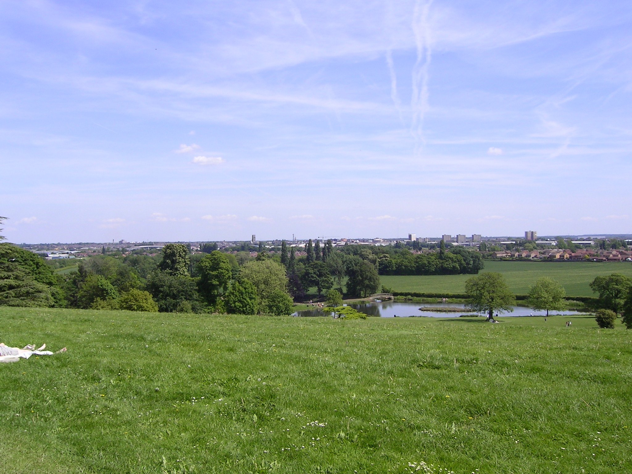
Bassetlaw is a local government district in Nottinghamshire, England. The district has four towns: Worksop, Tuxford, Harworth Bircotes and Retford. It is bounded to the north by the Metropolitan Boroughs of Doncaster and Rotherham, the east by West Lindsey, the west by both the Borough of Chesterfield and North East Derbyshire and the south by Mansfield District and Newark and Sherwood. The district is along with Bolsover District, North East Derbyshire and Borough of Chesterfield is a non-constituent member of the Sheffield City Region. History Bassetlaw was created as a non-metropolitan district in 1974 by the merger of the municipal boroughs of Worksop and East Retford and most of Worksop Rural District and East Retford Rural District following the passage of the Local Government Act 1972. Local Government in Nottinghamshire is organised on a two-tier basis, with local district councils such as Bassetlaw District Council responsible for local services such as housin ... [...More Info...] [...Related Items...] OR: [Wikipedia] [Google] [Baidu] |
Worksop
Worksop ( ) is a market town in the Bassetlaw District in Nottinghamshire, England. It is located east-south-east of Sheffield, close to Nottinghamshire's borders with South Yorkshire and Derbyshire, on the River Ryton and not far from the northern edge of Sherwood Forest. Other nearby towns include Chesterfield, Doncaster, Retford, Gainsborough and Mansfield. Worksop had a population of 41,820 as of the 2011 Census and it is twinned with the German town Garbsen. History Anglo-Saxon and Anglo-Norman history Worksop was part of what was called Bernetseatte (burnt lands) in Anglo-Saxon times. The name Worksop is likely of Anglo Saxon origin, deriving from a personal name 'We(o)rc' plus the Anglo-Saxon placename element 'hop' (valley). The first element is interesting because while the masculine name Weorc is unrecorded, the feminine name Werca (Verca) is found in Bede's ''Life of St Cuthbert''. A number of other recorded place names contain this same personal name element. In ... [...More Info...] [...Related Items...] OR: [Wikipedia] [Google] [Baidu] |
S Postcode Area
The S postcode area, also known as the Sheffield postcode area,Royal Mail, ''Address Management Guide'', (2004) is a group of postcode districts in England, which are subdivisions of eight post towns. These cover most of South Yorkshire (including Sheffield, Barnsley, Rotherham and Mexborough), parts of north Derbyshire (including Chesterfield, Dronfield and the Hope Valley) and north-west Nottinghamshire (including Worksop), plus a small part of West Yorkshire. History For 1857–1868 an ''S sector'' of the London postal district existed. Similarly, there were also S-prefixed postal districts in the compass-based system used in Glasgow: ''Glasgow S1, S2, S3 and S4'', which later became G41 to G44. Three postcode districts were split and separated into ten new postcode districts. These were: *S20, formed out of ''S19'' *S21, S25 and S26, formed out of ''S31'' *S32 to S36, formed out of ''S30''. The S64 district covering the Mexborough post town was originally earmarked for us ... [...More Info...] [...Related Items...] OR: [Wikipedia] [Google] [Baidu] |
Mansfield District
Mansfield District is a local government district in Nottinghamshire, England. Its council is based in the town of Mansfield. The district is bounded by the districts of Ashfield, Newark and Sherwood and Gedling, as well as the Derbyshire districts of Bolsover and North East Derbyshire. It is also part of the Mansfield urban area. History The district was formed on 1 April 1974, under the Local Government Act 1972, by the merger of the Municipal Borough of Mansfield with Mansfield Woodhouse Urban District and Warsop Urban District. Geography As well as the town of Mansfield, settlements in the district include Mansfield Woodhouse, Forest Town and parts of Pleasley, with Warsop and Meden Vale distanced and annexed by open countryside. The district is entirely unparished apart from Warsop, which retains a parish council. Mansfield District Council Unlike most English councils, Mansfield District Council is led by a directly elected mayor, following a campaign in 2002 by lo ... [...More Info...] [...Related Items...] OR: [Wikipedia] [Google] [Baidu] |
North East Derbyshire
North East Derbyshire is a local government district in Derbyshire, England. It borders the districts of Chesterfield, Bolsover, Amber Valley and Derbyshire Dales in Derbyshire, and Sheffield and Rotherham in South Yorkshire. The population of the district as taken at the 2011 Census was 99,023. The district council is a non-constituent partner member of the Sheffield City Region Combined Authority. The district is a non-constituent member of the Sheffield City Region and shares a membership along with neighbouring Derbyshire Dales, Borough of Chesterfield, Bolsover District and Bassetlaw District in Nottinghamshire. The district is also part of The Derby, Derbyshire, Nottingham and Nottinghamshire Local Enterprise Partnership. Settlements in the district include: * Arkwright Town and Ashover * Barlow * Calow and Clay Cross * Dronfield * Eckington * Grassmoor * Holmesfield, Holymoorside and Holmewood * Killamarsh * Morton * North Wingfield * Pilsley * Renishaw and Rid ... [...More Info...] [...Related Items...] OR: [Wikipedia] [Google] [Baidu] |
Borough Of Chesterfield
The Borough of Chesterfield is a non-metropolitan district with borough status in Derbyshire, England. It is named after its main settlement of Chesterfield. History The district was formed on 1 April 1974, under the Local Government Act 1972, by a merger of the Municipal Borough of Chesterfield, Staveley Urban District and the Brimington part of Chesterfield Rural District. The borough's main two towns are Chesterfield and Staveley. With its geographical position, the borough offers convenient commuter links to the cities of Sheffield, Nottingham, Derby, Bradford, Wakefield, Manchester, Salford, Leeds and Lincoln, and via its mainline railway station at Chesterfield and the connections to the M1 motorway. Geography The borough is situated around the town of Chesterfield and includes the villages of Old Whittington, Brimington (which also has a parish council), Sheepbridge and New Whittington, and the town of Staveley which maintains a town council. The borough is bordered ... [...More Info...] [...Related Items...] OR: [Wikipedia] [Google] [Baidu] |
West Lindsey
West Lindsey is a local government district in Lincolnshire, England. Its council is based in Gainsborough. History The district was formed on 1 April 1974, from the urban districts of Gainsborough, Market Rasen, along with Caistor Rural District, Gainsborough Rural District and Welton Rural District, all in the historic Parts of Lindsey. The district council moved to neofficesin Marshall's Yard in Gainsborough in January 2008. In the 2016 EU referendum, West Lindsey voted 61.8% leave (33,847 votes) to 38.2% remain (20,906 votes). Governance Councillors are elected to the authority every four years, with 36 councillors representing 20 wards. Between 1974 and 2011 the council was elected in 'thirds' - this means that elections were held every year apart from the fourth year when County Council elections were held. In December 2010 the Council decided to change the system from 'thirds' to 'all out' elections commencing in May 2011. The most recent election to the council was ... [...More Info...] [...Related Items...] OR: [Wikipedia] [Google] [Baidu] |
Metropolitan Borough Of Rotherham
The Metropolitan Borough of Rotherham is a metropolitan borough of South Yorkshire, England. It is named after its largest town, Rotherham, but also spans the outlying towns of Maltby, Swinton, Wath-upon-Dearne, Dinnington and also the villages of Rawmarsh and Laughton. A large valley also spans the entire borough. Locally known as the Rother Valley. The district was formed on 1 April 1974, under the Local Government Act 1972, as a merger of the County Borough of Rotherham, with Maltby, Rawmarsh, Swinton and Wath-upon-Dearne urban districts along with Rotherham Rural District and Kiveton Park Rural District. Rotherham Metropolitan Borough Council is one of the safest Labour councils in the United Kingdom, although the number of Labour council seats dropped from 92% to 79% in 2014 following the Rotherham child sexual exploitation scandal. Geography Settlements in the borough of Rotherham include: : Anston, Aston, Aughton : Bramley, Brampton, Brampton-en-le-Morthen ... [...More Info...] [...Related Items...] OR: [Wikipedia] [Google] [Baidu] |
Metropolitan Borough Of Doncaster
The City of Doncaster is a metropolitan borough with city status in South Yorkshire, England. It is named after its principal settlement, Doncaster, and includes the surrounding suburbs of Doncaster as well as numerous towns and villages. The district has large amounts of countryside. At 219 sq miles, it is the largest metropolitan borough by area in England. The largest settlement in the borough are Doncaster itself, followed by the towns of Thorne, Hatfield and Mexborough (the latter of which is part of the Barnsley/Dearne Valley built-up area), and it additionally covers the towns of Conisbrough, Stainforth, Bawtry, Askern, Edlington and Tickhill. Doncaster borders the Selby district of North Yorkshire to the north, the East Riding of Yorkshire to the north-east, North Lincolnshire to the east, Bassetlaw in Nottinghamshire to the south-east, Rotherham to the south-west, Barnsley to the west, and Wakefield, West Yorkshire, to the north-west. It is part of the Yorkshire ... [...More Info...] [...Related Items...] OR: [Wikipedia] [Google] [Baidu] |
Retford
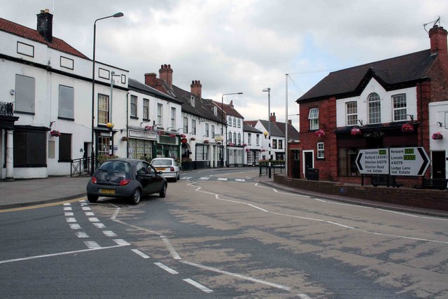
Retford (), also known as East Retford, is a market town in the Bassetlaw District in Nottinghamshire, England, and one of the oldest English market towns having been granted its first charter in 1105. It lies on the River Idle and the Chesterfield Canal passes through its centre. Retford is east of Sheffield, west of Lincoln, Lincolnshire, Lincoln and north-east of Nottingham. The population at the 2011 census was 22,013. In 1878 an Act of Parliament extended the borough of East Retford to include the village of Ordsall, Nottinghamshire, Ordsall, West Retford and part of the parish of Clarborough. It is administered by Bassetlaw District Council, which itself is now a non-constituent partner member of the Sheffield City Region Combined Authority. In addition to being an ancient market town and infamous Rotten Borough, Retford is known as being at the centre of Nonconformism, with the origins of the Pilgrims, Baptists and Wesleys being in this area. History Origins of the n ... [...More Info...] [...Related Items...] OR: [Wikipedia] [Google] [Baidu] |
Harworth Bircotes
Harworth Bircotes or Harworth and Bircotes is a town and civil parish in the Bassetlaw district of Nottinghamshire in the East Midlands of England. The parish includes the settlements of Bircotes and Harworth Harworth is an area in the civil parish of Harworth Bircotes (with Bircotes) in the Bassetlaw district in Nottinghamshire, England. It is approximately north of Worksop. The population of the civil parish was 7,948 in the 2011 Census. Histo .... The parish was created on 1 April 1974 out of Harworth parish. Harworth and Bircotes Town Council is the lowest tier of local government. References External linksHarworth Colliery - Miner's Advice Information Template [...More Info...] [...Related Items...] OR: [Wikipedia] [Google] [Baidu] |
Tuxford
Tuxford is a historic market town and a civil parish in the Bassetlaw District, Bassetlaw district of Nottinghamshire, England. At the 2001 census, it had a population of 2,516, increasing to 2,649 at the 2011 census. Geography Nearby towns are Ollerton, Nottinghamshire, Ollerton, Retford, Worksop, Mansfield and Newark-on-Trent. The nearest cities are Lincoln, England, Lincoln and Nottingham. The town is located near the border with Lincolnshire in The Dukeries. The A6075 passes through east–west and connects the A57 road, A57 to Ollerton and Mansfield. The East Coast Main Line passes close to the east. The A611 previously went east–west through the town; this is now the A6075; the A611 now goes from Mansfield to Hucknall. The Great North Road (United Kingdom), Great North Road runs through the town (now B1164), though the majority of traffic now uses the modern A1 road (Great Britain), A1 trunk road, which splits the town in two. The town was bypassed in 1967. The se ... [...More Info...] [...Related Items...] OR: [Wikipedia] [Google] [Baidu] |
Retford Town Hall
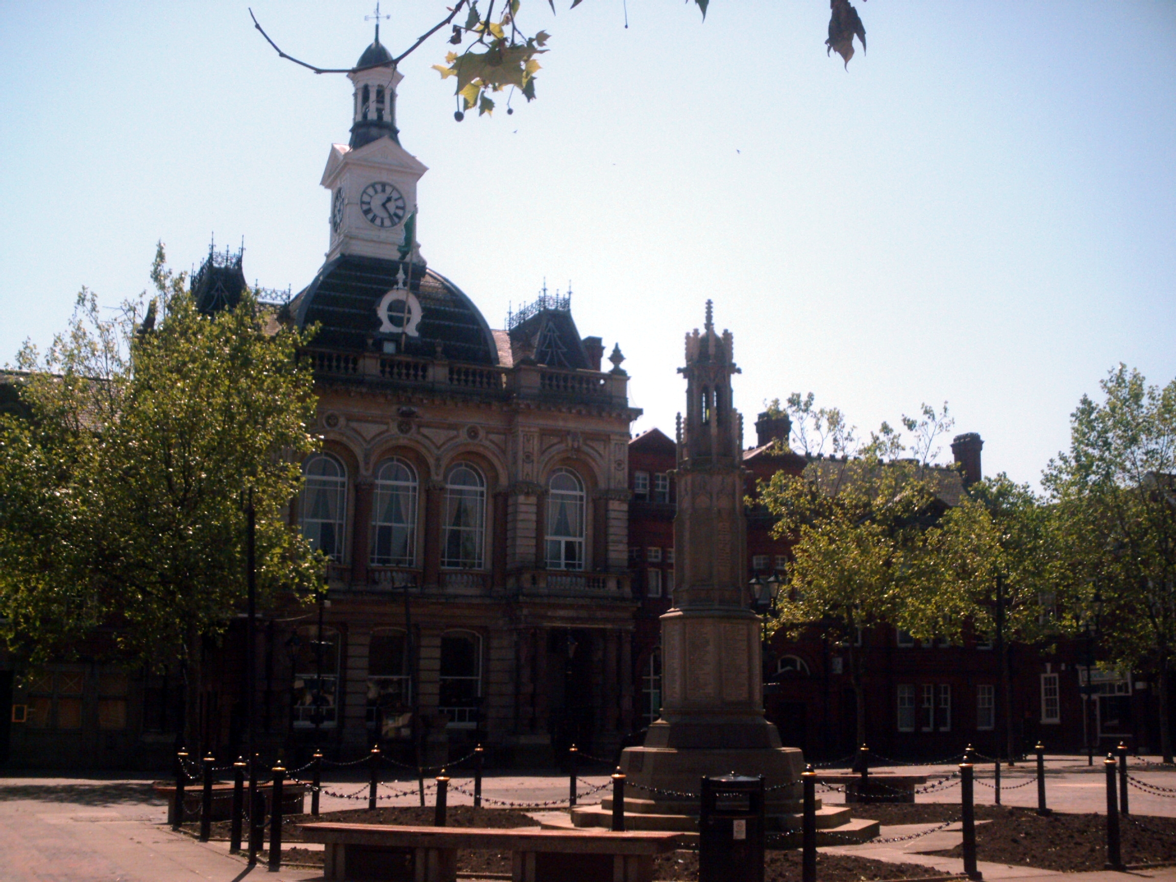
Retford Town Hall is a municipal building in The Square, Retford, Nottinghamshire, England. The town hall, which was the meeting place of Retford Borough Council, is a grade II listed building. History Earlier buildings A moot hall was built in Retford in 1388 on a different site to the present town hall, in between the old market place and St Swithun's church, to the North of the current market place. It was a medieval timbered structure and was destroyed by the fire which devastated three-quarters of Retford in 1528. A new moot hall was built to replace the one destroyed by fire but by August 1754 it was in danger of collapse. The corporation of East Retford decided to demolish it. The 1528 moot hall was replaced with another building on the same site designed in the neoclassical style by Messrs White and Watson. This was completed in 1755. The design involved a symmetrical main frontage with seven bays facing onto the Market Place; the central section of three bays was pe ... [...More Info...] [...Related Items...] OR: [Wikipedia] [Google] [Baidu] |


.jpg)


