|
Los Negrales
Los Negrales is a residential zone in the municipal area of Collado Villalba, Alpedrete, Saint Lorenzo de El Escorial, Guadarrama and Galapagar (municipalities of the northwest of the Community of Madrid, Spain), consisting mostly of detached houses. Although it was divided in three administrative zones, Los Negrales is a contiguous residential area. This residential zone was built gradually. The oldest houses date to the first half of the 20th century, and building has continued until contemporary times. A significant part of the houses are second residences of their owners, therefore, in summer and in holidays the population doubles. Los Negrales is situated near the Sierra de Guadarrama and near the centre of Collado Villalba, which makes it a favorable place to spend the holidays. The short distance to Collado Villalba facilitates shopping and leisure. Los Negrales has considerable public facilities (parish church, public schools, a sports center, a municipal park and a phar ... [...More Info...] [...Related Items...] OR: [Wikipedia] [Google] [Baidu] |
Collado Villalba
Collado Villalba () is a municipality of the Community of Madrid, in central Spain. It is located 40.3 kilometres north-west of the city of Madrid, at an altitude of 917 meters above sea level. It has a population of 63,679 (2019), with a population density of about 2,400 per km². Collado Villalba has a hot summer Mediterranean climate (Köppen ''Csa''). I.E.S Lázaro Cárdenas of Collado Villalba conducts an annual student exchange program with Burlington High School in Burlington, Massachusetts. It has been managed by Professor Ramón José García Rubio for over 20 years. I.E.S María Guerrero has also started an exchange with Minervaskolan High School of Umeå, located 600 kilometres north of Stockholm, in Sweden. In addition to this school-to-school exchange, the municipality has been twinned since 1991 with the French city of Bègles, located in the Bordeaux metropolitan area in Southwestern France. Public transport Train Collado Villalba has its own train station, w ... [...More Info...] [...Related Items...] OR: [Wikipedia] [Google] [Baidu] |
Alpedrete
Alpedrete () is a town and municipality in central Spain. It is located in the Sierra de Guadarrama in the autonomous community of the Community of Madrid. It had a population of 13,391 inhabitants in 2011 (INE, 2011). See also * Los Negrales Los Negrales is a residential zone in the municipal area of Collado Villalba, Alpedrete, Saint Lorenzo de El Escorial, Guadarrama and Galapagar (municipalities of the northwest of the Community of Madrid, Spain), consisting mostly of detached ho ... References External links The official site of the city Municipalities in the Community of Madrid {{Madrid-geo-stub ... [...More Info...] [...Related Items...] OR: [Wikipedia] [Google] [Baidu] |
San Lorenzo De El Escorial
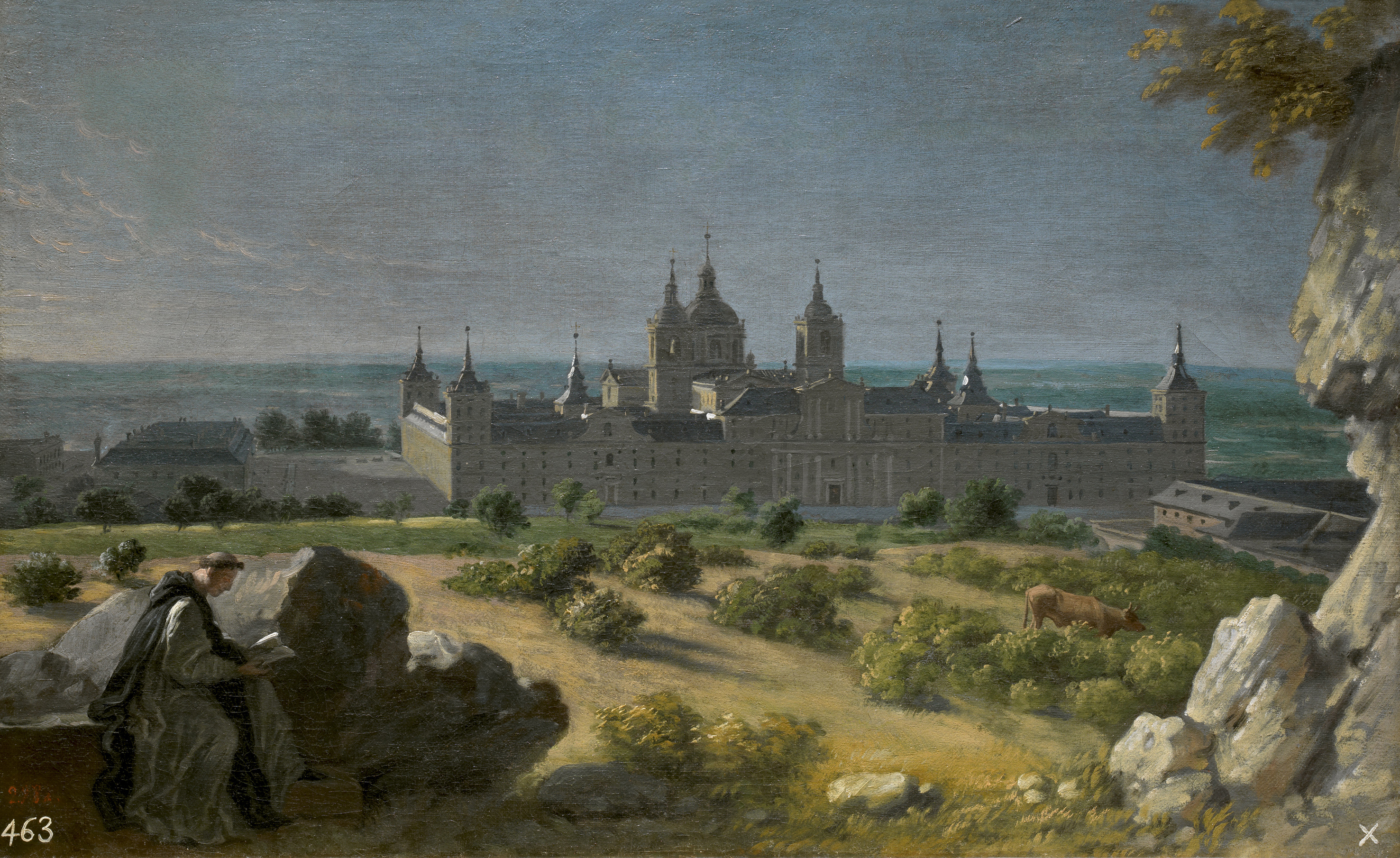
San Lorenzo de El Escorial, also known as El Escorial de Arriba, is a town and municipality in the Community of Madrid, Spain, located to the northwest of the region in the southeastern side of the Sierra de Guadarrama, at the foot of Mount Abantos and , from Madrid. It is head of the eponymous judicial party. The settlement is popularly called El Escorial de Arriba, to differentiate it from the neighbouring village of El Escorial, also known as El Escorial de Abajo. The Monastery of El Escorial is the most prominent building in the town and is one of the main Spanish Renaissance monuments. Especially remarkable is the Royal Library, inside the Monastery. The monastery and its historic surroundings were declared a World Heritage Site UNESCO on November 2, 1984, under the name of "El Escorial, monastery and site". The site also enjoys protection on Spain's heritage register; since June 21, 2006, it has been protected by the Community of Madrid as a Property of Cultural Int ... [...More Info...] [...Related Items...] OR: [Wikipedia] [Google] [Baidu] |
Guadarrama
Guadarrama is a town and municipality in the Cuenca del Guadarrama comarca, in the Community of Madrid, Spain. Its population is 13,032 (winter, according to a 2006 census); the population swells to approximately 60,000 in summer. Its name comes from arabic Wadi-ar-ramla river (dry riverbed). Guadarrama achieved the status of "villa" under Fernando V of Castile (II of Aragon) on November 22, 1504. Fernando VI ordered the building of a road to A Coruña through the Guadarrama Pass, through which passed the Grande Armée with Napoleon searching For John Moore's Army in 1808. This town was absolutely destroyed during the Spanish Civil War, as it was for almost three years a battlefront. All one can see in this town today is new, built in the mid-20th century. It was the location for some scenes in the 1964 film ''The Fall of the Roman Empire''. It is close to Sierra de Guadarrama, a mountain range that is visited by Madrid residents seeking cooler temperatures, especially ... [...More Info...] [...Related Items...] OR: [Wikipedia] [Google] [Baidu] |
Galapagar
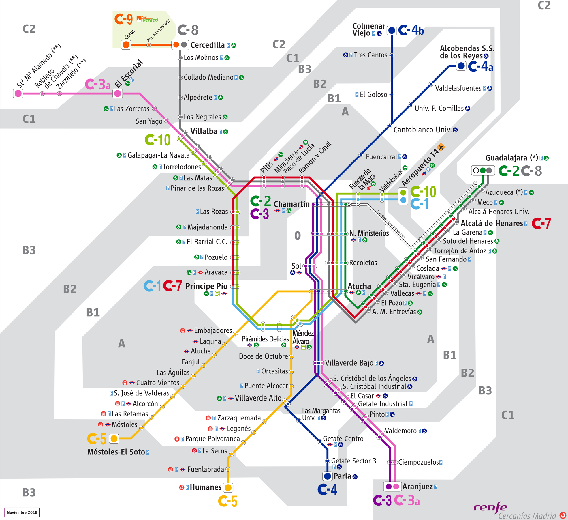
Galapagar is a town and municipality northwest of Madrid, Spain, situated in the autonomous community of the Community of Madrid. Of all the towns in the area, it was experiencing the most growth, mostly because of immigration and the conversion of old livestock fields into terrain for construction. The name Galapagar comes from the Spanish ''galápago'', meaning turtle, as the town centre was settled near a lake full of turtles. The town first appears as a village in the eleventh century, its importance due to the frequent hunting expeditions by the Spanish royalty, and being a main stop on the road from the capital to the Royal Monastery of San Lorenzo de El Escorial. Sights in the town include the church of The Asunción (Assumption). Galapagar is served by lines C-3, C-8 and C-10 of the Cercanías Madrid commuter rail service at its Galapagar-La Navata train station; and by 9 lines of Interurban Bus Service linking it to Moncloa district of Madrid. Jacinto Benavente, one o ... [...More Info...] [...Related Items...] OR: [Wikipedia] [Google] [Baidu] |
Community Of Madrid
The Community of Madrid (; es, Comunidad de Madrid ) is one of the seventeen autonomous communities of Spain. It is located in the centre of the Iberian Peninsula, and of the Central Plateau (''Meseta Central''). Its capital and largest municipality is the City of Madrid, which is also the capital of the country. The Community of Madrid is bounded to the south and east by Castilla–La Mancha and to the north and west by Castile and León. It was formally created in 1983, based on the limits of the province of Madrid, which was until then conventionally included in the historical region of New Castile. The Community of Madrid is the third most populous in Spain with 6,661,949 (2019) inhabitants mostly concentrated in the metropolitan area of Madrid. It is also the most densely populated autonomous community. In absolute terms, Madrid's economy has been, since 2018, slightly bigger in size than that of Catalonia. Madrid has the highest GDP per capita in the country. It cont ... [...More Info...] [...Related Items...] OR: [Wikipedia] [Google] [Baidu] |
Sierra De Guadarrama
The Sierra de Guadarrama (Guadarrama Mountains) is a mountain range forming the main eastern section of the Sistema Central, the system of mountain ranges along the centre of the Iberian Peninsula. It is located between the systems Sierra de Gredos in the province of Ávila, and Sierra de Ayllón in the province of Guadalajara. The range runs southwest–northeast, extending from the province of Ávila in the southwest, through the Community of Madrid, to the province of Segovia in the northeast. The range measures approximately in length. Its highest peak is Peñalara, in elevation. The flora of the Sierra de Guadarrama are characterized in the higher elevation Atlantic vegetation region with Juniper groves, montane grasslands, Spanish broom thickets, pine forests, and Pyrenean Oaks forests; and in the lower elevation Mediterranean vegetation region by Holm oak forests. while the pastures around the summits are fringed by juniper and Spanish broom shrubs. The mount ... [...More Info...] [...Related Items...] OR: [Wikipedia] [Google] [Baidu] |
Cercanías Madrid
Cercanías Madrid is the commuter rail service that serves Madrid, the capital of Spain, and its metropolitan area. It is operated by Cercanías Renfe, the commuter rail division of Renfe, the former monopoly of rail services in Spain. Its total length is 370 km. History Until 1989 The first railroad line departing from Madrid (the second in Spain and the third in the Iberian Peninsula) was built in 1851 between Madrid and Aranjuez. Soon the growing Spanish railway system was dominated by two large companies: the ''Compañía del Norte'' (Northern Company), who operated the lines between Madrid and the Atlantic North of Spain from the ''Estación del Norte'' (now Príncipe Pío),and the Madrid-Zaragoza-Alicante (MZA) who operated the lines between the capital and the Mediterranean and Andalusian cities from the Atocha station. Another station, Delicias, served the line to Lisbon. Other smaller companies operated from Madrid, mostly in narrow gauge. After the Civi ... [...More Info...] [...Related Items...] OR: [Wikipedia] [Google] [Baidu] |
Autopista AP-6
The Autopista AP-6 (also called ''Autopista del Noroeste or Carretera de La Coruña (Madrid-La Coruña National Road or N-VI'') is a part of the Spanish A-6 Autopista del Noroeste starting at Las Rozas de Madrid and finished at Adanero. Between Las Rozas and Collado Villalba, is a freeway. All of it is a Free/tollway or a Motorway. Las Rozas-Collado Villalba is not a Spanish "Autovía" autopista toll route which starts in Collado Villalba and ends in Adanero (Ávila). The portion, between Las Rozas and Collado Villalba, forms part of it, but without toll. Madrid-Las Rozas, Adanero-Arteixo (province of La Coruña) on the same route is a Spanish "autovía" not a free/tollway, motorway, either a two-lane road. "Autovia" is in the middle between both road types, but the crosses always are with bridges like in the motorways/toll/freeway. The first kilometres of freeway/free motorway between Las Rozas and Collado Villalba were the first kilometres of freeway/motorway in Spain since 196 ... [...More Info...] [...Related Items...] OR: [Wikipedia] [Google] [Baidu] |
Carretera Nacional N-VI
The N-VI is a major highway in Spain. It connects Madrid to A Coruña. It has generally been up-graded or replaced by the Autovía A-6. It passes via Tordesillas, Ponferrada Ponferrada () is a city of Spain, located in the autonomous community of Castile and León. Ponferrada, the second most populated municipality of the Province of León, is also the capital city of El Bierzo, the only ''comarca'' recognized as a ... and Lugo. {{DEFAULTSORT:Carretera Nacional N-Vi N-VI ... [...More Info...] [...Related Items...] OR: [Wikipedia] [Google] [Baidu] |
Pinus Pinaster
''Pinus pinaster'', the maritime pine or cluster pine, is a pine native to the south Atlantic Europe region and parts of the western Mediterranean. It is a hard, fast growing pine bearing small seeds with large wings. Description ''Pinus pinaster'' is a medium-size tree, reaching tall with a trunk diameter of up to , exceptionally . The bark is orange-red, thick, and deeply fissured at the base of the trunk, somewhat thinner in the upper crown. The leaves ('needles') are in pairs, very stout ( broad), up to long, and bluish-green to distinctly yellowish-green. The maritime pine features the longest and most robust needles of all European pine species. The cones are conic, long and broad at the base when closed, green at first, ripening glossy red-brown when 24 months old. They open slowly over the next few years, or after being heated by a forest fire, to release the seeds, opening to broad. The seeds are long, with a wing, and are wind- dispersed. Similar species ... [...More Info...] [...Related Items...] OR: [Wikipedia] [Google] [Baidu] |


