|
Lonmay Castle
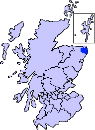
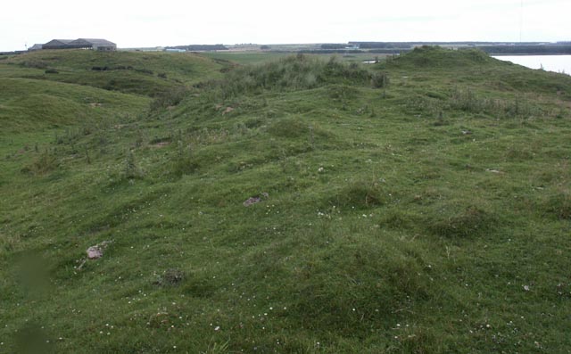
The remains of the Castle of Lonmay are found near Netherton of Lonmay, to the north of Loch Strathbeg in Buchan, Scotland. The remains are not located in the modern village of Lonmay which is approximately 6 km to the south-west. It was described by W. Douglas Simpson as one of the nine castles of the Knuckle, referring to the rocky headland of North-East Aberdeenshire. Dating from the 13th century it was home to the Clan Fraser, Fraser family. The castle ''"may have been a motte".'' It has long ceased to be in existence and there are very few remains to be found, all of which are buried under constantly shifting sand dunes that have over time engulfed the site. The castle provided protection to the north shore of the estuary that used to flow into Strathbeg Bay, before it closed off forming Loch Strathbeg around 1720. The south-shore (with Starny Keppie harbour and the village of Rattray, Aberdeenshire, Rattray) was protected by the Castle of Rattray. The remains are found ... [...More Info...] [...Related Items...] OR: [Wikipedia] [Google] [Baidu] |
Loch Strathbeg
The Loch of Strathbeg (also known as Loch Strathbeg; ''historically "Strathbeg Water"; "Water of Strathbeg"; "Rattray Water" or "Water of Rattray"'') is a designated Special Protection Area for wildlife conservation purposes. It is located near to Rattray and Crimond in Aberdeenshire, Scotland. The loch is maintained by the RSPB and around the loch there are three hides from which visitors may watch the birds and other wildlife. Access to the loch is through Crimond airfield where there is a car park at the edge of the reserve. There is also the 'Starnafin Centre' from which visitors may also watch the birds from and find out more information about which birds and animals are present locally. The RSPB has recorded over 260 species of bird, 280 species of insect and 26 species of mammal at the reserve. Formation The loch is a very recent creation of geological times, forming naturally in a massive storm in 1720. The lagoon, where the loch is now, its small harbour ''Starny ... [...More Info...] [...Related Items...] OR: [Wikipedia] [Google] [Baidu] |
Buchan
Buchan is an area of north-east Scotland, historically one of the original provinces of the Kingdom of Alba. It is now one of the six committee areas and administrative areas of Aberdeenshire Council, Scotland. These areas were created by the council in 1996, when the Aberdeenshire council area was created under the Local Government etc (Scotland) Act 1994. The council area was formed by merging three districts of the Grampian Region: Banff and Buchan, Gordon and Kincardine and Deeside. The committee area of Buchan was formed from part of the former district of Banff and Buchan. Etymology The genesis of the name ''Buchan'' is shrouded in uncertainty, but may be of Pictish origin. The name may involve an equivalent of Welsh ''buwch'' meaning "a cow". American academic Thomas Clancy has noted cautiously the similarity between the territory names ''Buchan'' and ''Marr'' to those of the Welsh commotes ''Cantref Bychan'' and ''Cantref Mawr'', meaning "small-" and "large-commote ... [...More Info...] [...Related Items...] OR: [Wikipedia] [Google] [Baidu] |
Scotland
Scotland (, ) is a country that is part of the United Kingdom. Covering the northern third of the island of Great Britain, mainland Scotland has a border with England to the southeast and is otherwise surrounded by the Atlantic Ocean to the north and west, the North Sea to the northeast and east, and the Irish Sea to the south. It also contains more than 790 islands, principally in the archipelagos of the Hebrides and the Northern Isles. Most of the population, including the capital Edinburgh, is concentrated in the Central Belt—the plain between the Scottish Highlands and the Southern Uplands—in the Scottish Lowlands. Scotland is divided into 32 administrative subdivisions or local authorities, known as council areas. Glasgow City is the largest council area in terms of population, with Highland being the largest in terms of area. Limited self-governing power, covering matters such as education, social services and roads and transportation, is devolved from the Scott ... [...More Info...] [...Related Items...] OR: [Wikipedia] [Google] [Baidu] |
Lonmay
Lonmay (Scottish Gaelic: ''Lòn Magh'') is a village and parish in the Buchan area of Aberdeenshire, Scotland. It lies along the A90 road, between Peterhead and Fraserburgh, near to the junction with the A952 road at Cortes. The parish, formerly known as St Colms, encompasses the villages of St Combs (to which it lent its name) and Crimond, as well as the village of Lonmay. It had a station on the Formartine and Buchan Railway, but this closed in 1965. The present Lonmay Kirk dates from 1786. Lonmay is largely agricultural and has several historic properties, notably Cairness House. Lonmay is said to be the home of the ancestors of Elvis Presley Elvis Aaron Presley (January 8, 1935 – August 16, 1977), or simply Elvis, was an American singer and actor. Dubbed the "Honorific nicknames in popular music, King of Rock and Roll", he is regarded as Cultural impact of Elvis Presley, one .... References Villages in Aberdeenshire {{Aberdeenshire-geo-stub ... [...More Info...] [...Related Items...] OR: [Wikipedia] [Google] [Baidu] |
Nine Castles Of The Knuckle
The nine castles of the Knuckle are a group of ancient castles found in Aberdeenshire in the Buchan area of Scotland. The term was used by historian William Douglas Simpson, who described the promontory between the Moray Firth and the North Sea as "the north-eastern knuckle The knuckles are the joints of the fingers. The word is cognate to similar words in other Germanic languages, such as the Dutch "knokkel" (knuckle) or German "Knöchel" (ankle), i.e., ''Knöchlein'', the diminutive of the German word for bone (' ... of Scotland". From west to east, the castles are Dundarg, Pitsligo, Pitullie, Kinnaird, Wine Tower, Cairnbulg, Inverallochy, Lonmay and Rattray. Although Simpson coined the term, he did not draw any connections between the sites, other than their location. References {{DEFAULTSORT:Knuckle, Nine Castles of Castles in Aberdeenshire ... [...More Info...] [...Related Items...] OR: [Wikipedia] [Google] [Baidu] |
Clan Fraser
Clan Fraser is a Scottish clan of the Scottish Lowlands.Way, George and Squire, Romily. ''Collins Scottish Clan & Family Encyclopedia''. (Foreword by The Rt Hon. The Earl of Elgin KT, Convenor, The Standing Council of Scottish Chiefs). Published in 1994. Pages 142 - 143. It is not to be confused with the Clan Fraser of Lovat who are a separate Scottish clan of the Scottish Highlands (though with a common ancestry). Both clans have their own separate chief, both of whom are officially recognized by the Standing Council of Scottish Chiefs. History Origins of the clan The exact origins of the surname "Fraser" can not be determined with any great certainty.Fraser Name Meaning ancestry.com. Retrieved on 14 June 2015. The Frasers are believed to have come from Plantagenet Anjou in |
Rattray, Aberdeenshire
Rattray (historic: Rettre; occasionally: Rattery; Scottish Gaelic: ''Raitear''), ''(found at )'' had been settled as far back as 4000 BC and was named a Royal Burgh in 1564 by Mary, Queen of Scots, "to put an end to the disputes about superiority over it between William Keith, 4th Earl Marischal and George Hay, 7th Earl of Erroll". The ancient burgh was located near to Crimond, but the village was largely destroyed and never recovered after a storm in the 18th century that covered it in shifting sands from the nearby dunes at Rattray Head. However, there is still a small modern settlement in the area. Features The nearby lagoon, ''Strathbeg Bay (also known as Strathbeg Water or Water of Rattray)'', had been an "open estuary which was navigable to trading ships" suiting itself to ''Starny Keppie'' harbour around which Rattray flourished. However, by 1654, the harbour was silting up badly and was finally cut off when shifting sands during a massive 1720 storm cut off the lagoon ... [...More Info...] [...Related Items...] OR: [Wikipedia] [Google] [Baidu] |
Castle Of Rattray
The Castle of Rattray was a medieval Scottish castle, with multiple variations on its structure over approximately six centuries. Originally built as a ''"late 12th- or early 13th century defensive motte"'' it provided protection for Starny Keppie Harbour and Rattray village. Sometime between 1214 and 1233 it was upgraded by William Comyn, jure uxoris Earl of Buchan before being destroyed in the 1308 Harrying of Buchan. After Comyn's timber castle was burned down, it was replaced by a stronger stone castle which was engulfed during a 1720 sand storm along with nearby Rattray village. After the storm, the castle was not dug out and remains covered to this day. The castle was described by W. Douglas Simpson as one of the nine castles of the Knuckle, referring to the rocky headland of north-east Aberdeenshire. Location The castle was sited on Castlehill, on the south bank of the now-closed estuary flowing into Strathbeg Bay- the north bank was protected by the opposite Lon ... [...More Info...] [...Related Items...] OR: [Wikipedia] [Google] [Baidu] |
Dune
A dune is a landform composed of wind- or water-driven sand. It typically takes the form of a mound, ridge, or hill. An area with dunes is called a dune system or a dune complex. A large dune complex is called a dune field, while broad, flat regions covered with wind-swept sand or dunes with little or no vegetation are called ''ergs'' or ''sand seas''. Dunes occur in different shapes and sizes, but most kinds of dunes are longer on the stoss (upflow) side, where the sand is pushed up the dune, and have a shorter ''slip face'' in the lee side. The valley or trough between dunes is called a ''dune slack''. Dunes are most common in desert environments, where the lack of moisture hinders the growth of vegetation that would otherwise interfere with the development of dunes. However, sand deposits are not restricted to deserts, and dunes are also found along sea shores, along streams in semiarid climates, in areas of glacial outwash, and in other areas where poorly cemented sa ... [...More Info...] [...Related Items...] OR: [Wikipedia] [Google] [Baidu] |
Ordnance Survey
, nativename_a = , nativename_r = , logo = Ordnance Survey 2015 Logo.svg , logo_width = 240px , logo_caption = , seal = , seal_width = , seal_caption = , picture = , picture_width = , picture_caption = , formed = , preceding1 = , dissolved = , superseding = , jurisdiction = Great BritainThe Ordnance Survey deals only with maps of Great Britain, and, to an extent, the Isle of Man, but not Northern Ireland, which has its own, separate government agency, the Ordnance Survey of Northern Ireland. , headquarters = Southampton, England, UK , region_code = GB , coordinates = , employees = 1,244 , budget = , minister1_name = , minister1_pfo = , chief1_name = Steve Blair , chief1_position = CEO , agency_type = , parent_agency = , child1_agency = , keydocument1 = , website = , footnotes = , map = , map_width = , map_caption = Ordnance Survey (OS) is the national mapping agency for Great Britain. The agency's name indicates its original military purpose (se ... [...More Info...] [...Related Items...] OR: [Wikipedia] [Google] [Baidu] |
History Of Aberdeenshire
History (derived ) is the systematic study and the documentation of the human activity. The time period of event before the invention of writing systems is considered prehistory. "History" is an umbrella term comprising past events as well as the memory, discovery, collection, organization, presentation, and interpretation of these events. Historians seek knowledge of the past using historical sources such as written documents, oral accounts, art and material artifacts, and ecological markers. History is not complete and still has debatable mysteries. History is also an academic discipline which uses narrative to describe, examine, question, and analyze past events, and investigate their patterns of cause and effect. Historians often debate which narrative best explains an event, as well as the significance of different causes and effects. Historians also debate the nature of history as an end in itself, as well as its usefulness to give perspective on the problems of the p ... [...More Info...] [...Related Items...] OR: [Wikipedia] [Google] [Baidu] |
Castles In Aberdeenshire
A castle is a type of fortified structure built during the Middle Ages predominantly by the nobility or royalty and by military orders. Scholars debate the scope of the word ''castle'', but usually consider it to be the private fortified residence of a lord or noble. This is distinct from a palace, which is not fortified; from a fortress, which was not always a residence for royalty or nobility; from a ''pleasance'' which was a walled-in residence for nobility, but not adequately fortified; and from a fortified settlement, which was a public defence – though there are many similarities among these types of construction. Use of the term has varied over time and has also been applied to structures such as hill forts and 19th-20th century homes built to resemble castles. Over the approximately 900 years when genuine castles were built, they took on a great many forms with many different features, although some, such as curtain walls, arrowslits, and portcullises, were ... [...More Info...] [...Related Items...] OR: [Wikipedia] [Google] [Baidu] |


.jpg)
