|
Loir
The Loir () is a long river in western France. It is a left tributary of the Sarthe. Its source is in the Eure-et-Loir department, north of Illiers-Combray. It joins the river Sarthe in Briollay, north of the city of Angers. It is indirectly a tributary of the Loire, and runs roughly parallel to it and slightly north of it for much of its length, and so might be regarded as a Yazoo type river. Departments and towns crossed include * Eure-et-Loir (28): Illiers-Combray, Bonneval, Châteaudun, Cloyes-sur-le-Loir * Loir-et-Cher (41): Fréteval, Morée, Vendôme, Montoire-sur-le-Loir * Sarthe (72): La Chartre-sur-le-Loir, Château-du-Loir, Le Lude, La Flèche * Maine-et-Loire (49): Durtal, Lézigné, Seiches-sur-le-Loir Tributaries include * Ozanne * Yerre * Braye * Aigre Aigre () is a commune in the Charente department in the Nouvelle-Aquitaine region of southwestern France. The inhabitants of the commune are known as ''Aigrinois'' or ''Aigrinoises'' The commune has been ... [...More Info...] [...Related Items...] OR: [Wikipedia] [Google] [Baidu] |
Loire
The Loire (, also ; ; oc, Léger, ; la, Liger) is the longest river in France and the 171st longest in the world. With a length of , it drains , more than a fifth of France's land, while its average discharge is only half that of the Rhône. It rises in the southeastern quarter of the French Massif Central in the Cévennes range (in the department of Ardèche) at near Mont Gerbier de Jonc; it flows north through Nevers to Orléans, then west through Tours and Nantes until it reaches the Bay of Biscay (Atlantic Ocean) at Saint-Nazaire. Its main tributaries include the rivers Nièvre, Maine and the Erdre on its right bank, and the rivers Allier, Cher, Indre, Vienne, and the Sèvre Nantaise on the left bank. The Loire gives its name to six departments: Loire, Haute-Loire, Loire-Atlantique, Indre-et-Loire, Maine-et-Loire, and Saône-et-Loire. The lower-central swathe of its valley straddling the Pays de la Loire and Centre-Val de Loire regions was added to the World ... [...More Info...] [...Related Items...] OR: [Wikipedia] [Google] [Baidu] |
Maine-et-Loire
Maine-et-Loire () is a department in the Loire Valley in the Pays de la Loire region in Western France. It is named after the two rivers, Maine and the Loire. It borders Mayenne and Sarthe to the north, Loire-Atlantique to the west, Indre-et-Loire to the east, Vienne and Deux-Sèvres to the south, Vendée to the south-west, and Ille-et-Vilaine to the north-west. It also borders Ille-et-Vilaine in the north for just , France's shortest department boundary. Its prefecture is Angers; its subprefectures are Cholet, Saumur and Segré-en-Anjou Bleu. Maine-et-Loire had a population of 818,273 in 2019.Populations légales 2019: 49 Maine-et-Loire INSEE History Maine-et-Loire is one of the original 83 departments created during the |
Departments Of France
In the administrative divisions of France, the department (french: département, ) is one of the three levels of government under the national level ("territorial collectivities"), between the administrative regions and the communes. Ninety-six departments are in metropolitan France, and five are overseas departments, which are also classified as overseas regions. Departments are further subdivided into 332 arrondissements, and these are divided into cantons. The last two levels of government have no autonomy; they are the basis of local organisation of police, fire departments and, sometimes, administration of elections. Each department is administered by an elected body called a departmental council ( ing. lur.. From 1800 to April 2015, these were called general councils ( ing. lur.. Each council has a president. Their main areas of responsibility include the management of a number of social and welfare allowances, of junior high school () buildings and technical staff, ... [...More Info...] [...Related Items...] OR: [Wikipedia] [Google] [Baidu] |
Eure-et-Loir
Eure-et-Loir (, locally: ) is a French department, named after the Eure and Loir rivers. It is located in the region of Centre-Val de Loire. In 2019, Eure-et-Loir had a population of 431,575.Populations légales 2019: 28 Eure-et-Loir INSEE History Eure-et-Loir is one of the original 83 departments created during the on March 4, 1790 pursuant to the Act of December 22, 1789. It was created mainly from parts of the former provinces of (Beauce) and Maine ( |
Angers
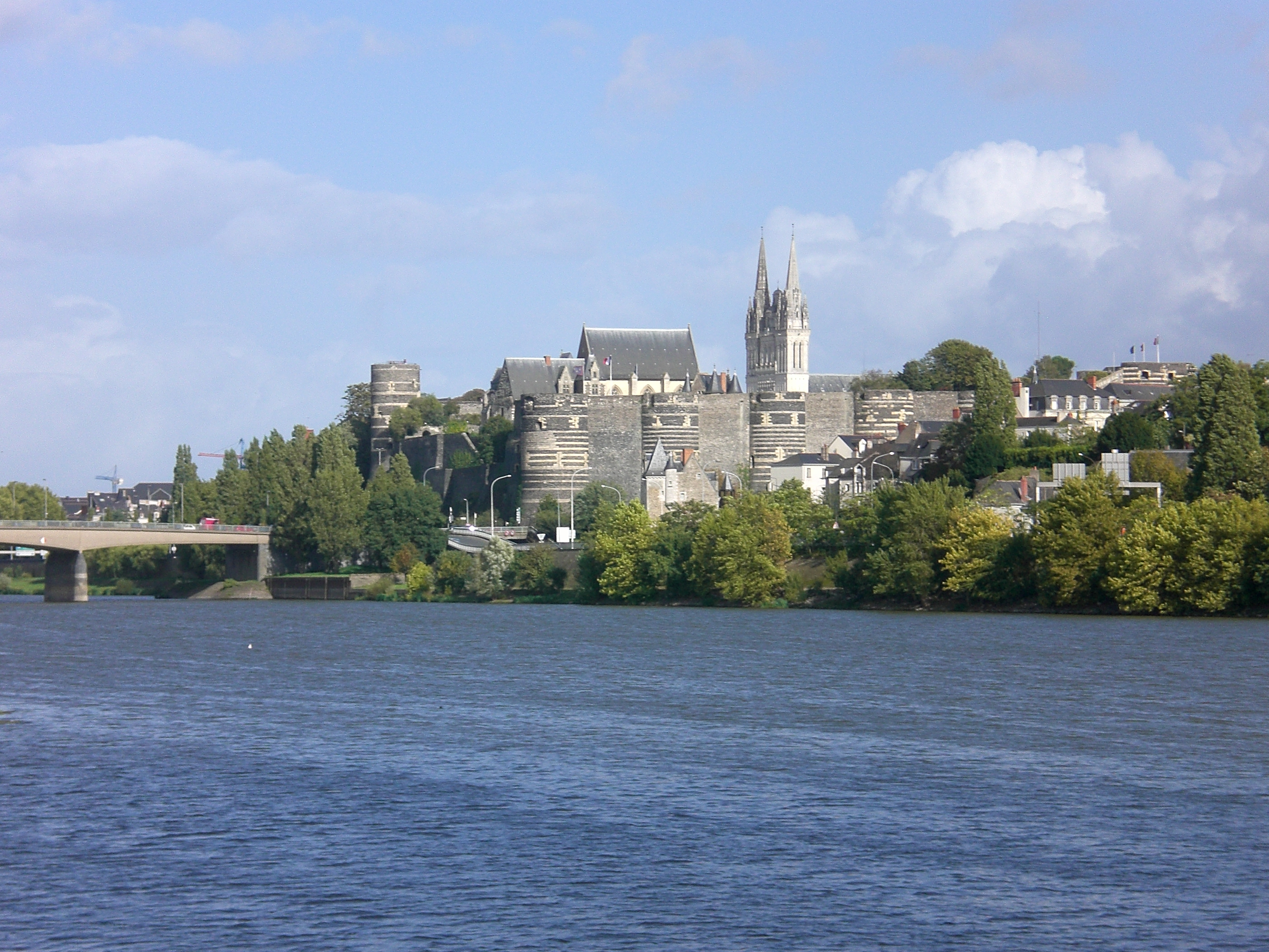
Angers (, , ) is a city in western France, about southwest of Paris. It is the prefecture of the Maine-et-Loire department and was the capital of the province of Anjou until the French Revolution. The inhabitants of both the city and the province are called ''Angevins'' or, more rarely, ''Angeriens''. Angers proper covers and has a population of 154,508 inhabitants, while around 432,900 live in its metropolitan area (''aire d'attraction''). The Angers Loire Métropole is made up of 29 communes covering with 299,500 inhabitants (2018).Comparateur de territoire INSEE Not including the broader metropolitan area, Angers is the third most populous |
Loir-et-Cher
Loir-et-Cher (, ) is a department in the Centre-Val de Loire region of France. Its name is originated from two rivers which cross it, the Loir in its northern part and the Cher in its southern part. Its prefecture is Blois. The INSEE and La Poste gave it the number 41. It had a population of 329,470 in 2019.Populations légales 2019: 41 Loir-et-Cher INSEE History The department of Loir-et-Cher covers a territory which had a substantial population during the prehistoric period. However it was not until the that local inhabitants built various castles and other fortifications to enable them to withstand a series of invasions of |
Montoire-sur-le-Loir
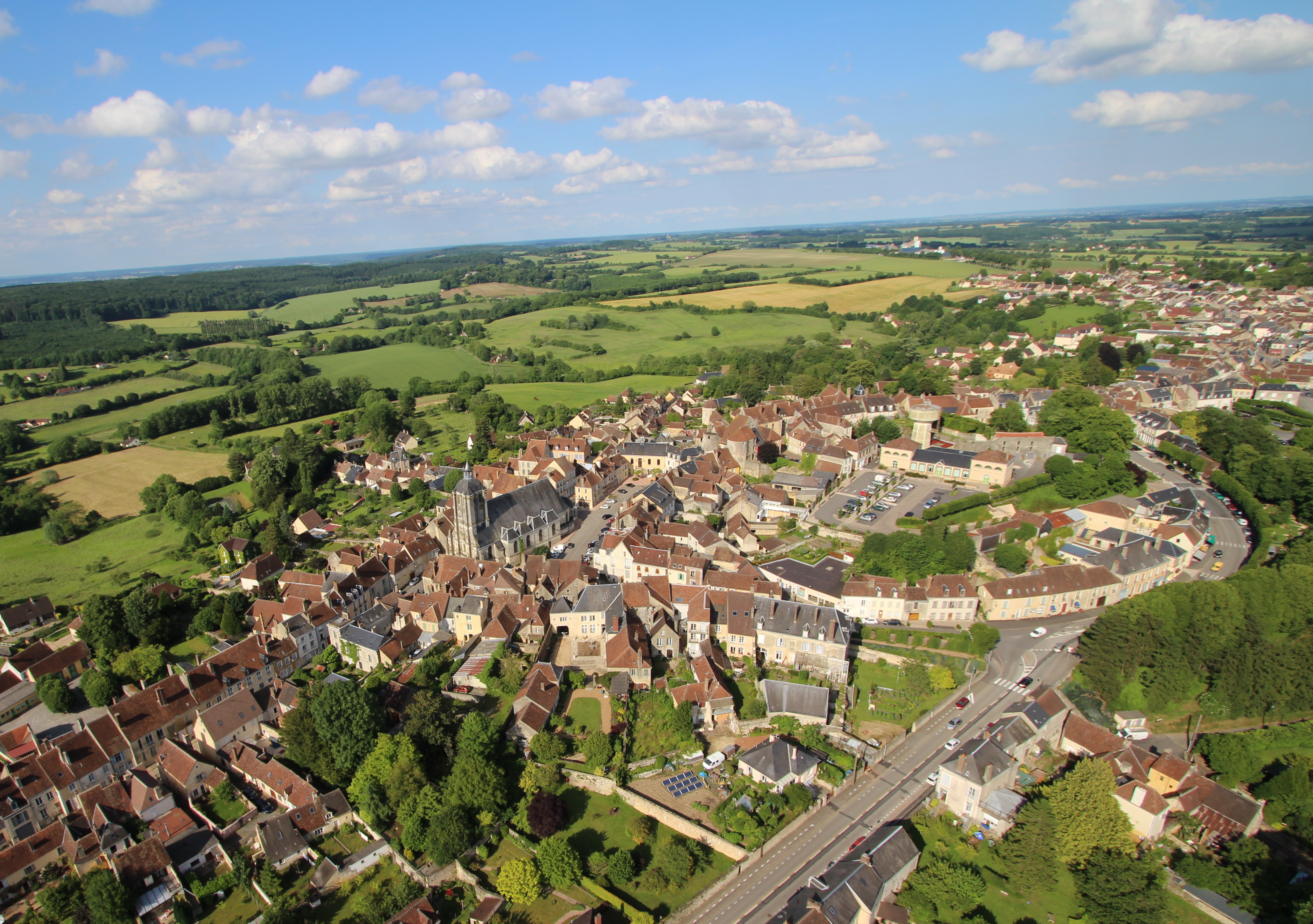
Montoire-sur-le-Loir (, literally ''Montoire on the Loir''), commonly known as Montoire, is a commune near Vendôme, in the Loir-et-Cher department in Centre-Val de Loire, France. History Montoire-sur-le-Loir is known as the location where, on 24 October 1940, the famous handshake between Adolf Hitler and Philippe Pétain took place signifying the start of organised collaboration of Vichy France with the Nazi regime. The meeting took place in a railway car just outside the town's railway station. The discussion was entirely a matter of generalities, with no specifics discussed or decided. Hitler was impressed with Pétain's commitment to defending the French colonial empire. False rumours abounded that France had made major concessions regarding colonies and German control of French ports and the French fleet. This was announced to the French public on 30 October in a radio broadcast speech when Pétain declared, "I enter, today, into the way of collaboration.""J'entre aujourd ... [...More Info...] [...Related Items...] OR: [Wikipedia] [Google] [Baidu] |
Perche
Perche () (French: ''le Perche'') is a former province of France, known historically for its forests and, for the past two centuries, for the Percheron draft horse breed. Until the French Revolution, Perche was bounded by four ancient territories of northwestern France: the provinces of Maine, Normandy, and Orléanais, and the region of Beauce. Afterwards it was absorbed into the present-day departments of Orne and Eure-et-Loir, with small parts in the neighboring departments of Eure, Loir-et-Cher, and Sarthe. Toponymy ''Perche'' is known by the following ancient Latin and French toponymic designations: ''saltus Particus'', ''silva Perticus'' before the 6th century, ''pagus quem Pert cnsem vocant'' and ''pagus pertensis'' in the 6th century, ''pagus Perticus'' no date and c. 815, ''Particus saltus'' in the 11th century, ''silva Perticus'' in 1045, '' ePerche'' in 1160 - 1174 and in 1308, ''Perche'' in1238, ''foresta de Pertico'' in1246,Nègre, Ernest (1990). ''Toponymie génér ... [...More Info...] [...Related Items...] OR: [Wikipedia] [Google] [Baidu] |
Ozanne
The Ozanne is a 46.0 km long French river, a tributary of the Loir, which is a tributary of the Loire. Geography The river spring is located at Perche-Gouët, Béthonvilliers at 222 m high at le Burail locality in le Bois de Beaumont. 2 offshoots: la Suzanne ou Sainte-Suzanne et l'Ozanne de Dampierre ou Moranne ou Mozanne which join near Brou. It flows into le Loir, right bank, 1 km north of Bonneval at 129 m high at Ouzenain (locality). Tributaries The Ozanne has 7 official affluents (14 including sub-affluents) : * ?(source secondaire), (rg), 3 km, sur les deux communes de Vicheres et Beaumont-les-Autels. * ?, (rg), 0.9 km, sur les deux communes de Miermaigne et Beaumont-les-Autels. * sept bras de l'Ozanne, pour un total de 8.3 km sur les six communes de Unverre, Brou, Yèvres, Dangeau, Moulhard et Luigny. * le Sainte Suzanne, (rd), 19.2 km sur les cinq communes de Unverre, Authon-du-Perche, Charbonnières, Beaumont-les-Autels et L ... [...More Info...] [...Related Items...] OR: [Wikipedia] [Google] [Baidu] |
La Flèche
La Flèche () is a town and commune in the French department of Sarthe, in the Pays de la Loire region in the Loire Valley. It is the sub-prefecture of the South-Sarthe, the chief district and the chief city of a canton, and the second most populous city of the department. The city is part of the Community of communes of the Pays La Flèche. The inhabitants of the town are called ''Fléchois''. It is classified as an area of art and history. The Prytanée National Militaire is located in La Flèche. Geography La Flèche is located on the Loir River and is also on the Greenwich Meridian. It is located halfway between Le Mans (45 km) and Angers. City communes * Sainte-Colombe * Saint-Germain-du-Val * Verron Neighboring municipalities * Bazouges Cré sur Loir * Crosmières * Villaines-sous-Malicorne * Bousse * Clermont-Créans * Mareil-sur-Loir * Thorée-les-Pins * Baugé-en-Anjou (Maine-et-Loire) History The origin of the name ''La Flèche'' is uncertain; th ... [...More Info...] [...Related Items...] OR: [Wikipedia] [Google] [Baidu] |
Château-du-Loir
Château-du-Loir (; literally 'Château of the Loir') is a former Communes of France, commune in the Sarthe Departments of France, department in the Regions of France, region of Pays de la Loire in north-western France. On 1 October 2016, it was merged into the new commune Montval-sur-Loir. 28 June 2016 Château-du-Loir station has rail connections to Tours and Le Mans. Notable people *Gervais II, Lord of Château-du-Loir, Gervais II, lord of Château-du-Loir *Cécile Didier (1888–1975), stage and film actress * Guillaume des Roches (1165 - 1222), lord of Longué-Jumelles and Château-du-Loir, comrade in arms of Philippe Auguste * Siméon-François Berneux, Saint Siméon-François Berneux (1814 - 1866), one of the Korean Martyrs * Pierre Loutrel (1916 - 1946), bandit |
Cloyes-sur-le-Loir
Cloyes-sur-le-Loir (, literally ''Cloyes on the Loir'') is a former commune on the River Loir, a few kilometres south of the town of Châteaudun in the department of Eure-et-Loir in northern France. On 1 January 2017, it was merged into the new commune Cloyes-les-Trois-Rivières. Population Personalities It was the home of Stephen of Cloyes, a leader of the Children's Crusade. Mezzo-soprano Juliette Borghèse was born in the town. See also *Communes of the Eure-et-Loir department The following is a list of the 365 communes of the Eure-et-Loir department of France. The communes cooperate in the following intercommunalities (as of 2020):Official web ... [...More Info...] [...Related Items...] OR: [Wikipedia] [Google] [Baidu] |


