|
Llanilar Railway Station
Llanilar railway stationRCAHMW Retrieved : 2012-09-25 was on the Carmarthen to Aberystwyth Line (originally called the Manchester and Milford Railway before being transferred to the Great Western Railway). History The station opened in August 1867 to serve the nearby village. The station closed in December 1964 when services were truncated at Strata Florida railway station, Strata Florida, following flood damage by the River Ystwyth to the line one mile east of Llanilar. Formal closure was confirmed two months later. In 2017, both platforms survive, together with some of the original spear fencing. The station had a signal box set back from the platform, and a combined waiting room and ticket office. The goods yard had a weighbridge and several sidings.References ; ...[...More Info...] [...Related Items...] OR: [Wikipedia] [Google] [Baidu] |
Llanilar
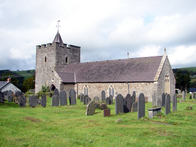
Llanilar is a village and community in Ceredigion, Wales, about southeast of Aberystwyth. It is the eponym of the hundred of Ilar. The population at the 2011 census was 1,085. The community includes Rhos-y-garth. Name In Welsh placenames, many smaller communities are named for their parish ('' llan''), having grown up around the local church. This town's name honours its patron saint, although it is disputed whether that is the church's presumed founder Ilar ( Welsh for " Hilary"), listed as a member of Cadfan's mission and a martyr but now almost totally forgotten, or the more famous Hilary who was bishop of Poitiers in France and is still celebrated by the Anglican and Catholic churches in Wales.Baring-Gould, Sabine & al''The Lives of the British Saints: The Saints of Wales and Cornwall and Such Irish Saints as Have Dedications in Britain'', Vol. III, pp. 299 f Chas. Clark (London), 1908. Hosted at Archive.org. Accessed 25 Nov 2014. (The confusion is ... [...More Info...] [...Related Items...] OR: [Wikipedia] [Google] [Baidu] |
Ceredigion
Ceredigion ( , , ) is a county in the west of Wales, corresponding to the historic county of Cardiganshire. During the second half of the first millennium Ceredigion was a minor kingdom. It has been administered as a county since 1282. Ceredigion is considered a centre of Welsh culture and just under half of the population can speak Welsh according to the 2011 Census. The county is mainly rural, with over of coastline and a mountainous hinterland. The numerous sandy beaches and the long-distance Ceredigion Coast Path provide views of Cardigan Bay. In the 18th and early 19th centuries, Cardiganshire had more industry than it does today; Cardigan was the commercial centre of the county; lead, silver and zinc were mined and Cardigan was the principal port of South Wales prior to the silting of its harbour. The economy became highly dependent on dairy farming and the rearing of livestock for the English market. During the 20th century, livestock farming became less profitable ... [...More Info...] [...Related Items...] OR: [Wikipedia] [Google] [Baidu] |
Ordnance Survey National Grid
The Ordnance Survey National Grid reference system (OSGB) (also known as British National Grid (BNG)) is a system of geographic grid references used in Great Britain, distinct from latitude and longitude. The Ordnance Survey (OS) devised the national grid reference system, and it is heavily used in their survey data, and in maps based on those surveys, whether published by the Ordnance Survey or by commercial map producers. Grid references are also commonly quoted in other publications and data sources, such as guide books and government planning documents. A number of different systems exist that can provide grid references for locations within the British Isles: this article describes the system created solely for Great Britain and its outlying islands (including the Isle of Man); the Irish grid reference system was a similar system created by the Ordnance Survey of Ireland and the Ordnance Survey of Northern Ireland for the island of Ireland. The Universal Transverse Merca ... [...More Info...] [...Related Items...] OR: [Wikipedia] [Google] [Baidu] |
Manchester And Milford Railway
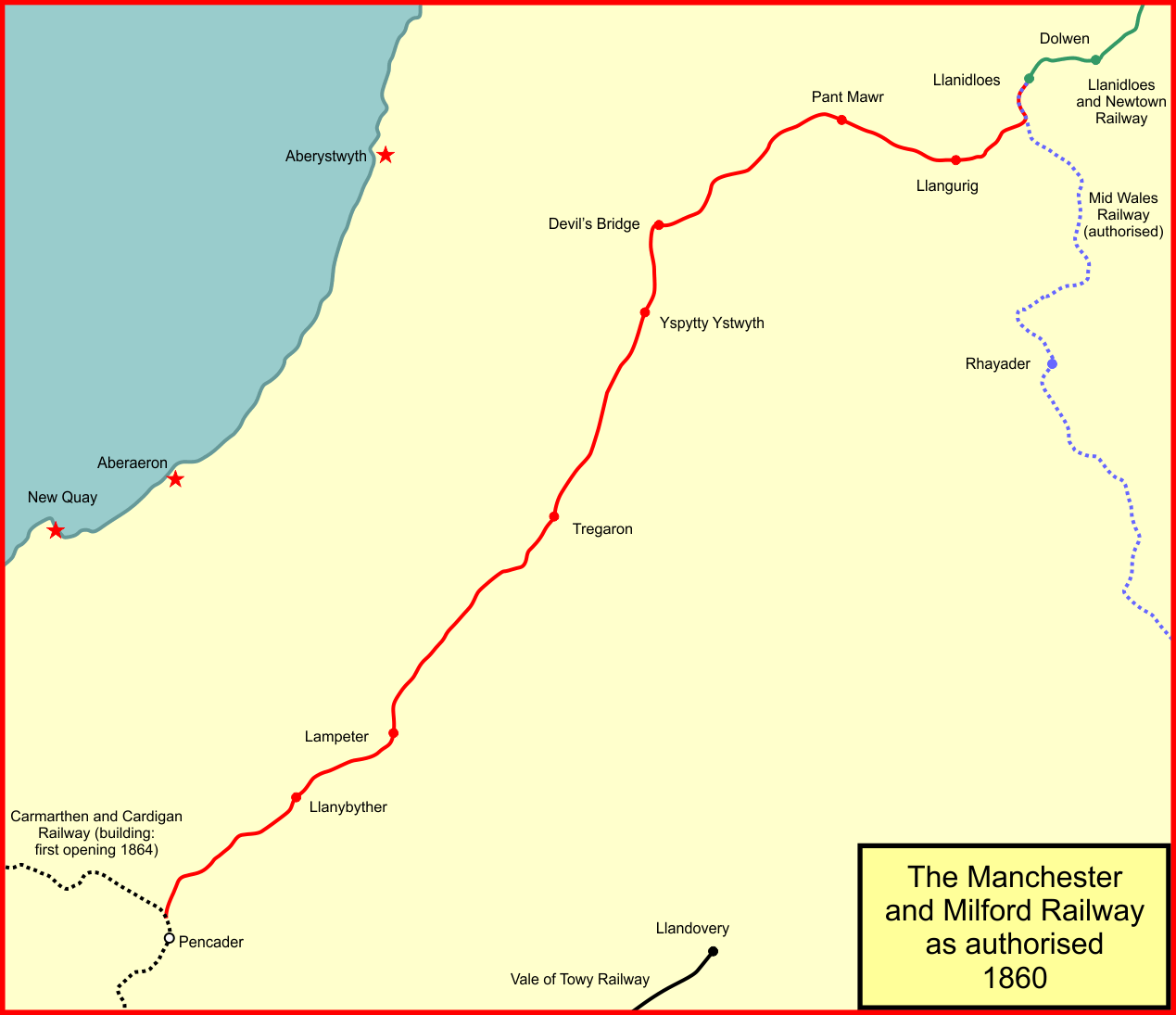
The Manchester and Milford Railway was a Welsh railway company, intended to connect Manchester and the industrial areas of Northwest England with a deep-water port on Milford Haven, giving an alternative to the Port of Liverpool. Despite the title, it was planned to connect other railways at Llanidloes and Pencader, near Carmarthen, and achieve the object in its name by connections with other lines, most of which were only planned. The M&MR had continuous difficulty in raising capital and also in operating profitably, but thanks to a wealthy supporter it opened from Pencader to Lampeter in 1866. Realising that its originally intended route to Llanidloes would be unprofitable, it diverted the course at the north end to Aberystwyth, which it reached in 1867. Sunk by financial difficulties, it was eventually absorbed into the Great Western Railway in 1911. Passenger operation ceased in 1964 and milk trains ran to a creamery until final closure in 1973. Early schemes In the early y ... [...More Info...] [...Related Items...] OR: [Wikipedia] [Google] [Baidu] |
Great Western Railway
The Great Western Railway (GWR) was a British railway company that linked London with the southwest, west and West Midlands of England and most of Wales. It was founded in 1833, received its enabling Act of Parliament on 31 August 1835 and ran its first trains in 1838 with the initial route completed between London and Bristol in 1841. It was engineered by Isambard Kingdom Brunel, who chose a broad gauge of —later slightly widened to —but, from 1854, a series of amalgamations saw it also operate standard-gauge trains; the last broad-gauge services were operated in 1892. The GWR was the only company to keep its identity through the Railways Act 1921, which amalgamated it with the remaining independent railways within its territory, and it was finally merged at the end of 1947 when it was nationalised and became the Western Region of British Railways. The GWR was called by some "God's Wonderful Railway" and by others the "Great Way Round" but it was famed as the "Holiday ... [...More Info...] [...Related Items...] OR: [Wikipedia] [Google] [Baidu] |
Ystwyth Trail Cycle Path - Geograph , a village in Ceredigion, west Wales
{{disambig ...
Ystwyth may refer to: * River Ystwyth, a river in West Wales, which drains into Cardigan Bay at Aberystwyth * Ystwyth valley, a location in Wales drained by the River Ystwyth, known for its lead and silver mines and low life expectancy * Cwm Ystwyth Lead Mine, a disused lead mine in the valley of the River Ystwyth * Baron Ystwyth, an extinct title in the peerage of the United Kingdom * Ysbyty Ystwyth Ysbyty Ystwyth () is a small village and community in Ceredigion, Wales, southeast of Aberystwyth. Its church and the parish of the same name were the property of the Order of the Knights of the Hospital of St John of Jerusalem, hence the 'Ysby ... [...More Info...] [...Related Items...] OR: [Wikipedia] [Google] [Baidu] |
Carmarthen To Aberystwyth Line
Carmarthen (, RP: ; cy, Caerfyrddin , " Merlin's fort" or "Sea-town fort") is the county town of Carmarthenshire and a community in Wales, lying on the River Towy. north of its estuary in Carmarthen Bay. The population was 14,185 in 2011, down from 15,854 in 2001, but gauged at 16,285 in 2019. It has a claim to be the oldest town in Wales – ''Old Carmarthen'' and ''New Carmarthen'' became one borough in 1546. It was the most populous borough in Wales in the 16th–18th centuries, described by William Camden as "chief citie of the country". Growth stagnated by the mid-19th century as new settlements developed in the South Wales Coalfield. History Early history When Britannia was a Roman province, Carmarthen was the civitas capital of the Demetae tribe, known as Moridunum ("Sea Fort"). It is possibly the oldest town in Wales, recorded by Ptolemy and in the Antonine Itinerary. The Roman fort is believed to date from about AD 75. A Roman coin hoard was found nearby in 20 ... [...More Info...] [...Related Items...] OR: [Wikipedia] [Google] [Baidu] |
Strata Florida Railway Station
Strata Florida was a railway station in Wales on the former Carmarthen to Aberystwyth Line serving the villages of Ystrad Meurig, Pontrhydfendigaid and Ffair-rhos. The Manchester and Milford Railway (M&MR) opened from Pencader, Carmarthenshire, Pencader to Aberystwyth on 12 August 1867. The line went into receivership from 1875 to 1900. History The M&MR's original plan was to build a line through the mountains, one scheme involving a six-mile tunnel, to Llangurig railway station, Llangurig whence it would proceed to Llanidloes, reaching Manchester over other companies' lines through Moat Lane, Newtown, Welshpool, Oswestry, Whitchurch and Crewe, however finance was not forthcoming and the prospect of such a route never being economic became apparent: only the section from Llangurig to Llanidloes was actually built. A line towards Aberystwyth via Llanilar railway station, Llanilar was opened instead in 1867; from Aberystwyth access to Moat Lane and onwards could be achieved, afte ... [...More Info...] [...Related Items...] OR: [Wikipedia] [Google] [Baidu] |
River Ystwyth
The River Ystwyth (; cy, Afon Ystwyth "winding river") is a river in Ceredigion, Wales. The length of the main river is . Its catchment area covers . Its source is a number of streams that include the Afon Diliw, located on the west slopes of Plynlimon on the border of Ceredigion and Powys in the Cambrian Mountains. The Ystwyth flows westwards before its confluence with the Afon Rheidol and the estuary at Aberystwyth to drain into Cardigan Bay. The Ystwyth valley is sparsely populated with villages, namely Ysbyty Ystwyth, Cwm Ystwyth, Pont-rhyd-y-groes, Llanilar and Llanfarian. In previous centuries, the valley was relatively densely populated due to its mineral wealth. Silver, lead and zinc have been mined in the valley since Roman times, an activity that reached its peak in the 18th century. The largest of the very many mines was Cwm Ystwyth Mine. It is reputed that the average age at death of the miners in Cwm Ystwyth was 32, largely because of acute lead poisoning. Ther ... [...More Info...] [...Related Items...] OR: [Wikipedia] [Google] [Baidu] |
Felindyffryn Halt Railway Station
Felindyffryn Halt was located on the Carmarthen to Aberystwyth Line, originally called the Manchester and Milford Railway, before being transferred to the Great Western Railway (GWR). History The station was opened in June 1935 by the GWR to serve the mill and the urban area. The station closed in December 1964 when services were truncated at Strata Florida, following flood damage by the River Ystwyth to the line one mile east of Llanilar Llanilar is a village and community in Ceredigion, Wales, about southeast of Aberystwyth. It is the eponym of the hundred of Ilar. The population at the 2011 census was 1,085. The community includes Rhos-y-garth. Name In Welsh placenames, man .... Formal closure was confirmed two months later. The halt was of a basic wooden platform construction with a simple shelter. References ;Notes ;Sources * Further reading * Holden, J.S. (1979, revised 2nd edition 2007): ''The Manchester & Milford Railway'', Oakwood Press, External links Vid ... [...More Info...] [...Related Items...] OR: [Wikipedia] [Google] [Baidu] |
Llanrhystyd Road Railway Station
Llanrhystyd Road railway stationRCAHMW Retrieved : 2012-09-25 was located on the Carmarthen to Aberystwyth Line, originally called the , before being transferred to the GWR. History The station opened in August 1867 to serve the village of wh ...[...More Info...] [...Related Items...] OR: [Wikipedia] [Google] [Baidu] |


