|
List Of Earthquakes In 1988
This is a list of earthquakes in 1988. Only magnitude 6.0 or greater earthquakes appear on the list. Lower magnitude events are included if they have caused death, injury, or damage. All dates are listed according to UTC time. Maximum intensities are indicated on the Modified Mercalli intensity scale and are sourced from United States Geological Survey (USGS) ShakeMap or the National Geophysical Data Center. Earthquake activity in 1988 was relatively low, with only 11 major events and none of magnitude 8.0+ occurring. Nevertheless, extremely destructive events took place in Burma, Nepal, China and Armenia. Burma saw two deadly earthquakes just a few months apart with the latter (on the Chinese border) claiming the lives of nearly a thousand. The Armenia earthquake in December was the deadliest earthquake in this year, with more than 25,000 deaths recorded. Early this year, Australia was also struck by an unusual series of strong earthquakes. Overall By death toll * Note: ... [...More Info...] [...Related Items...] OR: [Wikipedia] [Google] [Baidu] |
Spitak
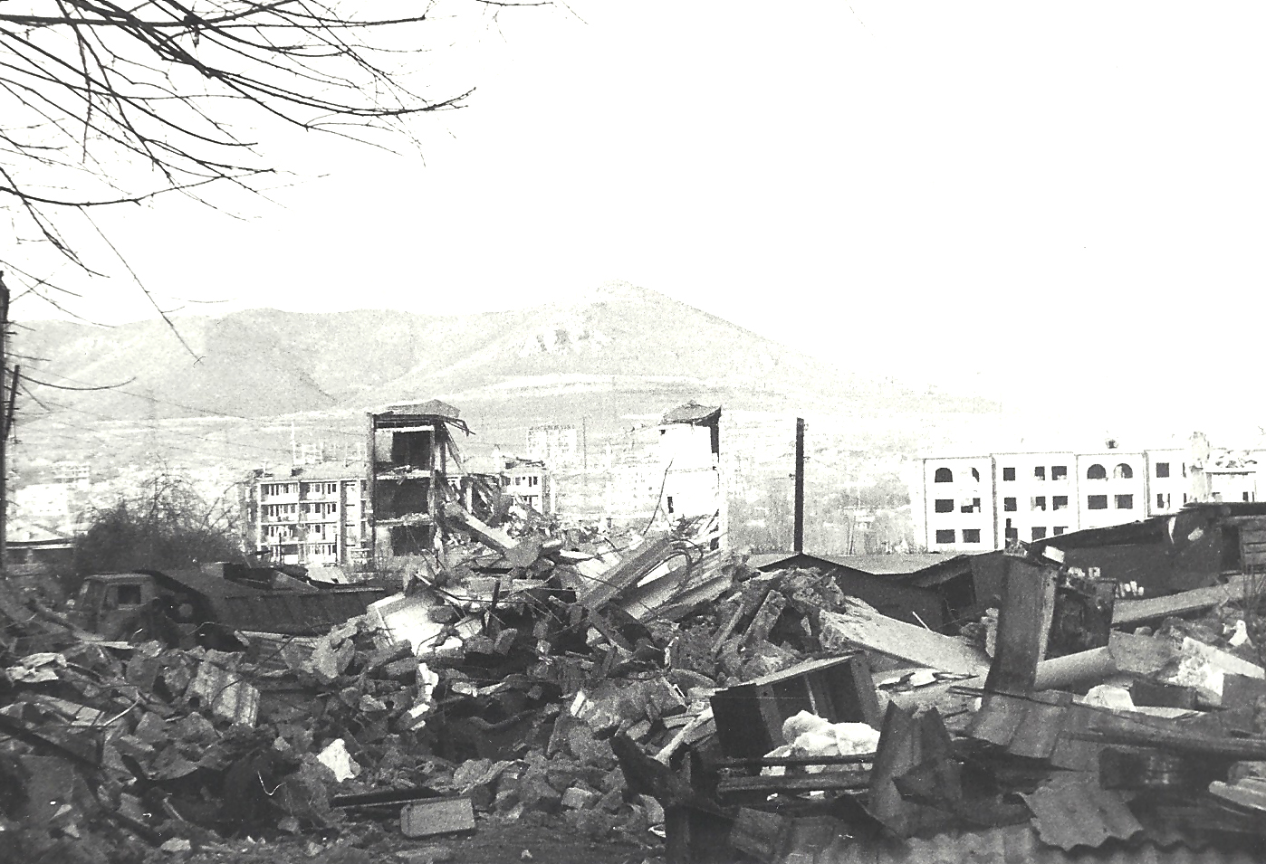
Spitak ( hy, Սպիտակ), is a town and urban municipal community in the northern Lori Province of Armenia. It is north of the capital, Yerevan, and west of the provincial center, Vanadzor. Spitak was entirely destroyed during the devastating 1988 earthquake, and it was rebuilt in a slightly different location. As of the 2011 census, the population of the town is 12,881. Currently, the town has an approximate population of 11,000 as per the 2016 official estimate. Etymology The settlement was first known as ''Hamamlu'', meaning "bath"' in Turkish, as the area had many baths. In 1948, it was renamed ''Spitak'', meaning ''white'' in Armenian because of the presence of white limestone rocks in the area. The word ''spitak'' itself derives from Middle Persian ''spēdag'' (compare Parthian ''ispēd''). History The area of modern-day Spitak was probably inhabited since the 4th millennium BC, based on ancient settlements found on the surrounding hills. Many remnants are found on th ... [...More Info...] [...Related Items...] OR: [Wikipedia] [Google] [Baidu] |
Ningxia
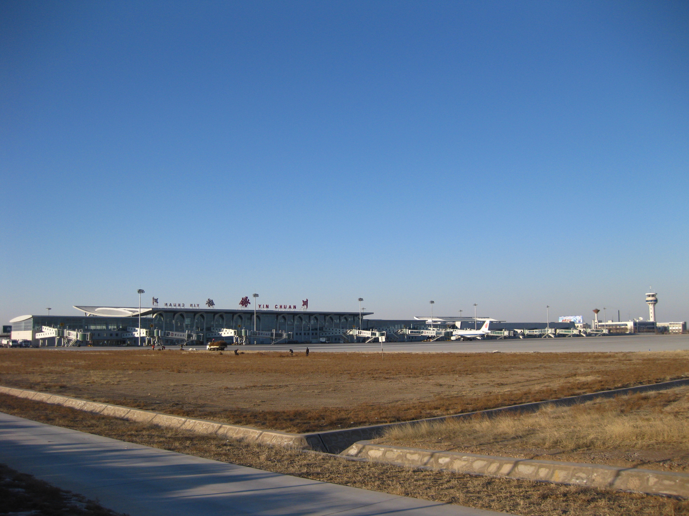
Ningxia (,; , ; alternately romanized as Ninghsia), officially the Ningxia Hui Autonomous Region (NHAR), is an autonomous region in the northwest of the People's Republic of China. Formerly a province, Ningxia was incorporated into Gansu in 1954 but was later separated from Gansu in 1958 and reconstituted as an autonomous region for the Hui people, one of the 56 officially recognised nationalities of China. Twenty percent of China's Hui population lives in Ningxia. Ningxia is bounded by Shaanxi to the east, Gansu to the south and west and Inner Mongolia Autonomous Region to the north and has an area of around . This sparsely settled, mostly desert region lies partially on the Loess Plateau and in the vast plain of the Yellow River and features the Great Wall of China along its northeastern boundary. Over about 2000 years an extensive system of canals (The total length about 1397 kilometers) has been built from Qin dynasty. Extensive land reclamation and irrigation projec ... [...More Info...] [...Related Items...] OR: [Wikipedia] [Google] [Baidu] |
Ninilchik, Alaska
Ninilchik (russian: Нинильчик) ( Dena'ina: ''Niqnalchint'') is a census-designated place (CDP) in Kenai Peninsula Borough, Alaska, United States. At the 2010 census the population was 883, up from 772 in 2000. It is considered an Alaska Native village under the Alaska Native Claims Settlement Act. In the 1970s, villagers formed the Ninilchik Native Association Incorporated. Later the Ninilchik Traditional Council (NTC) was established as the government of Alaska Natives in this area. The Alaska Native people of Ninilchik have ancestors of Aleut and Alutiiq (Sugpiaq) descent, as well as some Dena'ina. Many also include Russian ancestors, from a couple of men who settled here with their Alutiiq wives and children in 1847, and later migrants. Russian was widely spoken in the village for years. Due to the community's isolation, this Russian dialect continued much in its mid-19th century form. With some surviving speakers, it has been studied in the 21st century. Geography ... [...More Info...] [...Related Items...] OR: [Wikipedia] [Google] [Baidu] |
India
India, officially the Republic of India (Hindi: ), is a country in South Asia. It is the seventh-largest country by area, the second-most populous country, and the most populous democracy in the world. Bounded by the Indian Ocean on the south, the Arabian Sea on the southwest, and the Bay of Bengal on the southeast, it shares land borders with Pakistan to the west; China, Nepal, and Bhutan to the north; and Bangladesh and Myanmar to the east. In the Indian Ocean, India is in the vicinity of Sri Lanka and the Maldives; its Andaman and Nicobar Islands share a maritime border with Thailand, Myanmar, and Indonesia. Modern humans arrived on the Indian subcontinent from Africa no later than 55,000 years ago., "Y-Chromosome and Mt-DNA data support the colonization of South Asia by modern humans originating in Africa. ... Coalescence dates for most non-European populations average to between 73–55 ka.", "Modern human beings—''Homo sapiens''—originated in Africa. Then, int ... [...More Info...] [...Related Items...] OR: [Wikipedia] [Google] [Baidu] |
Meghalaya
Meghalaya (, or , meaning "abode of clouds"; from Sanskrit , "cloud" + , "abode") is a states and union territories of India, state in northeastern India. Meghalaya was formed on 21 January 1972 by carving out two districts from the state of Assam: (a) the United Khasi Hills and Jaintia Hills and (b) the Garo Hills.History of Meghalaya State Government of India Meghalaya was previously part of Assam, but on 21 January 1972, the districts of Khasi, Garo and Jaintia Hills became the new state of Meghalaya. The population of Meghalaya as of 2014 is estimated to be 3,211,474. Meghalaya covers an area of approximately 22,430 square kilometres, with a length-to-breadth ratio of about 3:1.Meghal ... [...More Info...] [...Related Items...] OR: [Wikipedia] [Google] [Baidu] |
Assam
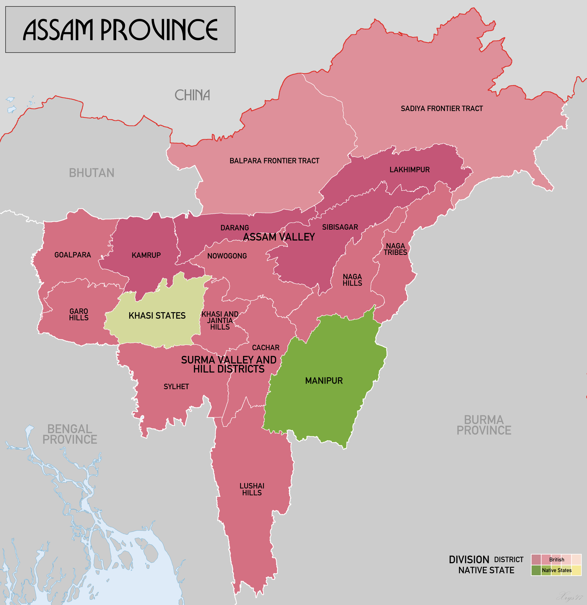
Assam (; ) is a state in northeastern India, south of the eastern Himalayas along the Brahmaputra and Barak River valleys. Assam covers an area of . The state is bordered by Bhutan and Arunachal Pradesh to the north; Nagaland and Manipur to the east; Meghalaya, Tripura, Mizoram and Bangladesh to the south; and West Bengal to the west via the Siliguri Corridor, a wide strip of land that connects the state to the rest of India. Assamese and Boro are the official languages of Assam, while Bengali is an additional official language in the Barak Valley. Assam is known for Assam tea and Assam silk. The state was the first site for oil drilling in Asia. Assam is home to the one-horned Indian rhinoceros, along with the wild water buffalo, pygmy hog, tiger and various species of Asiatic birds, and provides one of the last wild habitats for the Asian elephant. The Assamese economy is aided by wildlife tourism to Kaziranga National Park and Manas National Park, which are ... [...More Info...] [...Related Items...] OR: [Wikipedia] [Google] [Baidu] |
Tripura
Tripura (, Bengali: ) is a state in Northeast India. The third-smallest state in the country, it covers ; and the seventh-least populous state with a population of 36.71 lakh ( 3.67 million). It is bordered by Assam and Mizoram to the east and by Bangladesh to the north, south and west. Tripura is divided into 8 districts and 23 sub-divisions, where Agartala is the capital and the largest city in the state. Tripura has 19 different tribal communities with a majority of the Bengali population. Bengali, English and Kokborok are the state's official languages. The area of modern Tripura — ruled for several centuries by the Manikya Dynasty — was part of the Tripuri Kingdom (also known as Hill Tippera). It became a princely state under the British Raj during its tenure, and acceded to independent India in 1947. It merged with India in 1949 and was designated as a 'Part C State' ( union territory). It became a full-fledged state of India in 1972. Tripura lies in a geographic ... [...More Info...] [...Related Items...] OR: [Wikipedia] [Google] [Baidu] |
Sylhet Division
Sylhet Division ( bn, সিলেট বিভাগ) is the northeastern division of Bangladesh. It is bordered by the Indian states of Meghalaya, Assam and Tripura to the north, east and south respectively, and by the Bangladeshi divisions of Chittagong to the southwest and Dhaka and Mymensingh to the west. Prior to 1947, it included the subdivision of Karimganj (presently in Barak Valley, India). However, Karimganj (including the thanas of Badarpur, Patharkandi and Ratabari) was inexplicably severed from Sylhet by the Radcliffe Boundary Commission. According to Niharranjan Ray, it was partly due to a plea from a delegation led by Abdul Matlib Mazumdar. Etymology and names The name ''Sylhet'' is an anglicisation of ''Shilhot'' (শিলহট). Its origins seem to come from the Sanskrit words শিলা ''śilā'' (meaning 'stone') and হট্ট ''haṭṭa'' (meaning 'marketplace'). These words match the landscape and topography of the hilly region. The shila stones ... [...More Info...] [...Related Items...] OR: [Wikipedia] [Google] [Baidu] |
Aftershock
In seismology, an aftershock is a smaller earthquake that follows a larger earthquake, in the same area of the main shock, caused as the displaced crust adjusts to the effects of the main shock. Large earthquakes can have hundreds to thousands of instrumentally detectable aftershocks, which steadily decrease in magnitude and frequency according to a consistent pattern. In some earthquakes the main rupture happens in two or more steps, resulting in multiple main shocks. These are known as doublet earthquakes, and in general can be distinguished from aftershocks in having similar magnitudes and nearly identical seismic waveforms. Distribution of aftershocks Most aftershocks are located over the full area of fault rupture and either occur along the fault plane itself or along other faults within the volume affected by the strain associated with the main shock. Typically, aftershocks are found up to a distance equal to the rupture length away from the fault plane. The pattern ... [...More Info...] [...Related Items...] OR: [Wikipedia] [Google] [Baidu] |
Taltal
Taltal is a Chilean commune and city in Antofagasta Province, Antofagasta Region. According to the 2012 census, the commune has a population of 11,132 and has an area of . The commune is home to Paranal Observatory and includes the northern portion of Pan de Azúcar National Park. Etymology It has been claimed the etymological origin of the name is the Mapuche word ''Thalthal'', which means “night bird.” This would make it one of the northernmost Mapuche toponyms in Chile. History The history of Taltal begins with the opening of the copper mine "El Cobre" by José Antonio Moreno in 1850 about 20 kilometers north of Taltal. This brought miners and prospectors to the area. In 1855 Moreno expanded his operations to include Taltal. The discovery of copper in 1858 on nearby Mount Cachiyuyal increased pressure on the port, which had to utilize customs officials from Copiapo. So Moreno requested official recognition of the port which was granted by decree on 12 July 1858. Howe ... [...More Info...] [...Related Items...] OR: [Wikipedia] [Google] [Baidu] |
1988 Tennant Creek Earthquakes
On 22 January 1988, a sequence of destructive earthquakes measuring 6.2, 6.3, and 6.6 struck southwest of Tennant Creek, Australia which was felt as far north as Darwin and in other regions of the country. The largest event of the sequence was the largest earthquake ever recorded in mainland Australia since records began in 1800. An intensity of IX ''(Violent)'' was observed. Despite the large magnitude of the earthquakes and a close proximity to a town, in a country where earthquakes of this size are not common, damages were limited. Thousands of aftershocks were reported and felt across Northern Territory. Tectonic setting The continent of Australia borders some very seismically active regions, as such as the boundary between the Pacific and the Australian Plate where both plates collide, which runs from the island of New Guinea all the way to New Zealand. On the south and west sides of it are moderately active mid-ocean ridges which run through the Indian Ocean. However, the ... [...More Info...] [...Related Items...] OR: [Wikipedia] [Google] [Baidu] |
Northern Territory
The Northern Territory (commonly abbreviated as NT; formally the Northern Territory of Australia) is an states and territories of Australia, Australian territory in the central and central northern regions of Australia. The Northern Territory shares its borders with Western Australia to the west (129th meridian east), South Australia to the south (26th parallel south), and Queensland to the east (138th meridian east). To the north, the territory looks out to the Timor Sea, the Arafura Sea and the Gulf of Carpentaria, including Western New Guinea and other islands of the Indonesian archipelago. The NT covers , making it the third-largest Australian federal division, and List of country subdivisions by area, the 11th-largest country subdivision in the world. It is sparsely populated, with a population of only 249,000 – fewer than half as many people as in Tasmania. The largest population center is the capital city of Darwin, Northern Territory, Darwin. The archaeological hist ... [...More Info...] [...Related Items...] OR: [Wikipedia] [Google] [Baidu] |


