|
Lindenberg Peninsula
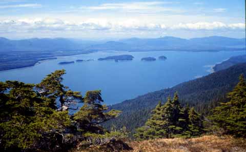
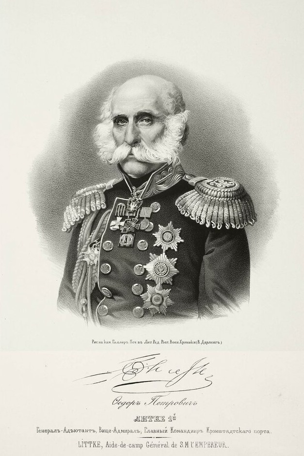
The Lindenberg Peninsula is a peninsula on the eastern coast of Kupreanof Island, Alexander Archipelago in southeastern Alaska, U.S.A. It is separated from the main portion of the island by the Duncan Canal, Alaska, Duncan Canal. The peninsula was named in 1853 by navigator Ensign Mikhail Vasiliev, Lt. Vasiliev of the Russian Hydrographic Department of the Imperial Russian Navy after Russian geographer of Finland, Finnish origin G. Lindenberg. Lindenberg explored and surveyed the Alexander Archipelago in 1838. References USGS-GNIS Peninsulas of Alaska Alexander Archipelago Landforms of Petersburg Borough, Alaska {{WrangellPetersburgAK-geo-stub ... [...More Info...] [...Related Items...] OR: [Wikipedia] [Google] [Baidu] |
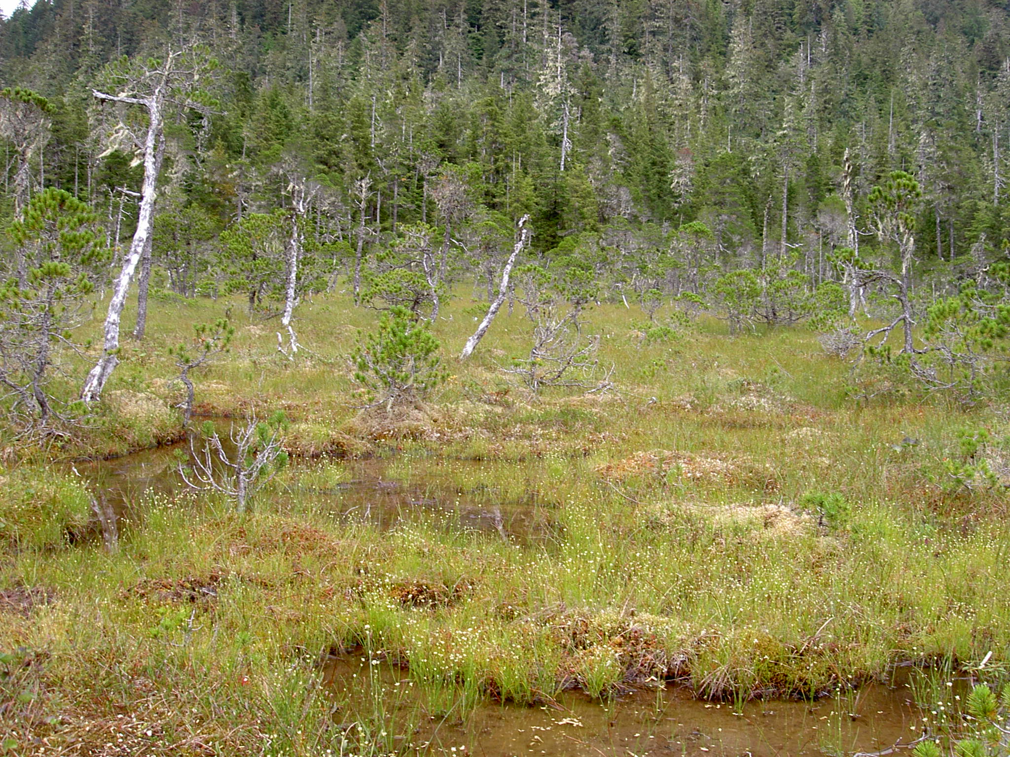
Lindenberg Peninsula Muskeg 4181
Lindenberg is a German language, German name meaning "Tilia tree" hill and may refer to: * Lindenberg im Allgäu, a town in Bavaria, Germany * Lindenberg, Mecklenburg-Vorpommern, a municipality in Mecklenburg-Vorpommern, Germany * Lindenberg, Rhineland-Palatinate, a municipality in Rhineland-Palatinate, Germany * Lindenberg (Habichtswald), a hill in Hesse, Germany * Lindenberg (Switzerland), a mountain in the canton of Lucerne, Switzerland * Governador Lindenberg, Espírito Santo, a municipality in Brazil * , near Beeskow, Oder-Spree Lindenberg is the surname of: * Carl Lindenberg (1850–1928), judge and major stamp collector in Germany. * Grzegorz Lindenberg (born 1955), Polish sociologist and journalist * James Lindenberg (1921–2009), American actor * Jarosław Lindenberg (born 1956), Polish philosopher, diplomat * Katja Lindenberg (born 1941), Ecuadorian-American chemical physicist * Udo Lindenberg (born 1946), German rock musician and composer See also * Lindberg (disam ... [...More Info...] [...Related Items...] OR: [Wikipedia] [Google] [Baidu] |
Kupreanof Island
Kupreanof Island (russian: Остров Купреянова) is an island in the Alexander Archipelago in southeastern Alaska. The island is long and wide with a total land area is , making it the 13th largest island in the United States and the 170th largest island in the world. The Lindenberg Peninsula on the southeast side of the island is considered part of the island. The peninsula is separated from the rest of the island by a narrow inlet called Duncan Canal. The island's population was 785 at the 2000 census. The island was first charted in 1793–1794 by James Johnstone and Joseph Whidbey, both part of British naval officer George Vancouver's 1791–1795 expedition. The island is named after vice admiral Ivan Antonovich Kupreianov, governor of the Russian American colonies from 1836 to 1840; the name was published in 1848 on a Russian Hydrographic Department chart as "Os(trov) Kupreyanova". The largest settlement on the island is Kake, on the northwestern side ... [...More Info...] [...Related Items...] OR: [Wikipedia] [Google] [Baidu] |
Alexander Archipelago
The Alexander Archipelago (russian: Архипелаг Александра) is a long archipelago (group of islands) in North America lying off the southeastern coast of Alaska. It contains about 1,100 islands, the tops of submerged coastal mountains that rise steeply from the Pacific Ocean. Deep channels and fjords separate the islands and cut them off from the mainland. The islands shelter the northern part of the Inside Passage as it winds its way among them. The islands have irregular, steep coasts and dense evergreen and temperate rain forests; most are accessible only by boat or by aeroplane. The vast majority of the islands are part of the Tongass National Forest. In order of land area, the largest islands are Prince of Wales Island, Chichagof Island, Admiralty Island, Baranof Island, Revillagigedo Island, Kupreanof Island, Kuiu Island, Etolin Island, Dall Island, Wrangell Island, Mitkof Island, Zarembo Island, Kosciusko Island, Kruzof Island, Annette Island, Gravin ... [...More Info...] [...Related Items...] OR: [Wikipedia] [Google] [Baidu] |
Alaska
Alaska ( ; russian: Аляска, Alyaska; ale, Alax̂sxax̂; ; ems, Alas'kaaq; Yup'ik: ''Alaskaq''; tli, Anáaski) is a state located in the Western United States on the northwest extremity of North America. A semi-exclave of the U.S., it borders the Canadian province of British Columbia and the Yukon territory to the east; it also shares a maritime border with the Russian Federation's Chukotka Autonomous Okrug to the west, just across the Bering Strait. To the north are the Chukchi and Beaufort Seas of the Arctic Ocean, while the Pacific Ocean lies to the south and southwest. Alaska is by far the largest U.S. state by area, comprising more total area than the next three largest states (Texas, California, and Montana) combined. It represents the seventh-largest subnational division in the world. It is the third-least populous and the most sparsely populated state, but by far the continent's most populous territory located mostly north of the 60th parallel, with ... [...More Info...] [...Related Items...] OR: [Wikipedia] [Google] [Baidu] |
Duncan Canal, Alaska
The Duncan Canal is a naturally occurring inland waterway in the Alexander Archipelago in Alaska, United States. It deeply penetrates Kupreanof Island, separating the Lindenberg Peninsula, on the southeast side of the island from the main island. It was first charted in 1793 by James Johnstone, one of George Vancouver's officers during his 1791-95 expedition. It was named after the English missionary William Duncan. The Duncan Canal Portage is a popular hiking trail across the northern end of the Lindenberg Peninsula. It originally provided access to the northern end of the Duncan Canal directly from Frederick Sound. Butterworth Island is located at the mouth of the Duncan Canal where it debouches into the Sumner Strait past the larger Woewodski Island. References External links Wright, Fred Eugene and Wright, Charles Will (1908) "Duncan Canal" ''The Ketchikan and Wrangell Mining Districts, Alaska'' Bulletin 347, United States Geological Survey, Government Printing Offic ... [...More Info...] [...Related Items...] OR: [Wikipedia] [Google] [Baidu] |
Ensign Mikhail Vasiliev
Mikhail Nikolayevich Vasilyev (russian: Михаил Николаевич Васильев; 1770 – June 23, 1847) was a Russian explorer and vice admiral of the Imperial Russian Navy. He is reputed for having surveyed the then little-known coast of Alaska as navigator. Vasiliev was sent by the Russian Imperial Hydrographic Service in 1819 to explore the northern parts of the Pacific Ocean and particularly the area around the Bering Strait. Certain geographic features of the Alaskan coast, like the Lindenberg Peninsula and Sealion Island were named by him in the maps that were subsequently published. In 1820 Mikhail Vasiliev on the ship ''Otkrytie (Discovery)'' entered the Chukchi Sea and explored the coast of Alaska from Kotzebue Sound to Icy Cape and later from Norton Sound to Cape Newenham. He was accompanied by Gleb Semenovich Shishmarev (1781-1835), who was in command of the ship ''Blagonamerennyi (Good Intent)''. After these surveys, in which he is credited to be the ... [...More Info...] [...Related Items...] OR: [Wikipedia] [Google] [Baidu] |
Russian Hydrographic Department
The Russian Hydrographic Service, full current official name Department of Navigation and Oceanography of the Ministry of Defence of the Russian Federation ( rus, Управление навигации и океанографии Министерства обороны Российской Федерации), is Russia's hydrographic office, with responsibility to facilitate navigation, performing hydrographic surveys and publishing nautical charts. Since the Russian state is of such a vast size and nature that it includes many different seas, long and indented coastlines and a great number of islands, as well as a complex system of waterways and lakes, surveying has been an indispensable activity for the Russian Navy since its modernization at the time of Czar Peter the Great in the 17th century. The hydrographic service has been historically attached to the Russian Navy and the agents and supervisors of hydrographic works have been largely naval officers throughout its history ... [...More Info...] [...Related Items...] OR: [Wikipedia] [Google] [Baidu] |
Imperial Russian Navy
The Imperial Russian Navy () operated as the navy of the Russian Tsardom and later the Russian Empire from 1696 to 1917. Formally established in 1696, it lasted until dissolved in the wake of the February Revolution of 1917. It developed from a smaller force that had existed prior to Tsar Peter the Great's founding of the modern Russian navy during the Second Azov campaign in 1696. It expanded in the second half of the 18th century and reached its peak strength by the early part of the 19th century, behind only the British and French fleets in terms of size. The Imperial Navy drew its officers from the aristocracy of the Empire, who belonged to the state Russian Orthodox Church. Young aristocrats began to be trained for leadership at a national naval school. From 1818 on, only officers of the Imperial Russian Navy were appointed to the position of Chief Manager of the Russian-American Company, based in Russian America (present-day Alaska) for colonization and fur-trade developme ... [...More Info...] [...Related Items...] OR: [Wikipedia] [Google] [Baidu] |
Russia
Russia (, , ), or the Russian Federation, is a List of transcontinental countries, transcontinental country spanning Eastern Europe and North Asia, Northern Asia. It is the List of countries and dependencies by area, largest country in the world, with its internationally recognised territory covering , and encompassing one-eighth of Earth's inhabitable landmass. Russia extends across Time in Russia, eleven time zones and shares Borders of Russia, land boundaries with fourteen countries, more than List of countries and territories by land borders, any other country but China. It is the List of countries and dependencies by population, world's ninth-most populous country and List of European countries by population, Europe's most populous country, with a population of 146 million people. The country's capital and List of cities and towns in Russia by population, largest city is Moscow, the List of European cities by population within city limits, largest city entirely within E ... [...More Info...] [...Related Items...] OR: [Wikipedia] [Google] [Baidu] |
Finland
Finland ( fi, Suomi ; sv, Finland ), officially the Republic of Finland (; ), is a Nordic country in Northern Europe. It shares land borders with Sweden to the northwest, Norway to the north, and Russia to the east, with the Gulf of Bothnia to the west and the Gulf of Finland across Estonia to the south. Finland covers an area of with a population of 5.6 million. Helsinki is the capital and largest city, forming a larger metropolitan area with the neighbouring cities of Espoo, Kauniainen, and Vantaa. The vast majority of the population are ethnic Finns. Finnish, alongside Swedish, are the official languages. Swedish is the native language of 5.2% of the population. Finland's climate varies from humid continental in the south to the boreal in the north. The land cover is primarily a boreal forest biome, with more than 180,000 recorded lakes. Finland was first inhabited around 9000 BC after the Last Glacial Period. The Stone Age introduced several differ ... [...More Info...] [...Related Items...] OR: [Wikipedia] [Google] [Baidu] |
Peninsulas Of Alaska
A peninsula (; ) is a landform that extends from a mainland and is surrounded by water on most, but not all of its borders. A peninsula is also sometimes defined as a piece of land bordered by water on three of its sides. Peninsulas exist on all continents. The size of a peninsula can range from tiny to very large. The largest peninsula in the world is the Arabian Peninsula. Peninsulas form due to a variety of causes. Etymology Peninsula derives , which is translated as 'peninsula'. itself was derived , or together, 'almost an island'. The word entered English in the 16th century. Definitions A peninsula is usually defined as a piece of land surrounded on most, but not all sides, but is sometimes instead defined as a piece of land bordered by water on three of its sides. A peninsula may be bordered by more than one body of water, and the body of water does not have to be an ocean or a sea. A piece of land on a very tight river bend or one between two rivers is sometimes s ... [...More Info...] [...Related Items...] OR: [Wikipedia] [Google] [Baidu] |


