|
Duncan Canal, Alaska
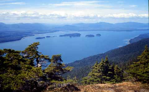
The Duncan Canal is a naturally occurring inland waterway in the Alexander Archipelago in Alaska, United States. It deeply penetrates Kupreanof Island, separating the Lindenberg Peninsula, on the southeast side of the island from the main island. It was first charted in 1793 by James Johnstone, one of George Vancouver's officers during his 1791-95 expedition. It was named after the English missionary William Duncan. The Duncan Canal Portage is a popular hiking trail across the northern end of the Lindenberg Peninsula. It originally provided access to the northern end of the Duncan Canal directly from Frederick Sound. Butterworth Island is located at the mouth of the Duncan Canal where it debouches into the Sumner Strait past the larger Woewodski Island. References External links Wright, Fred Eugene and Wright, Charles Will (1908) "Duncan Canal" ''The Ketchikan and Wrangell Mining Districts, Alaska'' Bulletin 347, United States Geological Survey, Government Printing Offic ... [...More Info...] [...Related Items...] OR: [Wikipedia] [Google] [Baidu] |
Waterway
A waterway is any navigable body of water. Broad distinctions are useful to avoid ambiguity, and disambiguation will be of varying importance depending on the nuance of the equivalent word in other languages. A first distinction is necessary between maritime shipping routes and waterways used by inland water craft. Maritime shipping routes cross oceans and seas, and some lakes, where navigability is assumed, and no engineering is required, except to provide the draft for deep-sea shipping to approach seaports (channels), or to provide a short cut across an isthmus; this is the function of ship canals. Dredged channels in the sea are not usually described as waterways. There is an exception to this initial distinction, essentially for legal purposes, see under international waters. Where seaports are located inland, they are approached through a waterway that could be termed "inland" but in practice is generally referred to as a "maritime waterway" (examples Seine Maritime, Loir ... [...More Info...] [...Related Items...] OR: [Wikipedia] [Google] [Baidu] |
Alexander Archipelago
The Alexander Archipelago (russian: Архипелаг Александра) is a long archipelago (group of islands) in North America lying off the southeastern coast of Alaska. It contains about 1,100 islands, the tops of submerged coastal mountains that rise steeply from the Pacific Ocean. Deep channels and fjords separate the islands and cut them off from the mainland. The islands shelter the northern part of the Inside Passage as it winds its way among them. The islands have irregular, steep coasts and dense evergreen and temperate rain forests; most are accessible only by boat or by aeroplane. The vast majority of the islands are part of the Tongass National Forest. In order of land area, the largest islands are Prince of Wales Island, Chichagof Island, Admiralty Island, Baranof Island, Revillagigedo Island, Kupreanof Island, Kuiu Island, Etolin Island, Dall Island, Wrangell Island, Mitkof Island, Zarembo Island, Kosciusko Island, Kruzof Island, Annette Island, Gravin ... [...More Info...] [...Related Items...] OR: [Wikipedia] [Google] [Baidu] |
Alaska
Alaska ( ; russian: Аляска, Alyaska; ale, Alax̂sxax̂; ; ems, Alas'kaaq; Yup'ik: ''Alaskaq''; tli, Anáaski) is a state located in the Western United States on the northwest extremity of North America. A semi-exclave of the U.S., it borders the Canadian province of British Columbia and the Yukon territory to the east; it also shares a maritime border with the Russian Federation's Chukotka Autonomous Okrug to the west, just across the Bering Strait. To the north are the Chukchi and Beaufort Seas of the Arctic Ocean, while the Pacific Ocean lies to the south and southwest. Alaska is by far the largest U.S. state by area, comprising more total area than the next three largest states (Texas, California, and Montana) combined. It represents the seventh-largest subnational division in the world. It is the third-least populous and the most sparsely populated state, but by far the continent's most populous territory located mostly north of the 60th parallel, with ... [...More Info...] [...Related Items...] OR: [Wikipedia] [Google] [Baidu] |
United States
The United States of America (U.S.A. or USA), commonly known as the United States (U.S. or US) or America, is a country primarily located in North America. It consists of 50 states, a federal district, five major unincorporated territories, nine Minor Outlying Islands, and 326 Indian reservations. The United States is also in free association with three Pacific Island sovereign states: the Federated States of Micronesia, the Marshall Islands, and the Republic of Palau. It is the world's third-largest country by both land and total area. It shares land borders with Canada to its north and with Mexico to its south and has maritime borders with the Bahamas, Cuba, Russia, and other nations. With a population of over 333 million, it is the most populous country in the Americas and the third most populous in the world. The national capital of the United States is Washington, D.C. and its most populous city and principal financial center is New York City. Paleo-Americ ... [...More Info...] [...Related Items...] OR: [Wikipedia] [Google] [Baidu] |
Kupreanof Island
Kupreanof Island (russian: Остров Купреянова) is an island in the Alexander Archipelago in southeastern Alaska. The island is long and wide with a total land area is , making it the 13th largest island in the United States and the 170th largest island in the world. The Lindenberg Peninsula on the southeast side of the island is considered part of the island. The peninsula is separated from the rest of the island by a narrow inlet called Duncan Canal. The island's population was 785 at the 2000 census. The island was first charted in 1793–1794 by James Johnstone and Joseph Whidbey, both part of British naval officer George Vancouver's 1791–1795 expedition. The island is named after vice admiral Ivan Antonovich Kupreianov, governor of the Russian American colonies from 1836 to 1840; the name was published in 1848 on a Russian Hydrographic Department chart as "Os(trov) Kupreyanova". The largest settlement on the island is Kake, on the northwestern side ... [...More Info...] [...Related Items...] OR: [Wikipedia] [Google] [Baidu] |
Lindenberg Peninsula
The Lindenberg Peninsula is a peninsula on the eastern coast of Kupreanof Island, Alexander Archipelago in southeastern Alaska, U.S.A. It is separated from the main portion of the island by the Duncan Canal, Alaska, Duncan Canal. The peninsula was named in 1853 by navigator Ensign Mikhail Vasiliev, Lt. Vasiliev of the Russian Hydrographic Department of the Imperial Russian Navy after Russian geographer of Finland, Finnish origin G. Lindenberg. Lindenberg explored and surveyed the Alexander Archipelago in 1838. References USGS-GNIS Peninsulas of Alaska Alexander Archipelago Landforms of Petersburg Borough, Alaska {{WrangellPetersburgAK-geo-stub ... [...More Info...] [...Related Items...] OR: [Wikipedia] [Google] [Baidu] |
James Johnstone (explorer)
James Johnstone (c. 1759 – 1823) was a British naval officer and explorer. He is noted for having served as sailing master of the armed tender and later acting lieutenant during George Vancouver's 1791–1795 expedition to the Pacific Northwest. Johnstone Strait in British Columbia is named after him. Naval and private career Johnstone joined the navy early in 1779, serving aboard the ships HMS ''Keppel'' (a 14-gun sloop), HMS ''La Fortune'' (a recently captured French frigate), , , and ; during this time he sailed to New York, the West Indies (several times), and participated in the Battle of the Chesapeake. On the last ship he met Archibald Menzies, whom Johnstone would become lifelong friends with. He was appointed master in 1785, receiving his master's certificate the following year. Both he and Menzies were discharged in August 1786. Despite passing his lieutenant's examination the next month, he wouldn't receive his commission until seven years later. In October 1786 J ... [...More Info...] [...Related Items...] OR: [Wikipedia] [Google] [Baidu] |
George Vancouver
Captain George Vancouver (22 June 1757 – 10 May 1798) was a British Royal Navy officer best known for his 1791–1795 expedition, which explored and charted North America's northwestern Pacific Coast regions, including the coasts of what are now the Canadian province of British Columbia as well as the US states of Alaska, Washington and Oregon. He also explored the Hawaiian Islands and the southwest coast of Australia. Vancouver Island, the city of Vancouver in British Columbia, Vancouver, Washington in the United States, Mount Vancouver on the Canadian–US border between Yukon and Alaska, and New Zealand's fourth-highest mountain, also Mount Vancouver, are all named after him. Early life George Vancouver was born in the seaport town of King's Lynn (Norfolk, England) on 22 June 1757 - the sixth and youngest child of John Jasper Vancouver, a Dutch-born deputy collector of customs, and Bridget Berners. He came from an old respected family. The surname Vancouver comes ... [...More Info...] [...Related Items...] OR: [Wikipedia] [Google] [Baidu] |
Vancouver Expedition
The Vancouver Expedition (1791–1795) was a four-and-a-half-year voyage of exploration and diplomacy, commanded by Captain George Vancouver of the Royal Navy. The British expedition circumnavigated the globe and made contact with five continents. The expedition at various times included between two and four vessels, and up to 153 men, all but 6 of whom returned home safely. Origin Several previous voyages of exploration including those of Ferdinand Magellan and James Cook, and the Spanish Manila-Acapulco galleons trade route active since 1565, had established the strategic and commercial value of exploring and claiming the Pacific Ocean access, both for its wealth in whales and furs and as a trade route to the "Orient". Britain was especially interested in improving its knowledge of the Southern Pacific whale fisheries, and in particular the location of the strategically positioned Australia, New Zealand, the legendary ''Isla Grande'', and the Northwest Passage. A new ship was ... [...More Info...] [...Related Items...] OR: [Wikipedia] [Google] [Baidu] |
William Duncan (missionary)
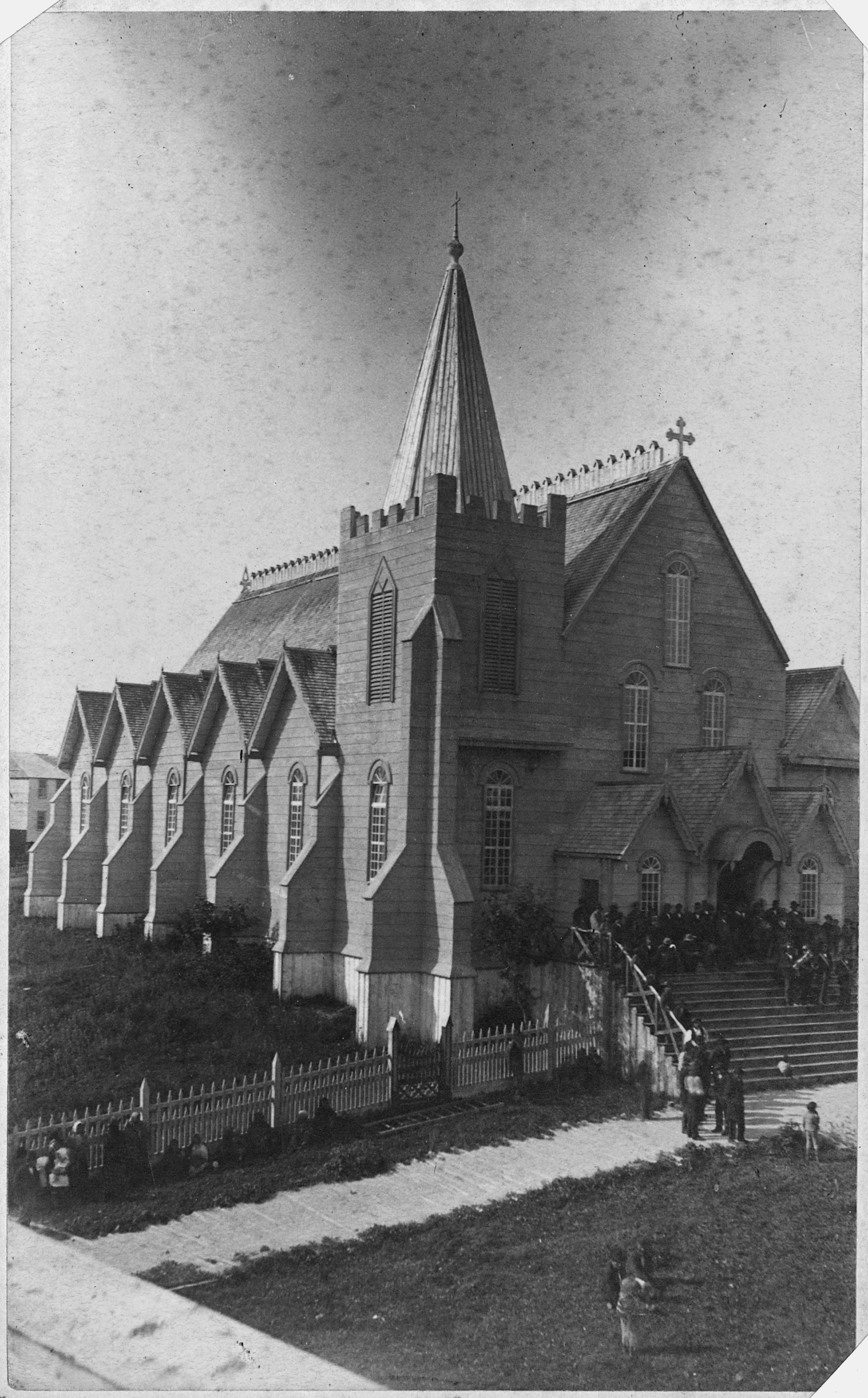
William Duncan (3 April 1832 – 30 August 1918) was an English-born Anglican missionary who founded the Tsimshian communities of Metlakatla, British Columbia, in Canada, and Metlakatla, Alaska, in the United States. Although sometimes referred to as "Father Duncan" in subsequent reports, he was never ordained. Early years Duncan was born in the hamlet of Bishop Burton, Yorkshire, England, the illegitimate son of Maria Duncan, a teenaged servant. He was raised by his mother's parents, William and Elizabeth Duncan. In the 1841 census he is recorded as living with his father and his sister Mary Duncan on Lairgate in Beverley. In 1851 he was lodging with William Botterill, a tailor, and Mary Botterill in Keldgate, Beverley and his occupation is described as book-keeper. Duncan later worked in his grandfather/adoptive father's trade as a tanner. Duncan became the only churchgoer in his impoverished family. In 1854 he joined the Church Missionary Society (CMS) and attended the C ... [...More Info...] [...Related Items...] OR: [Wikipedia] [Google] [Baidu] |
Frederick Sound
Frederick Sound (also called Prince Frederick Sound or Prince Frederick's Sound) is a passage of water in the Alexander Archipelago in Southeast Alaska that separates Kupreanof Island to the south from Admiralty Island in the north. Frederick Sound was named by Captain George Vancouver for Prince Frederick, Duke of York and Albany. It was first charted in 1794 by two of his men, Joseph Whidbey and James Johnstone. The sound may also be known as the Russian transliteration ''Fridrikhe Zund''. The sound is a popular location for watching whales in the summer and is busy marine passageway for both Alaska Marine Highway ferries and cruise ships. The sound is home to the Five Finger Islands Light The Five Finger Islands Light is a lighthouse located on a small island that lies between Stephens Passage and Frederick Sound in Alaska Panhandle, southeastern Alaska. It and Sentinel Island Light Station were the first U.S. government lighthous .... References Alexander Archip ... [...More Info...] [...Related Items...] OR: [Wikipedia] [Google] [Baidu] |


