|
Limestone Way
The Limestone Way is a waymarked long-distance footpath in Derbyshire, England. It runs for through the White Peak of the Peak District National Park, from Castleton south to Rocester over the county boundary into Staffordshire. The trail is named for the limestone scenery along its route. It was devised by Brian Spencer of Matlock Rotary Club and developed and opened in 1986 by the West Derbyshire District Council (which became Derbyshire Dales District Council in 1987). It originally ran to Matlock, but was extended to its current, longer route in 1992 to join up with the Staffordshire Way. The route From Castleton, the route runs up Cave Dale, past the village of Peak Forest, down Hay Dale (shared with the Peak District Boundary Walk) and along Peter Dale. It then runs parallel to Monk's Dale and through the village of Millers Dale (passing under the viaduct which carries the Monsal Trail and crossing the River Wye). It then crosses the A6 near the Waterloo Inn ... [...More Info...] [...Related Items...] OR: [Wikipedia] [Google] [Baidu] |
Derbyshire
Derbyshire ( ) is a ceremonial county in the East Midlands, England. It includes much of the Peak District National Park, the southern end of the Pennine range of hills and part of the National Forest. It borders Greater Manchester to the north-west, West Yorkshire to the north, South Yorkshire to the north-east, Nottinghamshire to the east, Leicestershire to the south-east, Staffordshire to the west and south-west and Cheshire to the west. Kinder Scout, at , is the highest point and Trent Meadows, where the River Trent leaves Derbyshire, the lowest at . The north–south River Derwent is the longest river at . In 2003, the Ordnance Survey named Church Flatts Farm at Coton in the Elms, near Swadlincote, as Britain's furthest point from the sea. Derby is a unitary authority area, but remains part of the ceremonial county. The county was a lot larger than its present coverage, it once extended to the boundaries of the City of Sheffield district in South Yorkshire where it cov ... [...More Info...] [...Related Items...] OR: [Wikipedia] [Google] [Baidu] |
Derbyshire Dales
Derbyshire Dales ( ) is a local government district in Derbyshire, England. The population at the 2011 Census was 71,116. Much of it is in the Peak District, although most of its population lies along the River Derwent. The borough borders the districts of High Peak, Amber Valley, North East Derbyshire and South Derbyshire in Derbyshire, Staffordshire Moorlands and East Staffordshire in Staffordshire and Sheffield in South Yorkshire. The district also lies within the Sheffield City Region, and the district council is a non-constituent partner member of the Sheffield City Region Combined Authority. A significant amount of the working population is employed in Sheffield and Chesterfield. The district offices are at Matlock Town Hall in Matlock. It was formed on 1 April 1974, originally under the name of West Derbyshire. The district adopted its current name on 1 January 1987. The district was a merger of Ashbourne, Bakewell, Matlock and Wirksworth urban districts alon ... [...More Info...] [...Related Items...] OR: [Wikipedia] [Google] [Baidu] |
Monyash
Monyash (/muhn-ee-ash/ munyash) is a village and civil parish in the Peak District, Derbyshire, England, west of the market town Bakewell. It is centred on a village green above sea level at the head of Lathkill Dale in the limestone area known as the White Peak. At the 2011 census, it had a population of 314. Tourism and farming (milk, beef and lamb) are the predominant activities of the village. The area was once an important meeting place, a watering point for drovers’ animals at the intersection of several trade routes, and industrial centre supporting the local lead mining industry.Johnston, Robert and Shirley Johnston, (2010), Monyash: The Making of a Derbyshire Village, The Horizon Press, Ashbourne, History People have been living in and around Monyash since Neolithic times (3750–1750 BC) and probably before then. The nearby impressive stone circle and henge, Arbor Low, was likely built around 2000 BC by people living in the village who also farmed the relativ ... [...More Info...] [...Related Items...] OR: [Wikipedia] [Google] [Baidu] |
Flagg, Derbyshire
Flagg (Old Norse ''A sod of peat'') is a small Peak District village and civil parish, set in the Derbyshire Dales, halfway between the small market town of Bakewell and the spa town of Buxton, in the area known as the White Peak. The population of the civil parish as taken at the 2011 Census was 192. Flagg is predominantly a farming village. As well as farms, houses and cottages, Flagg has an Elizabethan manor house, Flagg Hall, which is not open to the public. There is a caravan/campsite within its grounds. The former Unitarian church, built in 1838, is now a private dwelling. A Methodist chapel is also situated in the village. It was completed in 1839. Next to the chapel is the former village school, now a nursery school. 1000 feet above sea level, Flagg is recorded in the Domesday Book as "Flagun", and is believed to have originally been a Viking settlement engaged primarily in lead mining, the evidence of which can still be seen today with many spoil heaps and disused min ... [...More Info...] [...Related Items...] OR: [Wikipedia] [Google] [Baidu] |
River Wye, Derbyshire
The River Wye is a limestone river in the Peak District of Derbyshire, England. It is 22 miles long (widely but incorrectly attributed as 15 miles/24 km, which refers to the section within the National Park), and is one of the major tributaries of the River Derwent, which flows into the River Trent, and ultimately into the Humber and the North Sea. The river rises just west of Buxton, on Axe Edge Moor. Part of the flow passes underground through Poole's Cavern before rising at Wye Head, and flowing through the Pavilion Gardens in Buxton. It then flows east through the dales of the Wye Valley, along a route roughly followed by the A6 road. It enters the Peak District, flows just south of Tideswell, then through Ashford in the Water and Bakewell, and south of Haddon Hall, before meeting the River Derwent at Rowsley. The main tributary of the river is the River Lathkill, which enters approximately one mile from its mouth. The River Wye is one of Derbyshire's best-known ... [...More Info...] [...Related Items...] OR: [Wikipedia] [Google] [Baidu] |
Monsal Trail
The Monsal Trail is a cycling, horse riding and walking trail in the Derbyshire Peak District. It was constructed from a section of the former Manchester, Buxton, Matlock and Midland Junction Railway, which was built by the Midland Railway in 1863 to link Manchester with London and closed in 1968. The Monsal Trail is about long and opened in 1981. It starts at the Topley Pike junction in Wye Dale, east of Buxton, and runs to Coombs Viaduct, south-east of Bakewell. It follows the valley of the River Wye. The trail passes through Blackwell Mill, Chee Dale, Millers Dale, Cressbrook, Monsal Dale, Great Longstone, Hassop and Bakewell. The trail has numerous landmarks including Headstone Viaduct, Cressbrook Mill, Litton Mill and Hassop railway station, and passes through six tunnels. It is a major part of the as yet incomplete White Peak Loop and is designated as National Cycle Route 680. History The Monsall Trail follows a section of the former Manchester, Buxton, Matlock and ... [...More Info...] [...Related Items...] OR: [Wikipedia] [Google] [Baidu] |
Millers Dale
Millers Dale (Ordnance Survey: Miller's Dale) is a valley on the River Wye in Derbyshire, England, where there is also a hamlet of the same name. It is a popular beauty spot in the Peak District of England, much of the area being preserved as a Site of Special Scientific Interest. Nearby are Ravenstor and Chee Dale, both popular with rock-climbers. Just to the north of the dale lie the village of Wormhill and the lesser-known valleys of Peter Dale and Monk's Dale, the latter being listed as a Site of Special Scientific Interest and a nature reserve. A local landmark is the viaduct, first built by the Midland Railway in 1866. Increasing traffic meant that a second viaduct parallel to the first was built in 1905, increasing the number of tracks to four. Millers Dale station was at the junction where passengers for Buxton joined or left the trains between London and Manchester. The station closed in 1967 and the line closed in the following year. Large sections of the track ... [...More Info...] [...Related Items...] OR: [Wikipedia] [Google] [Baidu] |
Monk's Dale
Monk's Dale is a short steep-sided dry gorge near Buxton, Derbyshire, in the Peak District of England. The dale is cut into a plateau of farmland and lies to the east of the village of Wormhill. The head of the valley leads into Peter Dale to the north. Miller's Dale is at the foot of the valley to the south. The dale is named after monks of Lenton Priory (a Benedictine monastery in Nottingham). During the 12th-century the priory was granted the income from a large area of north Derbyshire by William Peverel. 14th-century carved stones (of the low septum, or stone screen, dividing the chancel from the nave) are all that remains of the monks' grange. The valley is dry over the summer but has a winterbourne stream which runs into the River Wye at Miller's Dale. Monk's Dale is part of the Derbyshire Dales National Nature Reserve. Natural England manages the reserve which covers five separate dales of the White Peak (Lathkill Dale, Cressbrook Dale, Hay Dale, Long Dale and Monk' ... [...More Info...] [...Related Items...] OR: [Wikipedia] [Google] [Baidu] |
Peter Dale (Derbyshire)
Peter Dale is a short dry crag-sided valley near Buxton, Derbyshire, in the Peak District of England. There is a farmland plateau on either side. The northern end of the valley leads into Hay Dale at Dale Head and the foot of the valley leads into Monk's Dale. Hay Dale and Monk's Dale are both part of the Derbyshire Dales National Nature Reserve managed by Natural England. The Carboniferous limestone rocks of all these dales were formed 350 million years ago from the shells and sediments of a tropical sea. The landscape was then sculpted by the ice sheets from the last Ice Age 20,000 years ago. The walking along the flat valley floor is easy except for a couple of short rock-strewn sections. The Limestone Way long-distance footpath runs along the length of the gentle valley floor. The Peak District Boundary Walk trail passes the northern end of the valley. The Pennine Bridleway runs across the southern end and then parallel to the dale about 1km to the east (through the hamlet ... [...More Info...] [...Related Items...] OR: [Wikipedia] [Google] [Baidu] |
Peak District Boundary Walk
The Peak District Boundary Walk is a circular walking trail, starting and finishing at Buxton and broadly following the boundary of the Peak District, Britain's first national park. The route was developed by the Friends of the Peak District (a branch of the Campaign to Protect Rural England) and was launched on 17 June 2017. The Friends of the Peak District's founders, Gerald and Ethel Haythornthwaite, proposed the boundary of the Peak District National Park, which was subsequently established as the United Kingdom's first National Park in 1951. The route is waymarked with green markers and uses existing footpaths, tracks, quiet lanes, disused railway lines and a canal towpath. The start and finish is at the King's Head pub on Buxton Market Place, where a plaque has been installed by the Peak & Northern Footpaths Society (PNFS). The terrain covers open moorlands of the South Pennines, the limestone scenery of the Derbyshire Dales, woodlands, reservoirs and rural farming ... [...More Info...] [...Related Items...] OR: [Wikipedia] [Google] [Baidu] |
Hay Dale
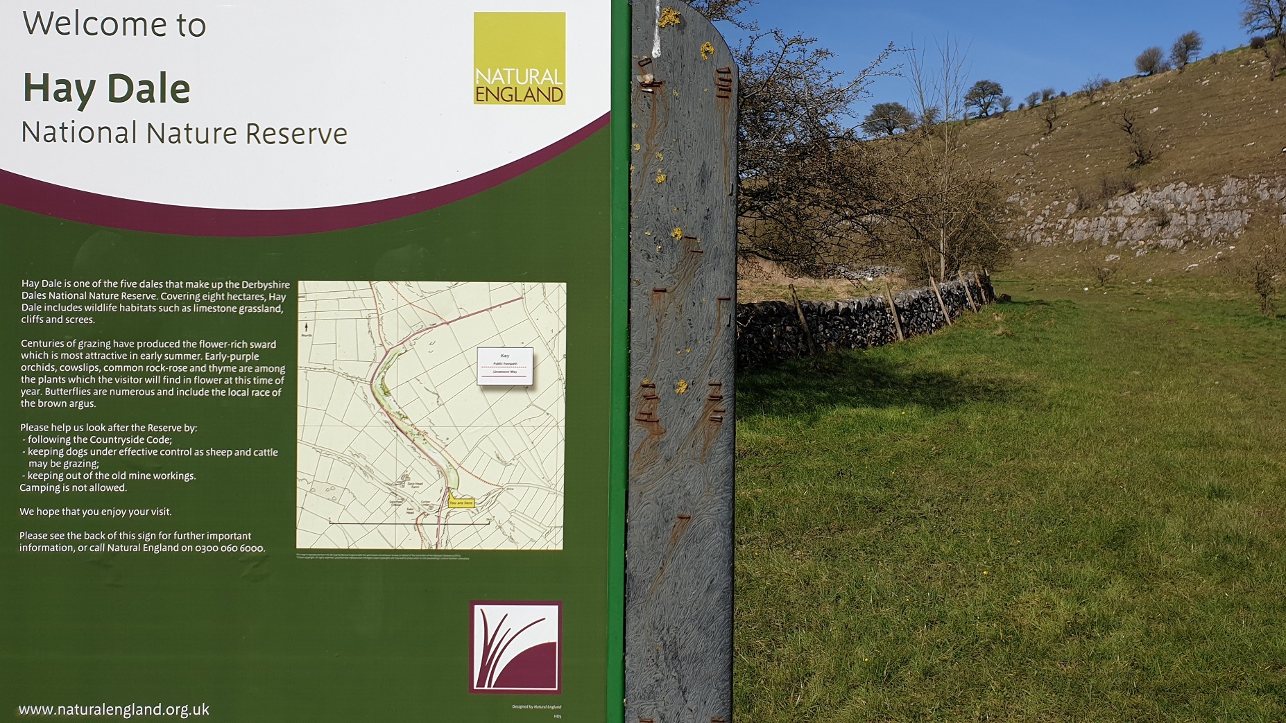
Hay Dale is a short dry valley near Buxton, Derbyshire, in the Peak District of England. It is part of a longer valley that runs for approximately north–south from Peak Forest (on the A623 road) to the River Wye at Millers Dale. This valley has several names along its length: from the northern end running downhill these are Dam Dale, Hay Dale, Peter Dale and Monk's Dale. There is a farmland plateau on either side. Hay Dale is part of the Derbyshire Dales National Nature Reserve. Natural England manages the reserve which covers five separate dales of the White Peak (Lathkill Dale, Cressbrook Dale, Hay Dale, Long Dale and Monk's Dale). The Carboniferous limestone rocks of the reserve were formed 350 million years ago from the shells and sediments of a tropical sea. The landscape was then sculpted by the ice sheets from the last Ice Age 20,000 years ago. The reserve contains ash woodland, limestone grassland and many wildflowers including early purple orchid, cowslip, c ... [...More Info...] [...Related Items...] OR: [Wikipedia] [Google] [Baidu] |
Cave Dale
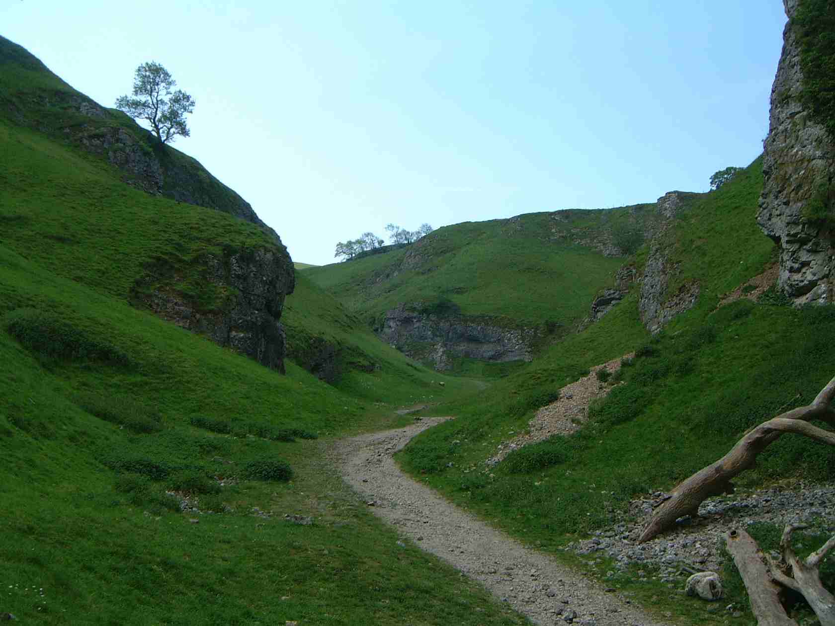
Cave Dale (sometimes spelt Cavedale) is a dry limestone valley in the Derbyshire Peak District, England. It is located at grid reference . The northern end of the dale starts at the village of Castleton where the valley sides are almost perpendicular and over in height. The dale rises gently after leaving Castleton for approximately before becoming steeper culminating in a fine viewpoint down the dale taking in Peveril Castle with Lose Hill behind (see picture). After the viewpoint the dale swings west and levels out with gentle gradients, becoming just a shallow depression as it peters out onto the open pastureland between Castleton and Chapel-en-le-Frith. Cave Dale was initially formed by glacial meltwater carving a deep narrow valley in the local soluble limestone. The river then found a route underground leaving a dry valley with caverns underneath. Later on the caverns below Cave Dale collapsed making the valley even deeper and gorge-like at the northern end. The Castleto ... [...More Info...] [...Related Items...] OR: [Wikipedia] [Google] [Baidu] |


