|
Limes Moesiae
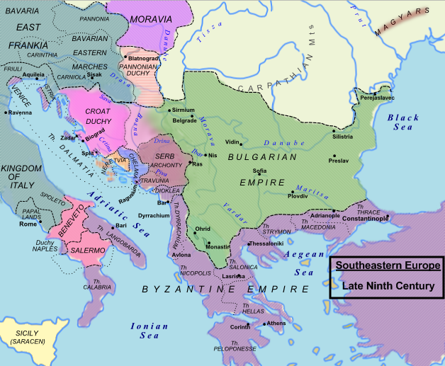
The Moesian Limes ( la, Limes Moesiae) is the modern term given to a collection of Ancient Rome, Roman fortifications between the Black Sea shore and Pannonia, present-day Hungary, consisting primarily of forts along the Danube (so-called Danubian Limes) to protect the Roman provinces of Upper and Lower Moesia south of the river. In addition the term Limes Moesiae may be used to include many other linked lines of defence were established in the region in different periods and later abandoned in favour of others depending on the military situation. Characteristics The ''Limes Moesiae'' includes essentially the linked forts and stations along the Danube from Singidunum (Belgrade) to the mouth of the Danube on the Black Sea. It was not fortified with palisades or a boundary wall but the forts were linked by a road and included eight legionary fortresses, many forts for auxiliary troops and watch/signal towers. The legionary fortresses included: *Singidunum (Belgrade) *Vimina ... [...More Info...] [...Related Items...] OR: [Wikipedia] [Google] [Baidu] |
Djerdap
The Iron Gates ( ro, Porțile de Fier; sr, / or / ; Hungarian: ''Vaskapu-szoros'') is a gorge on the river Danube. It forms part of the boundary between Serbia (to the south) and Romania (north). In the broad sense it encompasses a route of ; in the narrow sense it only encompasses the last barrier on this route, just beyond the Romanian city of Orșova, that contains two hydroelectric dams, with two power stations, Iron Gate I Hydroelectric Power Station and Iron Gate II Hydroelectric Power Station. At this point in the Danube, the river separates the southern Carpathian Mountains from the northwestern foothills of the Balkan Mountains. The Romanian side of the gorge constitutes the Iron Gates Natural Park, whereas the Serbian part constitutes the Đerdap National Park. A wider protected area on the Serbian side was declared the UNESCO global geopark in July 2020. Archaeologists have named the Iron Gates mesolithic culture, of the central Danube region circa 13,000 to ... [...More Info...] [...Related Items...] OR: [Wikipedia] [Google] [Baidu] |
Trajan's Wall
Trajan's Wall (''Valul lui Traian'' in Romanian) is the name used for several linear earthen fortifications ( valla) found across Eastern Europe, in Moldova, Romania, and Ukraine. Contrary to the name and popular belief, the ramparts were not built by Romans during Trajan's reign, but during other imperial periods. Furthermore, the association with the Roman Emperor may be a recent scholarly invention, only entering the imagination of the locals with the national awakening of the 19th century. Medieval Moldavian documents referred to the earthworks as ''Troian'', likely in reference to a mythological hero in the Romanian and Slavic folklore. The other major earthen fortification in Romania, Brazda lui Novac (''Novac's Furrow''), is also named after a mythological hero. Romania There are three valla in Romania, in south-central Dobruja, extending from the Danube to the Black Sea coast. While the relative chronology of the complex is widely accepted, the exact dating of each for ... [...More Info...] [...Related Items...] OR: [Wikipedia] [Google] [Baidu] |
Carpathian Mountains
The Carpathian Mountains or Carpathians () are a range of mountains forming an arc across Central Europe. Roughly long, it is the third-longest European mountain range after the Urals at and the Scandinavian Mountains at . The range stretches from the far eastern Czech Republic (3%) and Austria (1%) in the northwest through Slovakia (21%), Poland (10%), Ukraine (10%), Romania (50%) to Serbia (5%) in the south. "The Carpathians" European Travel Commission, in The Official Travel Portal of Europe, Retrieved 15 November 2016 The Carpathian ... [...More Info...] [...Related Items...] OR: [Wikipedia] [Google] [Baidu] |
Hadrian
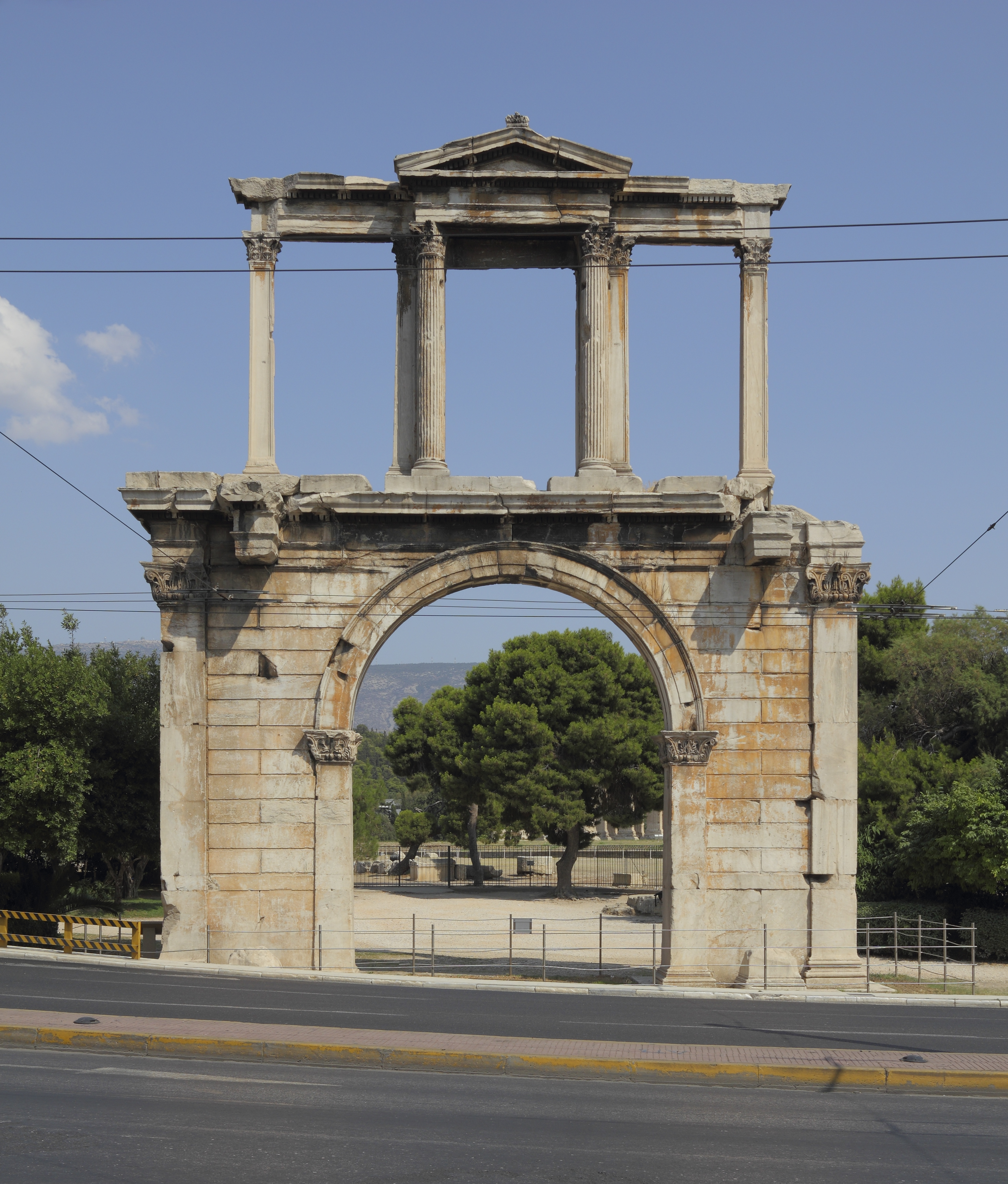
Hadrian (; la, Caesar Trâiānus Hadriānus ; 24 January 76 – 10 July 138) was Roman emperor from 117 to 138. He was born in Italica (close to modern Santiponce in Spain), a Roman ''municipium'' founded by Italic settlers in Hispania Baetica and he came from a branch of the gens Aelia that originated in the Picenean town of Hadria, the ''Aeli Hadriani''. His father was of senatorial rank and was a first cousin of Emperor Trajan. Hadrian married Trajan's grand-niece Vibia Sabina early in his career before Trajan became emperor and possibly at the behest of Trajan's wife Pompeia Plotina. Plotina and Trajan's close friend and adviser Lucius Licinius Sura were well disposed towards Hadrian. When Trajan died, his widow claimed that he had nominated Hadrian as emperor immediately before his death. Rome's military and Senate approved Hadrian's succession, but four leading senators were unlawfully put to death soon after. They had opposed Hadrian or seemed to threaten his s ... [...More Info...] [...Related Items...] OR: [Wikipedia] [Google] [Baidu] |
Walachia
Wallachia or Walachia (; ro, Țara Românească, lit=The Romanian Land' or 'The Romanian Country, ; archaic: ', Romanian Cyrillic alphabet: ) is a historical and geographical region of Romania. It is situated north of the Lower Danube and south of the Southern Carpathians. Wallachia is traditionally divided into two sections, Muntenia (Greater Wallachia) and Oltenia (Lesser Wallachia). Dobruja could sometimes be considered a third section due to its proximity and brief rule over it. Wallachia as a whole is sometimes referred to as Muntenia through identification with the larger of the two traditional sections. Wallachia was founded as a principality in the early 14th century by Basarab I after a rebellion against Charles I of Hungary, although the first mention of the territory of Wallachia west of the river Olt dates to a charter given to the voivode Seneslau in 1246 by Béla IV of Hungary. In 1417, Wallachia was forced to accept the suzerainty of the Ottoman Empire; this la ... [...More Info...] [...Related Items...] OR: [Wikipedia] [Google] [Baidu] |
Brazda Lui Novac De Nord
Brazda lui Novac is a Roman ''limes'' in present-day Romania, known also as Constantine's Wall. It is believed by some historians like Alexandru Madgearu to border Ripa Gothica. The vallum of Brazda lui Novac starts from Drobeta, nowadays it is visible to Ploiești. There is some evidence that the vallum eastern limit was the Siret River. The height of the vallum was 3 metres and the ditch was 2 metres deep. It is believed that the wall was raised during Tiberius Plautius Aelianus. Some historians such as Ioan Donat date the wall during the 1st century AD, others date the wall to 322 during Constantine I.Madgearu, Alexandru (2008). ''Istoria Militară a Daciei Post Romane 275-376''. Cetatea de Scaun. ,p.64 p. 126. See also * Devil's Dykes * Wall of Constantine in Constantinople * Trajan's Wall Trajan's Wall (''Valul lui Traian'' in Romanian) is the name used for several linear earthen fortifications ( valla) found across Eastern Europe, in Moldova, Romania, and Ukraine. ... [...More Info...] [...Related Items...] OR: [Wikipedia] [Google] [Baidu] |
Limes Transalutanus
''Limes Transalutanus''Technological challenges on the Limes Transalutanus, Eugen S. Teodor, Dan Ştefan, https://www.antiquity.ac.uk/projgall/teodor342 is the modern name given to a fortified frontier system of the Roman Empire, built on the western edge of Teleorman's forests in the Roman province of Dacia, modern-day Romania. The frontier was composed of a road following the border, a military stronghold, a three-metre vallum 10–12 metres wide, reinforced with wood palisades on stone walls, and also a ditch. The Transalutanus limes was 235 km long, parallel to Olt river at a distance varying from 5 to 30 km east of the river. The construction was started in 107 under the command of Marcius Turbo, and developed under Iulius Severus (120–126); the final stage of the construction was performed under Septimius Severus (193–211 d.C.). Between 244–247, under Philip the Arab, after the Carpian and Getae (or Goths, confusion due to Jordanes) attacks, the Roman Imperi ... [...More Info...] [...Related Items...] OR: [Wikipedia] [Google] [Baidu] |
Brazda Lui Novac
Brazda lui Novac is a Roman ''limes'' in present-day Romania, known also as Constantine's Wall. It is believed by some historians like Alexandru Madgearu to border Ripa Gothica. The vallum of Brazda lui Novac starts from Drobeta, nowadays it is visible to Ploiești. There is some evidence that the vallum eastern limit was the Siret River. The height of the vallum was 3 metres and the ditch was 2 metres deep. It is believed that the wall was raised during Tiberius Plautius Aelianus. Some historians such as Ioan Donat date the wall during the 1st century AD, others date the wall to 322 during Constantine I.Madgearu, Alexandru (2008). ''Istoria Militară a Daciei Post Romane 275-376''. Cetatea de Scaun. ,p.64 p. 126. See also * Devil's Dykes * Wall of Constantine in Constantinople * Trajan's Wall Trajan's Wall (''Valul lui Traian'' in Romanian) is the name used for several linear earthen fortifications ( valla) found across Eastern Europe, in Moldova, Romania, and Ukraine. ... [...More Info...] [...Related Items...] OR: [Wikipedia] [Google] [Baidu] |
Wallachia
Wallachia or Walachia (; ro, Țara Românească, lit=The Romanian Land' or 'The Romanian Country, ; archaic: ', Romanian Cyrillic alphabet: ) is a historical and geographical region of Romania. It is situated north of the Lower Danube and south of the Southern Carpathians. Wallachia is traditionally divided into two sections, Muntenia (Greater Wallachia) and Oltenia (Lesser Wallachia). Dobruja could sometimes be considered a third section due to its proximity and Dobruja#Wallachian rule, brief rule over it. Wallachia as a whole is sometimes referred to as Muntenia through identification with the larger of the two traditional sections. Wallachia was founded as a principality in the early 14th century by Basarab I of Wallachia, Basarab I after a rebellion against Charles I of Hungary, although the first mention of the territory of Wallachia west of the river Olt River, Olt dates to a charter given to the voivode Seneslau in 1246 by Béla IV of Hungary. In 1417, Wallachia was fo ... [...More Info...] [...Related Items...] OR: [Wikipedia] [Google] [Baidu] |
Drobeta (ancient City)
Drobeta-Turnu Severin (), colloquially Severin, is a city in Mehedinți County, Oltenia, Romania, on the northern bank of the Danube, close to the Iron Gates. "Drobeta" is the name of the ancient Dacian and Roman towns at the site, and the modern town of Turnu Severin received the additional name of Drobeta during Nicolae Ceaușescu's national-communist dictatorship as part of his myth-making efforts. The city administers three villages: Dudașu Schelei, Gura Văii, and Schela Cladovei. The city's population is 92,617 (2011), up from 18,628 in 1900. Etymology Drobeta Drobeta was a Dacian town.Drobeta–Turnu Severin at britannica.com, accessed 2021-10-14. The Roman castrum built by Emperor Trajan at the site preserved the Dacian ... [...More Info...] [...Related Items...] OR: [Wikipedia] [Google] [Baidu] |


