|
Lika (river)
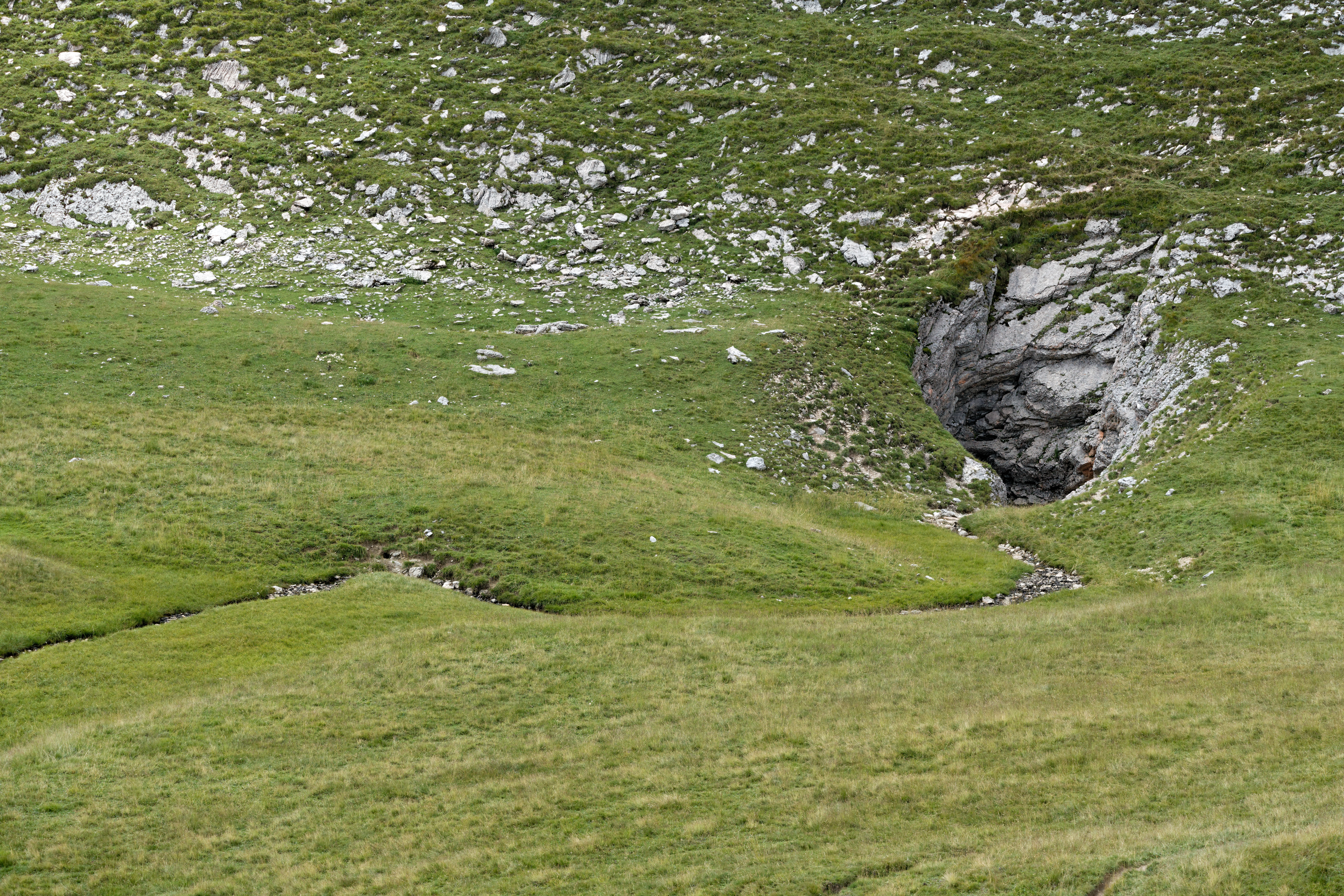
The Lika is a river in Croatia which gives its name to the Lika region. It is long and it has a basin with an area of . Its average discharge at the measurement station in Bilaj (covering 225 km2 of the basin) is 7.33 m3/s, and it can go completely dry. It is known as a sinking river because at the end of its course, it flows into a series of ponors or swallow-holes and disappears from the surface. The Lika River rises near the village of Kukljić at the foot of the Velebit Mountains, flows in a northwesterly direction past the town of Gospić, enters and leaves Lake Krušćica, and continues to the northwest until it sinks into the karst topography Karst is a topography formed from the dissolution of soluble rocks such as limestone, dolomite, and gypsum. It is characterized by underground drainage systems with sinkholes and caves. It has also been documented for more weathering-resistant ro ... at ponors near Lipovo Polje. References Bonacci, Ognjen and Andric, Ivo. c ... [...More Info...] [...Related Items...] OR: [Wikipedia] [Google] [Baidu] |
Kosinj
Kosinj (English: Denison), also known as Kosinj Valley, is a hilly region in Perušić municipality, Lika-Senj County, Croatia. It contains three villages: Gornji Kosinj and Donji Kosinj, which are connected by the Kosinj Bridge on the Lika river, and Bakovac Kosinjski. The population of the villages is 752 according to the 2011 census. History Middle Ages Many Croatian archaeological sites, such as Bočaj, Basarica, Ribnik/grad Kosinj, Pisani kamen, Prespa, Mlakvena Greda etc. state that there was evidence of life in the valley since the Roman era. Many medieval and historical records say that the city Ribnik or Kosinjgrad or Lasch de Kosin, the princes who reigned the year of our Lord mentions Kosinjski first in the year 1071 in the charter of the Croatian king Peter Krešimir IV. Renaissance One of the oldest printers in south Slavic, that wrote in Glagolitic breviary, was the first and oldest book known to have been printed on Croatian soil using the Gutenberg press ... [...More Info...] [...Related Items...] OR: [Wikipedia] [Google] [Baidu] |
Velebit
Velebit (; it, Alpi Bebie) is the largest, though not the highest, mountain range in Croatia. The range forms a part of the Dinaric Alps and is located along the Adriatic coast, separating it from Lika in the interior. Velebit begins in the northwest near Senj with the Vratnik mountain pass and ends 145 km to the southeast near the source of the Zrmanja river northwest of Knin. Its highest peak is the Vaganski vrh at 1,757 m. Major mountain passes on Velebit include the aforementioned Vratnik or Senjsko bilo at 694 m.a.s.l., where the ''Josephina (road), Josephina'' connects Senj with Josipdol; Oštarijska vrata at 928 m.a.s.l. that connects Karlobag and Gospić; and Prezid at 766 m.a.s.l. that connects Obrovac, Croatia, Obrovac and Gračac. The important characteristic of Velebit is its simple, solid form, stiff cliffs, and the nakedness of seaward side (towards the Velebit Channel) and the wood-covered slopes of the Lika side. The basic geological characteristic of the m ... [...More Info...] [...Related Items...] OR: [Wikipedia] [Google] [Baidu] |
Ponor
A ponor is a natural opening where surface water enters into underground passages; they may be found in karst landscapes where the geology and the geomorphology is typically dominated by porous limestone rock. Ponors can drain stream or lake water continuously or can at times work as springs, similar to estavelles. Morphologically, ponors come in forms of large pits and caves, large fissures and caverns, networks of smaller cracks, and sedimentary, Alluvium, alluvial drains. Etymology The name for the karst formation ponor comes from Croatian language, Croatian and Slovene language, Slovene. It derives from the proto-Slavic language, proto-Slavic word ''nora'', meaning ''pit'', ''hole'', ''abyss''; the English word ''narrow'' probably has the same origin. Several places in southeast Europe (Bulgaria, Croatia, Czech Republic, Hungary, Romania, Montenegro, Slovenia) bear the name ''Ponor'' due to associated karst openings. Description Whereas a sinkhole (doline) is a depression o ... [...More Info...] [...Related Items...] OR: [Wikipedia] [Google] [Baidu] |
Croatia
, image_flag = Flag of Croatia.svg , image_coat = Coat of arms of Croatia.svg , anthem = "Lijepa naša domovino"("Our Beautiful Homeland") , image_map = , map_caption = , capital = Zagreb , coordinates = , largest_city = capital , official_languages = Croatian , languages_type = Writing system , languages = Latin , ethnic_groups = , ethnic_groups_year = 2021 , religion = , religion_year = 2021 , demonym = , government_type = Unitary parliamentary republic , leader_title1 = President , leader_name1 = Zoran Milanović , leader_title2 = Prime Minister , leader_name2 = Andrej Plenković , leader_title3 = Speaker of Parliament , leader_name3 = Gordan Jandroković , legislature = Sabor , sovereignty_type ... [...More Info...] [...Related Items...] OR: [Wikipedia] [Google] [Baidu] |
Lika
Lika () is a traditional region of Croatia proper, roughly bound by the Velebit mountain from the southwest and the Plješevica mountain from the northeast. On the north-west end Lika is bounded by Ogulin-Plaški basin, and on the south-east by the Malovan pass. Today most of the territory of Lika ( Brinje, Donji Lapac, Gospić, Lovinac, Otočac, Perušić, Plitvička Jezera, Udbina and Vrhovine) is part of Lika-Senj County. Josipdol, Plaški and Saborsko are part of Karlovac County and Gračac is part of Zadar County. Major towns include Gospić, Otočac, and Gračac, most of which are located in the karst poljes of the rivers of Lika, Gacka and others. The Plitvice Lakes National Park is also in Lika. History Antiquity Since the first millennium BC the region was inhabited by Iapydes, an ancient people related to Illyrians. During the Gallic invasion of the Balkans, a division of the Gallic army passed through the territory of today's Lika and a part of this army sett ... [...More Info...] [...Related Items...] OR: [Wikipedia] [Google] [Baidu] |
Croatian Parliament
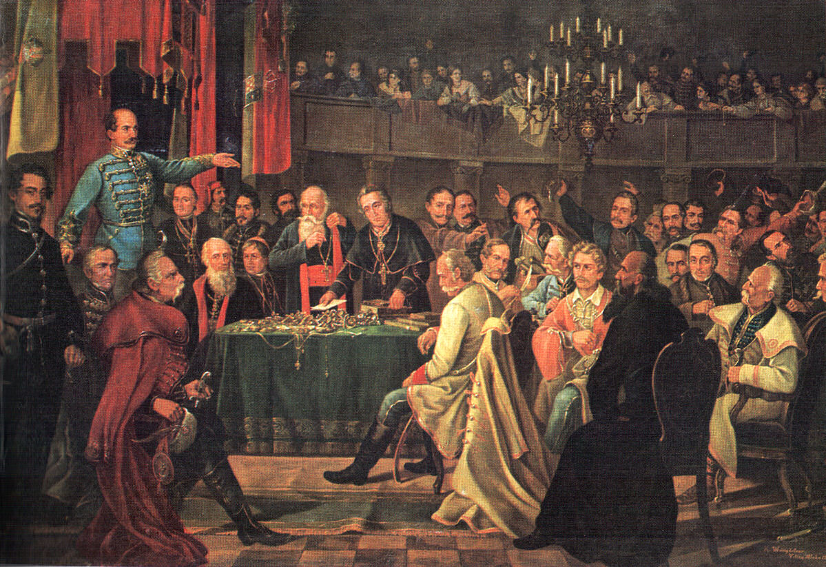
The Croatian Parliament ( hr, Hrvatski sabor) or the Sabor is the unicameral legislature of the Republic of Croatia. Under the terms of the Croatian Constitution, the Sabor represents the people and is vested with legislative power. The Sabor is composed of 151 members elected to a four-year term on the basis of direct, universal and equal suffrage by secret ballot. Seats are allocated according to the Croatian Parliament electoral districts: 140 members of the parliament are elected in multi-seat constituencies. An additional three seats are reserved for the diaspora and Croats in Bosnia and Herzegovina, while national minorities have eight places reserved in parliament. The Sabor is presided over by a Speaker, who is assisted by at least one deputy speaker (usually four or five deputies). The Sabor's powers are defined by the Constitution and they include: defining economic, legal and political relations in Croatia, preservation and use of its heritage and entering into alli ... [...More Info...] [...Related Items...] OR: [Wikipedia] [Google] [Baidu] |
Gospić
Gospić () is a town in the mountainous and sparsely populated region of Lika, Croatia. It is the administrative centre of Lika-Senj County. Gospić is located near the Lika River in the middle of a karst field ( Ličko Polje). Gospić is the third smallest seat of a county government in Croatia. Its status as the county capital helped to spur some development in it, but the town as well as the entire region have suffered a constant decrease in population over the last several decades. Scientist and inventor Nikola Tesla was born in the nearby village of Smiljan and grew up in Gospić. Municipality * Aleksinica, population 169 * Barlete, population 28 * Bilaj, population 162 * , population 25 * Brušane, population 134 * Budak, population 151 * Bužim, population 74 * Debelo Brdo I, population 61 * Debelo Brdo II, population 8 * Divoselo, population 4 * Donje Pazarište, population 125 * Drenovac Radučki, population 0 * Gospić, population 6,575 * Kalinovača, pop ... [...More Info...] [...Related Items...] OR: [Wikipedia] [Google] [Baidu] |
Lake Krušćica
Lake Krušćica ( hr, Krušćičko jezero) is an artificial lake located in Kosinj, Lika, Croatia. It is administratively divided between the municipalities of Gospić and Perušić of the Lika-Senj County Lika-Senj County (, hr, Ličko-senjska županija) is a county in Croatia that includes most of the Lika region and some northern coastline of the Adriatic near the town of Senj, including the northern part of the Pag island. Its center is Go .... The total lake area is , while its elevation is 554 m.a.s.l. Lake Krušćica was created by damming the Lika River. See also * References Lakes of Croatia Landforms of Lika-Senj County {{LikaSenj-geo-stub ... [...More Info...] [...Related Items...] OR: [Wikipedia] [Google] [Baidu] |
Karst Topography
Karst is a topography formed from the dissolution of soluble rocks such as limestone, dolomite, and gypsum. It is characterized by underground drainage systems with sinkholes and caves. It has also been documented for more weathering-resistant rocks, such as quartzite, given the right conditions. Subterranean drainage may limit surface water, with few to no rivers or lakes. However, in regions where the dissolved bedrock is covered (perhaps by debris) or confined by one or more superimposed non-soluble rock strata, distinctive karst features may occur only at subsurface levels and can be totally missing above ground. The study of ''paleokarst'' (buried karst in the stratigraphic column) is important in petroleum geology because as much as 50% of the world's hydrocarbon reserves are hosted in carbonate rock, and much of this is found in porous karst systems. Etymology The English word ''karst'' was borrowed from German in the late 19th century, which entered German much earlier. ... [...More Info...] [...Related Items...] OR: [Wikipedia] [Google] [Baidu] |
Rivers Of Croatia ...
This is a list of rivers in Croatia. Rivers longer than 50 km in Croatia Rivers shorter than 50 km in Croatia See also *Geography of Croatia Sources * * * {{List of rivers of Europe * Croatia Rivers A river is a natural flowing watercourse, usually freshwater, flowing towards an ocean, sea, lake or another river. In some cases, a river flows into the ground and becomes dry at the end of its course without reaching another body of wate ... [...More Info...] [...Related Items...] OR: [Wikipedia] [Google] [Baidu] |
.jpg)


.jpg)