|
Leyland Hundred
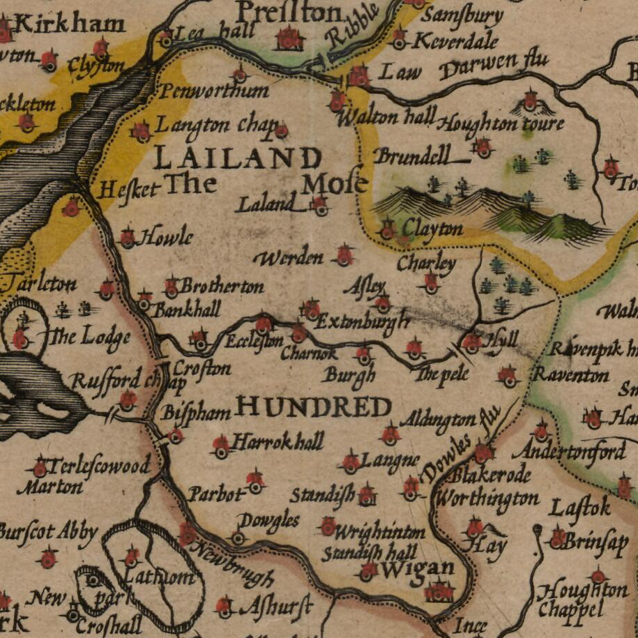
The Leyland Hundred (also known as Leylandshire) is a historic subdivision of the English county of Lancashire. It covered the parishes of Brindle, Chorley, Croston, Eccleston, Hoole, Leyland, Penwortham, Rufford, Standish and Tarleton. In the Domesday Book the area was recorded as 'Lailand' Hundred, with Chorley Parish in Warmundestrou Hundred and Eccleston Parish in Duddeston Hundred, all included in the returns for Cheshire Cheshire ( ) is a ceremonial and historic county in North West England, bordered by Wales to the west, Merseyside and Greater Manchester to the north, Derbyshire to the east, and Staffordshire and Shropshire to the south. Cheshire's county t .... However, it cannot be said clearly to have been part of Cheshire.Crosby, A. (1996). writes on page 31: Notes and references Bibliography *Crosby, A. (1996). ''A History of Cheshire.'' (The Darwen County History Series.) Chichester, West Sussex, UK: Phillimore & Co. Ltd. . *Harris, B. E., and Thac ... [...More Info...] [...Related Items...] OR: [Wikipedia] [Google] [Baidu] |
Eccleston, Lancashire
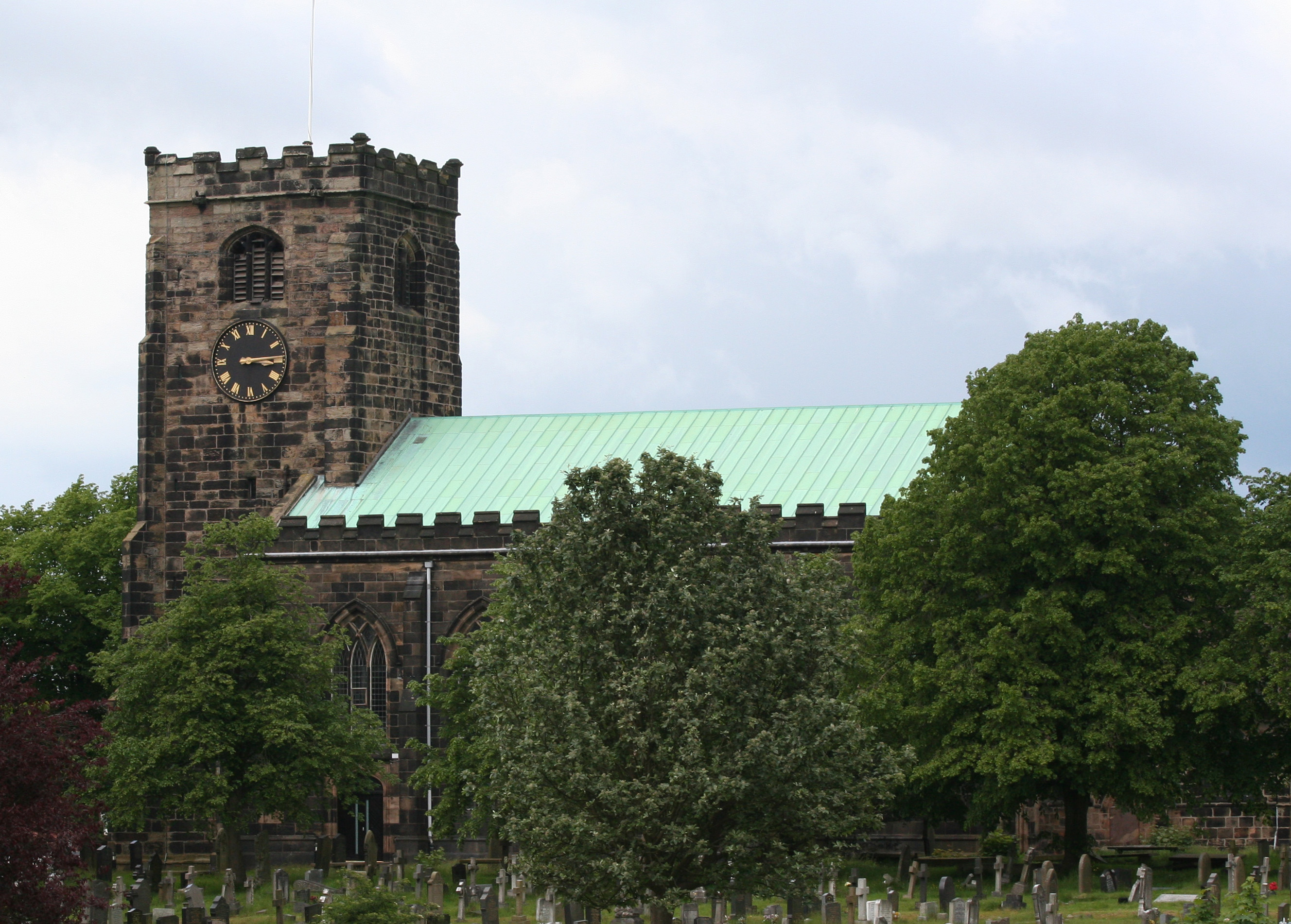
Eccleston is a village and civil parish of the Borough of Chorley in Lancashire, England. It is beside the River Yarrow, and was formerly an agricultural and later a weaving settlement. History Its name came from the Celtic word ''"eglēs"'' meaning a church, and the Old English word ''"tūn"'' meaning a farmstead or settlement, i.e. a settlement by a Romano-British church. Evidence of the settlement dates back hundreds of years; St. Mary's Church dates back to the 14th century AD. The village was mentioned in the Domesday Book of 1086, the book ordered by William the Conqueror, to detail all settlements and farms in England for the purpose of tax collection. Ingrave Farm, located on the northern side of the River Yarrow, is built on a moated site of an earlier building thought to date from the medieval period. The partly waterlogged moat about is wide and deep in places. About to the west is a smaller site about square, the moat of which has since been infilled. It ... [...More Info...] [...Related Items...] OR: [Wikipedia] [Google] [Baidu] |
Croston
Croston is a village and civil parish near Chorley in Lancashire, England. The River Yarrow flows through the village. The population of the civil parish taken at the 2011 census was 2,917. History Croston was founded in the 7th century when St Aidan arrived at the riverside settlements. In the absence of a church, a cross was erected as a place of worship. The name is derived from the two Old English words 'cross' and 'tūn' (town/homestead/village) and is unique to the village. The parish of Croston was formerly far larger than it is today. It included Chorley, Much Hoole, Rufford, Bretherton, Mawdesley, Tarleton, Hesketh Bank, Bispham, Walmer Bridge and Ulnes Walton. These became independent parishes as a result of a series of separations between 1642 and 1821. A charter granted by Edward I in 1283 permitted an annual medieval fair and market to be held on the village green. Pre-20th Century maps also depict a castle which is believed to have been of a wooden co ... [...More Info...] [...Related Items...] OR: [Wikipedia] [Google] [Baidu] |
Domesday Book
Domesday Book () – the Middle English spelling of "Doomsday Book" – is a manuscript record of the "Great Survey" of much of England and parts of Wales completed in 1086 by order of King William I, known as William the Conqueror. The manuscript was originally known by the Latin name ''Liber de Wintonia'', meaning "Book of Winchester", where it was originally kept in the royal treasury. The '' Anglo-Saxon Chronicle'' states that in 1085 the king sent his agents to survey every shire in England, to list his holdings and dues owed to him. Written in Medieval Latin, it was highly abbreviated and included some vernacular native terms without Latin equivalents. The survey's main purpose was to record the annual value of every piece of landed property to its lord, and the resources in land, manpower, and livestock from which the value derived. The name "Domesday Book" came into use in the 12th century. Richard FitzNeal wrote in the '' Dialogus de Scaccario'' ( 1179) that the bo ... [...More Info...] [...Related Items...] OR: [Wikipedia] [Google] [Baidu] |
Tarleton
Tarleton is a village and civil parish in the borough of West Lancashire, Lancashire, England. It situated in the Lancashire mosslands approximately 10 miles north east of Southport, approximately 10 miles south west of Preston, approximately 10 miles west of the (formerly mining and cotton milling) town of Chorley, and approximately 10 miles north of Ormskirk. The village is known for farming due to its rich soil quality. The River Douglas runs northwards to the east of the village, which is locally thought to be where the Vikings camped on the river banks of what is now Tarleton. The parish also includes the village of Mere Brow and the hamlets of Sollom and Holmes. History Tarleton is derived from the Old Norse ''Tharaldr'', a personal name and the Old English ''tun'', a farmstead or enclosure. The township was recorded as Tharilton in 1246 and subsequently Tarleton. Tarleton is mentioned in the Feet of Fines in 1298. A local family with the Tarleton name either was ... [...More Info...] [...Related Items...] OR: [Wikipedia] [Google] [Baidu] |
Standish, Greater Manchester
Standish is a small town in the Metropolitan Borough of Wigan, Greater Manchester, England. Within the boundaries of the historic county of Lancashire, it is on the A49 road between Chorley and Wigan, near Junction 27 of the M6 motorway. The population of the town was 13,278 in the 2011 census. Formed around a crossroads, the village has grown into a small town as urban expansion between Manchester and Liverpool extends outwards. St Wilfrid's Church is a Grade I listed parish church. History The name Standish is derived from the Old English ''stan'', meaning stone, and ''edisc'', a park or enclosure. It has been variously recorded as Stanedis in 1206, Stanediss in 1219, Standissh, Stanedich and Stanedissh in 1292 and Standisch in 1330. The adjoining village of Langtree was recorded as Langetre in 1206 and Longetre in 1330. A Roman road passed through the township. Standish and Langtree were part of the Penwortham barony in the 12th century, and between 1150 and 1164, Ri ... [...More Info...] [...Related Items...] OR: [Wikipedia] [Google] [Baidu] |
Rufford, Lancashire
Rufford is a village in West Lancashire, England, where the Leeds and Liverpool Canal, Liverpool, Ormskirk and Preston Railway, the A59 and the River Douglas meet. Rufford is also a civil parish, which includes the neighbouring village of Holmeswood, and in 2011 had a population of 2,049. History Rufford's name derives from the Old English ''rūh'' and ''ford'', the rough ford. It was a crossing place over the River Douglas. Rufford was recorded as Ruchford in 1212, Rufford in 1285, Roughford in 1318, Rughford in 1332 and Roghforth in 1411. Part of the manor was granted by Richard Bussel, baron of Penwortham to Richard Fitton in the reign of Henry I. In 1278 his descendant and heiress Dame Maude Fitton married Sir William Hesketh. Sir William's grandson married the daughter of Edmund Fitton, who owned the other moiety of the manor which then descended with the Heskeths. In 1339 Sir William Hesketh was granted a charter for a weekly market and annual fair. He fought at t ... [...More Info...] [...Related Items...] OR: [Wikipedia] [Google] [Baidu] |
Penwortham
Penwortham () is a town in South Ribble, Lancashire, England, on the south bank of the River Ribble facing the city of Preston. The town is at the most westerly crossing point of the river, with major road and rail links crossing it here. The population of the town at the 2011 census was 23,047. History The distinctive town name is derived from Celtic and Anglo Saxon origins, pen (meaning a hill or head), wort (meaning green) and ham (meaning settlement) with earlier names of Peneverdant and Pendrecham in 1200; Penwrtham in 1204; Penuertham in 1212; Penwortham 1260 and Penewrthamn in 1292.'Townships: Penwortham', A History of the County of Lancaster: Volume 6 (1911), pp. 56–61 accessed 17 October 2010. [...More Info...] [...Related Items...] OR: [Wikipedia] [Google] [Baidu] |
Leyland, Lancashire
Leyland () is a town in South Ribble, Lancashire, England, six miles (10 km) south of Preston. The population was 35,578 at the 2011 Census. The name of the town is Anglo-Saxon, meaning "untilled land". History English Leyland was an area of fields, with Roman roads passing through, from ancient Wigan to Walton-le-Dale. It was left undisturbed for many centuries until rediscovered shortly after the Battle of Hastings (1066). Leyland is mentioned in the Domesday Book (1085). In 1066, King Edward the Confessor presided over the whole of Leyland. The manor was divided into three large ploughlands, which were controlled by local noblemen. In the 12th century, it came under the barony of Penwortham. The area of Worden, which is now Worden Park, was one of nine oxgangs of land granted to the Knights Hospitaller, by Roger de Lacy, in Lancashire, but the land was not assigned to any individual and a local man, who was a very close friend of de Lacy, Hugh Bussel, was a ... [...More Info...] [...Related Items...] OR: [Wikipedia] [Google] [Baidu] |
Much Hoole
Much Hoole is a village and civil parish in the borough of South Ribble, Lancashire, England. The parish of Much Hoole had a population of 1,851 at the time of the 2001 census, increasing to 1,997 at the 2011 Census. History Hoole derives from the Old English ''hulu'', a shed or hovel. It was recorded as Hull in 1204, Hole in 1212 and Hoole in 1508. Magna Hole was recorded in 1235, Much Hole in 1260 and Grett Wholle in 1551. At Much Hoole there are the remains of a medieval settlement and moat adjacent to Town Lane. Hoole gave its name to a family in the reign of King John and the parish has been held by the Montebegon family and by others, including those of Sir Thomas Hesketh and George Anthony Legh Keck. Governance The township was separated from Croston in 1642, and made into a parish in the Leyland hundred of Lancashire. It became part of the Preston Poor Law Union, formed in 1837, which took responsibility for the administration and funding of the Poor Law and built a ... [...More Info...] [...Related Items...] OR: [Wikipedia] [Google] [Baidu] |
Chorley
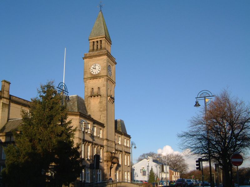
Chorley is a town and the administrative centre of the wider Borough of Chorley in Lancashire, England, north of Wigan, south west of Blackburn, north west of Bolton, south of Preston and north west of Manchester. The town's wealth came principally from the cotton industry. In the 1970s, the skyline was dominated by factory chimneys, but most have now been demolished: remnants of the industrial past include Morrisons chimney and other mill buildings, and the streets of terraced houses for mill workers. Chorley is the home of the Chorley cake. History Toponymy The name ''Chorley'' comes from two Anglo-Saxon words, and , probably meaning "the peasants' clearing". (also or ) is a common element of place-name, meaning a clearing in a woodland; refers to a person of status similar to a freeman or a yeoman. Prehistory There was no known occupation in Chorley until the Middle Ages, though archaeological evidence has shown that the area around the town has been inhabit ... [...More Info...] [...Related Items...] OR: [Wikipedia] [Google] [Baidu] |
History Of Lancashire
Lancashire is a county of England, in the northwest of the country. The county did not exist in 1086, for the Domesday Book, and was apparently first created in 1182, making it one of the youngest of the traditional counties. The historic county consisted of two separate parts. The main part runs along the northwestern coast of England. When it included Manchester and Liverpool it had a greatest length of 76 miles, and breadth of 45 miles, and an area of 1,208,154 acres. The northern detached part of the old county palatine, consisting of Furness and Cartmell was 25 miles in length, 23 miles in breadth and was separated from the main portion of Lancashire by Morecambe Bay and the Kendal district of Westmorland. The highest point in the historic county is at the Old Man of Coniston. As a county palatine, the Duke of Lancaster had sovereignty rights in the areas of justice and administration within the county. However the third man to hold the title, Henry Bolingbroke seiz ... [...More Info...] [...Related Items...] OR: [Wikipedia] [Google] [Baidu] |
Brindle, Lancashire, England
Brindle is a small village and civil parish of the borough of Chorley, Lancashire, England. The population of the civil parish at the 2011 census was 978. It is in the centre of a triangle between Preston, Blackburn, and Chorley. The area has little industry. Brindle is one of the more affluent areas in Lancashir with average earnings over 33% higher than the national average. Occupations include professionals, teachers, and an increasingly retired population as well as some remaining agricultural employment. Brindle is home to the Anglicanism, Anglican St James' Church and a number of trails and bridle paths. As a parish offering excellent links to nearby towns including business centres such as Preston, Bolton, Chorley and Manchester. Brindle could be described as a commuter village A commuter town is a populated area that is primarily residential rather than commercial or industrial. Routine travel from home to work and back is called commuting, which is where th ... [...More Info...] [...Related Items...] OR: [Wikipedia] [Google] [Baidu] |


