|
Croston
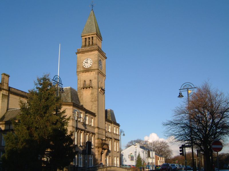
Croston is a village and civil parish near Chorley in Lancashire, England. The River Yarrow flows through the village. The population of the civil parish taken at the 2011 census was 2,917. History Croston was founded in the 7th century when St Aidan arrived at the riverside settlements. In the absence of a church, a cross was erected as a place of worship. The name is derived from the two Old English words 'cross' and 'tūn' (town/homestead/village) and is unique to the village. The parish of Croston was formerly far larger than it is today. It included Chorley, Much Hoole, Rufford, Bretherton, Mawdesley, Tarleton, Hesketh Bank, Bispham, Walmer Bridge and Ulnes Walton. These became independent parishes as a result of a series of separations between 1642 and 1821. A charter granted by Edward I in 1283 permitted an annual medieval fair and market to be held on the village green. Pre-20th Century maps also depict a castle which is believed to have been of a wooden constructio ... [...More Info...] [...Related Items...] OR: [Wikipedia] [Google] [Baidu] |
Croston Hall
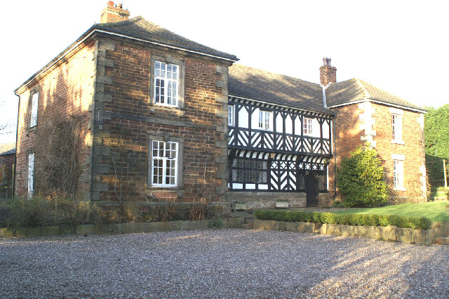
Croston Hall was a country mansion house, built in a gothic style architecture, situated in the village of Croston, Lancashire, England. History The original Croston Hall was constructed in the 14th century, for the Assheton family. The old hall was taken down and a new hall was erected in the 19th century and was occupied by Henry Tempest, a magistrate, following his marriage to Jemima, the daughter of Joseph Thomas Trafford, whose family owned the hall for the rest of its existence. The last Croston Hall was built by the De Trafford Family in the 19th century to the east of the village of Croston. Thomas de Trafford, who was born at Croston Hall, became 1st Baronet. The last of the De Trafford family to live at the hall was Geoffrey de Trafford - known locally as "the Squire" and his sister. He died in 1960, followed by his sister in 1964. Neither had an heir, so when he died, the small chapel in the grounds along with of land around it was left for the use of the Catholic ... [...More Info...] [...Related Items...] OR: [Wikipedia] [Google] [Baidu] |
River Yarrow (Lancashire)
The River Yarrow is in Lancashire, with its source at an area called ''Will Narr'' at ''Hordern Stoops'', along Spitlers Edge - the Chorley/Blackburn boundary - on the West Pennine Moors. The river feeds the Yarrow Reservoir, which in turn feeds the Anglezarke and Upper and Lower Rivington Reservoirs. Upon leaving the reservoirs via a pumping station, the river passes through an area that was formerly known as ''Abyssinia''. Currently, this area is within the boundaries of Heath Charnock and Limbrick, but the original name was given because it was a route frequented by coal miners, and the workers were said to look like natives of Abyssinia (modern day Ethiopia): until the mid 20th century it was usual for miners to return from work covered in coal dust. From here, the river flows underneath the Leeds and Liverpool Canal, joining Black Brook at Yarrow Bridge, then continuing through the ancient woodland of Duxbury into Yarrow Valley Park forming a boundary of Euxton and on thr ... [...More Info...] [...Related Items...] OR: [Wikipedia] [Google] [Baidu] |
Bretherton
Bretherton is a small village and civil parish in the Borough of Chorley, Lancashire, England, situated to the south west of Leyland and east of Tarleton. The population of the civil parish at the 2011 census was 669. Its name suggests pre-conquest origins and its early history was closely involved with the manor house Bank Hall and the families who lived there. Bretherton remained a rural community and today is largely residential with residents commuting to nearby towns. History Toponymy Bretherton derives from either the Old English ''brothor'' and ''tun'' or Norse ''brothir'' and means "farmstead of the brothers". It was first recorded in documents in 1190. Bretherton has been variously recorded as Bretherton in 1242, Brotherton occurs in 1292, Bertherton in 1292 and Thorp was mentioned in 1212. Manor Bretherton, was part of the Penwortham fee and assessed as two plough-lands. It was given by the Bussels to Richard le Boteler of Amounderness, who made grants to Cockersand ... [...More Info...] [...Related Items...] OR: [Wikipedia] [Google] [Baidu] |
Ulnes Walton
Ulnes Walton is a village and civil parish of the Borough of Chorley in Lancashire, England. According to the United Kingdom Census 2011 it had a population of 2,672. The village is also the location of two prisons. Garth Prison, holds Category B adult males, while Wymott Prison holds Category C adult males. History Due to variations in spelling over time, the pronunciation of the name of this village has varied. It is known to have been Oves Walton and Oos Walton. There is much of interest in this small township, a part of Chorley Rural District until 1974, situated about south west of Preston between Croston and Leyland, with the ecclesiastical parishes of Croston and St James, Leyland, within its boundaries. In the 13th century the manor of Walton was in the possession of Ulf of Walton, and was part of the barony of Penwortham. Legend has it that the original UIf was a Danish pirate who sailed up the river Douglas, into the river Lostock and settled at Littlewood. Ulf ... [...More Info...] [...Related Items...] OR: [Wikipedia] [Google] [Baidu] |
Chorley (borough)
The Borough of Chorley is a local government district with borough status in Lancashire, England. The population of the Borough at the 2011 census was 107,155. It is named after its largest settlement, the town of Chorley. History The non-metropolitan district of Chorley was formed on 1 April 1974, covering the area of four former districts, which were abolished at the same time: * Adlington Urban District * Chorley Municipal Borough *Chorley Rural District *Withnell Urban District The new district was named Chorley, and the borough status previously held by the town was passed to the new district on the day that it came into being, allowing the chairman of the council to take the title of mayor. Council Elections are generally held three years out of every four, with a third of the council elected each time. In the fourth year where there are no borough council elections, elections for Lancashire County Council as the higher tier authority for the area are held instead. Cho ... [...More Info...] [...Related Items...] OR: [Wikipedia] [Google] [Baidu] |
Chorley
Chorley is a town and the administrative centre of the wider Borough of Chorley in Lancashire, England, north of Wigan, south west of Blackburn, north west of Bolton, south of Preston and north west of Manchester. The town's wealth came principally from the cotton industry. In the 1970s, the skyline was dominated by factory chimneys, but most have now been demolished: remnants of the industrial past include Morrisons chimney and other mill buildings, and the streets of terraced houses for mill workers. Chorley is the home of the Chorley cake. History Toponymy The name ''Chorley'' comes from two Anglo-Saxon words, and , probably meaning "the peasants' clearing". (also or ) is a common element of place-name, meaning a clearing in a woodland; refers to a person of status similar to a freeman or a yeoman. Prehistory There was no known occupation in Chorley until the Middle Ages, though archaeological evidence has shown that the area around the town has been inhabited ... [...More Info...] [...Related Items...] OR: [Wikipedia] [Google] [Baidu] |
Rufford, Lancashire
Rufford is a village in West Lancashire, England, where the Leeds and Liverpool Canal, Liverpool, Ormskirk and Preston Railway, the A59 road, A59 and the River Douglas, Lancashire, River Douglas meet. Rufford is also a civil parish, which includes the neighbouring village of Holmeswood, and in 2011 had a population of 2,049. History Rufford's name derives from the Old English ''rūh'' and ''ford'', the rough Ford (crossing), ford. It was a crossing place over the River Douglas. Rufford was recorded as Ruchford in 1212, Rufford in 1285, Roughford in 1318, Rughford in 1332 and Roghforth in 1411. Part of the manor was granted by Richard Bussel, baron of Penwortham to Richard Fitton in the reign of Henry I of England, Henry I. In 1278 his descendant and heiress Dame Maude Fitton married Sir William Hesketh. Sir William's grandson married the daughter of Edmund Fitton, who owned the other moiety title, moiety of the manor which then descended with the Heskeths. In 1339 Sir William ... [...More Info...] [...Related Items...] OR: [Wikipedia] [Google] [Baidu] |
Azay Le Rideau
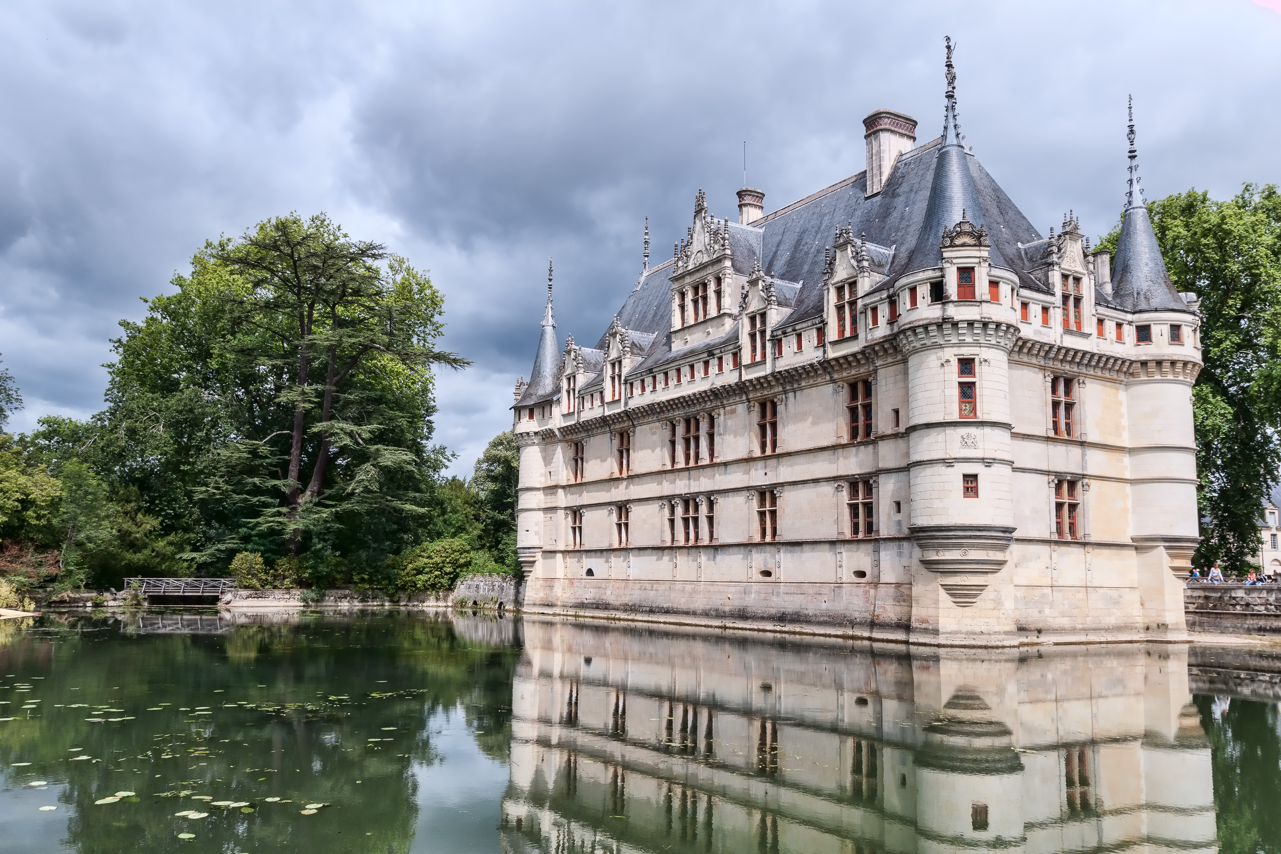
Azay-le-Rideau () is a commune in the Indre-et-Loire department in central France. Château The château of Azay-le-Rideau was built from 1515 to 1527, one of the earliest French Renaissance châteaux. Built on an island in the river Indre, its foundations rise straight out of the water. It is one of the best known of the châteaux of the Loire valley. Church There is a church dedicated to Saint Symphorien near the château that is interesting for the number of architectural periods incorporated in its design. While the newest portion dates from 1603, the current façade incorporates an older 9th century façade in the Carolingian style. The original carved figures are still visible, though an added window destroyed part of the second row. The rest of the church is of a Romanesque style. It was built between 1518 and 1527. Wine Azay-le-Rideau is the centre of the Touraine Azay-le-Rideau AOC for white and rose wine. Twin towns Azay-le-Rideau is twinned with Croston in Lanc ... [...More Info...] [...Related Items...] OR: [Wikipedia] [Google] [Baidu] |
Tarleton
Tarleton is a village and civil parish in the borough of West Lancashire, Lancashire, England. It situated in the Lancashire mosslands approximately 10 miles north east of Southport, approximately 10 miles south west of Preston, approximately 10 miles west of the (formerly mining and cotton milling) town of Chorley, and approximately 10 miles north of Ormskirk. The village is known for farming due to its rich soil quality. The River Douglas runs northwards to the east of the village, which is locally thought to be where the Vikings camped on the river banks of what is now Tarleton. The parish also includes the village of Mere Brow and the hamlets of Sollom and Holmes. History Tarleton is derived from the Old Norse ''Tharaldr'', a personal name and the Old English ''tun'', a farmstead or enclosure. The township was recorded as Tharilton in 1246 and subsequently Tarleton. Tarleton is mentioned in the Feet of Fines in 1298. A local family with the Tarleton name either was nam ... [...More Info...] [...Related Items...] OR: [Wikipedia] [Google] [Baidu] |
Mawdesley
Mawdesley is a village and civil parish in Lancashire, England, which had a population of 1,702 at the 2011 Census. History The name Mawdesley is thought to have originated in the reign of Edward I (1272–1308). The suffix -''ley'' describes a field, meadow or clearing. Records show that a manor existed in 1250 AD on the site of the present Mawdesley Hall. Mawdesley Hall is a small hall on a back road leading into the village. It was built by William Mawdesley in 1625, but altered towards the end of the 18th century. Transport The village is isolated from public transport services. No main roads pass through the enclave. An infrequent day time bus service runs from the centre of the village to Chorley and Southport. The nearest railway station is three miles away at Rufford. The local roads are minor back lanes, mostly narrow, unlit, lacking pavements, poorly maintained and generally unsuitable for the high volume of large 4x4 commuter vehicles and heavy farm traffic t ... [...More Info...] [...Related Items...] OR: [Wikipedia] [Google] [Baidu] |
Ormskirk Branch Line
The Ormskirk branch line is a railway line in Lancashire, England, running between Preston and Ormskirk. The train service is operated by Northern Trains, who usually operate class 150, 156, and 158 units. The line is the northern section of the former Liverpool, Ormskirk and Preston Railway; the line from Ormskirk to Liverpool is now part of Merseyrail's Northern Line. Prior to the introduction of the 1970–71 London Midland Region timetable, it was a secondary main line from Liverpool to Scotland, Blackpool, and Yorkshire. From 4 May 1970, however, the line was severed at Ormskirk. With express trains eliminated, stopping services at the village stations en route were improved, and have retained a similar frequency to this day. Signalling The line is controlled by Preston Power Signal Box (PSB) from where it leaves the West Coast Main Line at Farington Curve Jn by Track Circuit Block signalling regulations until Midge Hall signal box. From here until Rufford signal box, the t ... [...More Info...] [...Related Items...] OR: [Wikipedia] [Google] [Baidu] |
Chorley (UK Parliament Constituency)
Chorley is a constituency in Lancashire represented in the House of Commons of the UK Parliament since 1997 by Lindsay Hoyle. Hoyle was originally elected for the Labour Party, but in 2019 became the Speaker, making him unaffiliated. Constituency profile Chorley constituency consists of the majority of the borough of Chorley. As well as the central market town of Chorley itself, the seat extends into southern Lancashire rural hinterland with three major villages and minor villages. Chorley's expansion is assured with the building of Buckshaw Village, an urban development sprawling over the former Royal Ordnance Site east of Leyland in the seat. Boundaries 1885–1918: The Sessional Division of Leyland Hundred, and part of the Sessional Division of Leyland. 1918–1950: The Municipal Borough of Chorley, the Urban Districts of Adlington, Croston, Leyland, and Withnell, the Rural District of Chorley, and in the Rural District of Wigan the civil parishes of Haigh, Parbold, ... [...More Info...] [...Related Items...] OR: [Wikipedia] [Google] [Baidu] |


