|
Lynfield
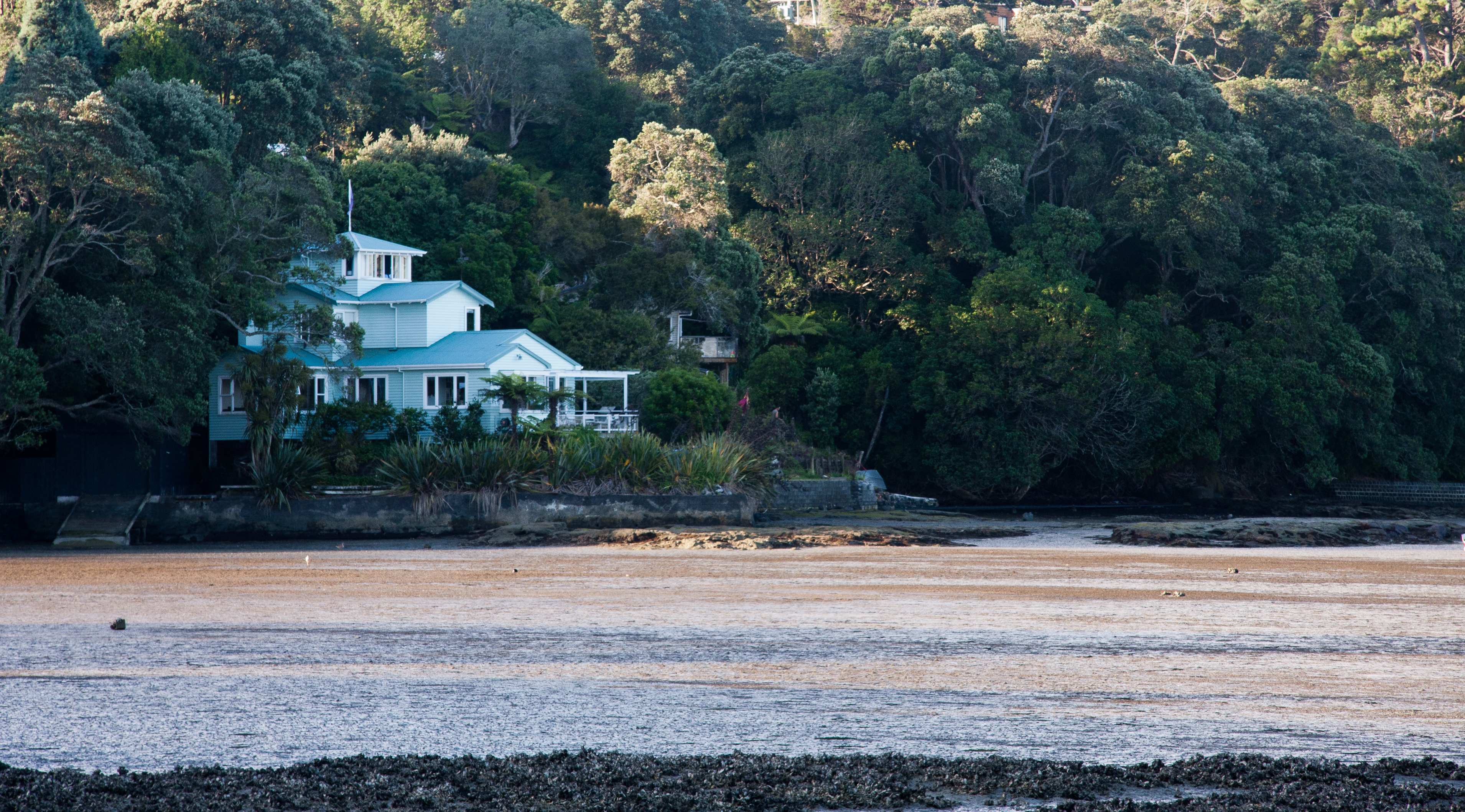
Lynfield is a suburb of Auckland, New Zealand. It is under the local governance of Auckland Council. The suburb is located on the southwestern Auckland isthmus bordering the Manukau Harbour, much of which is densely forested with native forest. Lynfield was developed for suburban housing in the late 1950s and 1960s, modelled after American-style suburbs. Etymology The name Lynfield was first used in the area in the early 20th century, when Australian Albert William Irvine established a poultry farm on Pah Road in Epsom, New Zealand, Epsom, later moving to land owned by Sir Alfred Bankart in the southwestern Auckland isthmus in 1913. Irvine named the farm after Lindfield, New South Wales, which was the birthplace of his wive. Before Lynfield College opened in 1958, parents and teachers chose the name Lynfield, due to the Linfield poultry farm, owned by , adjacent to the school grounds. The college's name was adopted for the modern suburb, which developed south of the school. Geo ... [...More Info...] [...Related Items...] OR: [Wikipedia] [Google] [Baidu] |
Lynfield College
"Learn to Live" , established = 1958 , principal = Ms Cath Knell , address = White Swan Road,Mt Roskill,Auckland , coordinates = , type = State coed secondary, years 9–13 , roll = () , decile = 6N , MOE = 75 , homepage lynfield.school.nz Lynfield College is a secondary education provider in Lynfield, Auckland, New Zealand. It celebrated its 50th anniversary in 2008. The Principal of Lynfield College is Ms Cath Knell. The school practices NCEA for assessments and examinations, and has high achievement rates compared to the national average. History Lynfield College opened its doors for the first time in 1958. Originally planned to be called Blockhouse Bay High School, it was renamed Lynfield by parents and teachers associated with the school. The name Lynfield was taken from the poultry farm run by Sir Alfre Bankart, that was formerly opposite the school's main entrance. Gilletta Road in Lynfield was named after Bankheart's wife's ma ... [...More Info...] [...Related Items...] OR: [Wikipedia] [Google] [Baidu] |
Waikowhai
Waikowhai is an Auckland suburb. Waikowhai is under the local governance of the Auckland Council. The name is Māori: Wai means "Water" and the kōwhai is a native tree with a bright yellow flower. Waikōwhai means kōwhai by the water in Māori. Waikowhai has the largest block of native forest left in Auckland City. The block was considered too infertile for farming and subsequently not cleared but given to the Wesley Mission. Today the forest block hosts a valuable sample of Auckland's original fauna and flora. Waikōwhai Walkway extends for linking Onehunga to Lynfield Cove. Demographics Waikowhai covers and had an estimated population of as of with a population density of people per km2. Waikowhai had a population of 5,439 at the 2018 New Zealand census, an increase of 483 people (9.7%) since the 2013 census, and an increase of 606 people (12.5%) since the 2006 census. There were 1,518 households, comprising 2,715 males and 2,721 females, giving a sex ratio of 1. ... [...More Info...] [...Related Items...] OR: [Wikipedia] [Google] [Baidu] |
Blockhouse Bay
Blockhouse Bay is a residential suburb in the south west of Auckland, in New Zealand's North Island. It is sited on the northern coast of the Manukau Harbour, and is also close to the administrative boundary that existed between Auckland City and Waitakere City, two of the former four cities of what was the Auckland conurbation before amalgamation into Auckland Council. The suburb is located 11 kilometres to the southwest of the city centre, and is surrounded by the more central suburbs of Lynfield and New Windsor, and the Waitakere suburbs of New Lynn and Green Bay. The Blockhouse Bay Library is located in the town centre, as is the Blockhouse Bay Community Centre, located 200 metres from the library. History Early history Portage Road is the location of Te Tōanga Waka, one of the overland routes between the two harbours (and thus the Pacific Ocean and the Tasman Sea), where Māori would beach their waka (canoes) and drag them overland to the other coast, thus av ... [...More Info...] [...Related Items...] OR: [Wikipedia] [Google] [Baidu] |
Auckland Isthmus
The Auckland isthmus, also known as the Tāmaki isthmus, is a narrow stretch of land on the North Island of New Zealand in the Auckland Region, and the location of the central suburbs of the city of Auckland, including the CBD. The isthmus is located between two rias (drowned river valleys), the Waitematā Harbour to the north, which opens to the Hauraki Gulf / Tīkapa Moana and Pacific Ocean, and the Manukau Harbour to the south, which opens to the Tasman Sea. The isthmus is the most southern section of the Northland Peninsula. The Auckland isthmus is bound on the eastern side by the Tāmaki River and by the Whau River on the west; two tidal estuaries of the Waitematā Harbour. These were used as portages by early Māori migration canoes and Tāmaki Māori to cross the isthmus (the Tāmaki River crossing known as Te Tō Waka, and the Whau River as Te Tōangawaka). Through early European settler history, canals were variously considered at either portage, however by the 191 ... [...More Info...] [...Related Items...] OR: [Wikipedia] [Google] [Baidu] |
Mount Roskill
Mount Roskill is a suburban area in the city of Auckland, New Zealand. It is named for the volcanic peak Puketāpapa (commonly called "Mount Roskill" in English). Description The suburb, named after the Mount, is located seven kilometres to the south of the city centre, and is surrounded by the neighbouring suburbs of Three Kings, New Zealand, Three Kings, Sandringham, New Zealand, Sandringham, Wesley, Hillsborough, Auckland, Hillsborough and Mount Albert, New Zealand, Mount Albert. The Mount Roskill shops are located at the intersection of Mount Albert and Dominion Roads. In the 1920s, a new subdivision off Dominion Road was established. It was named the Victory Estate after notable First World War personnel. One of the city's larger suburbs, it was largely farmland until after the Second World War. It was a separate borough from 1947 until local government reorganisation in 1989 amalgamated it with Auckland City. In the past, Mount Roskill was referred to as the Bible Bel ... [...More Info...] [...Related Items...] OR: [Wikipedia] [Google] [Baidu] |
Puketāpapa Local Board
The Puketāpapa Local Board is one of the 21 local boards of the Auckland Council, and is one of the two boards overseen by the council's Albert-Eden-Puketāpapa ward councilors. The Puketāpapa board, named after the Māori name for Mount Roskill, covers the suburbs of Hillsborough, Lynfield, Mount Roskill, Three Kings, Waikowhai, and Wesley. The board is governed by six board members elected at-large. The first board members were elected by the nationwide local elections, which were held on Saturday 9 October 2010. The Puketāpapa board collaborated closely with Beca on the Hinaki Eel Trap Bridge. Demographics Puketāpapa Local Board Area covers and had an estimated population of as of with a population density of people per km2. Puketāpapa Local Board Area had a population of 57,555 at the 2018 New Zealand census, an increase of 4,617 people (8.7%) since the 2013 census, and an increase of 6,753 people (13.3%) since the 2006 census. There were 17,328 househol ... [...More Info...] [...Related Items...] OR: [Wikipedia] [Google] [Baidu] |
New Windsor, New Zealand
New Windsor ( mi, Niu Winiha), founded in 1865, is a suburb of Auckland, New Zealand. It is located from the Auckland city centre, between Mount Albert, Blockhouse Bay, Mt Roskill and Avondale. History In the early 20th century, the area was well known for market gardens. New Windsor developed as suburban housing in the 1950s and 1960s. During this time, the area was officially known as Avondale East. In 1984, the name New Windsor, previously only used as a colloquial name, was officially adopted as the name of the suburb. Demographics New Windsor covers and had an estimated population of as of with a population density of people per km2. New Windsor had a population of 7,758 at the 2018 New Zealand census, an increase of 477 people (6.6%) since the 2013 census, and an increase of 663 people (9.3%) since the 2006 census. There were 2,145 households, comprising 3,960 males and 3,795 females, giving a sex ratio of 1.04 males per female, with 1,476 people (19.0%) aged ... [...More Info...] [...Related Items...] OR: [Wikipedia] [Google] [Baidu] |
Edmund Hillary
Sir Edmund Percival Hillary (20 July 1919 – 11 January 2008) was a New Zealand mountaineer, explorer, and philanthropist. On 29 May 1953, Hillary and Sherpa mountaineer Tenzing Norgay became the first climbers confirmed to have reached the summit of Mount Everest. They were part of the ninth British expedition to Everest, led by John Hunt. From 1985 to 1988 he served as New Zealand's High Commissioner to India and Bangladesh and concurrently as Ambassador to Nepal. Hillary became interested in mountaineering while in secondary school. He made his first major climb in 1939, reaching the summit of Mount Ollivier. He served in the Royal New Zealand Air Force as a navigator during World War II and was wounded in an accident. Prior to the Everest expedition, Hillary had been part of the British reconnaissance expedition to the mountain in 1951 as well as an unsuccessful attempt to climb Cho Oyu in 1952. As part of the Commonwealth Trans-Antarctic Expedition he reached t ... [...More Info...] [...Related Items...] OR: [Wikipedia] [Google] [Baidu] |
Auckland War Memorial Museum
The Auckland War Memorial Museum Tāmaki Paenga Hira (or simply the Auckland Museum) is one of New Zealand's most important museums and war memorials. Its collections concentrate on New Zealand history (and especially the history of the Auckland Region), natural history, and military history. The present museum building was constructed in the 1920s in the neo-classicist style, and sits on a grassed plinth (the remains of a dormant volcano) in the Auckland Domain, a large public park close to the Auckland CBD. Auckland Museum's collections and exhibits began in 1852. In 1867 Aucklanders formed a learned society – the Auckland Philosophical Society, later the Auckland Institute. Within a few years the society merged with the museum and '' Auckland Institute and Museum'' was the organisation's name until 1996. Auckland War Memorial Museum was the name of the new building opened in 1929, but since 1996 was more commonly used for the institution as well. From 1991 to 2003 the muse ... [...More Info...] [...Related Items...] OR: [Wikipedia] [Google] [Baidu] |
Auckland Star
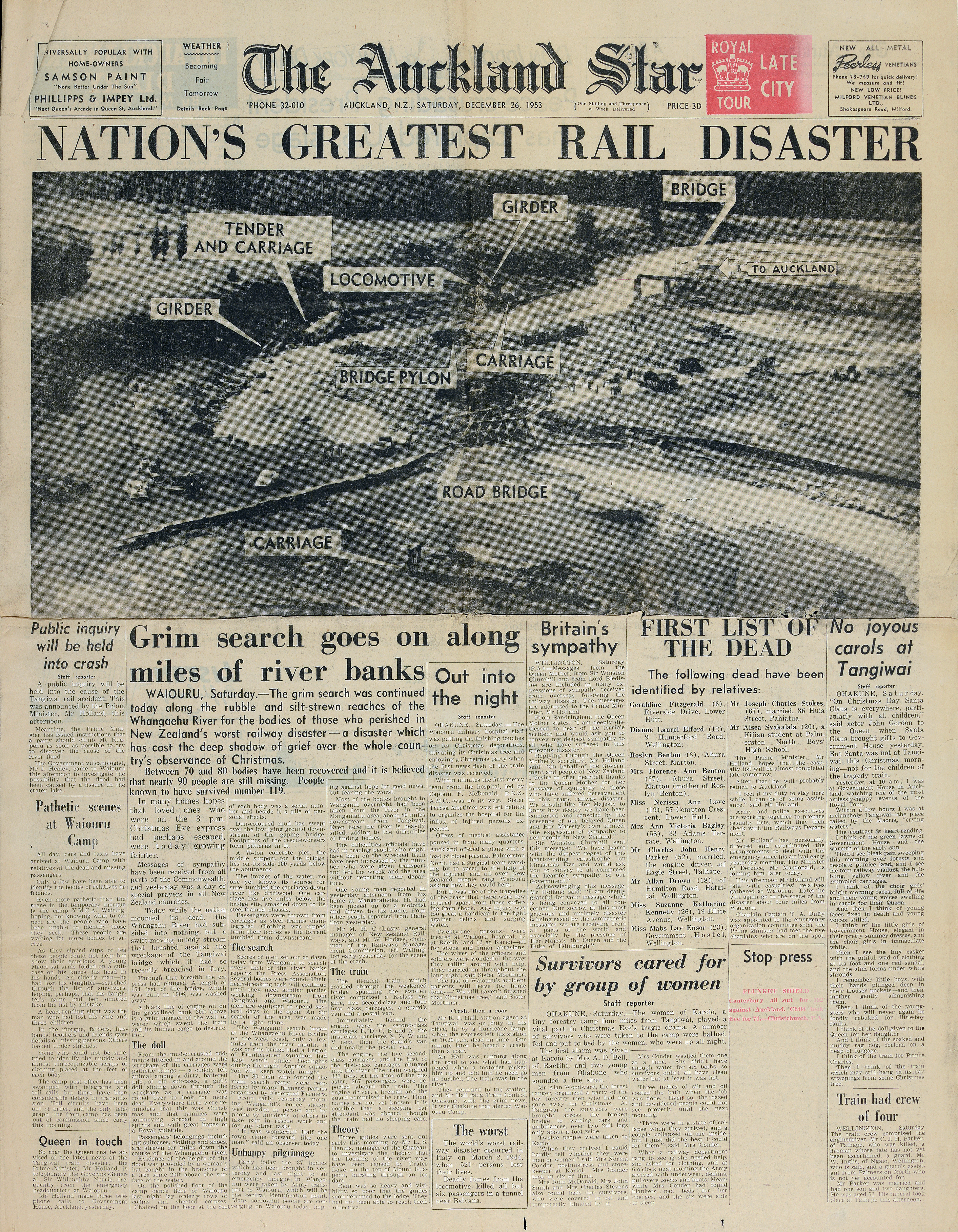
The ''Auckland Star'' was an evening daily newspaper published in Auckland, New Zealand, from 24 March 1870 to 16 August 1991. Survived by its Sunday edition, the ''Sunday Star'', part of its name endures in ''The Sunday Star-Times'', created in the 1994 merger of the ''Dominion Sunday Times'' and the ''Sunday Star''. Originally published as the ''Evening Star'' from 24 March 1870 to 7 March 1879, the paper continued as the ''Auckland Evening Star'' between 8 March 1879 and 12 April 1887, and from then on as the ''Auckland Star''. One of the paper's notable investigative journalists was Pat Booth, who was responsible for notable coverage of the Crewe murders and the eventual exoneration of Arthur Allan Thomas. Booth and the paper extensively reported on the Mr Asia case. In 1987, the owners of the ''Star'' launched a morning newspaper to more directly compete with ''The New Zealand Herald''. The ''Auckland Sun'' was affected by the 1987 stock market crash and folded a year l ... [...More Info...] [...Related Items...] OR: [Wikipedia] [Google] [Baidu] |
New Zealand Government
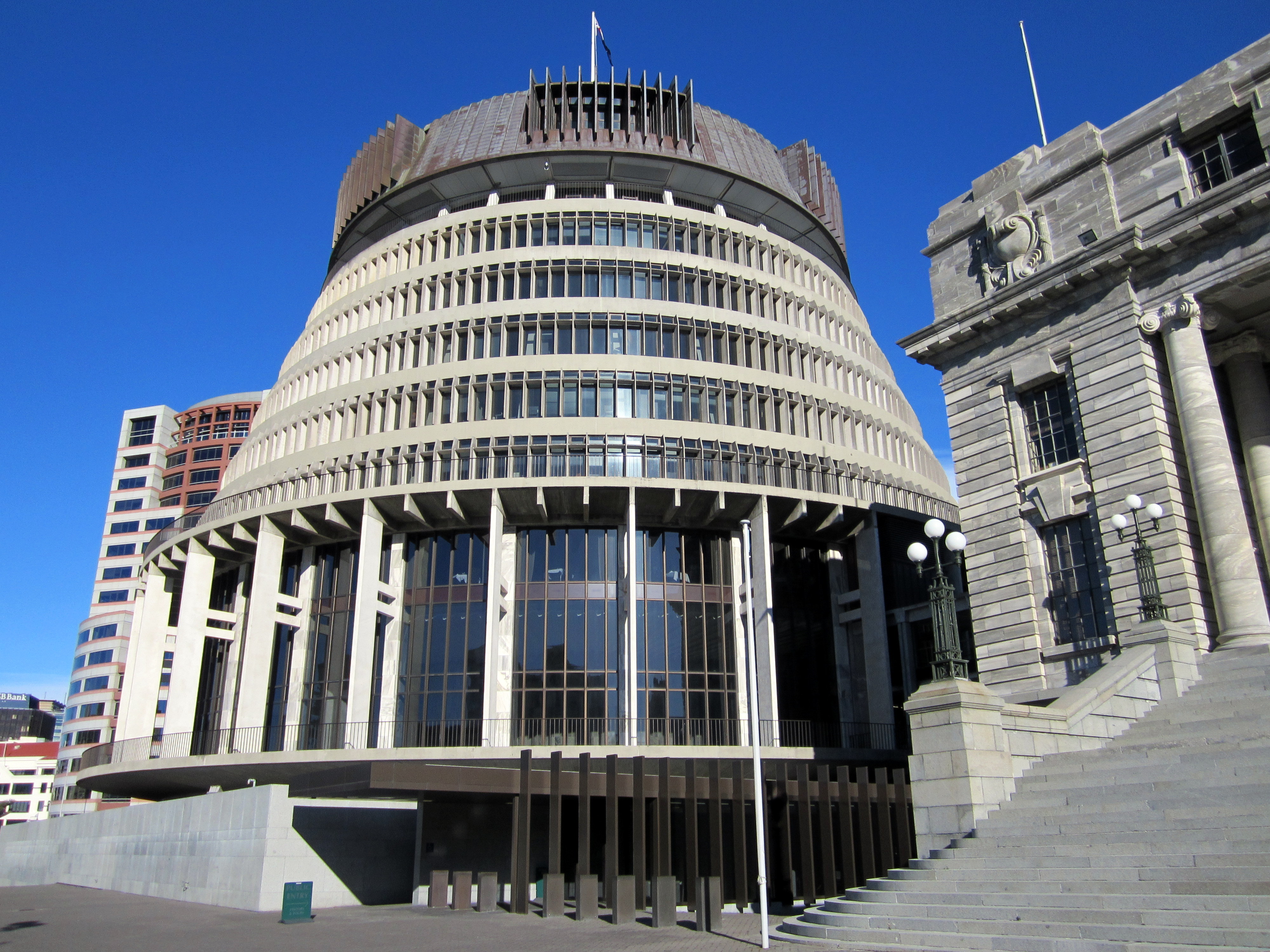
, background_color = #012169 , image = New Zealand Government wordmark.svg , image_size=250px , date_established = , country = New Zealand , leader_title = Prime Minister Jacinda Ardern , appointed = Governor-General , main_organ = , ministries = 32 ministries and departments , responsible = House of Representatives , budget = 119.3 billion (2018–19) , address = The Beehive and other locations across Wellington , url = The New Zealand Government ( mi, Te Kāwanatanga o Aotearoa) is the central government through which political authority is exercised in New Zealand. As in most other parliamentary democracies, the term "Government" refers chiefly to the executive branch, and more specifically to the collective ministry directing the executive. Based on the principle of responsible government, it operates within the framework that "the Queen reigns, but the government rules, so long as it has the support of the House of Representatives".Sir Kenneth Keith, qu ... [...More Info...] [...Related Items...] OR: [Wikipedia] [Google] [Baidu] |
Auckland
Auckland (pronounced ) ( mi, Tāmaki Makaurau) is a large metropolitan city in the North Island of New Zealand. The List of New Zealand urban areas by population, most populous urban area in the country and the List of cities in Oceania by population, fifth largest city in Oceania, Auckland has an urban population of about It is located in the greater Auckland Region—the area governed by Auckland Council—which includes outlying rural areas and the islands of the Hauraki Gulf, and which has a total population of . While European New Zealanders, Europeans continue to make up the plurality of Auckland's population, the city became multicultural and Cosmopolitanism, cosmopolitan in the late-20th century, with Asian New Zealanders, Asians accounting for 31% of the city's population in 2018. Auckland has the fourth largest Foreign born, foreign-born population in the world, with 39% of its residents born overseas. With its large population of Pasifika New Zealanders, the city is ... [...More Info...] [...Related Items...] OR: [Wikipedia] [Google] [Baidu] |


_p225_AUCKLAND%2C_NEW_ZEALAND.jpg)