|
Lychna
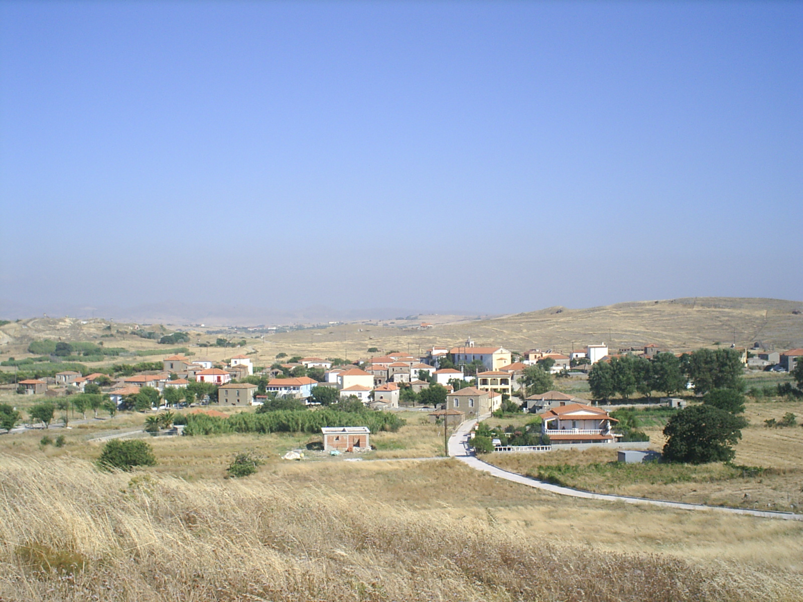
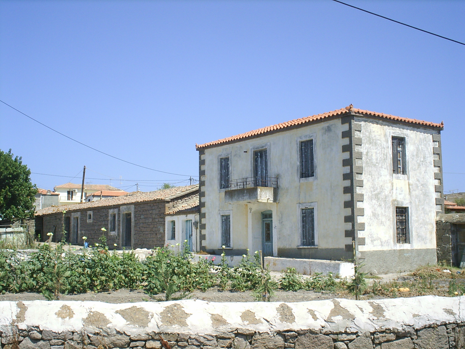
Lychna ( el, Λύχνα) is a village and a community in the island of Lemnos, Greece. In 2001 its population was 110 people for the village, and 320 for the community, which includes the village Anemoessa. It is part of the municipal unit of Moudros. It is situated at about one kilometer from the swampy shore of the bay of Moudros, at 10 m elevation. It is 1.5 km south of Varos, 2 km northwest of Romanou, 4 km north of Moudros and 18 km east of Myrina. Population Name According to tradition, its name (meaning "lights") is derived from the small lamps of the houses, that were visible at night to sailors on the bay. It can't be excluded that there was some sort of lighthouse, from which the name could be derived. On the English Admiralty charts a small cape named ''Akra Likhna'' was indicated. The village was first mentioned in 1785 by the French traveller Choiseul-Gouffier. On his map the name was marked including the article "ta": ''Taligna'' (τα Λύχ ... [...More Info...] [...Related Items...] OR: [Wikipedia] [Google] [Baidu] |
Lemnos
Lemnos or Limnos ( el, Λήμνος; grc, Λῆμνος) is a Greek island in the northern Aegean Sea. Administratively the island forms a separate municipality within the Lemnos regional unit, which is part of the North Aegean region. The principal town of the island and seat of the municipality is Myrina. At , it is the 8th-largest island of Greece. Geography Lemnos is mostly flat, but the west, and especially the northwest part, is rough and mountainous. The highest point is Mount Skopia at the altitude of 430 m. The chief towns are Myrina, on the western coast, and Moudros on the eastern shore of a large bay in the middle of the island. Myrina (also called Kastro, meaning "castle") possesses a good harbour. It is the seat of all trade carried on with the mainland. The hillsides afford pasture for sheep, and Lemnos has a strong husbandry tradition, being famous for its Kalathaki Limnou ( PDO), a cheese made from sheep and goat milk and melipasto cheese, and fo ... [...More Info...] [...Related Items...] OR: [Wikipedia] [Google] [Baidu] |
Moudros
Moudros ( el, Μούδρος) is a town and a former municipality on the island of Lemnos, North Aegean, Greece. Since the 2011 local government reform it is part of the municipality Lemnos, of which it is a municipal unit. It covers the entire eastern peninsula of the island, with a land area of 185.127 km², covering 38.8% of the island's territory. The municipal seat was the town of Moúdros (pop. 974). Its next largest town is Kontopoúli (623). The municipal unit's total population was 3,925 in the 2011 census. History During the Dardanelles Campaign of the First World War, the town and its harbour were used as an Allied base, commanded by Admiral Rosslyn Wemyss. The British Empire troops used the form ''Mudros''. On 30 October 1918, it was the site of the signing of the Armistice of Mudros, which saw the end of hostilities between the Ottoman Empire and the Allies. Moudros has a Commonwealth War Graves Commission (CWGC) cemetery for 148 Australian and 76 New Zealand ... [...More Info...] [...Related Items...] OR: [Wikipedia] [Google] [Baidu] |
Romanou
Romanou ( el, Ρωμανού) is a village and a community on the island of Lemnos, Greece. It is part of the municipal unit of Moudros. The community consists of the village Romanou and the deserted rural settlement Komi. Romanou is southwest of Repanidi, southeast of Lychna and northeast of Moudros. Komi The settlement Komi is situated on a low hill northeast of Romanou. In the late 19th century, the remains of an ancient temple of Heracles were found near the village. The German archaeologist Fredrich photographed the ruins and estimated that the temple had a size of . The ancient temple was succeeded by a Byzantine settlement with a church, as shown by the remains of walls and marble that can be found in today's farming settlement. Most of the remains were used for construction, and already in 1918 nearly nothing remained from the ancient temple. Italian archaeologists have found ancient tombs near the site of the temple. The settlement Komi was first mentioned in 1785 a ... [...More Info...] [...Related Items...] OR: [Wikipedia] [Google] [Baidu] |
List Of Settlements In The Lemnos Regional Unit
This is a list of settlements in Lemnos regional unit in Greece: * Agios Dimitrios * Agios Efstratios * Angariones * Atsiki * Dafni * Fisini * Kalliopi * Kallithea * Kaminia * Karpasi * Kaspakas * Katalakko * Kontias * Kontopouli * Kornos * Livadochori * Lychna * Moudros * Myrina * Nea Koutali * Pedino * Panagia * Plaka * Platy * Portianou * Repanidi * Romanou * Roussopouli * Sardes * Skandali * Thanos * Tsimandria * Varos By municipality Agios Efstratios (no subdivisions) {{Lemnos div See also * List of towns and villages in Greece Lemnos Lemnos or Limnos ( el, Λήμνος; grc, Λῆμνος) is a Greek island in the northern Aegean Sea. Administratively the island forms a separate municipality within the Lemnos regional unit, which is part of the North Aegean region. The ... Populated places in Lemnos ... [...More Info...] [...Related Items...] OR: [Wikipedia] [Google] [Baidu] |
Greece
Greece,, or , romanized: ', officially the Hellenic Republic, is a country in Southeast Europe. It is situated on the southern tip of the Balkans, and is located at the crossroads of Europe, Asia, and Africa. Greece shares land borders with Albania to the northwest, North Macedonia and Bulgaria to the north, and Turkey to the northeast. The Aegean Sea lies to the east of the mainland, the Ionian Sea to the west, and the Sea of Crete and the Mediterranean Sea to the south. Greece has the longest coastline on the Mediterranean Basin, featuring thousands of islands. The country consists of nine traditional geographic regions, and has a population of approximately 10.4 million. Athens is the nation's capital and largest city, followed by Thessaloniki and Patras. Greece is considered the cradle of Western civilization, being the birthplace of democracy, Western philosophy, Western literature, historiography, political science, major scientific and mathematical p ... [...More Info...] [...Related Items...] OR: [Wikipedia] [Google] [Baidu] |
Myrina, Greece
Myrina ( el, Μύρινα) (Also known as Kastro) is a former municipality on the island of Lemnos, North Aegean, Greece. Since the 2011 local government reform it is part of the municipality Lemnos, of which it is a municipal unit. It covers the west coast of the island, and has a land area of , about 17.2% of the island's area. Its municipal seat was the town of Mýrina (pop. 5,107 at the 2001 census), located in the middle of the island's west coast. The town is also the capital of Lemnos, as well as the seat of the Metropolitan (Greek Orthodox bishop) of Lemnos. In addition to the town of Myrina, the municipal unit includes the communities of Káspakas (792), Platý (785), Thános (451), and Kornós (267). The 2011 census recorded 5,711 residents in the town and 8,006 residents in the municipal unit. Climate The climate in Lemnos is mainly Mediterranean. Myrina has a hot summer Mediterranean climate(Köppen:Csa) The winters are generally mild, but there will be a snowfall oc ... [...More Info...] [...Related Items...] OR: [Wikipedia] [Google] [Baidu] |
View Of Lychna Village, Lemnos
A view is a sight or prospect or the ability to see or be seen from a particular place. View, views or Views may also refer to: Common meanings * View (Buddhism), a charged interpretation of experience which intensely shapes and affects thought, sensation, and action * Graphical projection in a technical drawing or schematic ** Multiview orthographic projection, standardizing 2D images to represent a 3D object * Opinion, a belief about subjective matters * Page view, a visit to a World Wide Web page * Panorama, a wide-angle view * Scenic viewpoint, an elevated location where people can view scenery * World view, the fundamental cognitive orientation of an individual or society encompassing the entirety of the individual or society's knowledge and point-of-view Places * View, Kentucky, an unincorporated community in Crittenden County * View, Texas, an unincorporated community in Taylor County Arts, entertainment, and media Music * ''View'' (album), the 2003 debut album by ... [...More Info...] [...Related Items...] OR: [Wikipedia] [Google] [Baidu] |
Piastre
The piastre or piaster () is any of a number of units of currency. The term originates from the Italian for "thin metal plate". The name was applied to Spanish and Hispanic American pieces of eight, or pesos, by Venetian traders in the Levant in the 16th century. These pesos, minted continually for centuries, were readily accepted by traders in many parts of the world. After the countries of Latin America had gained independence, pesos of Mexico began flowing in through the trade routes, and became prolific in the Far East, taking the place of the Spanish pieces of eight which had been introduced by the Spanish at Manila, and by the Portuguese at Malacca Malacca ( ms, Melaka) is a state in Malaysia located in the southern region of the Malay Peninsula, next to the Strait of Malacca. Its capital is Malacca City, dubbed the Historic City, which has been listed as a UNESCO World Heritage Site s .... When the French French Indochina, colonised Indochina, they began issuin ... [...More Info...] [...Related Items...] OR: [Wikipedia] [Google] [Baidu] |
Asia Minor
Anatolia, tr, Anadolu Yarımadası), and the Anatolian plateau, also known as Asia Minor, is a large peninsula in Western Asia and the westernmost protrusion of the Asian continent. It constitutes the major part of modern-day Turkey. The region is bounded by the Turkish Straits to the northwest, the Black Sea to the north, the Armenian Highlands to the east, the Mediterranean Sea to the south, and the Aegean Sea to the west. The Sea of Marmara forms a connection between the Black and Aegean seas through the Bosporus and Dardanelles straits and separates Anatolia from Thrace on the Balkan peninsula of Southeast Europe. The eastern border of Anatolia has been held to be a line between the Gulf of Alexandretta and the Black Sea, bounded by the Armenian Highlands to the east and Mesopotamia to the southeast. By this definition Anatolia comprises approximately the western two-thirds of the Asian part of Turkey. Today, Anatolia is sometimes considered to be synonymou ... [...More Info...] [...Related Items...] OR: [Wikipedia] [Google] [Baidu] |
World War I
World War I (28 July 1914 11 November 1918), often abbreviated as WWI, was List of wars and anthropogenic disasters by death toll, one of the deadliest global conflicts in history. Belligerents included much of Europe, the Russian Empire, the United States, and the Ottoman Empire, with fighting occurring throughout Europe, the Middle East, Africa, the Pacific Ocean, Pacific, and parts of Asia. An estimated 9 million soldiers were killed in combat, plus another 23 million wounded, while 5 million civilians died as a result of military action, hunger, and disease. Millions more died in Genocides in history (World War I through World War II), genocides within the Ottoman Empire and in the Spanish flu, 1918 influenza pandemic, which was exacerbated by the movement of combatants during the war. Prior to 1914, the European great powers were divided between the Triple Entente (comprising French Third Republic, France, Russia, and British Empire, Britain) and the Triple A ... [...More Info...] [...Related Items...] OR: [Wikipedia] [Google] [Baidu] |


