|
Lutterworth Rural District
The rural district of Lutterworth in Leicestershire, England existed from 1894 to 1974. It contained the following civil parishes: *Arnesby *Ashby Magna *Ashby Parva * Bittesby *Bitteswell *Broughton Astley *Bruntingthorpe *Catthorpe *Claybrooke Magna * Claybrooke Parva *Cotesbach *Dunton Bassett *Frolesworth * Gilmorton *Kimcote and Walton *Knaptoft *Leire *Lutterworth * Misterton *North Kilworth *Peatling Magna *Peatling Parva * Shawell *Shearsby *South Kilworth *Swinford *Ullesthorpe * Walton in Knaptoft * Westrill and Starmore *Wigston Parva *Willoughby Waterleys In 1974 it was merged under the Local Government Act 1972 to form part of the new Harborough non-metropolitan district, along with Market Harborough Rural District and Market Harborough Market Harborough is a market town in the Harborough district of Leicestershire, England, in the far southeast of the county, forming part of the border with Northamptonshire. Market Harborough's population was 25,143 in 2020. ... [...More Info...] [...Related Items...] OR: [Wikipedia] [Google] [Baidu] |
Rural District
Rural districts were a type of local government area – now superseded – established at the end of the 19th century in England, Wales, and Ireland for the administration of predominantly rural areas at a level lower than that of the Administrative county, administrative counties.__TOC__ England and Wales In England and Wales they were created in 1894 (by the Local Government Act 1894) along with Urban district (Great Britain and Ireland), urban districts. They replaced the earlier system of sanitary districts (themselves based on poor law unions, but not replacing them). Rural districts had elected rural district councils (RDCs), which inherited the functions of the earlier sanitary districts, but also had wider authority over matters such as local planning, council house, council housing, and playgrounds and cemeteries. Matters such as education and major roads were the responsibility of county councils. Until 1930 the rural district councillors were also poor law gu ... [...More Info...] [...Related Items...] OR: [Wikipedia] [Google] [Baidu] |
Gilmorton
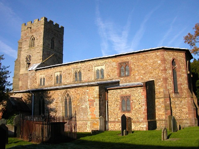
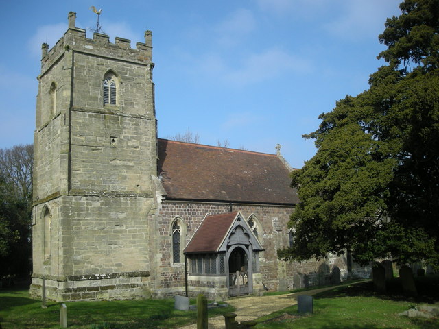
Gilmorton is a village and civil parish about northeast of Lutterworth in Leicestershire, England. The 2011 Census recorded the parish population as 976. Manor The Domesday Book of 1086 records the village, when its population was about 140. The toponym may be derived from Old English: ''gilden'' (or ''gylden'') meaning "golden", and ''morton'', "town on the moor". In 1303 Roger de Martivall was permitted to alienate land and property at Noseley, Gilmorton and Stretton to create an income for four chaplains at a chantry chapel at Noseley. Parish church The Church of England parish church of All Saints has a 14th- and 15th-century tower but it and its spire were rebuilt in 1909. The nave, aisles and chancel were rebuilt in 1860–61 and the south porch was built in 1897. Burlison and Grylls made the stained glass for the east window of the chancel in 1878. Shrigley and Hunt made the stained glass for the Lady Chapel in 1896. Kempe and Kempe made all the other stained g ... [...More Info...] [...Related Items...] OR: [Wikipedia] [Google] [Baidu] |
Ullesthorpe
Ullesthorpe is a small village and civil parish situated in the Harborough district in southern Leicestershire. Ullesthorpe is noted for its historic background with a mill, disused railway station and traces of a medieval settlement evident on the edge of the village. Geography Located 10 miles north of Rugby, Ullesthorpe is within easy access of the M1, M69 and M6. Local amenities include a primary school, post office, village shop, butchers, doctors surgery, hairdressers, garden centre, congregational church, two pubs and a golf course associated with the 'Ullesthorpe Court Hotel'. History Many prehistoric items have been located in and around Ullesthorpe, this includes flint tools found by the Lutterworth Archaeological Fieldwork Group. This indicates a settlement was located here during the prehistoric period. There is significant evidence that Romans came to Ullesthorpe in the 1st century AD because Roman coins, roof tiles and pottery have been recovered, as well ... [...More Info...] [...Related Items...] OR: [Wikipedia] [Google] [Baidu] |
Swinford, Leicestershire
Swinford is a nucleated village and civil parish in the Harborough District, Harborough district of the England, English county of Leicestershire. The population of the civil parish at the 2011 census was 586. It used to be on the former A427 road, A427, which led under the M1 motorway, M1, to Catthorpe. The parish church is All Saints, a 12th-century Norman architecture, Norman rebuilding of an earlier Saxons, Saxon church with a 14th-century square bell tower and a Listed building#Categories of listed building, Grade II* listed building.A History of All Saints Church, Swinford (link on web page opens this document) [...More Info...] [...Related Items...] OR: [Wikipedia] [Google] [Baidu] |
South Kilworth
South Kilworth is a village and civil parish in the southern part of Leicestershire, England, south of North Kilworth. The parish has a population of 430, according to the 2001 Census, and is part of the district of Harborough. The population had risen to 513 at the 2011 census. History At the time of the Domesday survey (1086) there were two settlements Chivelesworde and Cleveliorde which later differentiated into North and South Kilworth. In ''-iorde'' can be immediately recognised ''yard'', and the ''-worde'' or ''-worth'' form of the same suffix can be recognised in ''garth'', all of them words denoting hedged enclosures, which each belonged to ''Ceofel''. In it was noted that the site to the south of the village of the "manor house", actually a grange of Selby Abbey, Yorkshire,''History of Leicestershire'' (Victoria County History) vol. I p. 27. was marked by a dry moat 22 feet wide, and fishponds to its northwest. Both this site and the "Old Hall" site in North Kilworth ha ... [...More Info...] [...Related Items...] OR: [Wikipedia] [Google] [Baidu] |
Shearsby
Shearsby is a rural village in the English county of Leicestershire. Shearsby is in the Harborough district around nine miles due south of Leicester and north east of Lutterworth. The population of the civil parish at the 2011 census was 240. History In the early 17th century the Vicar of St Mary Magdelene, and Rector of Knaptoft was John Moore, a Puritan who wrote ''A Mappe of Man's Mortalite'' in 1617 and often struggled to maintain his principles against the authorities within the Church of England. In November 1604 he was brought before the ecclesiastical court for nonconformity, refusing to wear the surplice, and summoned a further four more times in 1605. He was finally discharged by the court in 'hope of conformity'. Not long after the Inclosure Act of 1773, it was recorded that 1,100 acres of land in and around Shearsby belonged to the lord of the manor, George Turvile, esq. It was during this time that a local printer and author, John Nichols, noted whilst visiting t ... [...More Info...] [...Related Items...] OR: [Wikipedia] [Google] [Baidu] |
Shawell
Shawell is a small village in the Harborough district of Leicestershire, England. Its population at the 2001 UK census was 126, increasing to 162 at the 2011 census. It lies less than a mile from the M1 and M6 motorways. The site of the Roman town of Tripontium is on the A5 (Watling Street), west of the village. Near to the church are the earthwork remains of a motte and bailey castle. The Great Central main railway line, the last main line to be built from the north of England to London, was opened on 15 March 1899 and ran just to the west of Shawell, mainly in a deep cutting where an important signal box was also sited. Although there was never a station at Shawell, one was proposed a little way to the south-west where the line crossed over the A5 and would have been named "Watling Street". The station, which would have lain roughly at the midpoint between Rugby and Lutterworth Lutterworth is a market town and civil parish in the Harborough district of Leicestersh ... [...More Info...] [...Related Items...] OR: [Wikipedia] [Google] [Baidu] |
Peatling Parva
Peatling Parva is a village and civil parish in the Harborough District, Harborough district, south Leicestershire, England. It lies 2.6 km west-north-west of Ashby Magna and 2.9 km south-south-west of Peatling Magna. The village is recorded in the Domesday Book from 1086 and was known as Alia Petlinge with listed landowners Howard, from Hugh de Grandmesnil, and Leofric, from Adelaide wife of Hugh de Grandmensil. The population was recorded as 159 in the 1841 census and 181 in the census of 2001. A village church, St Andrews Church, is part of the Diocese of Leicester of the Church of England. The village also has a public house, The Shires Inn. A village hall was built in 1989 and holds local meetings of the Parish Council. It is a regular polling station for local, national and European elections and hosts performances from Centre Stage, a rural and community touring scheme. Peatling Parva lies adjacent to the villages of Gilmorton and Bruntingthorpe, home to the Br ... [...More Info...] [...Related Items...] OR: [Wikipedia] [Google] [Baidu] |
Peatling Magna
Peatling Magna (also once known as “Great Petlyng” and later as “Great Peatling”) is a village in Harborough district, south Leicestershire. The population of the civil parish at the 2011 census was 210. It lies 3.7 km north-east of Ashby Magna and 2.9 km north-north-east of Peatling Parva. Church The church of All Saints is mainly of the 14th and 15th centuries and contains some fine examples of carved woodwork of different periods. Medieval notableness *In 1265, Peatling Magna stepped onto the national stage when, after the battle of Evesham, the villages refused to co-operate with men of the victorious royal forces, on the grounds that the latter were “going against the welfare of the community of the realm”. The fracas which followed eventually led to the village appearing in court, as recorded in the Plea Rolls of 1266, in the person of the reeve and four men as representatives of “the community of the vill.” F. M. Powicke saw the case as indic ... [...More Info...] [...Related Items...] OR: [Wikipedia] [Google] [Baidu] |
North Kilworth
North Kilworth is a village and civil parish in the Harborough district, in south Leicestershire, England, north of South Kilworth. The population of the civil parish at the 2011 census was 597. Largely bypassed by the A4304 road, the village consists of a mix of old and new housing and includes a primary school and the parish church of St. Andrew's dating from the 13th century. At the time of the Domesday survey (1086) there were two settlements Chivelesworde and Cleveliorde, both belonging to the ''vill'' of Stanford-on-Avon across the border in Northamptonshire; they were given by Guy de Reinbudcurt to Benedict, founding abbot of Selby, Yorkshire later differentiated into North and South Kilworth. In ''-iorde'' can be immediately recognized ''yard'', and the ''-worde'' or ''-worth'' form of the same suffix can be recognized in ''garth'', all of them words denoting hedged enclosures that each belonged to ''Ceofel''. The site of the "Old Hall" was noted to the northwest of t ... [...More Info...] [...Related Items...] OR: [Wikipedia] [Google] [Baidu] |
Lutterworth
Lutterworth is a market town and civil parish in the Harborough district of Leicestershire, England. The town is located in southern Leicestershire, close to the borders with Warwickshire and Northamptonshire. It is located north of Rugby, Warwickshire and south of Leicester. At the 2021 UK census, the civil parish of Lutterworth had a population of 10,833. The built up area of Lutterworth, which also includes the adjacent village of Bitteswell had a population of 11,364. History Lutterworth was originally an Anglo Saxon settlement, its name is probably derived from the Old English ''Hlutre Worth'': Lutterworth was mentioned in the Domesday Book of 1086. Lutterworth was granted its market charter in 1214 by King John and became a small but busy market town. In the 14th century, the religious reformer John Wycliffe was rector in St Mary's Church, Lutterworth between 1374 and 1384, and it was here that he is traditionally believed to have produced the first transl ... [...More Info...] [...Related Items...] OR: [Wikipedia] [Google] [Baidu] |


