Shawell on:
[Wikipedia]
[Google]
[Amazon]
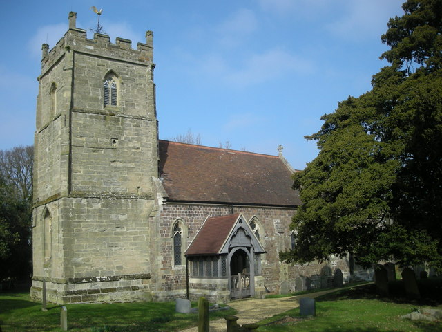
 Shawell is a small village in the
  It lies less than a mile from the M1 and M6 motorways. The site of the Roman town of
Lutterworth Online-Shawell
* Villages in Leicestershire Civil parishes in Harborough District {{Leicestershire-geo-stub
 Shawell is a small village in the
 Harborough
Market Harborough is a market town in the Harborough district of Leicestershire, England, in the far southeast of the county, forming part of the border with Northamptonshire.
Market Harborough's population was 25,143 in 2020. It is the ad ...
district of Leicestershire
Leicestershire ( ; postal abbreviation Leics.) is a ceremonial and non-metropolitan county in the East Midlands, England. The county borders Nottinghamshire to the north, Lincolnshire to the north-east, Rutland to the east, Northamptonshire t ...
, England. Its population at the 2001 UK census
A nationwide census, known as Census 2001, was conducted in the United Kingdom on Sunday, 29 April 2001. This was the 20th UK census and recorded a resident population of 58,789,194.
The 2001 UK census was organised by the Office for National ...
was 126, increasing to 162 at the 2011 census.
 It lies less than a mile from the M1 and M6 motorways. The site of the Roman town of
 Tripontium
Tripontium (Latin for "Place of three bridges") was a town in Roman Britain. It lay on the Roman road later called Watling Street (and known today as the A5) at a site now chiefly within the civil parish of Churchover in the English county of ...
is on the A5 (Watling Street
Watling Street is a historic route in England that crosses the River Thames at London and which was used in Classical Antiquity, Late Antiquity, and throughout the Middle Ages. It was used by the ancient Britons and paved as one of the main R ...
), west of the village.
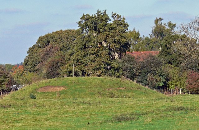
Near to the church are the earthwork remains of a motte and bailey
A motte-and-bailey castle is a European fortification with a wooden or stone keep situated on a raised area of ground called a motte, accompanied by a walled courtyard, or Bailey (castle), bailey, surrounded by a protective Rampart (fortification ...
castle.
The Great Central main railway line, the last main line to be built from the north of England
England is a country that is part of the United Kingdom. It shares land borders with Wales to its west and Scotland to its north. The Irish Sea lies northwest and the Celtic Sea to the southwest. It is separated from continental Europe b ...
to London
London is the capital and largest city of England and the United Kingdom, with a population of just under 9 million. It stands on the River Thames in south-east England at the head of a estuary down to the North Sea, and has been a majo ...
, was opened on 15 March 1899 and ran just to the west of Shawell, mainly in a deep cutting where an important signal box
In signal processing, a signal is a function that conveys information about a phenomenon. Any quantity that can vary over space or time can be used as a signal to share messages between observers. The ''IEEE Transactions on Signal Processing'' ...
was also sited. Although there was never a station
Station may refer to:
Agriculture
* Station (Australian agriculture), a large Australian landholding used for livestock production
* Station (New Zealand agriculture), a large New Zealand farm used for grazing by sheep and cattle
** Cattle statio ...
at Shawell, one was proposed a little way to the south-west where the line crossed over the A5 and would have been named "Watling Street". The station, which would have lain roughly at the midpoint between Rugby
Rugby may refer to:
Sport
* Rugby football in many forms:
** Rugby league: 13 players per side
*** Masters Rugby League
*** Mod league
*** Rugby league nines
*** Rugby league sevens
*** Touch (sport)
*** Wheelchair rugby league
** Rugby union: 1 ...
and Lutterworth
Lutterworth is a market town and civil parish in the Harborough district of Leicestershire, England. The town is located in southern Leicestershire, close to the borders with Warwickshire and Northamptonshire. It is located north of Rugby, ...
, was never built however, and the line closed on 5 May 1969, the cutting now being partly filled in.
References
External links
Lutterworth Online-Shawell
* Villages in Leicestershire Civil parishes in Harborough District {{Leicestershire-geo-stub