|
Ludworth, County Durham
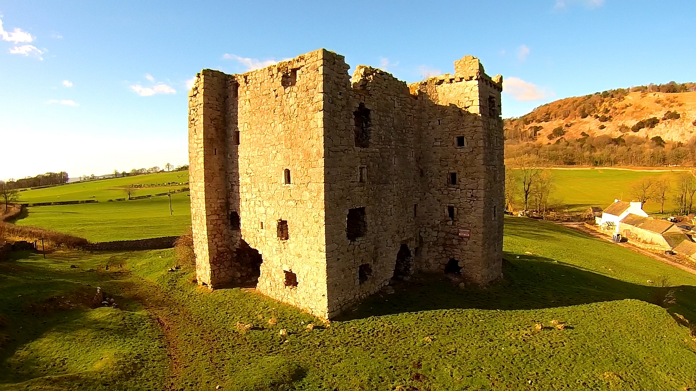
Ludworth is a pit village in County Durham, England situated between Durham and Peterlee. It consists of just over 350 houses in three main housing estates (Barnard Avenue, Moor Crescent and Springfield Meadows) and a few smaller streets. Ludworth has a post office, a primary school, a community centre and a printers. The village used to have a church, two Methodist chapels and a fish shop, most of which were destroyed in a fire. The last public house in Ludworth, ''The Queen's Head'', has been closed since before 2009. Ludworth Tower was originally a medieval manor house, founded by the de Ludworth family. In 1422, Thomas Holden added a rectangular pele tower Peel towers (also spelt pele) are small fortified keeps or tower houses, built along the English and Scottish borders in the Scottish Marches and North of England, mainly between the mid-14th century and about 1600. They were free-stan ..., when he was granted licence to crenellate his manorial complex, by C ... [...More Info...] [...Related Items...] OR: [Wikipedia] [Google] [Baidu] |
County Durham
County Durham ( ), officially simply Durham,UK General Acts 1997 c. 23Lieutenancies Act 1997 Schedule 1(3). From legislation.gov.uk, retrieved 6 April 2022. is a ceremonial county in North East England.North East Assembly �About North East England. Retrieved 30 November 2007. The ceremonial county spawned from the historic County Palatine of Durham in 1853. In 1996, the county gained part of the abolished ceremonial county of Cleveland.Lieutenancies Act 1997 . Retrieved 27 October 2014. The is the of [...More Info...] [...Related Items...] OR: [Wikipedia] [Google] [Baidu] |
City Of Durham (UK Parliament Constituency)
City of Durham is a United Kingdom constituencies, constituency represented in the House of Commons of the United Kingdom, House of Commons of the Parliament of the United Kingdom, UK Parliament since 2019 by Mary Foy (politician), Mary Foy of the Labour Party (UK), Labour Party. Constituency profile The constituency contains a large minority of students, researchers and academics at the early 19th century founded University of Durham, that has a claim towards being the third oldest university in England debate, third oldest in England and has elected Labour MPs since 1935, although there have been strong SDP–Liberal Alliance and Liberal Democrats (UK), Liberal Democrat challenges to Labour since the 1980s. The constituency corresponds to the former Durham (district), City of Durham local government district and as such includes a number of surrounding villages and suburbs as well as Durham itself, the largest of these are Brandon, County Durham, Brandon, Coxhoe, Bowburn, F ... [...More Info...] [...Related Items...] OR: [Wikipedia] [Google] [Baidu] |
Pit Village
A pit village, colliery village or mining village is a settlement built by colliery owners to house their workers. The villages were built on the coalfields of Great Britain during the Industrial Revolution where new coal mines were developed in isolated or unpopulated areas. Such settlements were developed by companies for the incoming workers. Examples * New Sharlston Colliery Village, Yorkshire (1864) * Howe Bridge, Atherton, Lancashire (1873–79) * Gin Pit village, Tyldesley, Lancashire (1874) * Creswell Model Village, Derbyshire (1895) * New Bolsover model village, Derbyshire (1896) * Newstead Colliery Village * Woodlands, Yorkshire (1905) In popular culture The 1939 film ''The Stars Look Down'', based on the 1935 novel of the same name by A. J. Cronin, is set in the fictional pit village of Sleescale. The film was shot partly on location at St Helens Siddick Colliery in Workington. The novel '' How Green Was My Valley'' and the subsequent film adaptation of the ... [...More Info...] [...Related Items...] OR: [Wikipedia] [Google] [Baidu] |
Durham, England
Durham ( , locally ), is a cathedral city and civil parish on the River Wear, County Durham, England. It is an administrative centre of the County Durham District, which is a successor to the historic County Palatine of Durham (which is different to both the ceremonial county and district of County Durham). The settlement was founded over the final resting place of St Cuthbert. Durham Cathedral was a centre of pilgrimage in medieval England while the Durham Castle has been the home of Durham University since 1832. Both built in 11th-century, the buildings were designated as a World Heritage Site by UNESCO in 1986. HM Prison Durham is also located close to the city centre and was built in 1816. Name The name "Durham" comes from the Brythonic element , signifying a hill fort and related to -ton, and the Old Norse , which translates to island.Surtees, R. (1816) ''History and Antiquities of the County Palatine of Durham'' (Classical County Histories) The Lord Bishop of D ... [...More Info...] [...Related Items...] OR: [Wikipedia] [Google] [Baidu] |
Peterlee
Peterlee is a town in County Durham, England. It lies between Sunderland to the north, Hartlepool to the south, the Durham Coast to the east and Durham to the west. It gained town status in 1948 under the New Towns Act 1946. The act also created the nearby settlement of Newton Aycliffe and later Washington, Tyne and Wear. History The case for founding Peterlee as a new town was put forward in ''Farewell Squalor'' by Easington Rural District Council Surveyor C. W. Clarke, who also proposed that the town be named after the celebrated Durham miners' leader Peter Lee. It is one of the few places in the British Isles to be directly named after a recent individual, and unique among the post-Second World War new towns in having its existence requested by local people through their MP. A deputation, mostly if not wholly consisting of working miners, met the Minister of Town and Country Planning to put the case for a new town in the district. The Minister, Lewis Silkin, responde ... [...More Info...] [...Related Items...] OR: [Wikipedia] [Google] [Baidu] |
Peel Tower
Peel towers (also spelt pele) are small fortified keeps or tower houses, built along the English and Scottish borders in the Scottish Marches and North of England, mainly between the mid-14th century and about 1600. They were free-standing with defence being a prime consideration of their design with "confirmation of status and prestige" also playing a role. They also functioned as watch towers where signal fires could be lit by the garrison to warn of approaching danger. The FISH Vocabulary ''Monument Types Thesaurus'' lists "pele" alongside " bastle", "fortified manor house" and "tower house" under the broader term "fortified house". Pevsner defines a peel as simply a stone tower. Outside of this, "peel" or "pele" can also be used in related contexts, for example a "pele" or " barmkin" (in Ireland a bawn) was an enclosure where livestock were herded in times of danger. The rustling of livestock was an inevitable part of Border raids, and often their main purpos ... [...More Info...] [...Related Items...] OR: [Wikipedia] [Google] [Baidu] |
Shadforth
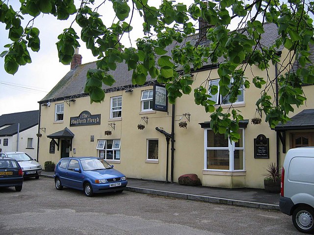
Shadforth is a village in County Durham, England. It is situated a few miles to the east of Durham. The historic centre of the village is designated a conservation area. The population of the civil parish taken at the 2011 census was 2118. Shadforth is also a civil parish that also incorporates Ludworth and Sherburn Hill. History Shadforth was a farming village from around AD 600. The village is mentioned in the Boldon Book The Boldon Book (also known as the Boldon Buke) contains the results of a survey of the bishopric of Durham that was completed on the orders of Hugh du Puiset, Bishop of Durham, in 1183, designed to assist the administration of the vast diocesan e ... of 1183. It is perhaps the only village in England with the name 'Shadforth' meaning 'Shallow Ford’. Shadforth is unusual in that it has never had its own pit in an area where mining was a large part of the community. References External links Shadforth Plough Pub & Restaurant Villages in Coun ... [...More Info...] [...Related Items...] OR: [Wikipedia] [Google] [Baidu] |
Hewer
A hewer (german: Hauer or ''Häuer'') is a miner who loosens rock and minerals in a mine. In medieval mining in Europe a ''Hauer'' was the name given to a miner who had passed his test (''Hauerprüfung'') as a hewer. Training In Europe in former times, before he could become a hewer, the miner had to learn to be a "sorter boy" (''Scheidejunge''), identifying ores and separating the ore from the gangue. After that he would continue his training in the pit itself. Here, he had to learn further skills, initially as a putter (''Hundtstößer'' literally "truck pusher"), transporting material around the mine in wagons. Only afterwards could he learn the skills, as an apprentice hewer (''Lehrhäuer''), that he would later need as a hewer. This form of training, the acquisition of knowledge by experience, was practised in mining until the First World War World War I (28 July 1914 11 November 1918), often abbreviated as WWI, was one of the deadliest global conflicts in histor ... [...More Info...] [...Related Items...] OR: [Wikipedia] [Google] [Baidu] |


