|
Loch Beannacharan
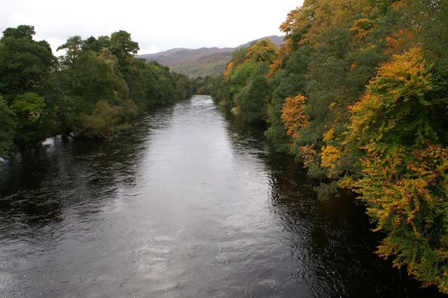
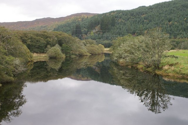
Loch Beannacharan is a freshwater loch in Glen Strathfarrar, situated roughly west of the village of Struy. The loch sits on the River Farrar, which runs from Loch Monar to meet the River Glass, forming the River Beauly. The loch's name likely derives from the Scottish Gaelic ''beannach'', meaning "peaked" or "horned", the suffix ''-an'' acting as a diminutive. Hence, the loch's name may mean "Little Horned Loch" or "Loch in the Place of the Little Peaks". Prior to WWII, most of the old Caledonian forest on the north shore of Loch Beannacharan was cut down. The land surrounding the loch is arable, and was formerly owned by the Lords Lovat but used mostly for hunting deer. Sheep were brought from Lanark in the 1950s to graze the land. One kilometre downstream from the loch is the Beannacharan Dam, constructed in 1951 as part of the Affric-Beauly hydro-electric power scheme. Deanie Power Station sits on the loch's northwest shore, though electricity generated there c ... [...More Info...] [...Related Items...] OR: [Wikipedia] [Google] [Baidu] |
Loch
''Loch'' () is the Scottish Gaelic, Scots language, Scots and Irish language, Irish word for a lake or sea inlet. It is Cognate, cognate with the Manx language, Manx lough, Cornish language, Cornish logh, and one of the Welsh language, Welsh words for lake, llwch. In English English and Hiberno-English, the Anglicisation, anglicised spelling lough is commonly found in place names; in Lowland Scots and Scottish English, the spelling "loch" is always used. Many loughs are connected to stories of lake-bursts, signifying their mythical origin. Sea-inlet lochs are often called sea lochs or sea loughs. Some such bodies of water could also be called firths, fjords, estuary, estuaries, straits or bays. Background This name for a body of water is Insular Celtic languages, Insular CelticThe current form has currency in the following languages: Scottish Gaelic, Irish language, Irish, Manx language, Manx, and has been borrowed into Scots language, Lowland Scots, Scottish English, Iri ... [...More Info...] [...Related Items...] OR: [Wikipedia] [Google] [Baidu] |
River Farrar
Farrar may refer to: * Cape Farrar, a headland on the Boothia Peninsula in Nunavut, Canada * Farrar, Georgia, a US unincorporated community * Farrar, Iowa, a US unincorporated community * Farrar Landing, Michigan, an unincorporated community * Farrar, Missouri, a US unincorporated community * Farrar, North Carolina, a US unincorporated community * Farrar, Northern Territory, a suburb in Australia * Farrar, Texas, a US unincorporated community * Farrar Hill, Tennessee, a US unincorporated community * Farrar's Island, a peninsula on the James River in Virginia * River Farrar, Scotland * ''Farrar'' (album), a 2008 album by Scottish fiddler Duncan Chisholm * Farrar (surname), people with the surname Farrar See also * Farrar & Rinehart, former name of American publishing firm Rinehart & Company * Farrar, Straus and Giroux, American publishing firm * Marvin, Welch & Farrar Marvin, Welch & Farrar ( MWF) were a 1970s British and Australian popular music group formed by Hank Marvin a ... [...More Info...] [...Related Items...] OR: [Wikipedia] [Google] [Baidu] |
Scotland
Scotland (, ) is a country that is part of the United Kingdom. Covering the northern third of the island of Great Britain, mainland Scotland has a border with England to the southeast and is otherwise surrounded by the Atlantic Ocean to the north and west, the North Sea to the northeast and east, and the Irish Sea to the south. It also contains more than 790 islands, principally in the archipelagos of the Hebrides and the Northern Isles. Most of the population, including the capital Edinburgh, is concentrated in the Central Belt—the plain between the Scottish Highlands and the Southern Uplands—in the Scottish Lowlands. Scotland is divided into 32 administrative subdivisions or local authorities, known as council areas. Glasgow City is the largest council area in terms of population, with Highland being the largest in terms of area. Limited self-governing power, covering matters such as education, social services and roads and transportation, is devolved from the Scott ... [...More Info...] [...Related Items...] OR: [Wikipedia] [Google] [Baidu] |
Fresh Water
Fresh water or freshwater is any naturally occurring liquid or frozen water containing low concentrations of dissolved salts and other total dissolved solids. Although the term specifically excludes seawater and brackish water, it does include non- salty mineral-rich waters such as chalybeate springs. Fresh water may encompass frozen and meltwater in ice sheets, ice caps, glaciers, snowfields and icebergs, natural precipitations such as rainfall, snowfall, hail/ sleet and graupel, and surface runoffs that form inland bodies of water such as wetlands, ponds, lakes, rivers, streams, as well as groundwater contained in aquifers, subterranean rivers and lakes. Fresh water is the water resource that is of the most and immediate use to humans. Water is critical to the survival of all living organisms. Many organisms can thrive on salt water, but the great majority of higher plants and most insects, amphibians, reptiles, mammals and birds need fresh water to survive. Fresh ... [...More Info...] [...Related Items...] OR: [Wikipedia] [Google] [Baidu] |
Glen Strathfarrar
Glen Strathfarrar ( gd, Srath Farair) is a glen in the Highland region of Scotland, near Loch Ness. The Glen is part of the Affric-Beauly hydro-electric power scheme, with a dam at Loch Monar and a 9 km tunnel carrying water to an underground power station at Deanie; a second dam just below Loch Beannacharan feeds a tunnel carrying water to Culligran power station (also underground). The Monar dam at Loch Monar is the largest arch dam in Britain. The central section of Glen Strathfarrar (covering 4027 ha) is designated as a national scenic area, one of forty such areas in Scotland, which have been defined so as to identify areas of exceptional scenery and to ensure its protection from inappropriate development. The area covered by the NSA represents the section of the glen least affected by the hydro-electric scheme, and includes the Culligran Falls. Etymology Glen Strathfarrar is named for the River Farrar, recorded in Roman times as ''Varrar''. The name is from ' ... [...More Info...] [...Related Items...] OR: [Wikipedia] [Google] [Baidu] |
Struy
Struy ( gd, An t-Srùigh or gd, Sruidh) is a small village at the end of Glen Strathfarrar, about 15 km south-west of Beauly in the Highland council area of Scotland. Description The confluence of the River Farrar and the River Glass is a short distance to the east of Struy, here the rivers join to become the River Beauly. The River Farrar is crossed by Thomas Telford's five arch Struy Bridge a short distance to the north, this carries the A831 road. A minor road crosses the Mauld Bridge, over the River Glass, to the south-east of Struy. Nature reserve and buildings Struy is the place to gain access to the nature reserve of Glen Strathfarrar and four Munros. The road is private and only a limited number of cars are allowed to access through the gate. [...More Info...] [...Related Items...] OR: [Wikipedia] [Google] [Baidu] |
Loch Monar
Loch Monar is a freshwater loch situated at the head of Glen Strathfarrar, in the West Highlands of Scotland. Since the 1960s, it has been dammed as part of the Affric-Beauly hydro-electric power scheme. The loch is fed by a number of small burns running off the surrounding hills. The loch's primary outflow is the Garbh-uisge, which joins with the Uisge Misgeach to form the River Farrar. Much of the area around Loch Monar is remote and mountainous. This include the Munros of Sgùrr a' Chaorachain, Sgùrr Choinnich, Maoile Lunndaidh, Lurg Mhòr and Bidein a' Choire Sheasgaich. See also *List of reservoirs and dams in the United Kingdom This is a list of dams and reservoirs in the United Kingdom. England Buckinghamshire * Foxcote Reservoir, north of Buckingham *Weston Turville Reservoir, between Weston Turville and Wendover Cambridgeshire *Grafham Water Cheshire * Bollinhurs ... Lochs of Highland (council area) Reservoirs in Highland (council area) Freshwater l ... [...More Info...] [...Related Items...] OR: [Wikipedia] [Google] [Baidu] |
River Glass, Strathglass
{{Scotland-river-stub ...
The River Glass ( gd, Abhainn Ghlais) is a river in the Scottish Highlands which flows northeastwards down Strathglass. It begins at the confluence of the River Affric and the Abhainn Deabhag, near the village of Tomich. It is joined by the River Cannich near the village of Cannich, then flows as far as a confluence with the River Farrar near Struy, from which point the merged waters are known as the River Beauly.Ordnance Survey 1:10,000 scale StreetView The river is crossed by several bridges: *Fasnakyle Bridge, unclassified road *Comar Bridge, near Cannich, carries the A831 *Mauld Bridge, near Struy, unclassified road References Glass Glass is a non-crystalline, often transparent, amorphous solid that has widespread practical, technological, and decorative use in, for example, window panes, tableware, and optics. Glass is most often formed by rapid cooling (quenching) of ... [...More Info...] [...Related Items...] OR: [Wikipedia] [Google] [Baidu] |
River Beauly
The River Beauly ( gd, Abhainn nam Manach, ) is a river in the Scottish Highlands, about 15 km west of the city of Inverness. It is about 25 km long, beginning near the village of Struy, at the confluence of the River Farrar and the River Glass (). The river meanders as it flows east, passing to the south of the village of Beauly and into the Beauly Firth. The river was first bridged in about 1817, when Thomas Telford constructed the five arched Lovat Bridge about 1 km south west of Beauly. Sabre Roads, Retrieved 25 March 2017 This bridge carried the A9, the main route north, until the |
World War II
World War II or the Second World War, often abbreviated as WWII or WW2, was a world war that lasted from 1939 to 1945. It involved the vast majority of the world's countries—including all of the great powers—forming two opposing military alliances: the Allies and the Axis powers. World War II was a total war that directly involved more than 100 million personnel from more than 30 countries. The major participants in the war threw their entire economic, industrial, and scientific capabilities behind the war effort, blurring the distinction between civilian and military resources. Aircraft played a major role in the conflict, enabling the strategic bombing of population centres and deploying the only two nuclear weapons ever used in war. World War II was by far the deadliest conflict in human history; it resulted in 70 to 85 million fatalities, mostly among civilians. Tens of millions died due to genocides (including the Holocaust), starvation, ma ... [...More Info...] [...Related Items...] OR: [Wikipedia] [Google] [Baidu] |
Lord Lovat
Lord Lovat ( gd, Mac Shimidh) is a title of the rank Lord of Parliament in the Peerage of Scotland. It was created in 1458 for Hugh Fraser, 1st Lord Lovat, Hugh Fraser by summoning him to the Scottish Parliament as Lord Fraser of Lovat, although the holder is referred to simply as Lord Lovat. It was a separate title from the Scottish feudal lordship of Lovat, already held by the highland Frasers. In 1837 they were created a third title, Baron Lovat, of Lovat in the County of Inverness, in the Peerage of the United Kingdom. The holder is separately and independently the Chiefs of Clan Fraser , Chief of the highland Clan Fraser of Lovat. The first Lord Lovat was one of the hostages for James I of Scotland on his return to Scotland in 1424, and in 1431 he was appointed high sheriff of the county of Inverness. The second Lord Lovat, Thomas, held the office of Justiciary of the North in the reign of James IV of Scotland, and died 21 October 1524. The title descended in a direct ... [...More Info...] [...Related Items...] OR: [Wikipedia] [Google] [Baidu] |


