|
Lobuche, Nepal
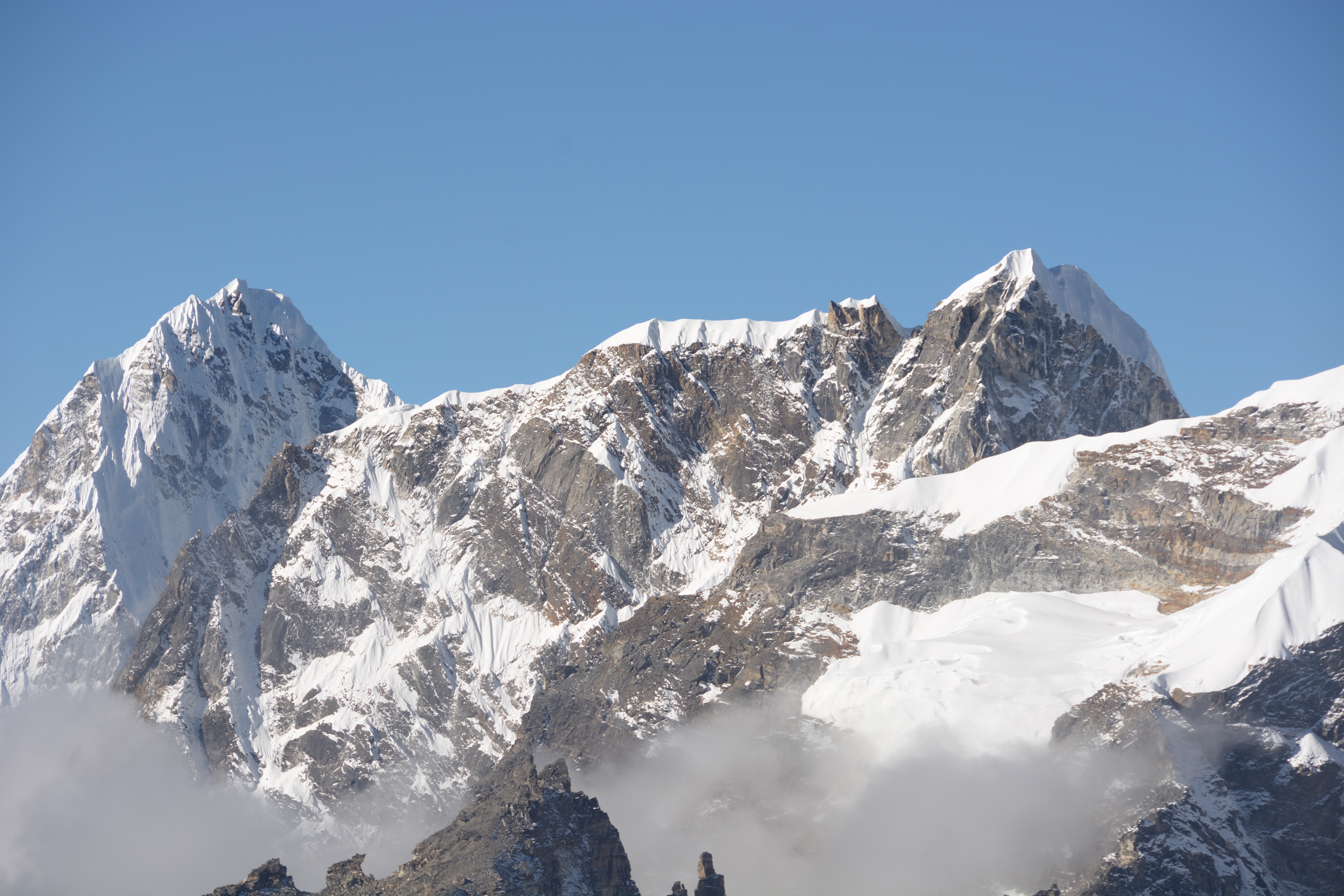
Lobuche (or Lobuje) is a small settlement near Mount Everest in the Khumbu region of Nepal. It is one of the last overnight stops with lodging on the "trail to base camp", a hike that climbers make on their way to Everest Base Camp (South) when attempting an ascent of Everest via the standard southeast route. It is also a popular stop among trekkers in the area. From there they can complete the trail on to EBC or stop at Gorak Shep, the last stop with lodging on the trail, and climb the modest nearby peak, Kala Patthar (5,545 m, 18,192 ft), for a rare view of the Everest summit. The structure of Everest is such that its actual summit is not visible from Base Camp. Lobuche, elevation of about , is situated about east of Nepal's capital Kathmandu and lies near the foot of the Khumbu Glacier, approximately 8.5 km SW of Everest Base Camp. It shares its name with several peaks in the area: Lobuche Far East, Lobuche East and Lobuche West (a separate mountain further west) ... [...More Info...] [...Related Items...] OR: [Wikipedia] [Google] [Baidu] |
Nepal
Nepal (; ne, नेपाल ), formerly the Federal Democratic Republic of Nepal ( ne, सङ्घीय लोकतान्त्रिक गणतन्त्र नेपाल ), is a landlocked country in South Asia. It is mainly situated in the Himalayas, but also includes parts of the Indo-Gangetic Plain, bordering the Tibet Autonomous Region of China to the north, and India in the south, east, and west, while it is narrowly separated from Bangladesh by the Siliguri Corridor, and from Bhutan by the Indian state of Sikkim. Nepal has a diverse geography, including fertile plains, subalpine forested hills, and eight of the world's ten tallest mountains, including Mount Everest, the highest point on Earth. Nepal is a multi-ethnic, multi-lingual, multi-religious and multi-cultural state, with Nepali as the official language. Kathmandu is the nation's capital and the largest city. The name "Nepal" is first recorded in texts from the Vedic period of the India ... [...More Info...] [...Related Items...] OR: [Wikipedia] [Google] [Baidu] |
Kathmandu
, pushpin_map = Nepal Bagmati Province#Nepal#Asia , coordinates = , subdivision_type = Country , subdivision_name = , subdivision_type1 = Province , subdivision_name1 = Bagmati Province , subdivision_type2 = District , subdivision_name2 = Kathmandu , established_title = , founder = Manjushri , parts_type = No. of Wards , parts = 32 , seat_type = , seat = , government_footnotes = , government_type = Mayor–council government , governing_body = Kathmandu Metropolitan Government, , leader_title = Mayor , leader_name = Balendra Shah ( Ind.) , leader_title1 = Deputy mayor , leader_name1 = Sunita Dangol (UML) , leader_title2 = Executive Officer , leader_name2 = Basanta Adhikari , unit_pref ... [...More Info...] [...Related Items...] OR: [Wikipedia] [Google] [Baidu] |
Populated Places In Solukhumbu District
Population typically refers to the number of people in a single area, whether it be a city or town, region, country, continent, or the world. Governments typically quantify the size of the resident population within their jurisdiction using a census, a process of collecting, analysing, compiling, and publishing data regarding a population. Perspectives of various disciplines Social sciences In sociology and population geography, population refers to a group of human beings with some predefined criterion in common, such as location, race, ethnicity, nationality, or religion. Demography is a social science which entails the statistical study of populations. Ecology In ecology, a population is a group of organisms of the same species who inhabit the same particular geographical area and are capable of interbreeding. The area of a sexual population is the area where inter-breeding is possible between any pair within the area and more probable than cross-breeding with ind ... [...More Info...] [...Related Items...] OR: [Wikipedia] [Google] [Baidu] |
Nuptse
Nuptse or Nubtse (Sherpa: नुबचे, Wylie: Nub rtse, ) is a mountain in the Khumbu region of the Mahalangur Himal, in the Nepalese Himalayas. It lies two kilometres WSW of Mount Everest. Nubtse is Tibetan for "west peak", as it is the western segment of the Lhotse-Nubtse massif. The main peak, Nubtse I, was first climbed on May 16, 1961 by Dennis Davis and Sherpa Tashi and the following day by Chris Bonington, Les Brown, James Swallow and Pemba Sherpa, members of a British expedition led by Joe Walmsley. After a long hiatus, Nubtse again became the objective of high-standard mountaineers in the 1990s and 2000s, with important routes being put up on its west, south, and north faces. While Nubtse is a dramatic peak when viewed from the south or west, and it towers above the base camp for the standard south col route on Everest, it is not a particularly independent peak: its topographic prominence is only . Hence it is not ranked on the list of highest mountains. Views ... [...More Info...] [...Related Items...] OR: [Wikipedia] [Google] [Baidu] |
Yaks
The domestic yak (''Bos grunniens''), also known as the Tartary ox, grunting ox or hairy cattle, is a species of long-haired domesticated cattle found throughout the Himalayan region of the Indian subcontinent, the Tibetan Plateau, Kachin State (Northern Myanmar), Yunnan, Sichuan, Gilgit-Baltistan (Kashmir), and as far north as Mongolia and Siberia. It is descended from the wild yak (''Bos mutus''). Etymology The English word "yak" originates from the . In Tibetan and Balti it refers only to the male of the species, the female being called , or in Tibetan and in Balti. In English, as in most other languages that have borrowed the word, "yak" is usually used for both sexes, with "bull" or "cow" referring to each sex separately. Taxonomy Belonging to the genus ''Bos'', Yaks are related to cattle (''Bos primigenius''). Mitochondrial DNA analyses to determine the evolutionary history of yaks have been inconclusive. The yak may have diverged from cattle at any point between ... [...More Info...] [...Related Items...] OR: [Wikipedia] [Google] [Baidu] |
Sherpas
The Sherpa are one of the Tibetan ethnic groups native to the most mountainous regions of Nepal, Tingri County in the Tibet Autonomous Region and the Himalayas. The term ''sherpa'' or ''sherwa'' derives from the Sherpa language words ("east") and ("people"), which refer to their geographical origin of eastern Tibet. Most Sherpa people live in the eastern regions of Nepal and Tingri County, though some live farther west in the Rolwaling Valley, Bigu and in the Helambu region north of Kathmandu, Nepal. Sherpas establish gompas where they practice their religious traditions. Tengboche was the first celibate monastery in Solu-Khumbu. Sherpa people also live in Tingri County, Bhutan, and the Indian states of Sikkim and the northern portion of West Bengal, specifically the district of Darjeeling. The Sherpa language belongs to the south branch of the Tibeto-Burman languages, mixed with Eastern Tibet (Khamba) and central Tibetan dialects. However, this language is separate from L ... [...More Info...] [...Related Items...] OR: [Wikipedia] [Google] [Baidu] |
Porter (carrier)
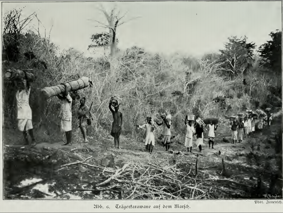
A porter, also called a bearer, is a person who carries objects or cargo for others. The range of services conducted by porters is extensive, from shuttling luggage aboard a train (a railroad porter) to bearing heavy burdens at altitude in inclement weather on multi-month mountaineering expeditions. They can carry items on their backs (backpack) or on their heads. The word "porter" derives from the Latin ''portare'' (to carry). The use of humans to transport cargo dates to the ancient world, prior to domesticating animals and development of the wheel. Historically it remained prevalent in areas where slavery was permitted, and exists today where modern forms of mechanical conveyance are impractical or impossible, such as in mountainous terrain, or thick jungle or forest cover. Over time slavery diminished and technology advanced, but the role of porter for specialized transporting services remains strong in the 21st century. Examples include bellhops at hotels, redcaps at ... [...More Info...] [...Related Items...] OR: [Wikipedia] [Google] [Baidu] |
Labuche Kang
Labuche Kang (or Lapche Kang, Lobuche Kang I, Choksiam) is a northern outlier of the Himalayas inside Tibet. It rises northwest of Rolwaling Himal and east of Shishapangma. The peak belongs to a little-known section of the Himalaya variously called Labuche Himal, Pamari Himal and Lapchi Kang. that extends from the valley of the Tamakosi River west to the valley of the Sun Kosi and Nyalam Tong La pass where Arniko- Friendship Highway cross the Himalaya. This section extends south into Nepal east of Arniko Highway. It is wholly within the catchment of the Kosi, a Ganges tributary. Labuche Kang was first climbed in 1987 by a Sino- Japanese expedition, via the West Ridge. No other attempts are recorded until September 2010 when American climber Joe Puryear fell to his death during an unsuccessful attempt. [...More Info...] [...Related Items...] OR: [Wikipedia] [Google] [Baidu] |
Lobuche
Lobuche (also spelt Lobuje) is a Nepalese mountain which lies close to the Khumbu Glacier and the settlement of Lobuche. There are two main peaks, Lobuche East and Lobuche West. A permit to climb the mountain is required from the Nepal Mountaineering Association (NMA), which classifies Lobuche East (6,119m) as a "trekking peak" and Lobuche West (6,145m) as an "expedition peak". As the easier, trekking peak, the East peak is climbed far more frequently than the West peak; however, most of those climbers only do so to a false summit a few hours from the true summit of Lobuche East. Between the two peaks is a long, deeply notched ridge, though a steep drop and considerable distance makes approaching the West peak from the East impossible. The first recorded ascent of Lobuche East was made by Laurence Nielson and Sherpa Ang Gyalzen on April 25, 1984. Lobuje West was first climbed in 1955 via the South Shoulder. Name Confusion Many of the tourist operators offering treks and clim ... [...More Info...] [...Related Items...] OR: [Wikipedia] [Google] [Baidu] |
Khumbu Glacier
The Khumbu Glacier ( ne, खुम्बु हिमनदी) is located in the Khumbu region of northeastern Nepal between Mount Everest and the Lhotse-Nuptse ridge. With elevations of at its terminus to at its source, it is the world's highest glacier. The Khumbu Glacier is followed for the final part of the trail to one of the Everest Base Camps. The start of the glacier is in the Western Cwm near Everest. The glacier has a large icefall, the Khumbu Icefall, at the west end of the lower Western Cwm. This icefall is the first major obstacle—and among the more dangerous—on the standard south col route to the Everest summit. It is also the largest glacier of Nepal. The end of Khumbu Glacier is located at . Overview Khumbu Glacier, Khumbu Icefall, Nepal, Asia.jpg, Khumbu Glacier and Khumbu Icefall Khumbu Glacier from Kala Patthar, Mountains of Nepal, Asia.jpg, Khumbu Glacier Khumbu glacier in relation to everest.jpg, Map See also * * List of glaciers * Retreat of gl ... [...More Info...] [...Related Items...] OR: [Wikipedia] [Google] [Baidu] |
Kala Patthar
Kala Patthar ( ne, काला पत्थर, lit=black rock) is a notable landmark located on the south ridge of Pumori in the Nepali Himalayas above Gorakshep. Although not a proper mountain, with a prominence of only , the ascent of Kala Patthar is very popular with trekkers in the region of Mount Everest since it provides the most accessible closeup view of Everest. Due to the structure of the Everest Massif, its high summit is blocked by Nuptse from much of the surrounding region. The views of Everest, Nuptse and Changtse are spectacular from Kala Patthar and there are glimpses of the northern flank and summit of Lhotse. The world's highest webcam, Mount Everest webcam, was located here. Kala Patthar is considered the highest altitude most will reach without a climbing permit, which must be obtained in Kathmandu, at the Nepal Mountaineering Association. Description The ascent of Kala Patthar begins at Gorakshep (), the original base camp for Mt. Everest. After a brief ... [...More Info...] [...Related Items...] OR: [Wikipedia] [Google] [Baidu] |


