|
Little Karimun
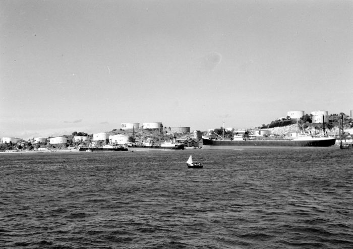
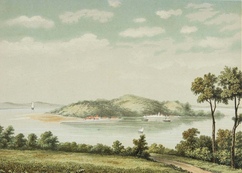
Little Karimun (''Karimun Kecil'' or ''Pulau Anak'' in Indonesian) is an island in the Strait of Malacca, about west of Batam and 35 km south-west of Singapore.Sailing Directions (Enroute), Strait of Malacca and Sumatra,'' page 50. Publication 174, National Geospatial Intelligence Agency, USA It belongs to the Karimun Regency of the Riau Islands Province of Indonesia. It is located just off the east coast of Sumatra. Little Karimun lies just to the north-east of Great Karimun, from which it is separated by a deep channel about wide. Its highest point is 377 m above sea level. It is hilly with fertile soil. The northern tip of Little Karimun is one of the baseline points that define the legal boundaries of Indonesia.(). Different Areas Tanjung Balai See also * Karimun Jawa, an unrelated archipelago off the north coast of Java Java (; id, Jawa, ; jv, ꦗꦮ; su, ) is one of the Greater Sunda Islands in Indonesia. It is bordered by the Indian Ocean to the sout ... [...More Info...] [...Related Items...] OR: [Wikipedia] [Google] [Baidu] |
Indonesian Language
Indonesian ( ) is the official and national language of Indonesia. It is a standardized variety of Malay, an Austronesian language that has been used as a lingua franca in the multilingual Indonesian archipelago for centuries. Indonesia is the fourth most populous nation in the world, with over 270 million inhabitants—of which the majority speak Indonesian, which makes it one of the most widely spoken languages in the world. James Neil Sneddon. ''The Indonesian Language: Its History and Role in Modern Society''. UNSW Press, 2004. Most Indonesians, aside from speaking the national language, are fluent in at least one of the more than 700 indigenous local languages; examples include Javanese and Sundanese, which are commonly used at home and within the local community. However, most formal education and nearly all national mass media, governance, administration, and judiciary and other forms of communication are conducted in Indonesian. Under Indonesian rule from ... [...More Info...] [...Related Items...] OR: [Wikipedia] [Google] [Baidu] |
Strait Of Malacca
The Strait of Malacca is a narrow stretch of water, 500 mi (800 km) long and from 40 to 155 mi (65–250 km) wide, between the Malay Peninsula (Peninsular Malaysia) to the northeast and the Indonesian island of Sumatra to the southwest, connecting the Andaman Sea (Indian Ocean) and the South China Sea (Pacific Ocean). As the main shipping channel between the Indian and Pacific oceans, it is one of the most important shipping lanes in the world. It is named after the Malacca Sultanate that ruled over the strait between 1400 and 1511, the center of administration of which was located in the modern-day state of Malacca, Malaysia. Extent The International Hydrographic Organization define the limits of the Strait of Malacca as follows: History Early traders from Arabia, Africa, Persia, and Southern India reached Kedah before arriving at Guangzhou. Kedah served as a western port on the Malay Peninsula. They traded glassware, camphor, cotton goods, brocades, ivory, sandalw ... [...More Info...] [...Related Items...] OR: [Wikipedia] [Google] [Baidu] |
Batam
Batam is the largest city in the province of Riau Islands, Indonesia. The city administrative area covers three main islands of Batam, Rempang, and Galang (collectively called Barelang), as well as several small islands. Batam Island is the core urban and industrial zone, while both Rempang Island and Galang Island maintain their rural character and are connected to Batam Island by short bridges. Batam is an industrial boomtown, an emerging transport hub, and part of a free trade zone in the Indonesia–Malaysia–Singapore Growth Triangle, located off Singapore's south coast and also part of the Indonesia–Malaysia–Thailand Growth Triangle. According to Statistics Indonesia's 2020 census, Batam had a population of 1,196,396, making it the third largest city in the region of Sumatra, after Medan and Palembang. It is the closest part of Indonesia to Singapore, at a minimum land distance of 5.8 km. During the 2010 national census, Batam was the fastest-growing mun ... [...More Info...] [...Related Items...] OR: [Wikipedia] [Google] [Baidu] |
Singapore
Singapore (), officially the Republic of Singapore, is a sovereign island country and city-state in maritime Southeast Asia. It lies about one degree of latitude () north of the equator, off the southern tip of the Malay Peninsula, bordering the Strait of Malacca to the west, the Singapore Strait to the south, the South China Sea to the east, and the Straits of Johor to the north. The country's territory is composed of one main island, 63 satellite islands and islets, and one outlying islet; the combined area of these has increased by 25% since the country's independence as a result of extensive land reclamation projects. It has the third highest population density in the world. With a multicultural population and recognising the need to respect cultural identities of the major ethnic groups within the nation, Singapore has four official languages: English, Malay, Mandarin, and Tamil. English is the lingua franca and numerous public services are available only i ... [...More Info...] [...Related Items...] OR: [Wikipedia] [Google] [Baidu] |
Karimun Regency
The Karimun Regency is located in the Riau Islands Province, Indonesia. Besides the central island of Great Karimun, the regency also includes the islands of Kundur and over 240 smaller islands. The district covers a land area of 1,524 km2 and a sea area of 6,460 km2, and its population was 212,561 at the 2010 Census and 253,457 at the 2020 Census. Administrative Districts As at 2010, the Regency was divided into nine districts (''kecamatan''), but subsequently on 11 June 2012 a further three districts have been added - Ungar (from part of Kundur district), Belat (from part of Kundur Utara district), and Meral Barat (out of the western part of Meral). The twelve districts are tabulated below with their areas and populations at the 2010 Census and 2020 Census.Badan Pusat Statistik, Jakarta, 2021. The table also includes the locations of the district administrative centres, the number of administrative villages (rural ''desa'' and urban ''kelurahan'') and the number of i ... [...More Info...] [...Related Items...] OR: [Wikipedia] [Google] [Baidu] |
Riau Islands Province
The Riau Islands ( id, Kepulauan Riau) is a province of Indonesia. It comprises a total of 1,796 islands scattered between Sumatra, Malay Peninsula, and Borneo including the Riau Archipelago. Situated on one of the world's busiest shipping lanes along the Malacca Strait and the South China Sea, the province shares water borders with neighboring countries such as Singapore, Malaysia, and Brunei. The Riau Islands also has a relatively large potential of mineral resources, energy, as well as marine resources. The capital of the province is Tanjung Pinang and the largest city is Batam. The Riau archipelago was once part of the Johor Sultanate, which was later partitioned between the Dutch East Indies and British Malaya after the Anglo-Dutch Treaty of 1824, in which the archipelago fell under Dutch influence. A Dutch protectorate, the Riau-Lingga Sultanate, was established in the region between 1824 and 1911 before being directly ruled by the Dutch East Indies. The archip ... [...More Info...] [...Related Items...] OR: [Wikipedia] [Google] [Baidu] |
Indonesia
Indonesia, officially the Republic of Indonesia, is a country in Southeast Asia and Oceania between the Indian and Pacific oceans. It consists of over 17,000 islands, including Sumatra, Java, Sulawesi, and parts of Borneo and New Guinea. Indonesia is the world's largest archipelagic state and the 14th-largest country by area, at . With over 275 million people, Indonesia is the world's fourth-most populous country and the most populous Muslim-majority country. Java, the world's most populous island, is home to more than half of the country's population. Indonesia is a presidential republic with an elected legislature. It has 38 provinces, of which nine have special status. The country's capital, Jakarta, is the world's second-most populous urban area. Indonesia shares land borders with Papua New Guinea, East Timor, and the eastern part of Malaysia, as well as maritime borders with Singapore, Vietnam, Thailand, the Philippines, Australia, Palau, and India ... [...More Info...] [...Related Items...] OR: [Wikipedia] [Google] [Baidu] |
Sumatra
Sumatra is one of the Sunda Islands of western Indonesia. It is the largest island that is fully within Indonesian territory, as well as the sixth-largest island in the world at 473,481 km2 (182,812 mi.2), not including adjacent islands such as the Simeulue, Nias, Mentawai, Enggano, Riau Islands, Bangka Belitung and Krakatoa archipelago. Sumatra is an elongated landmass spanning a diagonal northwest–southeast axis. The Indian Ocean borders the northwest, west, and southwest coasts of Sumatra, with the island chain of Simeulue, Nias, Mentawai, and Enggano off the western coast. In the northeast, the narrow Strait of Malacca separates the island from the Malay Peninsula, which is an extension of the Eurasian continent. In the southeast, the narrow Sunda Strait, containing the Krakatoa Archipelago, separates Sumatra from Java. The northern tip of Sumatra is near the Andaman Islands, while off the southeastern coast lie the islands of Bangka and Belitung, ... [...More Info...] [...Related Items...] OR: [Wikipedia] [Google] [Baidu] |
Great Karimun
Great Karimun ( id, Karimun Besar), also known as Nuwi Island, is one of the islands in the Riau Islands province of Indonesia, administratively part of Karimun Regency. It lies about 37 km southwest of Singapore, 54 km west of Batam, 24 km northeast of Rangsang Island and 32 km north of Kundur Island. History In the past, Great Karimun Island was the destination of foreign traders and the Malay Kings. Sixteenth century Portuguese reports claimed that the island was inhabited, possibly by the Orang Laut. In the 18th and 19th centuries, the island was part of the Johor Sultanate then the Riau-Lingga Sultanate. Around 1615 agents of the Dutch East India Company (VOC) inspected the northwestern coast of the island for the possible construction of a fortification. The proposed fort, however, was never built. Two centuries later, Colonel William Farquhar surveyed the island after receiving permission from the Bugis Raja Muda of Johor, Raja Ja'afar. Although Karimu ... [...More Info...] [...Related Items...] OR: [Wikipedia] [Google] [Baidu] |
Baselines Of Indonesia
The territorial waters of Indonesia are defined according to the principles set out in Article 46 of the United Nations Convention on the Law of the Sea. Their boundary consists of straight lines ("baselines") linking 195 coordinate points located at the outer edge of the archipelago ("basepoints"). Baselines legislation The current baselines were established by Government Regulation 38 of 2002 which defined by 183 coordinate points as basepoints. The baselines were modified by Government Regulation No 37 of 2008 which changed as well as added basepoints to take into account the International Court of Justice decision on the sovereignty of Sipadan and Ligitan islands and the independence of East Timor. No additional points were established for the area around Sipadan and Ligitan where the baselines was redrawn, while 10 new basepoints were added for the baseline to run around East Timor. Adjustments with two additional points were also made for the southern Java coast. History In ... [...More Info...] [...Related Items...] OR: [Wikipedia] [Google] [Baidu] |
Karimun Jawa
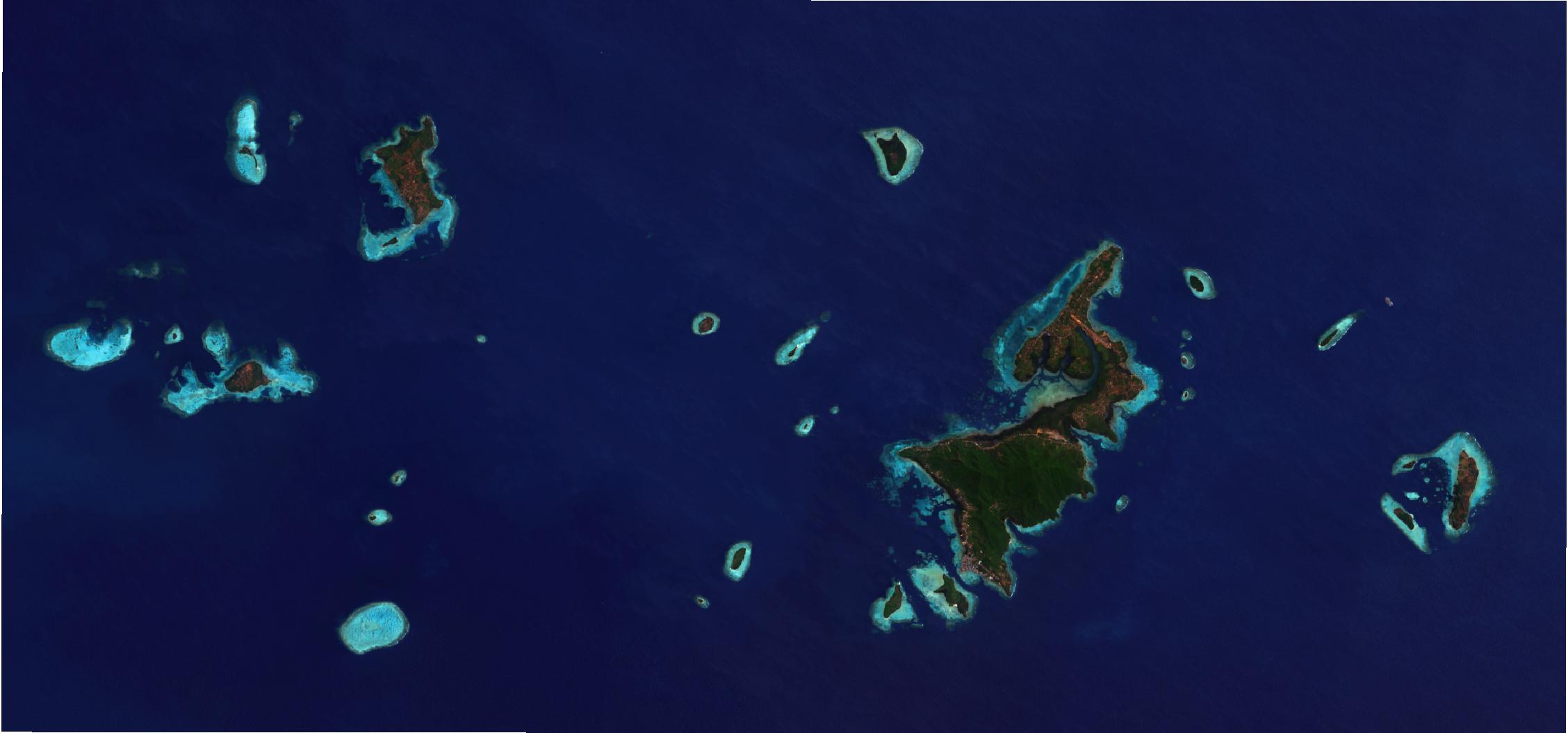
Karimunjawa Islands or Karimunjava Islands ( id, Kepulauan Karimunjawa) is an archipelago of 27 islands in the Java Sea, Indonesia, approximately 80 kilometres northwest of Jepara. They have a total land area of 71.2 km2. The main island is known as Karimun (2,700 ha), while the second-largest island is Kemujan (1,400 ha). At the 2020 Census, the population of the island group was 9,789Badan Pusat Statistik, Jakarta, 2021. who lived on five of the islands. The population is largely Javanese, with pockets of Bugis and Madurese inhabitants. Javanese culture is dominant in the islands which are the only islands off Java where Javanese is the lingua franca. Twenty-two of the islands have been declared 2001 as a marine reserve, the Karimunjawa National Park. Five more islands are either privately owned or are under the control of the Indonesian Navy. The archipelago is served by Dewadaru Airport which provides scheduled airline services to Semarang and Surabaya. Islands ... [...More Info...] [...Related Items...] OR: [Wikipedia] [Google] [Baidu] |
Java
Java (; id, Jawa, ; jv, ꦗꦮ; su, ) is one of the Greater Sunda Islands in Indonesia. It is bordered by the Indian Ocean to the south and the Java Sea to the north. With a population of 151.6 million people, Java is the world's most populous island, home to approximately 56% of the Indonesian population. Indonesia's capital city, Jakarta, is on Java's northwestern coast. Many of the best known events in Indonesian history took place on Java. It was the centre of powerful Hindu-Buddhist empires, the Islamic sultanates, and the core of the colonial Dutch East Indies. Java was also the center of the Indonesian struggle for independence during the 1930s and 1940s. Java dominates Indonesia politically, economically and culturally. Four of Indonesia's eight UNESCO world heritage sites are located in Java: Ujung Kulon National Park, Borobudur Temple, Prambanan Temple, and Sangiran Early Man Site. Formed by volcanic eruptions due to geologic subduction of the Austra ... [...More Info...] [...Related Items...] OR: [Wikipedia] [Google] [Baidu] |


