|
List Of The Busiest Airports In The Baltic States
This is a list of the busiest airports in the Baltic states in terms of total number of Passengers, Aircraft movements and Freight and Mail Tonnes per year. The statistics includes major airports in the Baltic States with commercial regular traffic. Aircraft movements and Freight and Mail Tonnes only include statistics for the 5 busiest airports in 2012 since reliable data is not available for all airports. Included are also a list of the Busiest Air Routes to/from and between the Baltic States for 2011 and 2012, data for 2019 will be added as soon as the data becomes available. Passengers Graph Summary Table 2021 statistics 2020 statistics 2019 statistics 2018 statistics 2017 statistics 2013 statistics 2012 statistics Aircraft movements 2019 statistics 2012 statistics Freight and Mail Tonnes 2021 statistics 2012 statistics Busiest Air Routes Busiest nonstop air routes within and to/from the Baltic States based on total annually car ... [...More Info...] [...Related Items...] OR: [Wikipedia] [Google] [Baidu] |
Baltic States
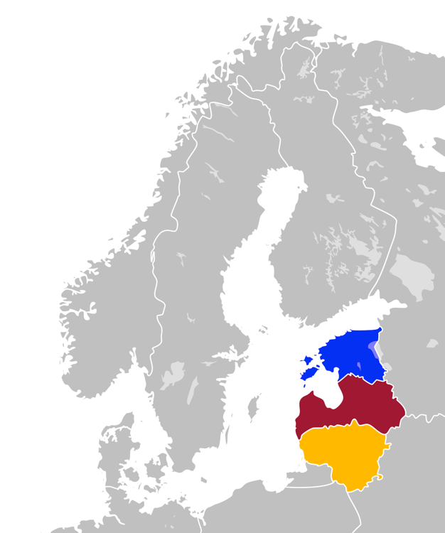
The Baltic states, et, Balti riigid or the Baltic countries is a geopolitical term, which currently is used to group three countries: Estonia, Latvia, and Lithuania. All three countries are members of NATO, the European Union, the Eurozone, and the OECD. The three sovereign states on the eastern coast of the Baltic Sea are sometimes referred to as the "Baltic nations", less often and in historical circumstances also as the "Baltic republics", the "Baltic lands", or simply the Baltics. All three Baltic countries are classified as high-income economies by the World Bank and maintain a very high Human Development Index. The three governments engage in intergovernmental and parliamentary cooperation. There is also frequent cooperation in foreign and security policy, defence, energy, and transportation. The term "Baltic states" ("countries", "nations", or similar) cannot be used unambiguously in the context of cultural areas, national identity, or language. While the majorit ... [...More Info...] [...Related Items...] OR: [Wikipedia] [Google] [Baidu] |
Palanga
Palanga (; bat-smg, Palonga; pl, Połąga; german: Polangen) is a seaside resort town in western Lithuania, on the shore of the Baltic Sea. Palanga is the busiest summer resort in Lithuania and has sandy beaches (18 km, 11 miles long and up to 300 metres, 1000 ft wide) and sand dunes. Officially Palanga has the status of a city municipality and includes Šventoji, Nemirseta, Būtingė, Palanga International Airport and other settlements, which are considered as part of the city of Palanga. Legend According to legend, there was a pagan shrine at the foot of a hill in Palanga where a beautiful priestess named Birutė used to tend the ceremonial fires. Having heard of Birutė's beauty, Kęstutis, the Grand Duke of Lithuania, came to make her his wife. The Lithuanian Bychowiec Chronicle records that Birutė "did not consent, and answered that she had promised the gods to remain a virgin as long as she lived. Kęstutis then resorted to take her by force, and with ... [...More Info...] [...Related Items...] OR: [Wikipedia] [Google] [Baidu] |
Kihnu
Kihnu is an island in the Baltic Sea. With an area of it is the largest island in the Gulf of Riga and the seventh largest island of Estonia. The length of the island is and width , the highest point is at above sea level. The island belongs to the Pärnu County of Estonia. Together with neighbouring islands it forms Kihnu Parish, one of the smallest municipalities of the country with an area of . 604 people live on Kihnu , 69 of whom are primary school pupils. There are four villages: Lemsi, Linaküla, Rootsiküla and Sääre. One can reach Kihnu by a 15-minute plane trip from Pärnu or by ferry, with trips taking 3 hours from Pärnu and 1 hour from Manilaid. When the sea is frozen in winter, it is possible to drive to the island over the ice. The nearby isle of Manilaid (or Manija, ''Manõja'' in the Kihnu dialect) was inhabited by people from Kihnu since 1933 and thus shares its culture. UNESCO proclaimed Kihnu's cultural space and traditions as a Masterpiece of ... [...More Info...] [...Related Items...] OR: [Wikipedia] [Google] [Baidu] |
Pärnu Airport
Pärnu Airport ( et, Pärnu lennujaam, ) is an airport in Estonia. The airport is situated northwest of Pärnu. Overview In October 1937, the Pärnu town council designated an area of for the building of an airport. Operations at the new airport began in 1939. During the Soviet occupation, the airfield was operated by the Soviet Air Force. It was an interceptor aircraft base, operated by 366 IAP (366th Interceptor Aviation Regiment) and possibly the 655 IAP (655th Interceptor Aviation Regiment), which flew Mikoyan-Gurevich MiG-23 aircraft from the 1970s until the 1990s. Aeroflot used to operate Tartu-Viljandi-Pärnu-Kingissepa (now Kuressaare) services using Antonov An-2 biplanes. In the summer of 1992, the re-constituted Estonian defence ministry took over the military airport, which had drawn down its operations. On 15 October the same year it was decided to build a civil airport at the site of the old military airport. The old runway was closed on 1 July 1997, and regular ... [...More Info...] [...Related Items...] OR: [Wikipedia] [Google] [Baidu] |
Pärnu
Pärnu () is the fourth largest city in Estonia. Situated in southwest Estonia, Pärnu is located south of the Estonian capital, Tallinn, and west of Estonia's second largest city, Tartu. The city sits off the coast of Pärnu Bay, an inlet of the Gulf of Riga, which is a part of the Baltic Sea. In the city, the Pärnu River drains into the Gulf of Riga. Pärnu is a popular summer holiday resort town among Estonians with many hotels, restaurants and large beaches. The city is served by Pärnu Airport. History Perona (german: Alt-Pernau, links=no, et, Vana-Pärnu, links=no), which was founded by the bishop of Ösel–Wiek , suffered heavily under pressure of the concurrent town, and was finally destroyed . Another town, Embeke (later german: Neu-Pernau, links=no, et, Uus-Pärnu, links=no) was founded by the Livonian Order, who began building an Ordensburg nearby in 1265. The latter town, then known by the German name of , was a member of the Hanseatic League and a ... [...More Info...] [...Related Items...] OR: [Wikipedia] [Google] [Baidu] |
Kärdla Airport
Kärdla Airport ( et, Kärdla lennujaam, ) is an airport in Estonia. The airport is situated east of the town of Kärdla on Hiiumaa island. The airport has one asphalt runway, 14/32, and is . The runway was upgraded in 1998. Overview Kärdla Airport opened in 1963. During the next years there was fairly high activity at the airport, with regular flights to Tallinn, Haapsalu, Vormsi, Kuressaare, Riga, Pärnu, Viljandi, and Tartu, and charter flights to Murmansk, Vilnius, and Kaunas. 24,335 passengers travelled via Kärdla Airport in 1987. Air traffic sank dramatically after Estonia became independent in 1991, and in 1995, only 727 passengers traveled via the airport. Since then, traffic has increased, and 10,551 passengers travelled via the airport in 2010. The airport has annual Flight Days in the first weekend of August. On November 23, 2001, two died after an Antonov An-28 crashed en route to Kärdla. An investigation found that pilot error was the cause, but a court late ... [...More Info...] [...Related Items...] OR: [Wikipedia] [Google] [Baidu] |
Kärdla
Kärdla (; sv, ; german: Kertel) is the only town on the island of Hiiumaa, Estonia. It is the capital of Hiiu County and the administrative center of Hiiumaa Parish. Geography Kärdla is located on the northeastern coast of Hiiumaa, by the Tareste Bay; to the southeast of the town lies the 455 million year old Kärdla meteorite crater. Several small rivers flow through the town. There are also artesian wells in Kärdla. The Swedish name ''Kärrdal'' means "marsh valley"; the town is located in a lowlands valley. History Kärdla was first mentioned in 1564 as a village inhabited by Swedes. Its growth was greatly influenced by the cloth factory founded in 1830. A port was built in 1849. Both the port and the factory were destroyed in World War II. Kärdla officially became a borough in 1920, and a town in 1938. In 2013 the town was merged with Kõrgessaare Parish to establish Hiiumaa Parish, therefore Kärdla lost its municipality status. Population Transport Road t ... [...More Info...] [...Related Items...] OR: [Wikipedia] [Google] [Baidu] |
Kuressaare Airport
Kuressaare Airport ( et, Kuressaare lennujaam, ) is an airport in Estonia. The airport is situated south southeast of Kuressaare on Saaremaa island. Overview The first runway was built in the last half of the 1930s. The airport was opened officially on 6 March 1945. The air traffic increased during the proceeding years and between 1949 and 1953 there were between 10 and 14 daily flights between Kuressaare and Tallinn. During this period, around 400 passengers flew to or from Kuressaare daily. The airport did not get electricity until 1958. The present terminal building was built in 1962. The second runway 05/23 was built in 1976 and in 1999 the main runway was lengthened. The terminal building was modernized in 2007. The airport is owned by AS Tallinna Lennujaam, which also owns Ruhnu Airfield Ruhnu Airfield is an airfield on Ruhnu island in Estonia. The airfield is situated to the south of the island, southeast of Kuressaare, near the village of Ringsu. It is owned by ... [...More Info...] [...Related Items...] OR: [Wikipedia] [Google] [Baidu] |
Kuressaare
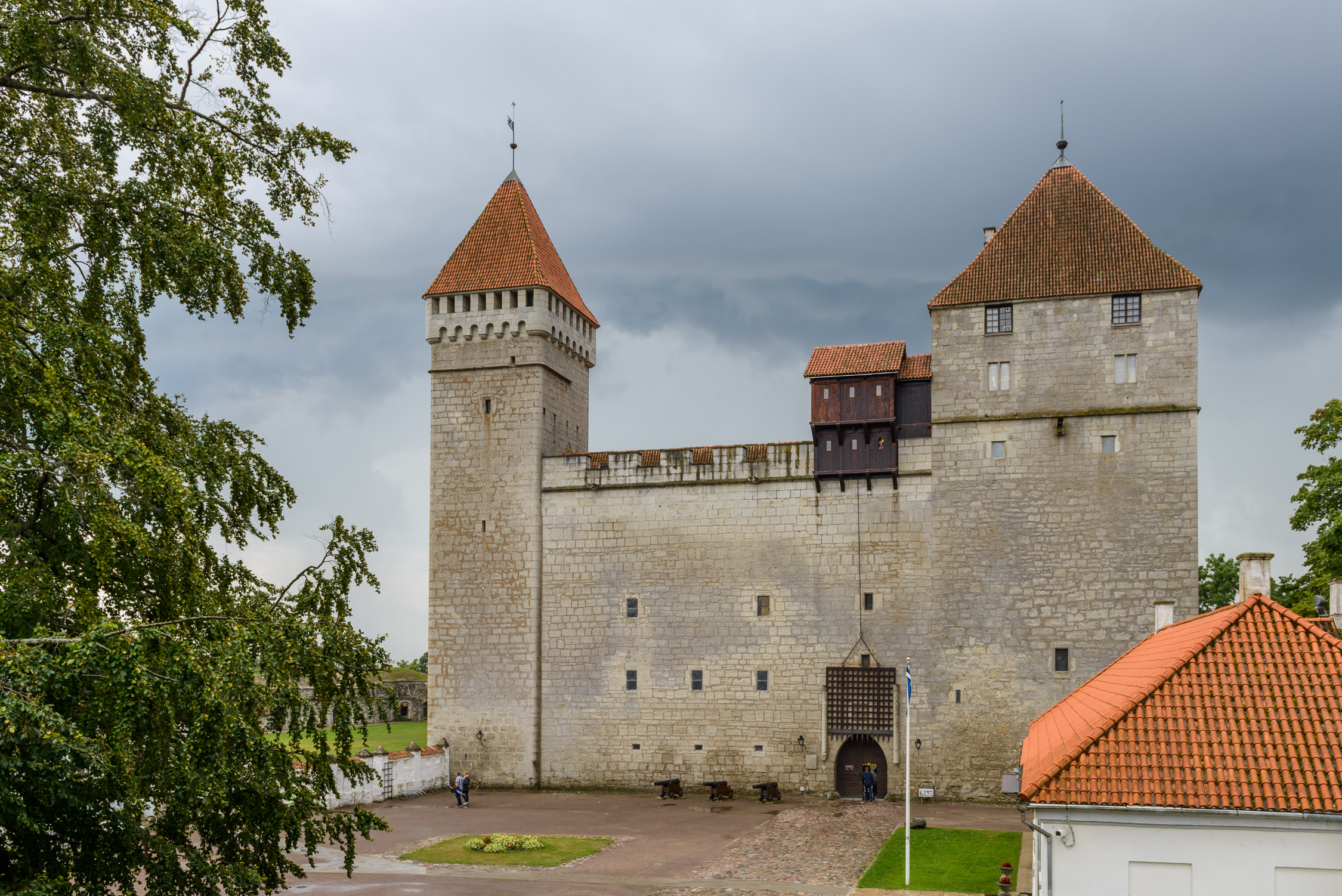
Kuressaare () is a town on Saaremaa island in Estonia. It is the administrative centre of Saaremaa Parish and the capital of Saare County. Kuressaare is the westernmost town in Estonia. The recorded population on 1 January 2018 was 13,276. The town is situated on the southern coast of Saaremaa island, facing the Gulf of Riga of the Baltic Sea, and is served by the Kuressaare Airport, Roomassaare harbour, and Kuressaare yacht harbour. Names Kuressaare's historic name Arensburg (from Middle High German ''a(a)r:'' eagle, raptor) renders the Latin denotation ''arx aquilae'' for the city's castle. The fortress and the eagle, tetramorph symbol of Saint John the Evangelist, are also depicted on Kuressaare's coat of arms. The town, which grew around the fortress, was simultaneously known as Arensburg and Kuressaarelinn; the latter name being a combination of ''Kuressaare''—an ancient name of the Saaremaa Island—and ''linn'', which means ''town''.Pospelov, p. 28 Alternative ... [...More Info...] [...Related Items...] OR: [Wikipedia] [Google] [Baidu] |
Tartu Airport
Tartu Airport ( et, Tartu lennujaam) is an airport in Reola, Ülenurme Parish, south southwest of Tartu, the second largest city in Estonia. It is also called Ülenurme Airport due to its proximity to the village of Ülenurme. The Tallinn–Tartu–Võru–Luhamaa highway (E263) passes near the airport. History The airport was opened on 15 May 1946. A new terminal building was built in 1981, and the runway and taxiway were also upgraded then. Since 2005, the airport has been operated by Tallinn Airport Ltd. In 2009, the runway was lengthened to . In 2010, Tartu International Airport served 23,504 passengers. Airlines and destinations As of 13 November 2022, there are no regular commercial passenger flights to/from Tartu.https://news.err.ee/1608722098/finnair-calls-time-on-tartu-helsinki-route Statistics List of the busiest airports in the Baltic states See also *Estonian Aviation Academy *Estonian Aviation Museum *Raadi Airfield (Tartu Air Base) References External ... [...More Info...] [...Related Items...] OR: [Wikipedia] [Google] [Baidu] |
Tartu
Tartu is the second largest city in Estonia after the Northern European country's political and financial capital, Tallinn. Tartu has a population of 91,407 (as of 2021). It is southeast of Tallinn and 245 kilometres (152 miles) northeast of Riga, Latvia. Tartu lies on the Emajõgi river, which connects the two largest lakes in Estonia, Lake Võrtsjärv and Lake Peipus. From the 13th century until the end of the 19th century, Tartu was known in most of the world by variants of its historical name Dorpat. Tartu, the largest urban centre of southern Estonia, is often considered the "intellectual capital city" of the country, especially as it is home to the nation's oldest and most renowned university, the University of Tartu (founded in 1632). Tartu also houses the Supreme Court of Estonia, the Ministry of Education and Research, the Estonian National Museum, and the oldest Estonian-language theatre, Vanemuine. It is also the birthplace of the Estonian Song Festivals ... [...More Info...] [...Related Items...] OR: [Wikipedia] [Google] [Baidu] |
Ĺ iauliai International Airport
Ĺ iauliai International Airport (also known as Zokniai Airport, lt, ZokniĹł oro uostas) is located southeast of the city of Ĺ iauliai, in northern Lithuania. It covers an area of . History The airport was one of the largest military airports in the former Soviet Union. In 1955 it was only one of six Soviet bases capable of handling the new Myasishchev M-4 bomber. The Tupolev Tu-126 was based here between the 1960s and 1970s. It was home to the 53 APIB (53rd Fighter-Bomber Aviation Regiment) flying MiG-23 aircraft with the ML, MLD, and UB variants and the MiG-27. It was also home to the 18th Guards Military Transport Aviation Division, and the 196 VTAP (196th Military Transport Aviation Regiment) flying Il-76 aircraft. It was a base of the 117 OAP (117th Independent Aviation Regiment) flying An-12PPS aircraft. The last Soviet troops based here left in 1993. Baltic air policing Ĺ iauliai is home to the NATO Baltic Air Policing The Baltic air-policing mission is a NATO ... [...More Info...] [...Related Items...] OR: [Wikipedia] [Google] [Baidu] |


