|
List Of Mesolithic Settlements
List of Mesolithic and Epipaleolithic settlements. Mesolithic Europe Epipaleolithic Near East See also * List of Neolithic settlements References {{Reflist Archaeology-related lists, Mesolithic Mesolithic settlements, ... [...More Info...] [...Related Items...] OR: [Wikipedia] [Google] [Baidu] |
Mesolithic
The Mesolithic (Greek: μέσος, ''mesos'' 'middle' + λίθος, ''lithos'' 'stone') or Middle Stone Age is the Old World archaeological period between the Upper Paleolithic and the Neolithic. The term Epipaleolithic is often used synonymously, especially for outside northern Europe, and for the corresponding period in the Levant and Caucasus. The Mesolithic has different time spans in different parts of Eurasia. It refers to the final period of hunter-gatherer cultures in Europe and Western Asia, between the end of the Last Glacial Maximum and the Neolithic Revolution. In Europe it spans roughly 15,000 to 5,000 BP; in Southwest Asia (the Epipalaeolithic Near East) roughly 20,000 to 10,000 BP. The term is less used of areas farther east, and not at all beyond Eurasia and North Africa. The type of culture associated with the Mesolithic varies between areas, but it is associated with a decline in the group hunting of large animals in favour of a broader hunter-g ... [...More Info...] [...Related Items...] OR: [Wikipedia] [Google] [Baidu] |
Howick House
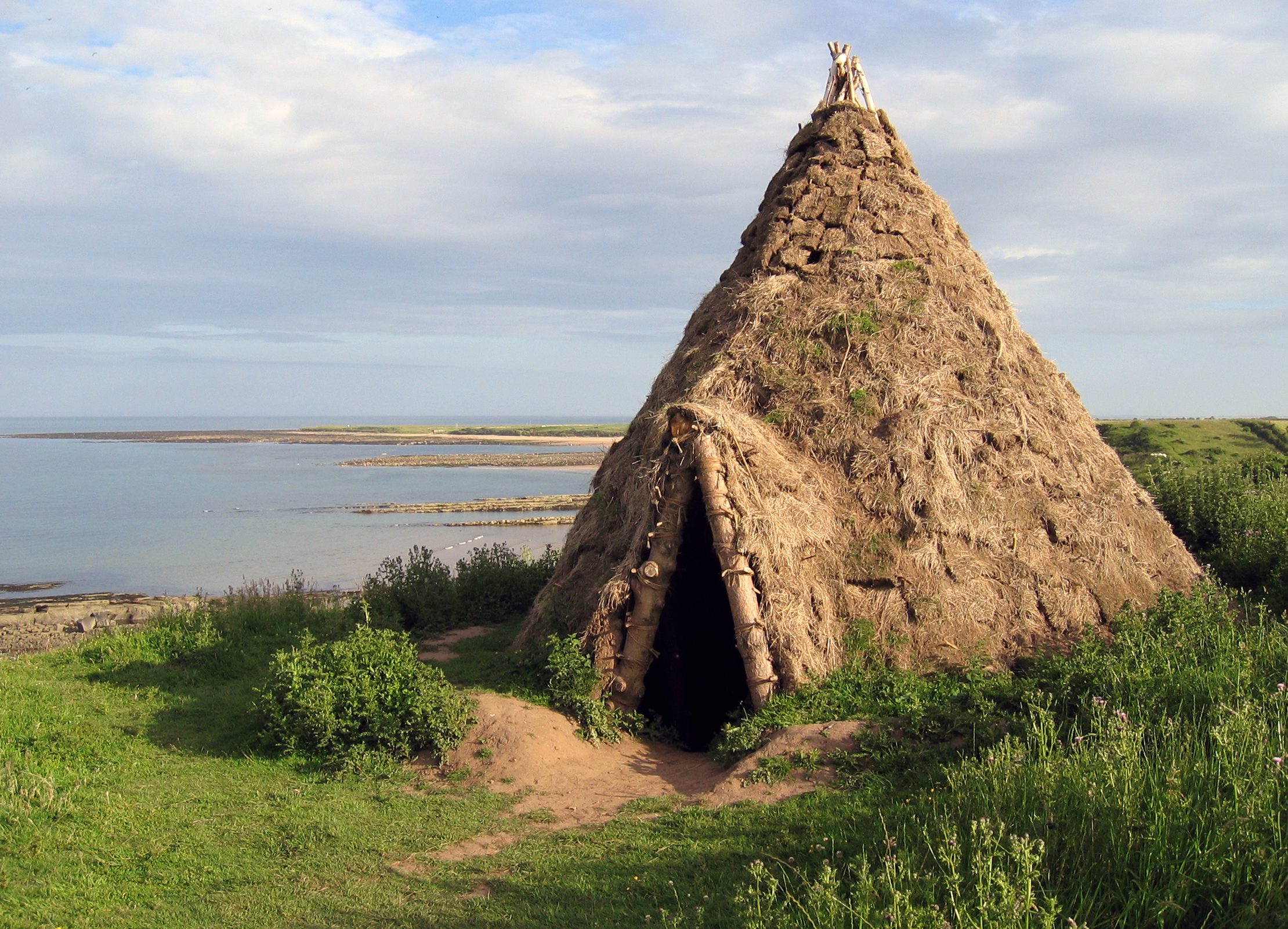
The Howick house is a Mesolithic site located in Northumberland, England. It was found when an amateur archaeologist noticed flint tools eroding out of a sandy cliff face near the village of Howick. Investigations found a circle of substantial post holes with charcoal stains in their bases, a number of smaller stake holes, some angled in from outside a hollow, and inside the house a number of shallow hearths filled with charcoal, burnt nutshells and some fragments of bone. Radiocarbon dating of the charred hazelnut shells established that the building was constructed about 7600 BC and occupied for about 100 years, which led to the find being called "Britain's oldest house". This title was disputed in 2010 when the discovery of the even older 'house-structure' at Star Carr in North Yorkshire was announced. Some of the hearths showed signs only of nut roasting, and the numbers of shells suggested that food was cooked here in quantity, perhaps to preserve it for times of scarcity. To ... [...More Info...] [...Related Items...] OR: [Wikipedia] [Google] [Baidu] |
Mureybet
Mureybet ( ar, مريبط, muribit, lit=covered) is a tell, or ancient settlement mound, located on the west bank of the Euphrates in Raqqa Governorate, northern Syria. The site was excavated between 1964 and 1974 and has since disappeared under the rising waters of Lake Assad. Mureybet was occupied between 10,200 and 8,000 BC and is the eponymous type site for the Mureybetian culture, a subdivision of the Pre-Pottery Neolithic A (PPNA). In its early stages, Mureybet was a small village occupied by hunter-gatherers. Hunting was important and crops were first gathered and later cultivated, but they remained wild. During its final stages, domesticated animals were also present at the site. History of research The first archaeological investigation of the site was carried out in 1964. In that year, the site was noted during an archaeological survey of the region directed by Maurits N. van Loon of the Oriental Institute of the University of Chicago, and a small sounding was mad ... [...More Info...] [...Related Items...] OR: [Wikipedia] [Google] [Baidu] |
Jordan Valley
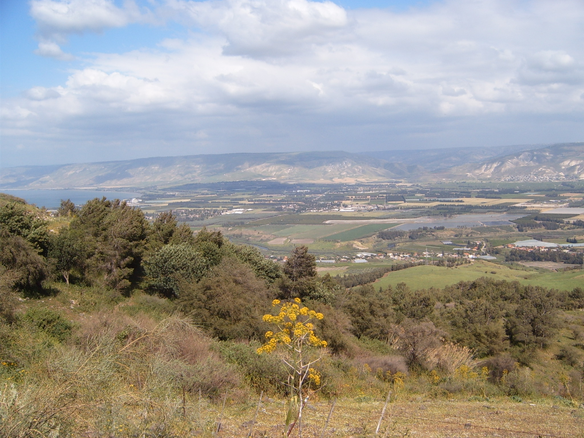
The Jordan Valley ( ar, غور الأردن, ''Ghor al-Urdun''; he, עֵמֶק הַיַרְדֵּן, ''Emek HaYarden'') forms part of the larger Jordan Rift Valley. Unlike most other river valleys, the term "Jordan Valley" often applies just to the lower course of the Jordan River, from the spot where it exits the Sea of Galilee in the north, to the end of its course where it flows into the Dead Sea in the south. In a wider sense, the term may also cover the Dead Sea basin and the Arabah valley, which is the rift valley segment beyond the Dead Sea and ending at Aqaba/ Eilat, farther south. The valley, in the common, narrow sense, is a long and narrow trough, long if measured "as the crow flies", with a width averaging with some points narrowing to over most of the course, before widening out to a delta when reaching the Dead Sea. Due to meandering, the length of the river itself is . This is the valley with the lowest elevation in the world, beginning at below sea level ... [...More Info...] [...Related Items...] OR: [Wikipedia] [Google] [Baidu] |
Beidha (archaeological Site)
Beidha ( ar, البيضا ''al-baīḍā'', "the white one"), also sometimes Bayda, is a major Neolithic archaeological site a few kilometres north of Petra near Siq al-Barid in Jordan. (Snippet view). It is included in Petra's inscription as a UNESCO World Heritage Site. Excavation history It was first excavated by Diana Kirkbride in 1957 and later by Brian Byrd. Periods of settlement Three periods of occupation were detected: the Natufian period in the 11th millennium BC, a Pre-Pottery Neolithic B (PPNB) village with masonry construction in the 7th millennium BC and a Nabatean period dating to the 1st or 2nd century BC. Natufian period Natufian Beidha is characterized as a seasonal encampment, repeatedly occupied over a long period of time. Evidence from Stone tool, lithics recovered along with the layout and position of hearths and roasting areas suggested the occupants were primarily engaged in hunting related activities. This was supported by the absence of permanent buil ... [...More Info...] [...Related Items...] OR: [Wikipedia] [Google] [Baidu] |
Mesopotamia
Mesopotamia ''Mesopotamíā''; ar, بِلَاد ٱلرَّافِدَيْن or ; syc, ܐܪܡ ܢܗܪ̈ܝܢ, or , ) is a historical region of Western Asia situated within the Tigris–Euphrates river system, in the northern part of the Fertile Crescent. Today, Mesopotamia occupies modern Iraq. In the broader sense, the historical region included present-day Iraq and Kuwait and parts of present-day Iran, Syria and Turkey. The Sumerians and Akkadians (including Assyrians and Babylonians) originating from different areas in present-day Iraq, dominated Mesopotamia from the beginning of written history () to the fall of Babylon in 539 BC, when it was conquered by the Achaemenid Empire. It fell to Alexander the Great in 332 BC, and after his death, it became part of the Greek Seleucid Empire. Later the Arameans dominated major parts of Mesopotamia (). Mesopotamia is the site of the earliest developments of the Neolithic Revolution from around 10,000 BC. It has been identi ... [...More Info...] [...Related Items...] OR: [Wikipedia] [Google] [Baidu] |
Tell Abu Hureyra
Tell Abu Hureyra ( ar, تل أبو هريرة) is a prehistoric archaeological site in the Upper Euphrates valley in Syria. The tell was inhabited between 13,000 and 9,000 years ago in two main phases: Abu Hureyra 1, dated to the Epipalaeolithic, was a village of sedentary hunter-gatherers; Abu Hureyra 2, dated to the Pre-Pottery Neolithic, was home to some of the world's first farmers. This almost continuous sequence of occupation through the Neolithic Revolution has made Abu Hureyra one of the most important sites in the study of the origins of agriculture. The site is significant because the inhabitants of Abu Hureyra started out as hunter-gatherers but gradually moved to farming, making them the earliest known farmers in the world. Cultivation started at the beginning of the Younger Dryas period at Abu Hureyra. Evidence uncovered at Abu Hureyra suggests that rye was the first cereal crop to be systematically cultivated. In light of this, it is now believed that the first sy ... [...More Info...] [...Related Items...] OR: [Wikipedia] [Google] [Baidu] |
Ubaid Period
The Ubaid period (c. 6500–3700 BC) is a prehistoric period of Mesopotamia. The name derives from Tell al-'Ubaid where the earliest large excavation of Ubaid period material was conducted initially in 1919 by Henry Hall and later by Leonard Woolley. In South Mesopotamia the period is the earliest known period on the alluvial plain although it is likely earlier periods exist obscured under the alluvium. In the south it has a very long duration between about 6500 and 3800 BC when it is replaced by the Uruk period.Carter, Robert A. and Philip, Graham. 2010. 'Deconstructing the Ubaid' in Carter, Robert A. and Philip, Graham (eds.) ''Beyond the Ubaid: Transformation and Integration in the Late Prehistoric Societies of the Middle East''. Chicago: The Oriental Institute of the University of Chicago. p. 2. In Northern Mesopotamia the period runs only between about 5300 and 4300 BC. It is preceded by the Halaf period and the Halaf-Ubaid Transitional period and succeeded by the Late Chalc ... [...More Info...] [...Related Items...] OR: [Wikipedia] [Google] [Baidu] |
Beqaa Valley
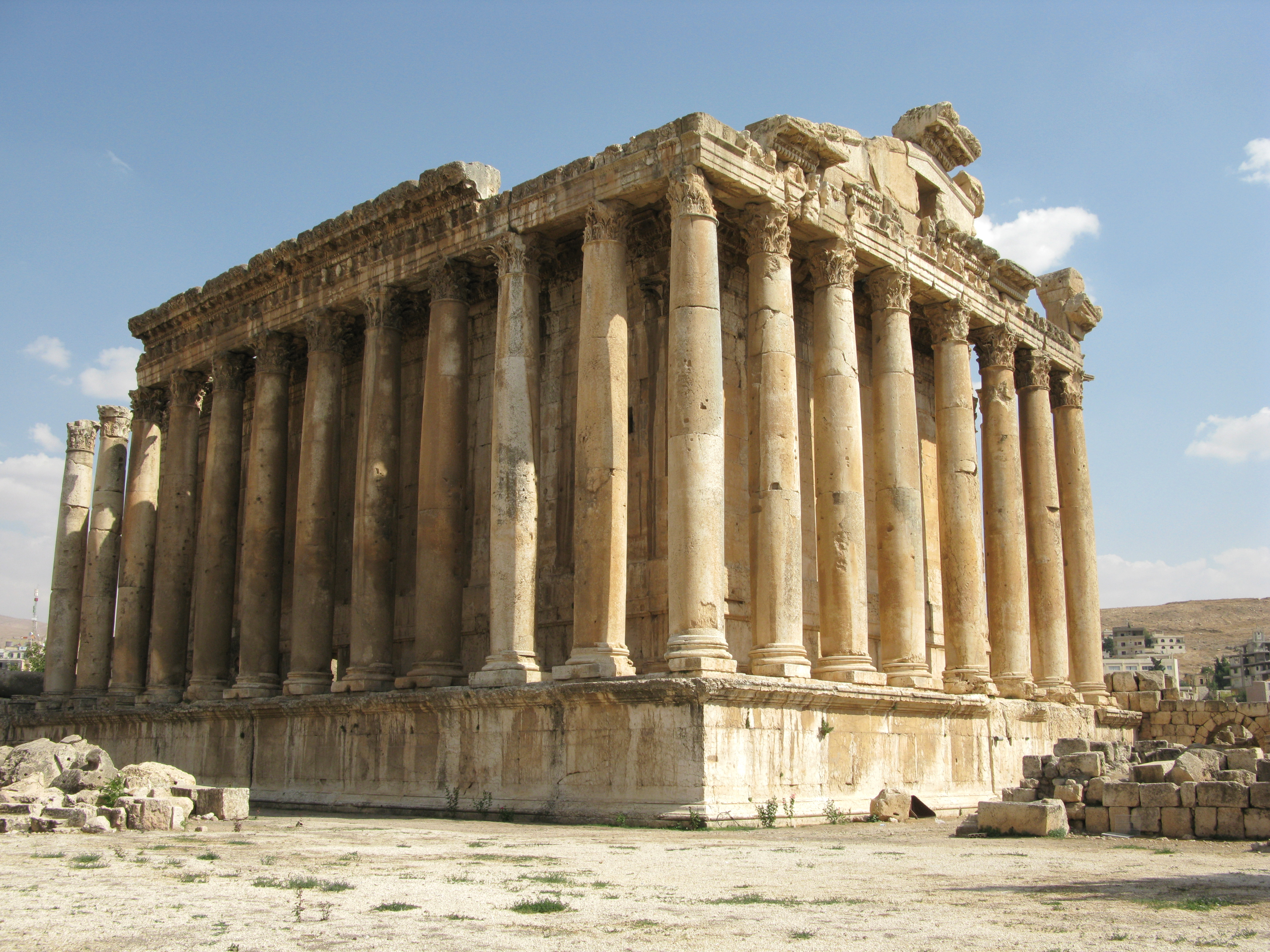
The Beqaa Valley ( ar, links=no, وادي البقاع, ', Lebanese ), also transliterated as Bekaa, Biqâ, and Becaa and known in classical antiquity as Coele-Syria, is a fertile valley in eastern Lebanon. It is Lebanon's most important farming region. Industry also flourishes in Beqaa, especially that related to agriculture. The Beqaa is located about east of Beirut. The valley is situated between Mount Lebanon to the west and the Anti-Lebanon Mountains to the east. It forms the northeasternmost extension of the Great Rift Valley, which stretches from Syria to the Red Sea. Beqaa Valley is long and wide on average. It has a Mediterranean climate of wet, often snowy winters and dry, warm summers. The region receives limited rainfall, particularly in the north, because Mount Lebanon creates a rain shadow that blocks precipitation coming from the sea. The northern section has an average annual rainfall of , compared to in the central valley. Nevertheless, two rivers ... [...More Info...] [...Related Items...] OR: [Wikipedia] [Google] [Baidu] |
Aammiq
Aammiq is a village in the Western Beqaa District in Lebanon. It is also the name of an archaeological site. Archaeology Aamiq or Aammiq II is an archaeological site southwest of Zahle in the Aammiq Wetland, Beqaa Valley, Lebanon. It was first excavated by Jacques Cauvin in 1963, then again by M. Cavalier in 1964, 1965 by Lorraine Copeland and Peter Wescombe and Jacques Besançon & Francis Hours in 1971. Two periods of inhabitation were found, the first period between 12000 and 10200 cal. BC was Natufian or perhaps preceramic neolithic where a skeleton was found covered with red ochre. Tools with agricultural purpose included mortars, grinders and stoneware basalt pestles. Other brown flint lithics recovered include a triangle, blades, scrapers and picks, tools suggested pre-natufian occupation. A late neolithic period was also detected at around 5000-4500 cal BC ( Ubaid period) similar to late neolithic Byblos. Ceramics found included some Chalcolithic sherds and lithics ... [...More Info...] [...Related Items...] OR: [Wikipedia] [Google] [Baidu] |
Natufian
The Natufian culture () is a Late Epipaleolithic archaeological culture of the Levant, dating to around 15,000 to 11,500 years ago. The culture was unusual in that it supported a sedentary or semi-sedentary population even before the introduction of agriculture. The Natufian communities may be the ancestors of the builders of the first Neolithic settlements of the region, which may have been the earliest in the world. Some evidence suggests deliberate cultivation of cereals, specifically rye, by the Natufian culture, at Tell Abu Hureyra, the site of earliest evidence of agriculture in the world. The world's oldest known evidence of the production of bread-like foodstuff has been found at Shubayqa 1, a 14,400-year-old site in Jordan's northeastern desert, 4,000 years before the emergence of agriculture in Southwest Asia In addition, the oldest known evidence of possible beer-brewing, dating to approximately 13,000 BP, was found at the Raqefet Cave in Mount Carmel near Haifa in I ... [...More Info...] [...Related Items...] OR: [Wikipedia] [Google] [Baidu] |
Levant
The Levant () is an approximate historical geographical term referring to a large area in the Eastern Mediterranean region of Western Asia. In its narrowest sense, which is in use today in archaeology and other cultural contexts, it is equivalent to a stretch of land bordering the Mediterranean in South-western Asia,Gasiorowski, Mark (2016). ''The Government and Politics of the Middle East and North Africa''. }, ), meaning "the eastern place, where the Sun rises". In the 13th and 14th centuries, the term ''levante'' was used for Italian maritime commerce in the Eastern Mediterranean, including Greece, Anatolia, Syria-Palestine, and Egypt, that is, the lands east of Venice. Eventually the term was restricted to the Muslim countries of Syria-Palestine and Egypt. In 1581, England set up the Levant Company to monopolize commerce with the Ottoman Empire. The name ''Levant States'' was used to refer to the French mandate over Syria and Lebanon after World War I. This is probab ... [...More Info...] [...Related Items...] OR: [Wikipedia] [Google] [Baidu] |


_1928_Natufian_culture_discovery.jpg)
.png)