|
List Of Category A Listed Buildings In Falkirk
This is a list of Category A listed buildings in the Falkirk council area, central Scotland. In Scotland, the term listed building refers to a building or other structure officially designated as being of "special architectural or historic interest". Category A structures are those considered to be "buildings of national or international importance, either architectural or historic, or fine little-altered examples of some particular period, style or building type." Listing was begun by a provision in the Town and Country Planning (Scotland) Act 1947, and the current legislative basis for listing is the Planning (Listed Buildings and Conservation Areas) (Scotland) Act 1997. The authority for listing rests with Historic Scotland, an executive agency of the Scottish Government, which inherited this role from the Scottish Development Department in 1991. Once listed, severe restrictions are imposed on the modifications allowed to a building's structure or its fittings. Listed bu ... [...More Info...] [...Related Items...] OR: [Wikipedia] [Google] [Baidu] |
Torwood Castle
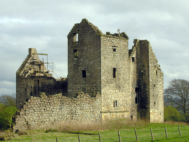
Torwood Castle is a ruined 16th-century L-plan castle near the village of Torwood, in the Falkirk Council area of central Scotland. It was designated as a Category A listed building in 1979. The Buildings at Risk Register for Scotland originally listed its level of risk as low, but raised that level to moderate in mid-2019 after seeing signs of continued neglect. History The estate was held originally by the Foresters of Garden, who were the foresters responsible for the nearby Royal Forest of Tor Wood from the second half of the 15th century until the mid-17th century. Based on the date found on a carved stone panel found not far from the castle in 1918, the castle has been estimated as being built around 1566 for Sir Alexander Forrester. It passed to Clan Baillie in the early 16th century and then to George, 1st Lord Forrester in 1635. The castle was captured prefatory to taking Stirling Castle during the 1585 successful rebellion of the Earls of Mar and Angus. The castle was ... [...More Info...] [...Related Items...] OR: [Wikipedia] [Google] [Baidu] |
West Lothian
West Lothian ( sco, Wast Lowden; gd, Lodainn an Iar) is one of the 32 council areas of Scotland, and was one of its shires of Scotland, historic counties. The county was called Linlithgowshire until 1925. The historic county was bounded geographically by the River Avon, Falkirk, Avon to the west and the River Almond, Lothian, Almond to the east. The modern council area occupies a larger area than the historic county. It was reshaped following local government reforms in 1975: some areas in the west were transferred to Falkirk (council area), Falkirk; some areas in the east were transferred to Edinburgh; and some areas that had formerly been part of in Midlothian were added to West Lothian. West Lothian lies on the southern shore of the Firth of Forth and is predominantly rural, though there were extensive coal, iron, and shale oil mining operations in the 19th and 20th centuries. These created distinctive red-spoil heaps (locally known as "bing (mining), bings") throughout the ... [...More Info...] [...Related Items...] OR: [Wikipedia] [Google] [Baidu] |
Avon Aqueduct
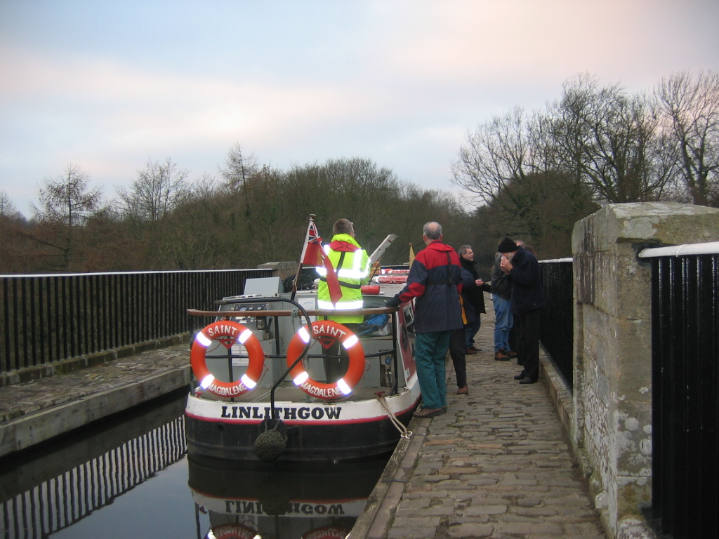
The Avon Aqueduct is a navigable aqueduct that carries the Union Canal over the River Avon, near Linlithgow, Scotland. History The aqueduct was built to a design by Hugh Baird, with advice from Thomas Telford, in tandem with the aqueducts at Slateford and Lin's Mill, with which it shares its design. Telford was not convinced that the stone arches were necessary in conjunction with the iron trough, but Baird used both on all three major aqueducts. Construction was carried out by Messrs. Craven, Whitaker and Nowell between 1819 and 1821, their success in building a stone bridge over the River Ouse making their tender for the contract "by far the most eligible". The aqueduct straddles the border between the West Lothian and Falkirk Council areas, so has two Historic Environment Scotland listings. The aqueduct is a category A listed building. Design The Barton Aqueduct of 1761, and subsequent canal aqueducts in the United Kingdom, used large quantities of masonry and puddli ... [...More Info...] [...Related Items...] OR: [Wikipedia] [Google] [Baidu] |
Castlecary
Castlecary () is a small historic village in North Lanarkshire, Scotland, directly adjacent to the border with Falkirk. It has long been associated with infrastructure, being adjacent to a bridged river, a Roman fort and roads, a nationwide canal, a Victorian railway viaduct, and a modern motorway. Castlecary is close to the town of Cumbernauld but like Dullatur and Luggiebank is not officially part of the town. Around 1725, the barony of Castlecary, with a population of just seventeen families, was disjoined from the parish of Falkirk, and annexed to Cumbernauld quoad sacra. Castlecary is also near Allandale which, though in the Falkirk council area, was built for Castlecary fireclay workers. Roman Heritage Castlecary, like many other settlements in the area, is steeped in the Roman history of Scotland. The route of the Antonine Wall passes through the village. Around 80 AD, a Roman camp was built at Castlecary. It may have been during governor Agricola's fourth campaign sea ... [...More Info...] [...Related Items...] OR: [Wikipedia] [Google] [Baidu] |
Castle Cary Castle
Castle Cary Castle (sometimes called Castlecary Castle) is a fifteenth-century tower house, about from Falkirk, in the former county of Stirlingshire, Scotland. It is less than 3 miles from Cumbernauld Village. It is located near to the site of one of the principal forts of the Roman Antonine Wall. History The earliest known record of Castlecary may be from 1304 when a writ was sent from St Andrews to the sheriff of Stirling by King Edward I. It reportedly contained orders for the sheriff to bring all of the forces under his command to 'Chastel Kary'. There are some Latin texts of unknown date which state that Grahames Dyke "goes directly to the Forrest of Commernald, and there is a great Fort and great building called Castle Kæney." The tower, about high, is thought have been built by Henry Livingstone of Myddillbynning being completed by 1480. Mary Queen of Scots is reported to have visited the castle with Mary Livingston and each to have planted a yew tree there. For t ... [...More Info...] [...Related Items...] OR: [Wikipedia] [Google] [Baidu] |
Stenhousemuir
Stenhousemuir (; gd, Featha Thaigh nan Clach) is a town in the Central Lowlands of Scotland. It lies within the Falkirk (council area), Falkirk council area of Scotland. The town is north-northwest of Falkirk and directly adjoins to Larbert in the west, where the nearest rail access is located. The villages of Carron, Falkirk, Carron and Carronshore adjoin Stenhousemuir to the east but to a lesser extent. At the United Kingdom Census 2001, 2001 census it showed that it had a resident population of 10,351 but according to a 2009 estimate this was revised to around 10,190 residents. The combined population of the four localities in 2011 was 24,722, representing about 15% of the Falkirk council area total. In 2008, a £15 million town centre development scheme was completed and opened which provided a new civic square, a library and large retailing outlets for Stenhousemuir. History The "stone house" from which the village took its name was a Roman building on the north of the ... [...More Info...] [...Related Items...] OR: [Wikipedia] [Google] [Baidu] |
James Bruce
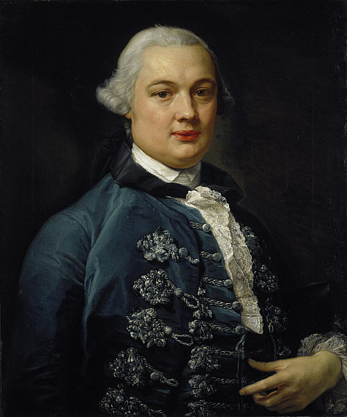
James Bruce of Kinnaird (14 December 1730 – 27 April 1794) was a Scottish traveller and travel writer who confirmed the source of the Blue Nile. He spent more than a dozen years in North Africa and Ethiopia and in 1770 became the first European to trace the origins of the Blue Nile from Egypt and Sudan. Early life James Bruce was born at the family seat of Kinnaird, Stirlingshire, and educated at Harrow School and Edinburgh University, and began to study for the bar, but his marriage to the daughter of a wine importer and merchant resulted in him entering that business instead. His wife died in October 1754, within nine months of marriage, and Bruce thereafter travelled in Portugal and Spain as part of the wine trade. The examination of oriental manuscripts at the Escorial in Spain led him to the study of Arabic and Ge'ez and determined his future career. In 1758 his father's death placed him in possession of the estate of Kinnaird. To North Africa On the outbreak of war ... [...More Info...] [...Related Items...] OR: [Wikipedia] [Google] [Baidu] |
John James Burnet
Sir John James Burnet (31 May 1857 – 2 July 1938) was a Scotland, Scottish Edwardian architecture, Edwardian architect who was noted for a number of prominent buildings in Glasgow and London. He was the son of the architect John Burnet (architect), John Burnet, and later went into partnership with his father, joining an architectural firm which would become an influential force in British Modern architecture in the 20th century. Biography John James Burnet was born in Blythswood Hill, Glasgow, on 31 May 1857. He was the youngest of the three sons of the architect John Burnet (architect), John Burnet and his wife, Elizabeth Hay Bennet. They were a Congregational church, Congregationalist family. John James was educated in Glasgow at the original Collegiate School, at the Western Academy, and at Blairlodge School, Polmont. Study in Paris He trained for two years in his father's architectural offices. His parents intended him to study at the Royal Academy Schools under Richard ... [...More Info...] [...Related Items...] OR: [Wikipedia] [Google] [Baidu] |
Carronvale House
Carronvale House is a category A listed country house in Larbert, Stirlingshire, Scotland. It is a large two-storey house with neo-Georgian details. Its outer walls date from the 18th century, with two new wings added in the 1820s, and it was extensively remodelled in 1897 by architect Sir John Burnet. It is home to the Boys' Brigade Scottish Headquarters, and is used as a training, conference and activity centre. The house is also utilised by health & local authorities, churches, charities, hospices, schools, other youth organisations and private groups. History The name was originally Broomage or Brumeinche, meaning broom meadow or links. In 1452, King James II gave the lands to James Rutherford for faithful service. In 1476 they belonged to James, Lord Livingston, who had probably bought them. A century later they were sold to John, Lord Thirlestane. In 1644, they passed to John Burne, The land was sold in 1715 by Lodovick Callander (alias Willison of Dorrator) to Alex Br ... [...More Info...] [...Related Items...] OR: [Wikipedia] [Google] [Baidu] |
Frederick Thomas Pilkington
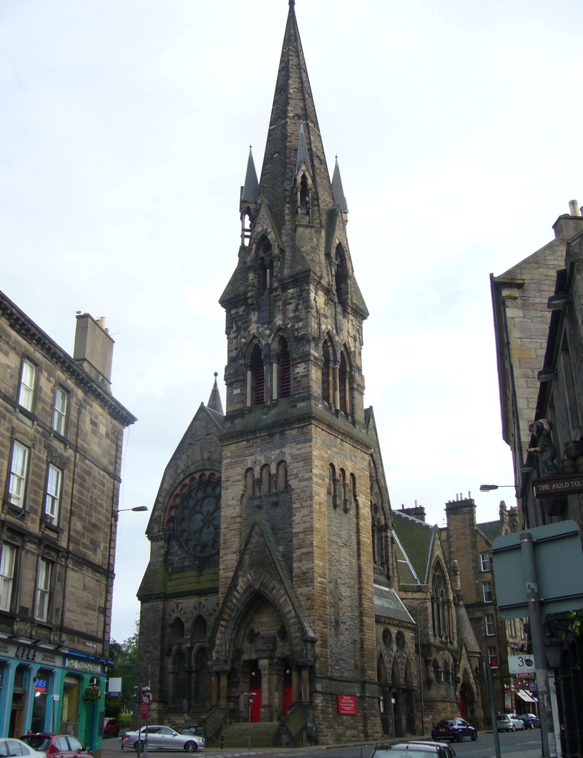
Frederick Thomas Pilkington (1832-1898), pupil of his father, was a "Rogue" British architect, practising in the Victorian architecture, Victorian Gothic Revival architecture, High Gothic revival style. He designed mostly churches and institutional buildings in Scotland. Typical of his work is the Barclay Church in Edinburgh, a polychrome stone structure with early French Gothic details. Life Pilkington was one of several children to Thomas Pilkington, architect, and Jane Butterworth of Stamford, England. The family moved to Edinburgh in 1854. In 1855 T. Pilkington & Son, architects and surveyors, were living and working at 10 Dundas Street in New Town, Edinburgh, Edinburgh's Second New Town. Pilkington studied mathematics under Professor Philip Kelland at the University of Edinburgh, passed his exams in 1858 and was Hamilton prizewinner in Logic, but did not bother to graduate. He signed the University Matriculation Register 1856/7 as of Stamford. Pilkington married in 1858 ... [...More Info...] [...Related Items...] OR: [Wikipedia] [Google] [Baidu] |
Larbert
Larbert ( gd, Lèirbert/Leth-pheairt, sco, Lairbert) is a small town in the Falkirk council area of Scotland. The town lies in the Forth Valley above the River Carron which flows from the west. Larbert is from the shoreline of the Firth of Forth and northwest of Falkirk, the main town in the area. The village of Stenhousemuir lies directly east of Larbert, with both settlements being contiguous and sharing certain public amenities with one another. In medieval times, the Larbert area was heavily forested, but this was cleared and gave rise to much of the agricultural land which surrounds the town. The coming of industry and especially the arrival in the 1840s of the Scottish Central Railway, which passes through the village, provided a base for economic growth. From the late 18th century until the mid-20th century heavy industry, such as boilermaking, casting and manufacturing underpinned the economy of Larbert. The Victorian era also saw the opening of the Sti ... [...More Info...] [...Related Items...] OR: [Wikipedia] [Google] [Baidu] |


