|
Leziate
Leziate is a village and civil parish in the English county of Norfolk. The village is west of Norwich, east of King's Lynn and north-north-east of London. The Village is located a small distance south of the B1145 a route which runs between King's Lynn and Mundesley. The nearest railway station is at King's Lynn for the Fen Line which runs between King's Lynn and Cambridge. The nearest airport is Norwich International Airport. The parish of Leziate in the 2001 census, has a population of 581, including Ashwicken and increasing to 592 at the 2011 census. History This large parish is in the west of the county located east of the town of King's Lynn. The parish is bordered with Grimston to the north, East Winch to the south, Bawsey to the west and Gayton to the east. There are two hamlets within the parish and they are Leziate and Ashwicken, both these settlements are described as a shrunken village. During the medieval period the village of Leziate was much larger, but the ... [...More Info...] [...Related Items...] OR: [Wikipedia] [Google] [Baidu] |
Ashwicken
Ashwicken is a small village and former civil parish, now in the parish of Leziate, in the King's Lynn and West Norfolk district, in the county of Norfolk, England. The village sits on the B1145 King's Lynn to Mundesley road around east of King's Lynn. In 1931 the parish had a population of 117. On 1 April 1935 the parish was abolished and merged with Leziate. The village name means 'At the specialised-farm', with the later addition of 'ash-tree' or a personal name. Ashwicken is the site of a shrunken medieval village, one of around 200 lost settlements in Norfolk.Parish Summary: Leziate Norfolk Heritage Explorer. Retrieved 2015-11-15. [...More Info...] [...Related Items...] OR: [Wikipedia] [Google] [Baidu] |
King's Lynn And West Norfolk
King's Lynn and West Norfolk is a local government district with borough status in Norfolk, England. Its council is based in the town of King's Lynn. The population of the Local Authority at the 2011 Census was 147,451. History The district was formed in 1974 by the merger of the Municipal Borough of King's Lynn, Hunstanton and Downham Market urban districts along with Docking Rural District, Downham Rural District, Freebridge Lynn Rural District and Marshland Rural District. The district was originally known as just West Norfolk, and adopted its present name in 1981. Politics Elections to the borough council are held every four years, with all of the 55 councillors, representing 42 wards, on the council being elected at each election. After being under no overall control from the 1999 election, the Conservative party gained a majority at the 2003 election and has held one ever since, although losing a large number of seats due to the resurgence of the Independent Group ... [...More Info...] [...Related Items...] OR: [Wikipedia] [Google] [Baidu] |
East Anglia Transport Museum
The East Anglia Transport Museum is an open-air transport museum, with numerous historic public transport vehicles (including many in full working order). It is located in Carlton Colville a suburb of Lowestoft, Suffolk. It is the only museum in the country where visitors can ride on buses, trams and trolleybuses, as well as a narrow-gauge railway. What the Museum offers The museum has many exhibits ranging from a 1904 Lowestoft Corporation tram to a 1985 Sinclair C5. Tram rides are available on a route passing the museum's trolleybus depot and up to a terminus at Woodside. Originally, the trolleybus route extended as far as the trolleybus depot where passengers could change for a ride on the museum's 2 ft gauge railway to Chapel Road (the other end of the tram route), or they could stay on the trolleybus whilst it performed a 3-point turn and returned to the museum entrance via the same route. 12 July 2008 marked Britain's first trolleybus extension for many decades thro ... [...More Info...] [...Related Items...] OR: [Wikipedia] [Google] [Baidu] |
Middleton Towers Railway Station
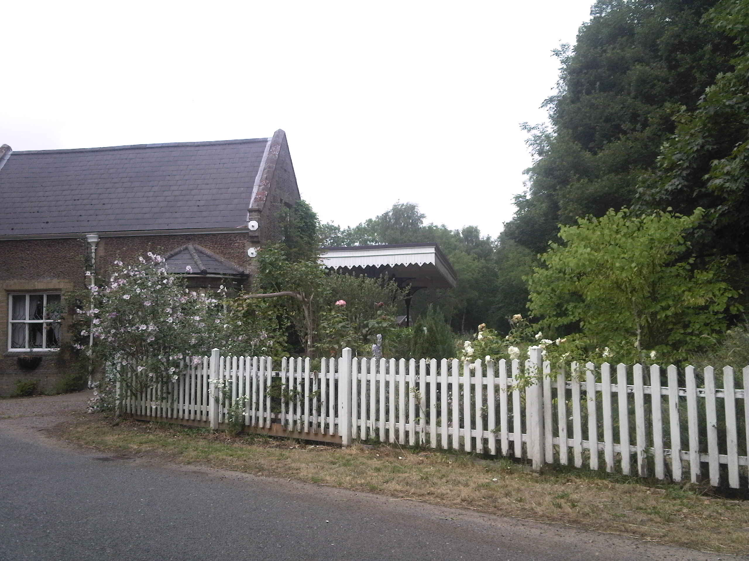
Middleton Towers railway station was a station in Middleton, Norfolk. It was on the line between Swaffham and King's Lynn, and closed along with the rest of the line in 1968. History The Lynn & Dereham Railway Bill received the Royal Assent on 21 July 1845. The line and its railway stations were opened on 27 October 1846 as far as Narborough. Middleton railway station opened with the line and was situated south-east of Lynn station and north-west of East Winch. While the line was still being built the Lynn & Dereham was taken over by the East Anglian Railway on 22 July 1847. The line reached Swaffham on 10 August 1847. The station was renamed from Middleton to Middleton Towers on 1 November 1924. After a large housing development was completed in Leziate in 1990, the line between Middleton Towers and King's Lynn was considered for restoration as a passenger route. With the electrification of the main line between Cambridge and King's Lynn the provision of rolling stock was a ... [...More Info...] [...Related Items...] OR: [Wikipedia] [Google] [Baidu] |
Thomas Thursby (d
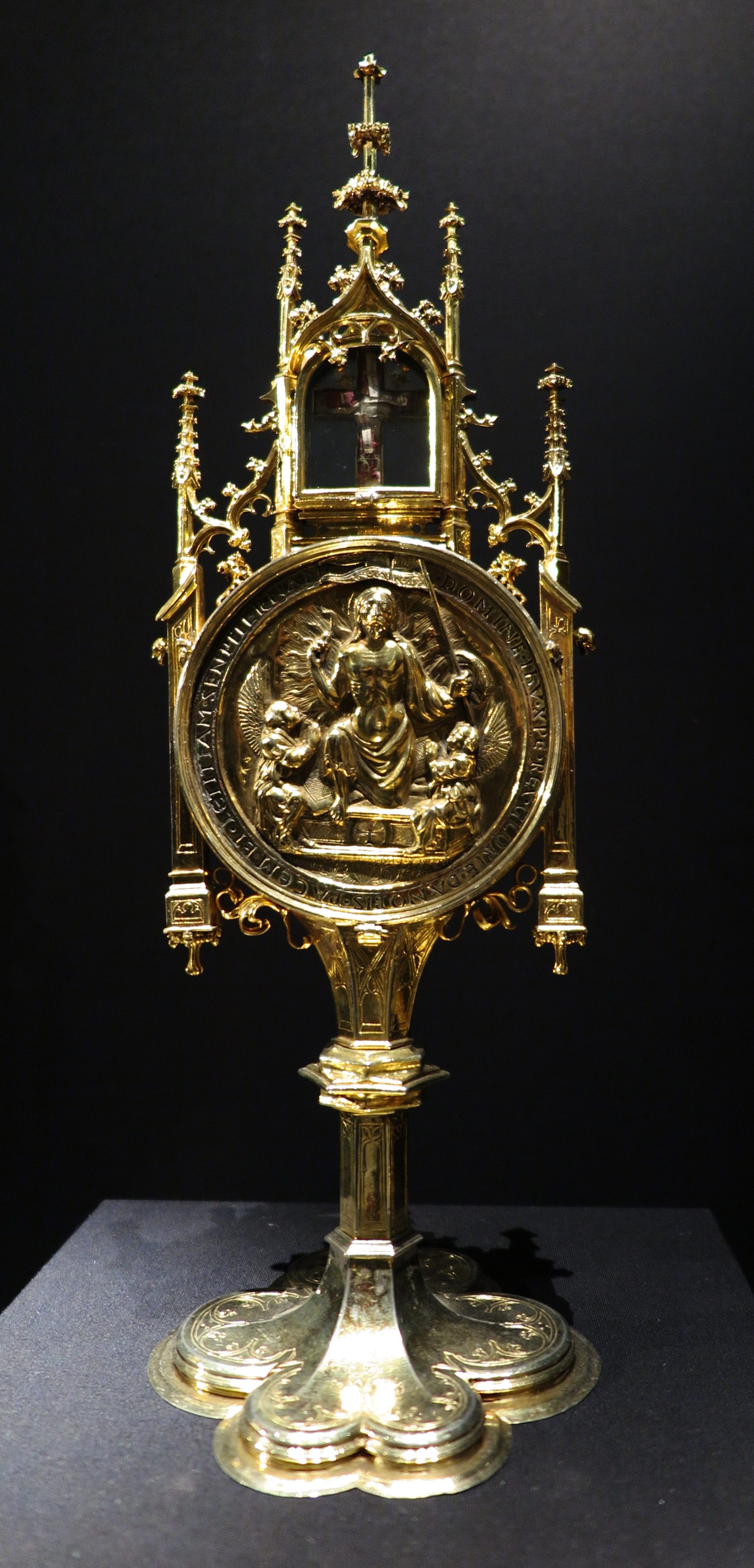
Thomas Thursby (died 9 August 1510), was a merchant, three times Mayor of King's Lynn and the founder and benefactor of Thoresby College. He was the son of Henry Thursby, four times Mayor of Lynn and Burgess for Lynn, in turn son of John Thursby, Mayor of Lynn Regis 1425 and Deputy-Mayor 1435. Thomas' brother, Robert Thursby, was Burgess for Lynn 1462–3, 1482–3 and 1487, holding the manors of Ashwicken and Burg's Hall in Hillington before his death, 29 October 1500. In his will he leaves 'my special good lord of Oxenford', John de Vere, 13th Earl of Oxford, a tabernacle of our Lady of gold. At the time of his death, he was married to Elizabeth (d.1518), the widow of Robert Aylmer (d.1493) Mayor of Norwich. Elizabeth is not the daughter of John Burgoyne who in the ''Visitations of Cambridgeshire'' marries 'Thomas Thorseby of Norfolk', as that Elizabeth is still alive and apparently a wife in 1528, when she receives an inheritance from her mother Margaret. Elizabeth Burgo ... [...More Info...] [...Related Items...] OR: [Wikipedia] [Google] [Baidu] |
Hundreds Of Norfolk
Between the 10th and the 19th centuries the hundreds of Norfolk and the boroughs of Norwich, King's Lynn, Thetford and Great Yarmouth were the administrative units of the English county of Norfolk. Each hundred had a separate council that met each month to rule on local judicial and taxation matters. The system of dividing shires into hundreds was established in East Anglia following the conquest by Wessex in the early 10th century. The boundaries described at the time of the Domesday Survey of 1086 remained largely unchanged up to the 1970s. The 36 Domesday hundreds were subdivided into ''leets'', now lost, and the boroughs of Norwich and Thetford ranked as separate hundreds, while Great Yarmouth was the chief town of three hundreds. Two of Thetford's parishes now lie partially in Norfolk with the remainder in Suffolk. The Domesday hundred of Emneth is now included in Freebridge, which was split into Freebridge-Lynn and Freebridge-Marshland. Docking hundred was then incorpora ... [...More Info...] [...Related Items...] OR: [Wikipedia] [Google] [Baidu] |
Bawsey
Bawsey is a village and civil parish in the English county of Norfolk. The village is about east of the town of King's Lynn and west of the city of Norwich. The village sits astride of the B1145 Kings Lynn to Mundesley road that dissects North Norfolk west to east. The village's name means 'Beaw's island' The civil parish has an area of and in the 2011 census had a population of 216 in 105 households. For the purposes of local government, the parish falls within the district of King's Lynn and West Norfolk. It forms part of the North West Norfolk constituency in the House of Commons. Norfolk County Council is responsible for roads, some schools, and social services. The church was dedicated to St James and has been in ruins since at least 1745. The building and its surrounding area were the subject of a live dig by the ''Time Team'' programme in 1998, they determined it started life as a monastic settlement before becoming the parochial church of Bawsey, also during the we ... [...More Info...] [...Related Items...] OR: [Wikipedia] [Google] [Baidu] |
East Winch
East Winch is a village and civil parish in the English county of Norfolk. The village is located south-east of King's Lynn and west of Norwich. History East Winch's name is of Anglo-Saxon origin and derives from the Old English for the eastern part of a settlement or farmstead based on a pasture. In the Domesday Book, East Winch is listed as a settlement of 51 households in the hundred of Freebridge. In 1086, the village formed part of the East Anglian estates of King William I, Roger Bigod, Ralph de Tosny, Hermer de Ferrers and a freeman by the name of Rainer. Crancourt Manor was a Medieval residence of the Howard family, built as a fortified manor house. By the mid-Nineteenth Century, the manor was ruined apart from a single chimney stack which remains the case today. In May 1944, a de Havilland Mosquito of No. 23 Squadron RAF crashed within the parish after technical difficulties on a test flight from RAF Little Snoring. Pilots F/O Charles J. Preece (RCAF) and F/O ... [...More Info...] [...Related Items...] OR: [Wikipedia] [Google] [Baidu] |
Middleton, Norfolk
Middleton is a village and civil parish in the English county of Norfolk. It covers an area of and had a population of 1,516 in 621 households at the 2001 census, reducing to 1,450 at the 2011 Census. The village's name means 'Middle farm/settlement'. Middleton is the second village on the A47 road to Norwich, after North Runcton, and lies approximately east of King's Lynn. The A47, the main road of Norfolk, effectively divides the village in two, and has long been a site of road traffic accidents. Fair Green and Blackborough End are also areas of Middleton. Fair Green is on the northern part of the village, whilst Blackborough End is in the southern half of the village. Middleton has a primary school, Middleton V.C. Primary School, a village hall, a post office and a car repair garage called Total Motors. The village church is called Saint Mary's, and the current Rector is the Revd Jim Ryan. The church is situated beside the A47, opposite the Middletons Steakhouse & Grill. ... [...More Info...] [...Related Items...] OR: [Wikipedia] [Google] [Baidu] |
Beeching Cuts
The Beeching cuts (also Beeching Axe) was a plan to increase the efficiency of the nationalised British Rail, railway system in Great Britain. The plan was outlined in two reports: ''The Reshaping of British Railways'' (1963) and ''The Development of the Major Railway Trunk Routes'' (1965), written by Richard Beeching and published by the British Railways Board. The first report identified 2,363 stations and of railway line for closure, amounting to 55% of stations, 30% of route miles, and 67,700 British Rail positions, with an objective of stemming the large losses being incurred during a period of increasing competition from road transport and reducing the rail subsidies necessary to keep the network running. The second report identified a small number of major routes for significant investment. The 1963 report also recommended some less well-publicised changes, including a switch to the now-standard practice of containerisation for rail freight, and the replacement of some ... [...More Info...] [...Related Items...] OR: [Wikipedia] [Google] [Baidu] |
Dereham
Dereham (), also known as East Dereham, is a town and civil parishes in England, civil parish in the Breckland District of the England, English county of Norfolk. It is situated on the A47 road, about 15 miles (25 km) west of the city of Norwich and 25 miles (40 km) east of King's Lynn. The civil parish has an area of and, in the United Kingdom Census 2001, 2001 census, had a population of 15,659 in 6,941 households; the population at the 2011 census increased to 18,609. Dereham falls within, and is the centre of administration for, Breckland (district), Breckland District Council.Office for National Statistics & Norfolk County Council (2001). Census population and household counts for unparished urban areas and all parishes'. Retrieved 2 December 2005. The town should not be confused with the Norfolk village of West Dereham, which lies about 25 miles (40 km) away. Since 1983, Dereham has been town twinning, twinned with the town of Rüthen in Nor ... [...More Info...] [...Related Items...] OR: [Wikipedia] [Google] [Baidu] |
Lynn And Dereham Railway
The Lynn and Dereham Railway was a standard gauge single track railway running between King's Lynn and Dereham in the English county of Norfolk. The Lynn to Dereham line opened in 1846 and closed in 1968, although the section between Middleton Towers and King's Lynn remains open to freight. History The Lynn & Dereham Railway, which weaved a route to East Dereham via Narborough and Swaffham, was given the Royal Assent on 21 July 1845, opening in stages between 1846 and 1848; this later became part of the Great Eastern Railway. Only the section of line between King's Lynn and Narborough was opened under the L&DR, on 17 October 1846. The remainder of the line was opened in stages by the L&DR's immediate successor, the East Anglian Railway. The original intention of the company had been to extend their line to Great Yarmouth, via Norwich, but this plan was blocked by the rival Wymondham to Dereham scheme proposed by the Norfolk Railway. A reported case in the Court of Common Ple ... [...More Info...] [...Related Items...] OR: [Wikipedia] [Google] [Baidu] |


