|
Lewis District, Mason County, West Virginia
Lewis Magisterial District is one of ten magisterial districts in Mason County, West Virginia, United States. The district was originally established as a civil township in 1863, and converted into a magisterial district in 1872."Division of the County into Townships", in ''Hardesty's Biographical Atlas of Mason County, West Virginia'', H.H. Hardesty & Co., New York, Toledo, and Chicago (1882). In 2020, Robinson District was home to 5,635 people. Geography Lewis District is located at the confluence of the Ohio River and the Great Kanawha, in the northern part of Mason County. To the north, it is bounded by Robinson District, to the east by Cooper District, to the south by the Kanawha River, and to the west by the Ohio. On the south side of the Kanawha are Arbuckle and Clendenin Districts, and across the Ohio to the west are Addison Township and the northernmost part of Gallipolis Township, both in Gallia County, Ohio. At just under nineteen square miles, Lewis is the s ... [...More Info...] [...Related Items...] OR: [Wikipedia] [Google] [Baidu] |
Minor Civil Division
A minor civil division (MCD) is a term used by the United States Census Bureau for primary governmental and/or administrative divisions of a county or county-equivalent, typically a municipal government such as a city, town, or civil township. MCDs are used for statistical purposes by the Census Bureau, and do not necessarily represent the primary form of local government. They range from non-governing geographical survey areas to municipalities with weak or strong powers of self-government. Some states with large unincorporated areas give substantial powers to counties; others have smaller or larger incorporated entities with governmental powers that are smaller than the MCD level chosen by the Census. As of 2010, MCDs exist in 29 states, the District of Columbia, and Puerto Rico. In all other states where state-defined entities are not used for census purposes (mostly in the South and the West), the Census Bureau designates Census County Divisions (CCDs). For several decennial c ... [...More Info...] [...Related Items...] OR: [Wikipedia] [Google] [Baidu] |
Arbuckle District, Mason County, West Virginia
Arbuckle Magisterial District is one of ten magisterial districts in Mason County, West Virginia, United States. The district was originally established as a civil township in 1863, and converted into a magisterial district in 1872."Division of the County into Townships", in ''Hardesty's Biographical Atlas of Mason County, West Virginia'', H.H. Hardesty & Co., New York, Toledo, and Chicago (1882). In 2020, Arbuckle District was home to 1,054 people. Geography Arbuckle District is located in the central portion of Mason County, between the Kanawha River and the northern end of Putnam County. To the north, it is bounded by the Kanawha River, and by Lewis and Cooper Districts; to the northeast by the Kanawha and Cologne District; to the east by the Kanawha and Union District; to the south by the Buffalo-Union District of Putnam County, formerly Buffalo District; and to the west and southwest by Clendenin District in Mason County."Arbuckle District", in ''Hardesty's Biograph ... [...More Info...] [...Related Items...] OR: [Wikipedia] [Google] [Baidu] |
Jackson County, West Virginia
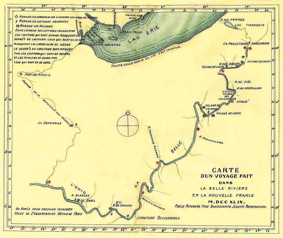
Jackson County is a county in the U.S. state of West Virginia. As of the 2020 census, the population was 27,791. Its county seat is Ripley, and its largest municipality is Ravenswood. History In 1674, frontiersman Gabriel Arthur visited a large Native American village, probably the first white person to reach the area. French traders visited by 1796 and British traders by 1703. In 1749, Celeron De Blainville and his party traveling on the Ohio River left lead plates claiming the area for France. Baltimore-born explorer Christopher Gist visited the following year. In 1770, George Washington with his friend Dr. James Craik and Col. William Crawford surveyed what eventually became Jackson County, staying on their return from Fort Pitt along Sand Creek at an Iroquois village led by Keoshuta and later at his hunting camp (which later became Ravenswood). Washington patented land claims in that area in 1793. and other land was deeded to Albert Gallatin. The future Ravenswood site w ... [...More Info...] [...Related Items...] OR: [Wikipedia] [Google] [Baidu] |
Ravenswood, West Virginia
Ravenswood is a city in Jackson County, West Virginia, United States, along the Ohio River. The population was 3,865 at the 2020 census. Geography Ravenswood is located at (38.952922, -81.761357), along the Ohio River at the mouth of Sandy Creek. According to the United States Census Bureau, the city has a total area of , of which is land and is water. Demographics 2010 census As of the census of 2010, there were 3,876 people, 1,657 households, and 1,061 families living in the city. The population density was . There were 1,807 housing units at an average density of . The racial makeup of the city was 97.4% White, 0.2% African American, 0.1% Native American, 0.7% Asian, 0.2% from other races, and 1.3% from two or more races. Hispanic or Latino of any race were 1.0% of the population. There were 1,657 households, of which 29.3% had children under the age of 18 living with them, 45.7% were married couples living together, 14.3% had a female householder with no husband p ... [...More Info...] [...Related Items...] OR: [Wikipedia] [Google] [Baidu] |
Huntington, West Virginia
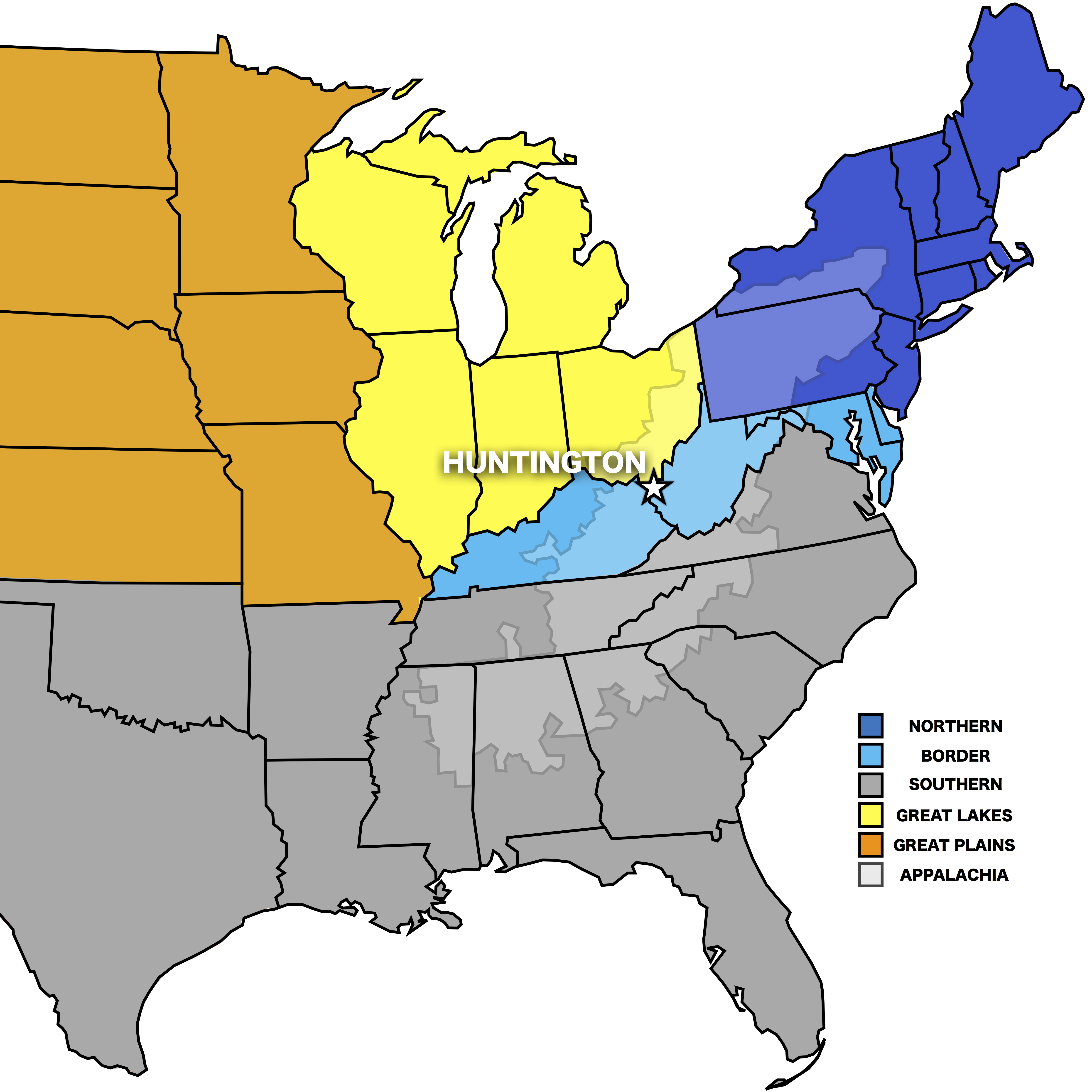
Huntington is a city in Cabell and Wayne counties in the U.S. state of West Virginia. It is the county seat of Cabell County, and the largest city in the Huntington–Ashland metropolitan area, sometimes referred to as the Tri-State Area. A historic and bustling city of commerce and heavy industry, Huntington has benefited from its location on the Ohio River at the mouth of the Guyandotte River. It is home to the Port of Huntington Tri-State, the second-busiest inland port in the United States. As of the 2020 census, its metro area is the largest in West Virginia, spanning seven counties across three states and having a population of 359,862. Huntington is the second-largest city in West Virginia, with a population of 46,842 at the 2020 census. Both the city and metropolitan area declined in population from the 2010 census, a trend that has been ongoing for six decades as Huntington has lost over 40,000 residents in that time frame. Surrounded by extensive natural resources, ... [...More Info...] [...Related Items...] OR: [Wikipedia] [Google] [Baidu] |
West Virginia Route 2
West Virginia Route 2 is a state highway in the US state of West Virginia. It generally parallels the Ohio River along the western border of the state, from U.S. Route 60 in Huntington (just west of the East End Bridge) northeasterly to U.S. Route 30 in Chester (just south of the Jennings Randolph Memorial Bridge). WV 2 leaves the shores of the Ohio River in two places: between Point Pleasant and Mount Alto (where West Virginia Route 62 follows the river) and between Ravenswood and Waverly (where West Virginia Route 68 mostly follows the river). The entire route is included as a part of the National Highway System, a system of routes determined to be the most important for the nation's economy, mobility, and defense. Route Huntington to Parkersburg WV 2 was reconstructed from Lesage to Glenwood as an improved two-lane highway with shoulders on a four-lane right-of-way in the mid-1980s. Parkersburg to Wheeling WV 2 follows the Ohio River from Parkersburg to Wheelin ... [...More Info...] [...Related Items...] OR: [Wikipedia] [Google] [Baidu] |
Flood Wall
A flood wall (or floodwall) is a primarily vertical artificial barrier designed to temporarily contain the waters of a river or other waterway which may rise to unusual levels during seasonal or extreme weather events. Flood walls are mainly used on locations where space is scarce, such as cities or where building levees or dikes (dykes) would interfere with other interests, such as existing buildings, historical architecture or commercial use of embankments. Flood walls are nowadays mainly constructed from pre-fabricated concrete elements. Flood walls often have floodgates which are large openings to provide passage except during periods of flooding, when they are closed. As a flood walls mostly consist of relatively short elements compared to dikes, the connections between the elements are critical to prevent the failure of the flood wall. The substantial costs of flood walls can be justified by the value of commercial property thus protected from damage caused by flooding. ... [...More Info...] [...Related Items...] OR: [Wikipedia] [Google] [Baidu] |
Ohio River Flood Of 1937
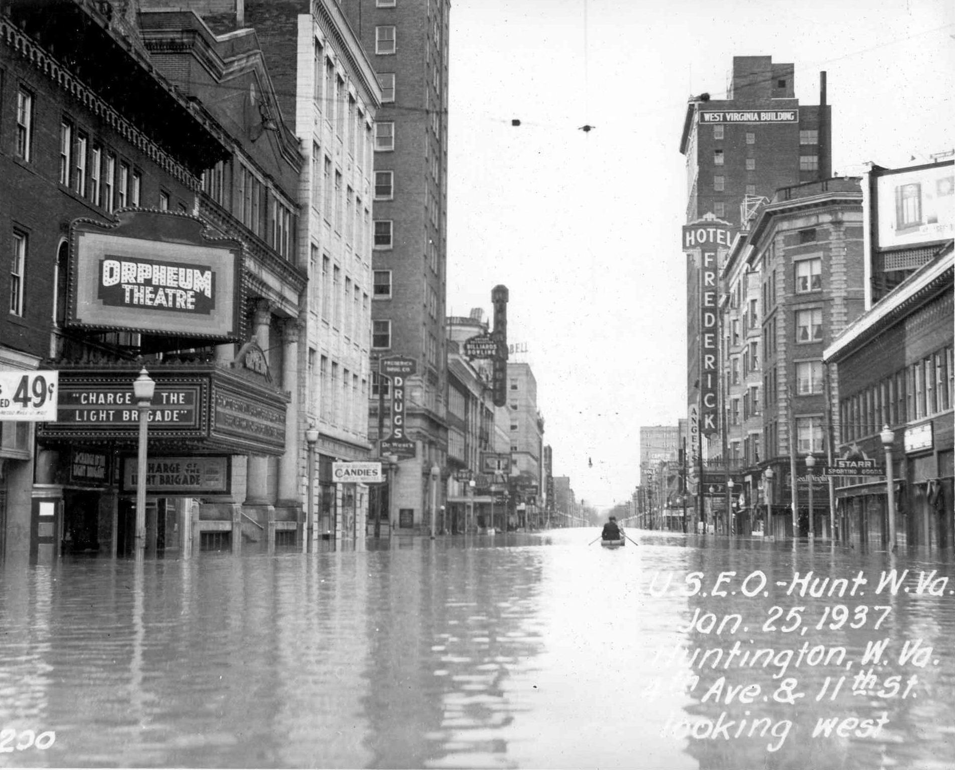
The Ohio River flood of 1937 took place in late January and February 1937. With damage stretching from Pittsburgh to Cairo, Illinois, 385 people died, one million people were left homeless and property losses reached $500 million ($10.2 billion when adjusted for inflation as of September 2022). Federal and state resources were strained to aid recovery as the disaster occurred during the depths of the Great Depression and a few years after the beginning of the Dust Bowl. Event timeline * January 5: Water levels began to rise. * January 10–18: Numerous flood warnings were issued across much of the region. * January 13–24: Near record rainfalls were recorded. * January 18: Numerous homes were flooded as the Ohio River started to overflow its banks due to the heavy rains. * January 23–24: Martial law was declared in Evansville, Indiana, where the water level was at . [...More Info...] [...Related Items...] OR: [Wikipedia] [Google] [Baidu] |
County Seat
A county seat is an administrative center, seat of government, or capital city of a county or civil parish. The term is in use in Canada, China, Hungary, Romania, Taiwan, and the United States. The equivalent term shire town is used in the US state of Vermont and in some other English-speaking jurisdictions. County towns have a similar function in the Republic of Ireland and the United Kingdom, as well as historically in Jamaica. Function In most of the United States, counties are the political subdivisions of a state. The city, town, or populated place that houses county government is known as the seat of its respective county. Generally, the county legislature, county courthouse, sheriff's department headquarters, hall of records, jail and correctional facility are located in the county seat, though some functions (such as highway maintenance, which usually requires a large garage for vehicles, along with asphalt and salt storage facilities) may also be located or conducted ... [...More Info...] [...Related Items...] OR: [Wikipedia] [Google] [Baidu] |
Point Pleasant, West Virginia
Point Pleasant is a city in and the county seat of Mason County, West Virginia, United States, at the confluence of the Ohio and Kanawha Rivers. The population was 4,101 at the 2020 census. It is the principal city of the Point Pleasant, WV-OH Micropolitan Statistical Area. Geography According to the United States Census Bureau, the city has a total area of , of which is land and is water. Point Pleasant is located at (38.857527, -82.128571). Point Pleasant is home to Tu-Endie-Wei State Park and Krodel Park. Demographics 2010 census As of the census of 2010, there were 4,350 people, 2,014 households, and 1,162 families residing in the city. The population density was . There were 2,244 housing units at an average density of . The racial makeup of the city was 95.9% White, 1.3% African American, 0.3% Native American, 0.6% Asian, 0.3% Pacific Islander, and 1.7% from two or more races. Hispanic or Latino of any race were 0.6% of the population. There were 2,014 hou ... [...More Info...] [...Related Items...] OR: [Wikipedia] [Google] [Baidu] |
Ohio
Ohio () is a state in the Midwestern region of the United States. Of the fifty U.S. states, it is the 34th-largest by area, and with a population of nearly 11.8 million, is the seventh-most populous and tenth-most densely populated. The state's capital and largest city is Columbus, with the Columbus metro area, Greater Cincinnati, and Greater Cleveland being the largest metropolitan areas. Ohio is bordered by Lake Erie to the north, Pennsylvania to the east, West Virginia to the southeast, Kentucky to the southwest, Indiana to the west, and Michigan to the northwest. Ohio is historically known as the "Buckeye State" after its Ohio buckeye trees, and Ohioans are also known as "Buckeyes". Its state flag is the only non-rectangular flag of all the U.S. states. Ohio takes its name from the Ohio River, which in turn originated from the Seneca word ''ohiːyo'', meaning "good river", "great river", or "large creek". The state arose from the lands west of the Appalachian Mountai ... [...More Info...] [...Related Items...] OR: [Wikipedia] [Google] [Baidu] |
Gallia County, Ohio
Gallia County (pronunciation: ''GAL-yuh'') is a county located in the U.S. state of Ohio. As of the 2020 census, the population was 29,220. Its county seat is Gallipolis. Named after the French people who originally settled there, its name “Gallia” is the Latin word for Gaul, the ancient region of Western Europe that included present day France. Gallia County is part of the Point Pleasant, WV-OH Micropolitan Statistical Area. History Gallia County was formed on March 25, 1803, from portions of Adams and Washington counties. Gallia County had originally been settled by French immigrants, who named the county “Gallia,” the Latin name for Gaul, the ancient region of Western Europe which included present day France. In the 19th century, the county was settled by numerous migrants from the Upper South, who traveled to the territory by the Ohio River. In the antebellum years, some of its towns became centers of settlement by African Americans, both free blacks (some also fr ... [...More Info...] [...Related Items...] OR: [Wikipedia] [Google] [Baidu] |


