|
Lesum
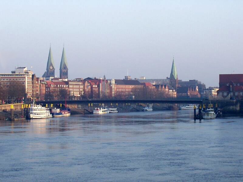
The Lesum is a river in northern Germany, right tributary of the Weser, navigable for Class III ships. Bundesministerium für Verkehr und digitale Infrastruktur It is formed at the confluence of the rivers and Hamme, near , northwest of |
Hamme (river)
The Hamme (in its upper reaches Giehler Bach) is a long river in Germany, Lower Saxony, north-east of Bremen. Its source is north of Osterholz-Scharmbeck. It flows through the moors north-east of Bremen called Teufelsmoor, and meets the river Wümme in Ritterhude. From this junction, the river is called Lesum. The Lesum flows into the river Weser in Bremen-Vegesack. On the river Hamme there are many water-sport clubs, for example the Wassersportclub Hamme e.V. (watersports-club Hamme), the Ruder-Verein Osterholz-Scharmbeck von 1901 e.V. (Rowing Club Osterholz-Scharmbeck since 1901) and the Segel Club Hamme e.V. (Sailing Club Hamme). Course The upper reaches of the Hamme are called the ''Giehler Bach'' (Giehl Stream). The ''Giehler Bach'' originates in the heathland of the ''Lange Heide'' northeast of Osterholz-Scharmbeck, a geest plateau at a height of about , which is also the source of many other geest streams (such as the Drepte, Scharmbecker Bach, Schönebecker Aue and Wie ... [...More Info...] [...Related Items...] OR: [Wikipedia] [Google] [Baidu] |
Wümme
Wümme () is a river in northern Germany, in the states Lower Saxony and Bremen, marking the border between the two states for part of its course. It is the main headstream of the Lesum. The Wümme's length is . Including the Lesum, that runs into the river Weser, its total length is . The river's source is on the Wulfsberg in Lüneburg Heath. West of Rotenburg, it takes up the rivers Rodau and Wiedau. The Wümme from the left and the Hamme from the right combine near Wasserhorst (part of Blockland in Bremen) forming the Lesum. Towns on the river Wümme are Lauenbrück, Scheeßel, Rotenburg, Ottersberg, Fischerhude, Lilienthal and Bremen. See also *List of rivers of Bremen *List of rivers of Lower Saxony All rivers in the German state of Lower Saxony flow directly or indirectly into the North Sea. A–Z A B D E F G H I J K L M N O P * Purrmühlenbach R S T * Tiefenbeek *Trillkebach *Trutenbeek * Twiste U * Uffe *Ulrichs ... References R ... [...More Info...] [...Related Items...] OR: [Wikipedia] [Google] [Baidu] |
Lesum Basin
The Lesum is a river in northern Germany, right tributary of the Weser, navigable for Class III ships. Bundesministerium für Verkehr und digitale Infrastruktur It is formed at the confluence of the rivers and , near , northwest of |
Vegesack
Vegesack is a northern district of the city of Bremen. Geography ''Vegesack'' is located about north from the centre of Bremen-city at the mouth of the river Lesum, beside the river Weser (). Abutting the district of Vegesack to the northwest is the district of Blumenthal, in the southeast the district of Burglesum. Across the river Weser is the Lower Saxony village Lemwerder, connected to Vegesack by a ferry service. History Vegesack was established long before the 14th century. At that time the mouth of the river Lesum and the small brook Aue to the river Weser was a preferred and protected berth for sailing ships in the winter time or in the stormy seasons. Therefore, the first buildings might have been a few workshops and accommodations and pubs for the sailors. After the first mention of a ferry across the Weser in the 14th century, the name "Vegesack" was first used in 1453. The source and the meaning of the name is unknown but might be derived from the pub "Thom Fege ... [...More Info...] [...Related Items...] OR: [Wikipedia] [Google] [Baidu] |
Weser
The Weser () is a river of Lower Saxony in north-west Germany. It begins at Hannoversch Münden through the confluence of the Werra and Fulda. It passes through the Hanseatic city of Bremen. Its mouth is further north against the ports of Bremerhaven and Nordenham. The latter is on the Butjadingen Peninsula. It then merges into the North Sea via two highly saline, estuarine mouths. It connects to the canal network running east-west across the North German Plain. The river, when combined with the Werra (a dialectal form of "Weser"), is long and thus, the longest river entirely situated within Germany (the Main, however, is the longest if the Weser and Werra are not combined). The Weser itself is long. The Werra rises in Thuringia, the German state south of the main projection (tongue) of Lower Saxony. Etymology "Weser" and "Werra" are the same words in different dialects. The difference reflects the old linguistic border between Central and Low German, passing through H ... [...More Info...] [...Related Items...] OR: [Wikipedia] [Google] [Baidu] |
Bremen-Vegesack
Vegesack is a northern district of the city of Bremen. Geography ''Vegesack'' is located about north from the centre of Bremen-city at the mouth of the river Lesum, beside the river Weser (). Abutting the district of Vegesack to the northwest is the district of Blumenthal, in the southeast the district of Burglesum. Across the river Weser is the Lower Saxony village Lemwerder, connected to Vegesack by a ferry service. History Vegesack was established long before the 14th century. At that time the mouth of the river Lesum and the small brook Aue to the river Weser was a preferred and protected berth for sailing ships in the winter time or in the stormy seasons. Therefore, the first buildings might have been a few workshops and accommodations and pubs for the sailors. After the first mention of a ferry across the Weser in the 14th century, the name "Vegesack" was first used in 1453. The source and the meaning of the name is unknown but might be derived from the pub "Thom Fege ... [...More Info...] [...Related Items...] OR: [Wikipedia] [Google] [Baidu] |
List Of Rivers Of Lower Saxony
All rivers in the German state of Lower Saxony flow directly or indirectly into the North Sea. A–Z A B D E F G H I J K L M N O P * Purrmühlenbach R S T *Tiefenbeek *Trillkebach *Trutenbeek * Twiste U * Uffe *Ulrichswasser *Unterelbe V W Z *Zellbach * Zorge By basin This list uses bullets and indents to show the rivers' hierarchy and the sequence from river mouth to source. The number of indents corresponds to the river's position in the sequence. Tributaries are shown orographically as either a left (l) or a right (r) tributary of the next waterway in the downstream direction. Elbe * Elbe (, into the North Sea) ** Medem (l) *** Emmelke ** Oste (l) (153 km) *** Aue (tributary of the Oste) (l) (14 km) *** Mehe (l) *** Bever (r) *** Twiste (r) *** Ramme (r) ** Schwinge (l) ** Lühe (l) *** Aue (tributary of the Elbe) (26 km) ** Este (l) ** Seeve (l) (40 km) ** Ilmenau (l) (107 km) *** Luhe (l) (58 km) *** Neetze ... [...More Info...] [...Related Items...] OR: [Wikipedia] [Google] [Baidu] |
Bremen
Bremen (Low German also: ''Breem'' or ''Bräm''), officially the City Municipality of Bremen (german: Stadtgemeinde Bremen, ), is the capital of the German state Free Hanseatic City of Bremen (''Freie Hansestadt Bremen''), a two-city-state consisting of the cities of Bremen and Bremerhaven. With about 570,000 inhabitants, the Hanseatic city is the 11th largest city of Germany and the second largest city in Northern Germany after Hamburg. Bremen is the largest city on the River Weser, the longest river flowing entirely in Germany, lying some upstream from its mouth into the North Sea, and is surrounded by the state of Lower Saxony. A commercial and industrial city, Bremen is, together with Oldenburg and Bremerhaven, part of the Bremen/Oldenburg Metropolitan Region, with 2.5 million people. Bremen is contiguous with the Lower Saxon towns of Delmenhorst, Stuhr, Achim, Weyhe, Schwanewede and Lilienthal. There is an exclave of Bremen in Bremerhaven, the "Citybremian Overseas Port ... [...More Info...] [...Related Items...] OR: [Wikipedia] [Google] [Baidu] |
Ritterhude
Ritterhude (Northern Low Saxon: ''Hu’e'') is a municipality in the district of Osterholz, in Lower Saxony, Germany. It is situated on the river Hamme, approx. 6 km southwest of Osterholz-Scharmbeck, and 13 km northwest of Bremen. Geography Geographical location The natural landscape is characterized by extended fens, the alluvial wetlands and marshes of the Hamme River and the Wümme River lowlands together with the glacially formed landscape Geest with typically sandy and loamy soils. Organization of the Municipality Since the reform of administration and reorganization of local government in 1974, today's municipality of Ritterhude was formed by the previously independent municipalities of Ritterhude (7.700 inhabitants), Platjenwerbe (2.300 inhabitants), Ihlpohl (2.000 inhabitants), Lesumstotel (800 inhabitants), Stendorf (600 inhabitants), and Werschenrege (400 inhabitants). Transportation * The Ritterhude railway station is connected via S-Bahn to the D ... [...More Info...] [...Related Items...] OR: [Wikipedia] [Google] [Baidu] |
List Of Rivers Of Bremen
A list of rivers of the state Bremen, Germany: B *Balge G * Geeste K * Kleine Weser and Werdersee L *Lesum *Lune O * Ochtum S *Schönebecker Aue V * Varreler Bäke W *Weser * Westergate *Wümme {{DEFAULTSORT:Rivers of Bremen Bremen Bremen (Low German also: ''Breem'' or ''Bräm''), officially the City Municipality of Bremen (german: Stadtgemeinde Bremen, ), is the capital of the German state Free Hanseatic City of Bremen (''Freie Hansestadt Bremen''), a two-city-state consis ... Bremen-related lists ... [...More Info...] [...Related Items...] OR: [Wikipedia] [Google] [Baidu] |
Germany
Germany,, officially the Federal Republic of Germany, is a country in Central Europe. It is the second most populous country in Europe after Russia, and the most populous member state of the European Union. Germany is situated between the Baltic and North seas to the north, and the Alps to the south; it covers an area of , with a population of almost 84 million within its 16 constituent states. Germany borders Denmark to the north, Poland and the Czech Republic to the east, Austria and Switzerland to the south, and France, Luxembourg, Belgium, and the Netherlands to the west. The nation's capital and most populous city is Berlin and its financial centre is Frankfurt; the largest urban area is the Ruhr. Various Germanic tribes have inhabited the northern parts of modern Germany since classical antiquity. A region named Germania was documented before AD 100. In 962, the Kingdom of Germany formed the bulk of the Holy Roman Empire. During the 16th ce ... [...More Info...] [...Related Items...] OR: [Wikipedia] [Google] [Baidu] |
River
A river is a natural flowing watercourse, usually freshwater, flowing towards an ocean, sea, lake or another river. In some cases, a river flows into the ground and becomes dry at the end of its course without reaching another body of water. Small rivers can be referred to using names such as Stream#Creek, creek, Stream#Brook, brook, rivulet, and rill. There are no official definitions for the generic term river as applied to Geographical feature, geographic features, although in some countries or communities a stream is defined by its size. Many names for small rivers are specific to geographic location; examples are "run" in some parts of the United States, "Burn (landform), burn" in Scotland and northeast England, and "beck" in northern England. Sometimes a river is defined as being larger than a creek, but not always: the language is vague. Rivers are part of the water cycle. Water generally collects in a river from Precipitation (meteorology), precipitation through a ... [...More Info...] [...Related Items...] OR: [Wikipedia] [Google] [Baidu] |


