|
Lesbia Nuna
The green-tailed trainbearer (''Lesbia nuna'') is a species of hummingbird in the "coquettes", tribe Lesbiini of subfamily Lesbiinae. It is found in Bolivia, Colombia, Ecuador, Peru, and possibly Venezuela.HBW and BirdLife International (2020) ''Handbook of the Birds of the World and BirdLife International digital checklist of the birds of the world'' Version 5. Available at: http://datazone.birdlife.org/userfiles/file/Species/Taxonomy/HBW-BirdLife_Checklist_v5_Dec20.zip xls zipped 1 MBretrieved 27 May 2021 Taxonomy and systematics The taxonomy of the green-tailed trainbearer is not settled. The International Ornithological Committee (IOC) recognizes these six subspecies: *''L. n. gouldii'' Loddiges (1832) *''L. n. gracilis'' Gould (1846) *''L. n. aureliae'' Weller & Schuchmann (2004) *''L. n. pallidiventris'' Simon (1902) *''L. n. huallagae'' Weller & Schuchmann (2004) *''L. n. nuna'' Lesson (1832) The Clements taxonomy and BirdLife International's ''Handbook of the B ... [...More Info...] [...Related Items...] OR: [Wikipedia] [Google] [Baidu] |
Handbook Of The Birds Of The World
The ''Handbook of the Birds of the World'' (HBW) is a multi-volume series produced by the Spanish publishing house Lynx Edicions in partnership with BirdLife International. It is the first handbook to cover every known living species of bird. The series was edited by Josep del Hoyo, Andrew Elliott, Jordi Sargatal and David A. Christie. All 16 volumes have been published. For the first time an animal class will have all the species illustrated and treated in detail in a single work. This has not been done before for any other group in the animal kingdom. Material in each volume is grouped first by family, with an introductory article on each family; this is followed by individual species accounts (taxonomy, subspecies and distribution, descriptive notes, habitat, food and feeding, breeding, movements, status and conservation, bibliography). In addition, all volumes except the first and second contain an essay on a particular ornithological theme. More than 200 renowned speci ... [...More Info...] [...Related Items...] OR: [Wikipedia] [Google] [Baidu] |
Polylepis
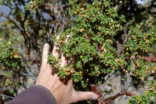
''Polylepis'' is a genus comprising 28 recognised shrub and tree species, that are endemic to the mid- and high-elevation regions of the tropical Andes. This group is unique in the rose family in that it is predominantly wind-pollinated. They are usually gnarled in shape, but in certain areas some trees are 15–20 m tall and have 2 m-thick trunks. The foliage is evergreen, with dense small leaves, and often having large amounts of dead twigs hanging down from the underside of the canopy. The name ''Polylepis'' is, in fact, derived from the Greek words poly (many) plus letis (layers), referring to the shredding, multi-layered bark that is common to all species of the genus. The bark is thick and rough and densely layered for protection against low temperatures. Some species of ''Polylepis'' form woodlands growing well above normal tree line within grass and scrub associations at elevations over 5000 m; which makes ''Polylepis'' appear to be the highest naturally occurring arbora ... [...More Info...] [...Related Items...] OR: [Wikipedia] [Google] [Baidu] |
Secondary Woodland
A secondary forest (or second-growth forest) is a forest or woodland area which has re-grown after a timber harvest or clearing for agriculture, until a long enough period has passed so that the effects of the disturbance are no longer evident. It is distinguished from an old-growth forest (primary or primeval forest), which has not recently undergone such disruption, and complex early seral forest, as well as third-growth forests that result from harvest in second growth forests. Secondary forest regrowing after timber harvest differs from forest regrowing after natural disturbances such as fire, insect infestation, or windthrow because the dead trees remain to provide nutrients, structure, and water retention after natural disturbances. However, often after natural disturbance the timber is harvested and removed from the system, in which case the system more closely resembles secondary forest rather than seral forest. Description Depending on the forest, the development of ... [...More Info...] [...Related Items...] OR: [Wikipedia] [Google] [Baidu] |
American Ornithological Society
The American Ornithological Society (AOS) is an ornithological organization based in the United States. The society was formed in October 2016 by the merger of the American Ornithologists' Union (AOU) and the Cooper Ornithological Society. Its members are primarily professional ornithologists, although membership is open to anyone with an interest in birds. The society publishes the two scholarly journals, ''The Auk'' and '' The Condor'' as well as the ''AOS Checklist of North American Birds''. In 2013, the American Ornithologists' Union announced a close partnership with the Cooper Ornithological Society, including joint meetings, a centralized publishing office, and a refocusing of their respective journals to increase efficiency of research. In October 2016, the AOU announced that it was ceasing to operate as an independent union and was merging with the Cooper Ornithological Society to create the American Ornithological Society. History The American Ornithologists' Unio ... [...More Info...] [...Related Items...] OR: [Wikipedia] [Google] [Baidu] |
Cochabamba Department
Cochabamba ( ay, Quchapampa Jach'a Suyu, es, Departamento de Cochabamba , qu, Quchapampa Suyu), from Quechua ''qucha'' or ''qhucha'', meaning "lake", ''pampa'' meaning "plain", is one of the nine departments of Bolivia. It is known to be the "granary" of the country because of its variety of agricultural products from its geographical position. It has an area of 55,631 km2. Its population in the 2012 census was 1,758,143. Its capital is the city of Cochabamba, known as the "City of Eternal Spring" and "The Garden City" because of its spring-like temperatures all year. History The Cochabamba valley was inhabited for over a thousand years due to its fertile productive soils and climate. Archaeological evidence suggests that the initial valley inhabitants were of various ethnic indigenous groups. Tiwanaku, Tupuraya, Mojocoya, Omereque and Inca inhabited the valley at various times before the Spanish arrived. The first Spanish inhabitant of the Valley was Garci Ruiz de Orell ... [...More Info...] [...Related Items...] OR: [Wikipedia] [Google] [Baidu] |
La Paz Department (Bolivia)
The La Paz Department of Bolivia comprises with a 2012 census population of 2,706,359 inhabitants. It is situated at the western border of Bolivia, sharing Lake Titicaca with adjacent Peru. It contains the '' Cordillera Real'', which reaches altitudes of . Northeast of the Cordillera Real are the ''Yungas'', the steep eastern slopes of the Andes Mountains that make the transition to the Amazon River basin to the northeast. The capital of the department is the city of La Paz and is the administrative city and seat of government/national capital of Bolivia. Provinces The Department of La Paz is divided into 20 provinces (''provincias'') which are further subdivided into 85 municipalities (''municipios'') and - on the fourth level - into cantons. The provinces with their capitals are: Government The chief executive office of Bolivia's departments (since May 2010) is the Governor; before then, the office was called the Prefect, and until 2006 the prefect was appointed by ... [...More Info...] [...Related Items...] OR: [Wikipedia] [Google] [Baidu] |
Huallaga River
The Huallaga River is a tributary of the Marañón River, part of the Amazon Basin. Old names for this river include ''Guallaga'' and ''Rio de los Motilones''. The Huallaga is born on the slopes of the Andes in central Peru and joins the Marañón before the latter reaches the Ucayali River to form the Amazon. Its main affluents are the Monzón, Mayo, Biabo, Abiseo and Tocache rivers. Coca is grown in most of those valleys, which are also exposed to periodic floods. Description Although it runs for 700 miles (1,100 km), it remains unnavigable for the most part. For nearly its entire length the Huallaga is an impetuous torrent running through a succession of gorges. It has forty-two rapids (pongos) and it crosses the Andes, forming the Pongo de Aguirre gorge. From this point, from the Amazon, the Huallaga can be ascended by larger river boats (''lanchas'') to the port city of Yurimaguas, Loreto. Although there are no defined boundaries, the river is commonly divided into tw ... [...More Info...] [...Related Items...] OR: [Wikipedia] [Google] [Baidu] |
Department Of Huánuco
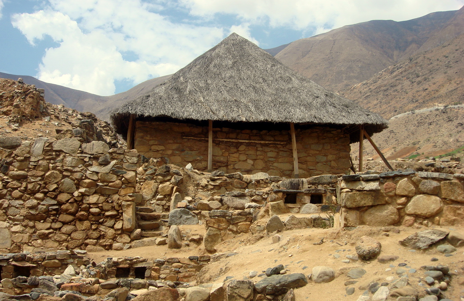
Huánuco () is a department and region in central Peru. It is bordered by the La Libertad, San Martín, Loreto and Ucayali regions in the north, the Ucayali Region in the east, the Pasco Region in the south and the Lima and Ancash regions in the west. Its capital is the city Huánuco. Huánuco has a rough topography comprising parts of the Sierra and the High Jungle (mountain rim) regions. Being equidistant from the north and the south of the country, it has the privilege of having a mild weather with an average annual temperature of 20 °C (68 °F). This region is important for its geographical location, history, and for the richness of its land, where the presence of man goes back to ancient times. ''El Hombre de Lauricocha'' (Man of Lauricocha) is among the most distinctive examples, dating from 10,000 BC, as well as Kotosh, where vestiges of the oldest settlement in the Americas (4200 BC) took place. Several ethnic groups inhabited this region. However, afte ... [...More Info...] [...Related Items...] OR: [Wikipedia] [Google] [Baidu] |
Department Of Piura
Piura () is a coastal department and region in northwestern Peru. The region's capital is Piura and its largest port cities, Paita and Talara, are also among the most important in Peru. The area is known for its tropical and dry beaches. It is the most populous department in Peru, its twelfth smallest department, and its fourth-most densely populated department, after Tumbes, La Libertad, and Lambayeque. The country's latest decentralization program is in hiatus after the proposal to merge departments was defeated in the national referendum in October 2005. The referendum held on October 30, 2005, as part of the ongoing decentralization process in Peru, to decide whether the region would merge with the current regions of Lambayeque and Tumbes to create a new ''Región Norte'' was defeated. Geography The Piura Region is bordered to the north by the Tumbes Region and Ecuador, to the east by Cajamarca Region, to the south by the Lambayeque Region, and to the west by the Pac ... [...More Info...] [...Related Items...] OR: [Wikipedia] [Google] [Baidu] |
Loja Province
Loja Province () is one of 24 provinces in Ecuador and shares its southern border on the west with El Oro Province, on the north with El Azuay, and on the east with Zamora-Chinchipe. Founded on its present site in 1548 by Captain Alonso de Mercadillo (Spanish), the site had been previously moved and rebuilt from La Toma due to earthquakes. It also is named as "Cuxibamba Valley", from the Quichua language, which means the "Smiley Valley". Overview Loja is located in a high Andean valley at an elevation of 7,300 feet (2,225 m). It had a population of 448,966 inhabitants at the 2010 census. It is recognized as being a friendly and pleasant city. This was demonstrated when Loja, both the provincial capital and one of the oldest cities in Ecuador, won a community involvement award in 2001 in recognition of the community's ongoing effort to support and to protect the environment. Surrounded by two rivers, the Zamora and Malacatos, Loja has a variety of microclimates. This uni ... [...More Info...] [...Related Items...] OR: [Wikipedia] [Google] [Baidu] |
Azuay Province
Azuay (), Province of Azuay is a province of Ecuador, created on 25 June 1824. It encompasses an area of . Its capital is Cuenca. It is located in the south center of Ecuador in the highlands. Its mountains reach above sea level in the national park of El Cajas. Azuay is located on the Panamerican Highway. Cuenca is connected by national flights from Quito and Guayaquil. It has the largest hydroelectric plant of the country, situated on the river Paute. Demographics Ethnic groups as of the Ecuadorian census of 2010: * Mestizo 90% * White 5.2% * Indigenous 2.5% * Afro-Ecuadorian 2.2% * Other 0.2% Cantons The province is divided into 15 cantons. The following table lists each with its population at the 2010 census, its area in square kilometres (km2), and the name of the canton seat or capital. Statoids.com. Retrieved 4 November ... [...More Info...] [...Related Items...] OR: [Wikipedia] [Google] [Baidu] |


