|
Leoganger Ache
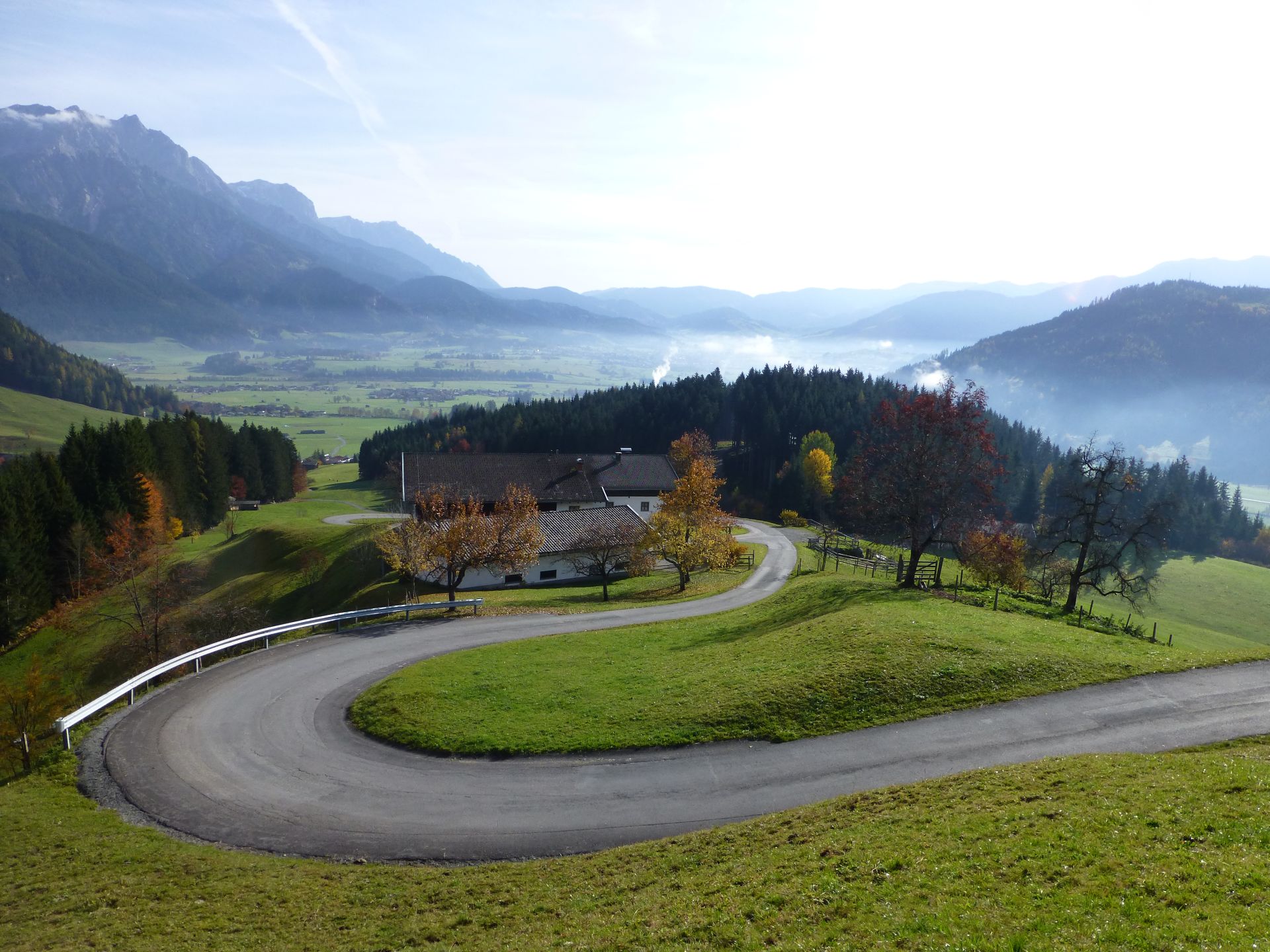
The Leoganger Ache is a river of Salzburg (state), Salzburg, Austria, a left tributary of the Saalach. The Leonganger Ache drains the valley of the same name, the Leoganger Tal. It originates near the border with state of Tyrol, Tyrol in Hütten, municipality of Leogang, at a height of out of its two headstreams: * the stream, which flows from the southwest below the mountain in the Tyrolean Slate Alps (north of Saalbach-Hinterglemm, Saalbach) having risen on the , at about and * the , which flows down from the Grießen Pass at from the and the . It flows from west to east and ist about long, including the . After half its way it passes through the municipality of Leogang. The Leoganger Valley falls openly and gently into the Saalfelden Basin. Northwest of Saalfelden, in the parish of , the Leoganger Ache discharges into the Saalach; at a triple confluence with the . Its northern, right hand tributaries comprise several mountain streams that drain the limestone massif of ... [...More Info...] [...Related Items...] OR: [Wikipedia] [Google] [Baidu] |
Austria
Austria, , bar, Östareich officially the Republic of Austria, is a country in the southern part of Central Europe, lying in the Eastern Alps. It is a federation of nine states, one of which is the capital, Vienna, the most populous city and state. A landlocked country, Austria is bordered by Germany to the northwest, the Czech Republic to the north, Slovakia to the northeast, Hungary to the east, Slovenia and Italy to the south, and Switzerland and Liechtenstein to the west. The country occupies an area of and has a population of 9 million. Austria emerged from the remnants of the Eastern and Hungarian March at the end of the first millennium. Originally a margraviate of Bavaria, it developed into a duchy of the Holy Roman Empire in 1156 and was later made an archduchy in 1453. In the 16th century, Vienna began serving as the empire's administrative capital and Austria thus became the heartland of the Habsburg monarchy. After the dissolution of the H ... [...More Info...] [...Related Items...] OR: [Wikipedia] [Google] [Baidu] |
Grießen Pass
Grießen Pass (el. 975 m.) is a high mountain pass in the Austrian Alps between the ''federal states'' of Salzburg and Tyrol. It connects the Kitzbühel Alps and the Leogang Steinberge. The road over the pass leads from Hochfilzen in Tyrol to Leogang in Salzburg, but it lies almost entirely in the state of Salzburg. The pass is traversed by the Salzburg-Tyrol Railway and the '' Hochkönig-Straße'' (B164). See also * List of highest paved roads in Europe * List of mountain passes This is a list of mountain passes. Africa Egypt * Halfaya Pass (near Libya) Lesotho * Moteng Pass * Mahlasela pass * Sani Pass Morocco * Tizi n'Tichka South Africa * Eastern Cape Passes * Western Cape Passes * Northern Cape Passes * ... Mountain passes of Tyrol (state) Mountain passes of Salzburg (state) Kitzbühel Alps {{Tyrol-geo-stub ... [...More Info...] [...Related Items...] OR: [Wikipedia] [Google] [Baidu] |
Little German Corner
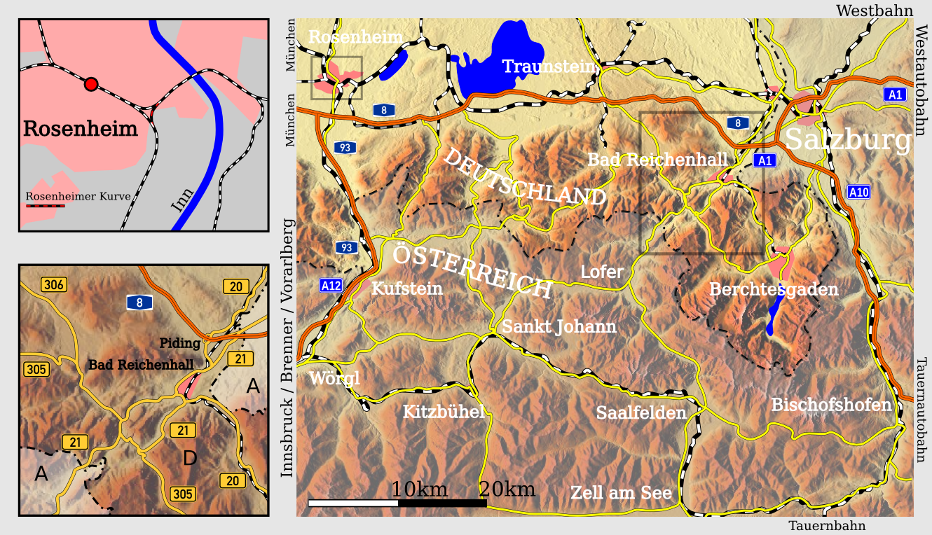
The ''Deutsches Eck'' ("German Corner") is the name given to the shortest and most convenient road and railway link between the Austrian metropolitan region of Salzburg and the Tyrolean Unterland with the state capital Innsbruck. Due to the mountainous landscape and the irregular course of the border, the main transport routes to the western Austrian states of Tyrol and Vorarlberg pass through the territory of the German state of Bavaria. While an alternative, albeit longer, all-Austrian Salzburg-Tyrol Railway exists, there is no continuous, intra-Austrian motorway route between the states of Salzburg and Tyrol. Großes Deutsches Eck A larger railway and autobahn (motorway) link runs from Salzburg westwards along the northern rim of the Chiemgau Alps to the Bavarian town of Rosenheim, then turns south through the Inn valley to reach the Tyrolean border at Kufstein. Since the conclusion of an 1851 treaty between the Austrian Empire and the Kingdom of Bavaria, [...More Info...] [...Related Items...] OR: [Wikipedia] [Google] [Baidu] |
Fieberbrunn
Fieberbrunn is a market town in the Austrian state of Tyrol (state), Tyrol in the Kitzbühel (district), Kitzbühel district. It is located at , in the Kitzbühel Alps. Fieberbrunn is the most populous municipality in the Pillerseetal valley. According to a legend, the fountain near its church, and later also the market town received the name ''Fieberbrunn'' (''fever well'') when Tyrolean Countess Margarete Maultasch was healed from fever after drinking from it. Previously the market town was named ''Pramau''. Fieberbrunn is a winter sports resort and venue of international snowboarding events (like ''Lords of the Boards''), as well as a hiking and mountaineering resort in summer. Since 2006 Fieberbrunn is venue of a new event called 'SNOWFEVER', which is one of the biggest Big mountain skiing, Big Mountain Events in Austria. It is also home of the churchjump. Schloss Rosenegg is nearby. The bathing lake of the Lauchsee is important for summer tourism. Population Gallery Fi ... [...More Info...] [...Related Items...] OR: [Wikipedia] [Google] [Baidu] |
Bischofshofen
Bischofshofen () is a town in the district of St. Johann im Pongau in the Austrian federal state of Salzburg. It is an important traffic junction located both on the Salzburg-Tyrol Railway line and at the Tauern Autobahn, a major highway route crossing the main chain of the Alps. Geography Bischofshofen is situated within the Northern Limestone Alps, in the valley of the Salzach river, about south of the state capital Salzburg. It is surrounded by the Hochkönig massif in the west, part of the Berchtesgaden Alps, the Tennen Mountains in the northeast, and the Salzburg Slate Alps in the southeast. The municipal area comprises the cadastral communities of Bischofshofen proper, Buchberg, Haidberg, and Winkl. Villages in Bischofshofen and population * Alpfahrt - 149 * Bischofshofen - 7.134 * Buchberg - 440 * Gainfeld - 109 * Haidberg - 98 * Kreuzberg - 263 * Laideregg - 488 * Mitterberghütten - 1.323 * Winkl - 83 * Asten - 50 History In Neolithic times local Celtic tribes mine ... [...More Info...] [...Related Items...] OR: [Wikipedia] [Google] [Baidu] |
Hochkönig Road
The Hochkönig Road (german: Hochkönig Straße or, in Tyrol, ''Hochkönigstraße''), – the B 164 – is a state road (''Landesstraße'') in Austria. It has a length of . Beginning in Bischofshofen in the Salzach valley, it runs initially between the Hochkönig and Dienten Mountains along the Dienten Saddle () and on into the valley of the Saalach to Saalfelden am Steinernen Meer. On the far side of the Saalach the road runs into the Leoganger Tal between the Leoganger Steinberge and the Loferer Steinberge to the north and the Kitzbühel Alps to the south via Leogang up to the Grießen Pass (), and via Fieberbrunn downhill again into the valley of the Kitzbühler Ache to St. Johann in Tirol. On the last section the road runs parallel to the Salzburg-Tyrol Railway. History Since 1948 three sections of the present-day Hochkönig Road in the state of Salzburg have been classified as Class II state highways ('' Landesstraßen''): *The Mühlbach Road (''Mühlbacher Str ... [...More Info...] [...Related Items...] OR: [Wikipedia] [Google] [Baidu] |
Birnhorn
The Birnhorn (2,634 m) is an isolated mountain in the Leoganger Steinberge, Northern Limestone Alps, Austria. See also *List of Alpine peaks by prominence This is a list of the mountains of the Alps, ordered by their topographic prominence. For a list by height, see the list of mountains of the Alps. By descending to 1,500 m of prominence, this list includes all the Ultras of the Alps. Some famous p ... References External links"Birnhorn, Austria" on Peakbagger Mountains of the Alps Mountains of Salzburg (state) {{Salzburg-geo-stub ... [...More Info...] [...Related Items...] OR: [Wikipedia] [Google] [Baidu] |
Leogang Mountains
The Leogang MountainsLichtenberger, Elisabeth (2000). ''Austria: society and regions'', Austrian Academy of Sciences, p. 173. . (german: Leoganger Steinberge, lit. "Leogang Rock Mountains") are a mountain range in Austria in the state of Salzburg and form part of the Northern Limestone Alps within the Eastern Alps. They are located between the Lofer valley, Saalfelden and Leogang and, together with the Lofer Mountains to the northwest form two mountain massifs that are separated by the saddle of the ''Römersattel'' (1,202 m), but which the Alpine categorisation of the Eastern Alps defines as a single sub-group (the Lofer and Leogang Mountains). The Leogang Mountains are separated from the Kitzbühel Alps to the south and the Steinernes Meer to the east by deeply incised valleys. Typical of the Steinberge are high plateaux with steep sides and sharply undulating high cirques. As typical karst mountains the Leogang Mountains are also pierced by numerous caves. The most famous of ... [...More Info...] [...Related Items...] OR: [Wikipedia] [Google] [Baidu] |
Saalfelden Basin
Saalfelden am Steinernen Meer is a town in the district of Zell am See in the Austrian state of Salzburg. With approximately 16,000 inhabitants, Saalfelden is the district's largest town and the third of the federal state after Salzburg and Hallein. Geography Although the Saalfelden area has always been the most populous of the historic Pinzgau region, the seat of the district administration is situated in the neighbouring town of Zell am See. Saalfelden Basin Saalfelden am Steinernen Meer lies at above sea level and its municipal area covers . The largest proportion of the municipality is formed by the Saalfelden Basin (''Saalfeldner Becken'') situated between the Northern Limestone Alps ranges of: * the Steinernes Meer high plateau to the north, forming the border with Germany * the Leogang Mountains and the Biberg to the west * the Hochkönig massif and the Salzburg Slate Alps to the east. To the south the basin is generally open, running into the Zell Basin (''Zeller Becke ... [...More Info...] [...Related Items...] OR: [Wikipedia] [Google] [Baidu] |
Saalbach-Hinterglemm
Saalbach-Hinterglemm is a municipality in the district of Zell am See (Pinzgau region), in the Austrian state of Salzburg. It is well known for its skiing and other winter sports. A four piste network consisting of Saalbach, Hinterglemm, Fieberbrunn and Leogang is located in the municipality, adding up to 270 kilometers of ski slopes. It is short transfer to resort from Salzburg Airport. Geography Saalbach-Hinterglemm is located in the Pinzgau region, in the Saalbach Valley, which is oriented east-west. The region is a part of the Kitzbüheler Alpen. The highest point is Spielberghorn (2,044 m) in the north and Hochkogel (2,249 m) in the south. The nearest large city is Zell am See, located about 20 km away. The municipality consists of two small towns: Saalbach and Hinterglemm, which each make up several ''Katastralgemeinden''. History The oldest evidence of settlements in the municipality stems from 1222. The name ''Salpach'' first showed up in 1350. Before 1410 ther ... [...More Info...] [...Related Items...] OR: [Wikipedia] [Google] [Baidu] |
States Of Austria
Austria is a federal republic made up of nine states (German: ''Länder''). Since ''Land'' is also the German word for "country", the term ''Bundesländer'' (literally ''federal states'') is often used instead to avoid ambiguity. The Constitution of Austria uses both terms. Austrian states can pass laws that stay within the limits of the constitution, and each state has representatives in the main Austrian parliament. Geography The majority of the land area in the states of Upper Austria, Lower Austria, Vienna, and Burgenland is situated in the Danube valley and thus consists almost completely of accessible and easily arable terrain. The other five states, in contrast, are located in the Alps and thus are comparatively unsuitable for agriculture. Their terrain is also relatively unfavourable to heavy industry and long-distance trade. Accordingly, the population of what now is the Republic of Austria has been concentrated in the former four states since prehistoric times. Austria ... [...More Info...] [...Related Items...] OR: [Wikipedia] [Google] [Baidu] |


