|
Lemon Fair River
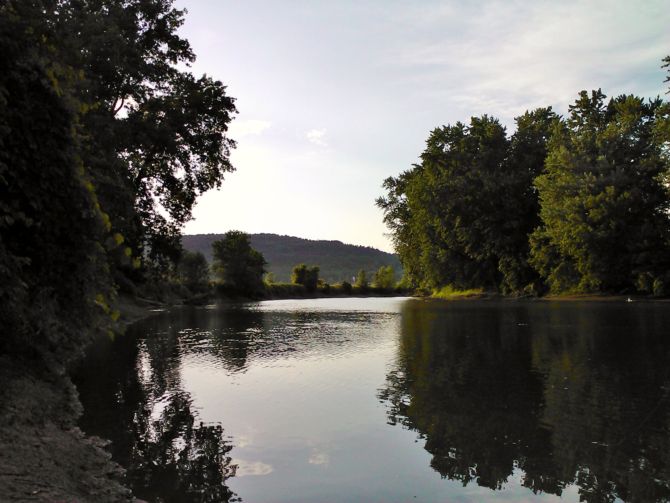
Lemon Fair River is a river in Addison County and Rutland County, in the U.S. state of Vermont. ''Les monts verts'', the French name for the Green Mountains, is thought to be the source of the name. The Lemon Fair begins in the fields and farmlands of southern Orwell, Vermont. From there it flows north, gaining tributaries, eventually draining into the Otter Creek by Route 23 in Weybridge, Vermont. The Lemon Fair is home to many forms of wildlife, including fish such as bass, northern pike, and bullhead. However, unlike other rivers around, it does not drain mountainous areas, only farmland. As such, the water quality is poorer than other rivers. See also *List of rivers of Vermont This is a list of rivers in the U.S. state of Vermont, sorted by drainage basin, and ordered from lower to higher, with the towns at their mouths: Connecticut River The Connecticut River flows south towards Long Island Sound in Connecticut. ... References Rivers of Addison County, Ver ... [...More Info...] [...Related Items...] OR: [Wikipedia] [Google] [Baidu] |
Addison County, Vermont
Addison County is a county located in the U.S. state of Vermont. As of the 2020 census, the population was 37,363. Its shire town (county seat) is the town of Middlebury. History Iroquois settled in the county before Europeans arrived in 1609. French settlers in Crown Point, New York extended their settlements across Lake Champlain. A few individuals or families came up the lake from Canada and established themselves at Chimney Point in 1730. In 1731, Fort Frederic was erected at Cross Point. In 1759, General Amherst occupied Cross Point and British settlers came in. The Battle of Bennington in Bennington, fought on August 16, 1777, brought a turning point for the American independence against British. Addison County was established by act of the Legislature October 18, 1785, during the period of Vermont Republic. In 1791, Vermont joined the federal union after the original thirteen colonies. The main product of the county was wheat. In the 1820s farmers began to raise s ... [...More Info...] [...Related Items...] OR: [Wikipedia] [Google] [Baidu] |
Rutland County, Vermont
Rutland County is a county located in the U.S. state of Vermont. As of the 2020 census, the population was 60,572, making it the second-most populous county in Vermont. Its county seat and most populous municipality is the city of Rutland. History On February 16, 1781, Rutland County was created from Bennington County. From June 26, 1781, until February 23, 1782, Vermont attempted to annex part of New York east of the Hudson River (the so-called West Union); inhabitants in the area favored Vermont's township form of government, while Vermont hoped to gain bargaining power through expansion. New York did not lose control of the area. For almost seven months Rutland County included part of Charlotte County (now Washington County), New York. In February 1783 Orange County gained the towns of Brookfield and Randolph and Windsor County gained the towns of Bethel and Rochester from Rutland. On October 18, 1785 Addison County was created from Rutland. On February 27, 1787, W ... [...More Info...] [...Related Items...] OR: [Wikipedia] [Google] [Baidu] |
Vermont
Vermont () is a state in the northeast New England region of the United States. Vermont is bordered by the states of Massachusetts to the south, New Hampshire to the east, and New York to the west, and the Canadian province of Quebec to the north. Admitted to the union in 1791 as the 14th state, it is the only state in New England not bordered by the Atlantic Ocean. According to the 2020 U.S. census, the state has a population of 643,503, ranking it the second least-populated in the U.S. after Wyoming. It is also the nation's sixth-smallest state in area. The state's capital Montpelier is the least-populous state capital in the U.S., while its most-populous city, Burlington, is the least-populous to be a state's largest. For some 12,000 years, indigenous peoples have inhabited this area. The competitive tribes of the Algonquian-speaking Abenaki and Iroquoian-speaking Mohawk were active in the area at the time of European encounter. During the 17th century, Fr ... [...More Info...] [...Related Items...] OR: [Wikipedia] [Google] [Baidu] |
Green Mountains
The Green Mountains are a mountain range in the U.S. state of Vermont. The range runs primarily south to north and extends approximately from the border with Massachusetts to the border with Quebec, Canada. The part of the same range that is in Massachusetts and Connecticut is known as The Berkshires or the Berkshire Hills (with the Connecticut portion, mostly in Litchfield County, locally called the Northwest Hills or Litchfield Hills) and the Quebec portion is called the Sutton Mountains, or ' in French. All mountains in Vermont are often referred to as the "Green Mountains". However, other ranges within Vermont, including the Taconic Mountains in southwestern Vermont and the Northeastern Highlands, are not geologically part of the Green Mountains. Peaks The best-known mountains—for reasons such as high elevation, ease of public access by road or trail (especially the Long Trail and Appalachian Trail), or with ski resorts or towns nearby—in the range include: # Mount ... [...More Info...] [...Related Items...] OR: [Wikipedia] [Google] [Baidu] |
Otter Creek (Vermont)
Otter Creek is the longest river entirely contained within the borders of Vermont. Roughly long, it is the primary watercourse running through Rutland County and Addison County. The mouth of the river flows into Lake Champlain. Settled by indigenous peoples at least 10-11,000 years ago, the river was an important economic region for indigenous people before European settlement. The river became an important economic region for settlers, who took advantage of the river for agriculture and industry through the 18th and 19th centuries. History Before European settlement, the river valley was settled by native peoples and was called by early settlers as the "Indian road" because of its importance to navigating Abenaki, Algonquin and Iroquois settlements in the region. Archeological evidence suggest both war parties and trading happened between communities on the river. Otter Creek (or "Kill") was known to the French as "La Rivière aux Loutres", whence the English name. On April ... [...More Info...] [...Related Items...] OR: [Wikipedia] [Google] [Baidu] |
List Of Rivers Of Vermont
This is a list of rivers in the U.S. state of Vermont, sorted by drainage basin, and ordered from lower to higher, with the towns at their mouths: Connecticut River The Connecticut River flows south towards Long Island Sound in Connecticut. Flowing into it are: * Deerfield River, Greenfield, Massachusetts ** Green River, Greenfield, Massachusetts ** Glastenbury River, Somerset * Fall River, Greenfield, Massachusetts * Whetstone Brook, Brattleboro, Vermont * West River, Brattleboro ** Rock River, Newfane ** Wardsboro Brook, Jamaica ** Winhall River, Londonderry ** Utley Brook, Londonderry * Saxtons River, Westminster * Williams River, Rockingham ** Middle Branch Williams River, Chester * Black River, Springfield * Mill Brook, Windsor * Ottauquechee River, Hartland ** Barnard Brook, Woodstock ** Broad Brook, Bridgewater ** North Branch Ottauquechee River, Bridgewater * White River, White River Junction ** First Branch White River, South Royalton ** Second Branc ... [...More Info...] [...Related Items...] OR: [Wikipedia] [Google] [Baidu] |
Rivers Of Addison County, Vermont
A river is a natural flowing watercourse, usually freshwater, flowing towards an ocean, sea, lake or another river. In some cases, a river flows into the ground and becomes dry at the end of its course without reaching another body of water. Small rivers can be referred to using names such as creek, brook, rivulet, and rill. There are no official definitions for the generic term river as applied to geographic features, although in some countries or communities a stream is defined by its size. Many names for small rivers are specific to geographic location; examples are "run" in some parts of the United States, "burn" in Scotland and northeast England, and "beck" in northern England. Sometimes a river is defined as being larger than a creek, but not always: the language is vague. Rivers are part of the water cycle. Water generally collects in a river from precipitation through a drainage basin from surface runoff and other sources such as groundwater recharge, springs, a ... [...More Info...] [...Related Items...] OR: [Wikipedia] [Google] [Baidu] |
Rivers Of Rutland County, Vermont
A river is a natural flowing watercourse, usually freshwater, flowing towards an ocean, sea, lake or another river. In some cases, a river flows into the ground and becomes dry at the end of its course without reaching another body of water. Small rivers can be referred to using names such as creek, brook, rivulet, and rill. There are no official definitions for the generic term river as applied to geographic features, although in some countries or communities a stream is defined by its size. Many names for small rivers are specific to geographic location; examples are "run" in some parts of the United States, "burn" in Scotland and northeast England, and "beck" in northern England. Sometimes a river is defined as being larger than a creek, but not always: the language is vague. Rivers are part of the water cycle. Water generally collects in a river from precipitation through a drainage basin from surface runoff and other sources such as groundwater recharge, springs, an ... [...More Info...] [...Related Items...] OR: [Wikipedia] [Google] [Baidu] |


