|
Lemhi River
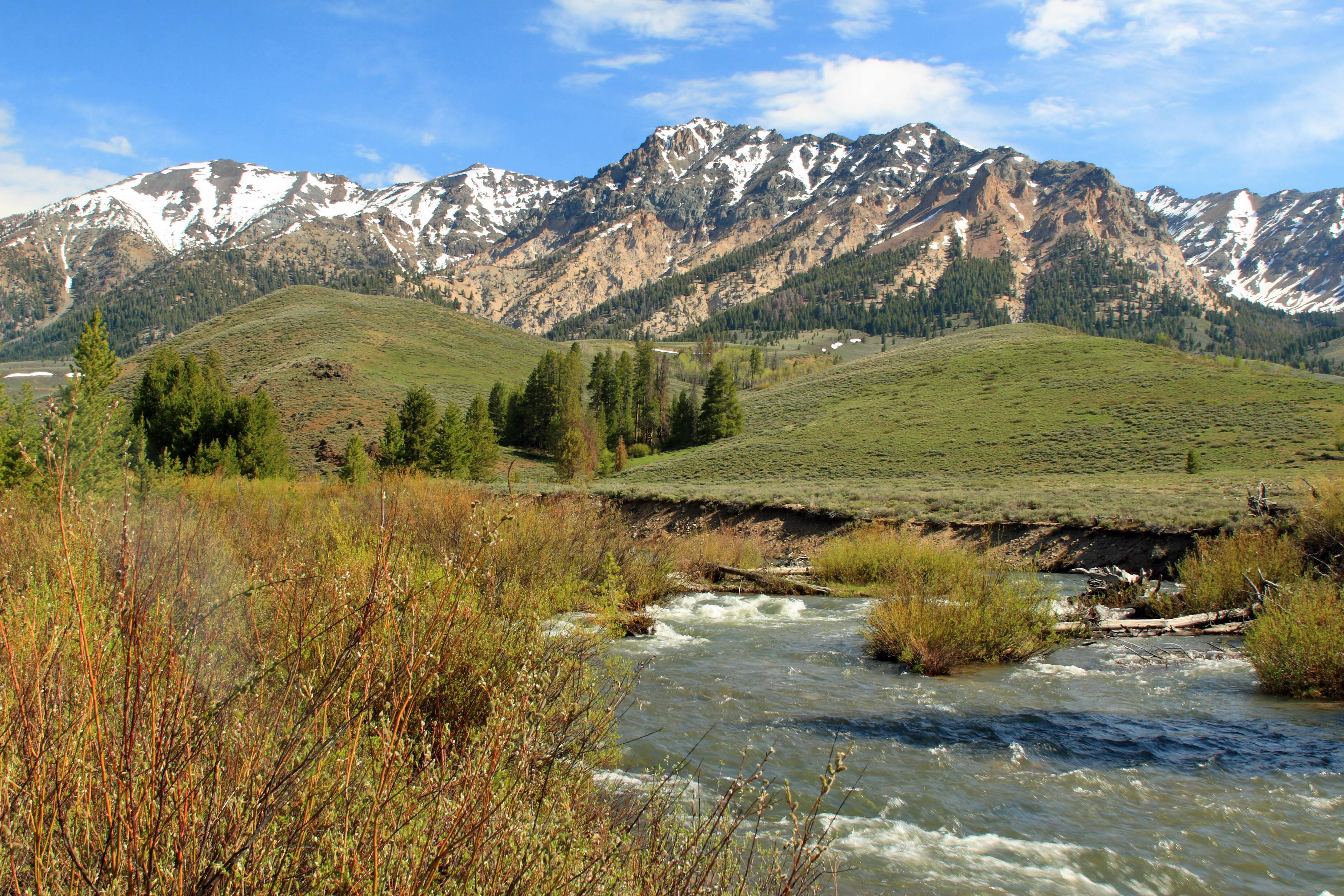
The Lemhi River is a U.S. Geological Survey. National Hydrography Dataset high-resolution flowline dataThe National Map, accessed May 3, 2011 river in Idaho in the United States. It is a tributary of the Salmon River, which in turn is tributary to the Snake River and Columbia River. Course From its source near Leadore and the confluence of several headwater streams, the Lemhi River flows generally northwest, through the Lemhi Valley, between the Lemhi Range to the west, and the Bitterroot Range and Beaverhead Mountains to the east. The Lemhi River flows into the Salmon River at the city of Salmon. River modification The water of the Lemhi River and its tributaries is used for irrigation agriculture. Of the river's mainstem tributaries, only 7% are not totally disconnected year round due to diversion for irrigation. History In August 1805 Lewis and Clark crossed the continental divide at the Lemhi Pass to the east of the Lemhi River. There, the group encountered a tribe of Sho ... [...More Info...] [...Related Items...] OR: [Wikipedia] [Google] [Baidu] |
United States
The United States of America (U.S.A. or USA), commonly known as the United States (U.S. or US) or America, is a country primarily located in North America. It consists of 50 states, a federal district, five major unincorporated territories, nine Minor Outlying Islands, and 326 Indian reservations. The United States is also in free association with three Pacific Island sovereign states: the Federated States of Micronesia, the Marshall Islands, and the Republic of Palau. It is the world's third-largest country by both land and total area. It shares land borders with Canada to its north and with Mexico to its south and has maritime borders with the Bahamas, Cuba, Russia, and other nations. With a population of over 333 million, it is the most populous country in the Americas and the third most populous in the world. The national capital of the United States is Washington, D.C. and its most populous city and principal financial center is New York City. Paleo-Americ ... [...More Info...] [...Related Items...] OR: [Wikipedia] [Google] [Baidu] |
Lemhi Range
The Lemhi Range is a mountain range in the U.S. state of Idaho, spanning the eastern part of the state between the Lost River Range and the Beaverhead Mountains. The highest point in the range is Diamond Peak at , the fourth highest peak in Idaho. The range is located within Salmon-Challis and Caribou-Targhee National Forests. Peaks See also * List of mountain ranges in Idaho There are at least 115 named mountain ranges in Idaho. Some of these ranges extend into the neighboring states of Montana, Nevada, Oregon, Utah, Washington, and Wyoming. Names, elevations and coordinates from the U.S. Geological Survey, Geographi ... References External links {{Authority control Mountain ranges of Idaho Ranges of the Rocky Mountains Landforms of Butte County, Idaho Landforms of Lemhi County, Idaho ... [...More Info...] [...Related Items...] OR: [Wikipedia] [Google] [Baidu] |
Rivers Of Idaho
This is a list of rivers in the U.S. state of Idaho. By drainage basin This list is arranged by drainage basin, with respective tributaries indented under each larger stream's name. Pacific Ocean *''Columbia River (WA)'' ** Snake River ***Palouse River **** Union Flat Creek *** Clearwater River **** Lapwai Creek **** Potlatch River ***** Pine Creek ***** Big Bear Creek ***** Moose Creek **** Big Canyon Creek **** North Fork Clearwater River ***** Elk Creek ***** Little North Fork Clearwater River ***** Beaver Creek ***** Washington Creek (Idaho) *****Orogrande Creek ****** French Creek ***** Weitas Creek ***** Fourth of July Creek ***** Kelly Creek ****Orofino Creek ***** Whiskey Creek *****Canal Gulch ****Jim Ford Creek ****Lolo Creek **** Lawyers Creek ****Middle Fork Clearwater River ***** Lochsa River ******White Sand Creek (meets the Lochsa near Powell Junction) *****Selway River (meets the Lochsa at Lowell) ****** Meadow Creek ****** Moose Creek *******North Fork Moose Creek ... [...More Info...] [...Related Items...] OR: [Wikipedia] [Google] [Baidu] |
List Of Longest Streams Of Idaho
A total of seventy streams that are at least long flow through the U.S. state of Idaho. All of these streams originate in the United States except the Kootenai River (third-longest) and the Moyie River (thirty-first-longest), both of which begin in the Canadian province of British Columbia. At , the Snake River is the longest and the only stream of more than in total length. It begins in Wyoming and flows through Idaho for , and then through Oregon and Washington. Some of the other streams also cross borders between Idaho and Montana, Nevada, Oregon, Utah, Washington, or Wyoming, but the majority flow entirely within Idaho, the longest of which is the Salmon River at . All but four of the streams lie within the large basin of the Columbia River, although the river itself does not flow through Idaho. Consequently, the predominant direction of the state's streamflow is northwest towards the Columbia River and its mouth at the Pacific Ocean. The only other major drainage basi ... [...More Info...] [...Related Items...] OR: [Wikipedia] [Google] [Baidu] |
List Of Rivers In Idaho
This is a list of rivers in the U.S. state of Idaho. By drainage basin This list is arranged by drainage basin, with respective tributaries indented under each larger stream's name. Pacific Ocean *''Columbia River (WA)'' **Snake River ***Palouse River ****Union Flat Creek *** Clearwater River ****Lapwai Creek ****Potlatch River ***** Pine Creek ***** Big Bear Creek ***** Moose Creek **** Big Canyon Creek ****North Fork Clearwater River ***** Elk Creek ***** Little North Fork Clearwater River ***** Beaver Creek ***** Washington Creek (Idaho) *****Orogrande Creek ****** French Creek ***** Weitas Creek *****Fourth of July Creek *****Kelly Creek ****Orofino Creek ***** Whiskey Creek *****Canal Gulch ****Jim Ford Creek ****Lolo Creek **** Lawyers Creek ****Middle Fork Clearwater River ***** Lochsa River ******White Sand Creek (meets the Lochsa near Powell Junction) *****Selway River (meets the Lochsa at Lowell) ****** Meadow Creek ****** Moose Creek *******North Fork Moose Creek ****** ... [...More Info...] [...Related Items...] OR: [Wikipedia] [Google] [Baidu] |
Lemhi (other) , a thoroughbred racehorse
{{disambig ...
Lemhi could refer to: People *Lemhi Shoshone, a band of Shoshone in Idaho *Limhi, a king mentioned in the Book of Mormon Places *Fort Lemhi, a fort built by Mormon missionaries in 1855 *Lemhi, Idaho, an unincorporated community *Lemhi County, Idaho * Lemhi County Airport, a public airport located south of Salmon, Idaho * Lemhi National Forest, in Idaho *Lemhi Pass, pass in the Rocky Mountains between Idaho and Montana *Lemhi River, a tributary of the Salmon River in Idaho *National Register of Historic Places listings in Lemhi County, Idaho Other *Lemhi Gold Lemhi Gold (foaled 1978 in Kentucky) was an American Thoroughbred Champion racehorse. In 1982, he was voted American Champion Older Male Horse at the Eclipse Awards after a season in which he won the Marlboro Cup and the Jockey Club Gold Cup. B ... [...More Info...] [...Related Items...] OR: [Wikipedia] [Google] [Baidu] |
Cameahwait
Cameahwait was the brother of Sacagawea, and a Shoshone chief. He was the head of the first group of inhabitants of modern-day Idaho who were encountered by Europeans. Cameahwait met Meriwether Lewis and three other members of the Lewis and Clark Expedition on August 13, 1805. He then accompanied Lewis across the Lemhi Pass to meet Clark. Sacagawea was with Clark's party and recognized Cameahwait as her brother. To the Shoshoni Cameahwait and Sacagawea were brother and sister. However, in Shoshoni language cousin and brother are the same word, indicating the tribe thinks of them as the same. Consequently, during the translation, when Sacagawea cried out that she recognized Cameahwait as her brother, that is what she meant, but whether they actually had the same father, let alone the same mother, is unclear. Cameahwait donated horses to Lewis and Clark to repay them for reuniting him with his long-lost sister. She and her friend Otter Woman had been kidnapped by the Hidatsa I ... [...More Info...] [...Related Items...] OR: [Wikipedia] [Google] [Baidu] |
Shoshone
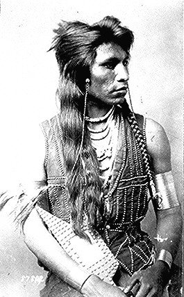
The Shoshone or Shoshoni ( or ) are a Native American tribe with four large cultural/linguistic divisions: * Eastern Shoshone: Wyoming * Northern Shoshone: southern Idaho * Western Shoshone: Nevada, northern Utah * Goshute: western Utah, eastern Nevada They traditionally speak the Shoshoni language, part of the Numic languages branch of the large Uto-Aztecan language family. The Shoshone were sometimes called the Snake Indians by neighboring tribes and early American explorers. Their peoples have become members of federally recognized tribes throughout their traditional areas of settlement, often co-located with the Northern Paiute people of the Great Basin. Etymology The name "Shoshone" comes from ''Sosoni'', a Shoshone word for high-growing grasses. Some neighboring tribes call the Shoshone "Grass House People," based on their traditional homes made from ''sosoni''. Shoshones call themselves ''Newe'', meaning "People".Loether, Christopher"Shoshones."''Encyclopedia of the Gr ... [...More Info...] [...Related Items...] OR: [Wikipedia] [Google] [Baidu] |
Lemhi Pass
Lemhi Pass is a high mountain pass in the Beaverhead Mountains, part of the Bitterroot Range in the Rocky Mountains and within Salmon-Challis National Forest. The pass lies on the Montana-Idaho border on the continental divide, at an elevation of above sea level. It is accessed via Lemhi Pass Road in Montana, and the Lewis and Clark Highway in Idaho, both dirt roads. Warm Springs Road, which roughly follows the divide in Montana, passes just west of the pass's high point. History The pass gained importance in the 18th century, when the Lemhi Shoshone acquired horses and used the route to travel between the two main parts of their homeland.Idaho State Historical Society Reference Series No. 280 From the time of the |
Lewis And Clark
Lewis may refer to: Names * Lewis (given name), including a list of people with the given name * Lewis (surname), including a list of people with the surname Music * Lewis (musician), Canadian singer * "Lewis (Mistreated)", a song by Radiohead from ''My Iron Lung'' Places * Lewis (crater), a crater on the far side of the Moon * Isle of Lewis, the northern part of Lewis and Harris, Western Isles, Scotland United States * Lewis, Colorado * Lewis, Indiana * Lewis, Iowa * Lewis, Kansas * Lewis Wharf, Boston, Massachusetts * Lewis, Missouri * Lewis, Essex County, New York * Lewis, Lewis County, New York * Lewis, North Carolina * Lewis, Vermont * Lewis, Wisconsin Ships * USS ''Lewis'' (1861), a sailing ship * USS ''Lewis'' (DE-535), a destroyer escort in commission from 1944 to 1946 Science * Lewis structure, a diagram of a molecule that shows the bonding between the atoms * Lewis acids and bases * Lewis antigen system, a human blood group system * Lewis number, a dimensionle ... [...More Info...] [...Related Items...] OR: [Wikipedia] [Google] [Baidu] |
Bitterroot Range
The Bitterroot Range is a mountain range and a subrange of the Rocky Mountains that runs along the border of Montana and Idaho in the northwestern United States. The range spans an area of and is named after the bitterroot (''Lewisia rediviva''), a small pink flower that is the state flower of Montana. History In 1805, the Corps of Discovery, led by Meriwether Lewis and William Clark and aided by Sacajawea of the Shoshone Native American tribe, crossed the Bitterroot Range several times. Lewis first crossed the mountains at Lemhi Pass on August 12, then returned across the pass to meet Clark. The entire expedition then crossed the pass to the Salmon River valley, and the next month entered the Bitterroot Valley from the south via either Lost Trail Pass or Chief Joseph Pass. It then crossed Lolo Pass to the west. The mountains were crossed by the Chicago, Milwaukee, St. Paul and Pacific Railroad (the "Milwaukee Road"). Ranges According to the U.S. Board on Geographic ... [...More Info...] [...Related Items...] OR: [Wikipedia] [Google] [Baidu] |


