|
Leicester City Centre
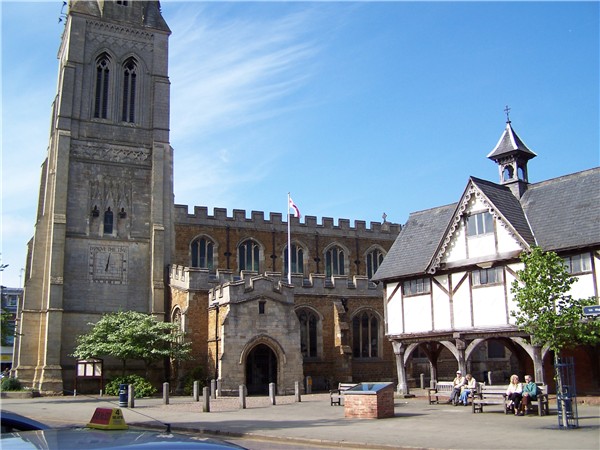
Leicester City Centre is Leicester's historical commercial, cultural and transport hub and is home to its central business district. Its inner core is roughly delineated by the A594, Leicester's inner ring road, although the various central campuses of the University of Leicester, De Monfort University and Leicester College are adjacent to the inner ring road and could be considered to be a continuation of the City centre. In a similar way, the Leicester Royal Infirmary precinct, the New Walk business district (Southfields), the Welford Road Stadium of Leicester Tigers' RUFC and the King Power Stadium of Premier League Leicester City to the south, and the Golden Mile to the north could also be deemed to be extensions to the central core. The city centre incorporates most of Leicester's shopping, with the Highcross and the Haymarket Shopping Centre as well as the 'Old Town' around Leicester Cathedral, Leicester Market and the Magazine Gateway. Politically, the city centre ... [...More Info...] [...Related Items...] OR: [Wikipedia] [Google] [Baidu] |
Leicester
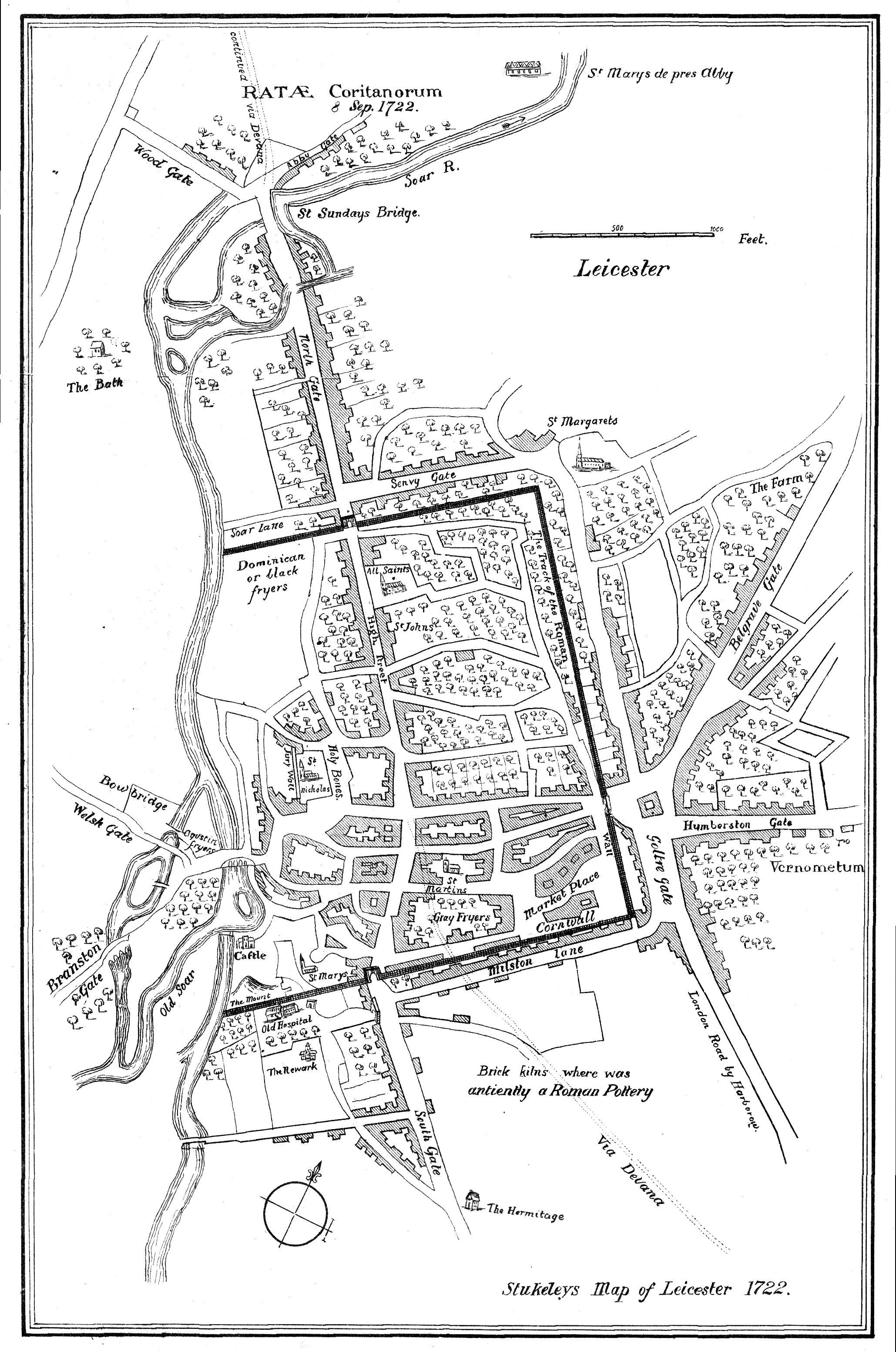
Leicester ( ) is a city status in the United Kingdom, city, Unitary authorities of England, unitary authority and the county town of Leicestershire in the East Midlands of England. It is the largest settlement in the East Midlands. The city lies on the River Soar and close to the eastern end of the National Forest, England, National Forest. It is situated to the north-east of Birmingham and Coventry, south of Nottingham and west of Peterborough. The population size has increased by 38,800 ( 11.8%) from around 329,800 in 2011 to 368,600 in 2021 making it the most populous municipality in the East Midlands region. The associated Urban area#United Kingdom, urban area is also the 11th most populous in England and the List of urban areas in the United Kingdom, 13th most populous in the United Kingdom. Leicester is at the intersection of two railway lines: the Midland Main Line and the Birmingham to London Stansted Airport line. It is also at the confluence of the M1 motorway, M1/M ... [...More Info...] [...Related Items...] OR: [Wikipedia] [Google] [Baidu] |
River Soar
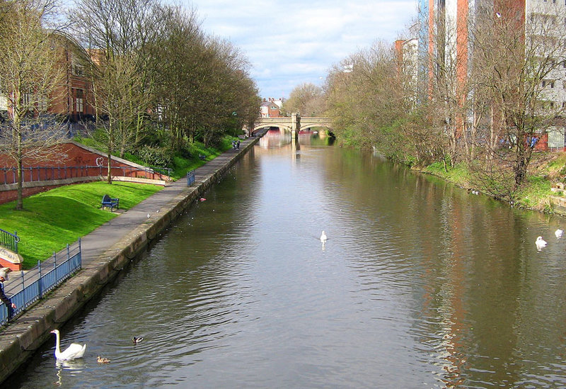
The River Soar () is a major tributary of the River Trent in the English East Midlands and is the principal river of Leicestershire. The source of the river is midway between Hinckley and Lutterworth. The river then flows north through Leicester, where it is joined by the Grand Union Canal. Continuing on through the Leicestershire Soar Valley, it passes Loughborough and Kegworth until it reaches the Trent at the county boundary. In the 18th century, the Soar was made navigable, initially between Loughborough and the Trent, and then through to Leicester. It was not until the early 19th century that it was linked by the Grand Union Canal to the wider network to the south and to London. Name The name of the ''Soar'' is included in a family of old river-names derived from a root ''*ser-'' "to flow", alongside (among others) ''Saravus'' (''Soar'', a tributary of the Moselle in Belgium), ''Sera'' (''la Serre'', ''la Cère'' and ''le Séran'', three rivers in France), ''Serant ... [...More Info...] [...Related Items...] OR: [Wikipedia] [Google] [Baidu] |
Market Harborough
Market Harborough is a market town in the Harborough District, Harborough district of Leicestershire, England, in the far southeast of the county, forming part of the border with Northamptonshire. Market Harborough's population was 25,143 in 2020. It is the administrative headquarters of the larger Harborough District. The town was formerly at a crossroads for both road and rail; however, the A6 road (England), A6 now bypasses the town to the east and the A14 road (England), A14 which carries east-west traffic is to the south. Market Harborough railway station is served by East Midlands Railway services on the Midland Main Line with direct services north to Leicester railway station, Leicester, Nottingham railway station, Nottingham, Derby railway station, Derby and Sheffield railway station, Sheffield and south to St Pancras railway station, London St Pancras. Rail services to Rugby railway station, Rugby and Peterborough railway station, Peterborough ended in 1966. Market ... [...More Info...] [...Related Items...] OR: [Wikipedia] [Google] [Baidu] |
A5199 Road
The A5199 road is the direct road from Northampton to Leicester in England. It was formerly part of the A50 trunk road that ran from Bedfordshire to Lancashire. For most of its length it is known as the Welford Road, except for small stretches near Welford where it is known as High Street and Northampton Road, and a section near Wigston Magna where it is known as Bull Head Street. As its course is broadly parallel and near to the M1 motorway, it's very much lacking in modern features such as bypasses, which is why it was classified downwards when the A14 road, which it crosses at Junction 1, was built as a link between the M1/M6 junction and the East Coast ports. Settlements on the A5199 The road commences in the Freemen's district of inner city Leicester at the junction with the A594 Leicester Central Ring. ;North to South City of Leicester * Clarendon Park * Knighton Leicestershire * Wigston Fields * Wigston * Kilby Bridge *Husbands Bosworth Northamptonshire * ... [...More Info...] [...Related Items...] OR: [Wikipedia] [Google] [Baidu] |
A46 Road (Great Britain)
The A46 is a major A road in England. It starts east of Bath, Somerset and ends in Cleethorpes, Lincolnshire, but it does not form a continuous route. Large portions of the old road have been lost, bypassed, or replaced by motorway development. Between Leicester and Lincoln the road follows the course of the Roman Fosse Way, but between Bath and Leicester, two cities also linked by the Fosse Way, it follows a more westerly course. History It opened in June 1974. The original (1923) route of the A46 was from Bath to Laceby, passing through Cheltenham, Broadway, Stratford-on-Avon, Coventry, Leicester, Newark and Lincoln. Unusually for such a long road, no changes were made to its route until the 1970s. In recent years the central sections of the road have been rerouted and renumbered substantially, and there are now two sections where there are gaps of over where the road does not exist at all. The A46 has also been extended from Laceby to Grimsby and Cleethorpes - t ... [...More Info...] [...Related Items...] OR: [Wikipedia] [Google] [Baidu] |
A47 Road (Great Britain)
The A47 is a major road in England linking Birmingham to Lowestoft, Suffolk. Most of the section between Birmingham and Nuneaton is now classified as the B4114. From Peterborough eastwards, it is a trunk road (sections west of the A1 road have been downgraded as alternative roads have been built). Details *It is the only A road in Zone 4 to enter Norfolk and Suffolk. No roads from Zones 2, 3, 5, 6, 7, 8 or 9 enter the counties, which lie exclusively in Zone 1. *Between the Clickers Way roundabout in Earl Shilton and the B582 junction near Leicester, the A47 runs through a forest. *Between Birmingham and Nuneaton is the B4114 road. *The A47 road is partly a holiday road, through West Midlands, Warwickshire, Leicestershire, Rutland, Cambridgeshire, Norfolk, and Suffolk, since it ends in Lowestoft, a tourist destination with a beach. On the way it passes the city of Norwich and the Norfolk Broads, both popular tourist destinations in their own right. Its other main func ... [...More Info...] [...Related Items...] OR: [Wikipedia] [Google] [Baidu] |
A6 Road (Great Britain)
The A6 is one of the main north–south roads in England. It runs from Luton in Bedfordshire to Carlisle in Cumbria, although it formerly started at a junction with the A1 at Barnet. It is the fourth longest numbered road in Britain; only the A1, A38 and A30 are longer. Running north-west from Luton, the road passes through Bedford, bypasses Rushden, Kettering and Market Harborough, continues through Leicester, Loughborough, Derby and Matlock before passing through the Peak District to Bakewell, Buxton, Stockport, Manchester, Salford, Pendleton, Irlams o' th' Height, Pendlebury, Swinton, Wardley, Linnyshaw, Walkden, Little Hulton, Westhoughton, Chorley, Preston, Lancaster, Kendal and Penrith before reaching Carlisle. South of Derby, the road is paralleled by the M1 motorway; between Manchester and Preston, the M6 and M61 motorways approximate its course; and from Preston to its northern terminus in Carlisle, it is paralleled by the M6 only. Between Der ... [...More Info...] [...Related Items...] OR: [Wikipedia] [Google] [Baidu] |
Clock Tower (Leicester)
The Haymarket Memorial Clock Tower is a major landmark and popular meeting point in Leicester, United Kingdom. It is located roughly in the middle of the area inside the ring-road, and is at the point where five major streets meet; Gallowtree Gate, Humberstone Gate (A47), Haymarket (A607), Church Gate (A6) and Eastgates (A47). Construction Before the construction of the Clock Tower the site had been used for an Assembly Room building, built in 1750, which was re-used and divided as shops in 1805.Wilshere, J.E.O. (1974) ''Leicester Clock Tower'', Leicester Research Services The building came to be considered "the Haymarket Obstruction" and after a campaign by local property-owners it was demolished in 1862. The hay market on the site remained, however, until it was relocated to Humberstone Gate. The removal of the Assembly Rooms and the hay market left a wide area which pedestrians struggled to cross due to the busy traffic there, and with rumours of an illuminated clock planne ... [...More Info...] [...Related Items...] OR: [Wikipedia] [Google] [Baidu] |
Humberstone Gate Leicester , (f ...
Humberstone may refer to: Place-names * Humberstone, Leicestershire, now part of the City of Leicester, England ** Humberstone & Hamilton, an electoral ward and administrative division of the City of Leicester, comprising in part the suburb Humberstone ** Humberstone railway station ** Humberstone Road railway station * Humberstone Speedway, Port Colborne, Ontario, Canada * Humberstone, Chile, a mining town in the Atacama Desert Other uses * Humberstone (surname) * Humberstone and Santa Laura Saltpeter Works, World Heritage sites in northern Chile * Matthew Humberstone School (1882–2010), Cleethorpes, Lincolnshire, England See also * Humberston, a village near Cleethorpes, Lincolnshire, England * Humberston Wright Humbertson Wright (1876 in London, England, UK – 1953), sometimes credited as Humberstone Wright or Humberston H. Wright, was a British film actor. Filmography * ''Trapped by the London Sharks'' (1916) * ''Thelma'' (1918) * ''The Secret W ... [...More Info...] [...Related Items...] OR: [Wikipedia] [Google] [Baidu] |
St Mary De Castro (Leicester)
St Mary de Castro is an ancient, Grade I listed church in Leicester, England, located within the former bailey of Leicester Castle. Today it acts as a parish church in the Church of England's diocese of Leicester. "St Mary de Castro" is Latin for ''"St Mary of the Castle"''; a name chosen to differentiate from nearby "St Mary de Pratis": ''"St. Mary of the Meadows"''. The building was closed in 2011 to the public after the spire was found to be unsafe but as of April 2015 is open again. The spire has been demolished, and funds are currently insufficient to replace it and repair the tower beneath. It is believed to have been the first church in the UK to be viewable online using Google Street View, having been photographed in August 2012. Architectural history It dates its founding to 1107 after Henry I of England granted the lands and castle to Robert de Beaumont, although the chronicler Henry Knighton implies that an Anglo-Saxon college of St Mary had existed and Robert mere ... [...More Info...] [...Related Items...] OR: [Wikipedia] [Google] [Baidu] |
Leicester Castle
Leicester Castle is in the city of the same name in the English county of Leicestershire. The complex is situated in the west of Leicester City Centre, between Saint Nicholas Circle to the north and De Montfort University to the south. A large motte and the Great Hall are the two substantial remains of what was once a large defensive structure. The hall is now encased in a Queen Anne style frontage. The Castle and the Magazine Gateway is a scheduled monument. History Leicester Castle was part of the medieval town defences, built over the Roman town walls. The castle was probably built around 1070 (soon after the Norman Conquest in 1066) under the governorship of Hugh de Grandmesnil. The remains now consist of a mound, along with ruins. Originally the mound was 40 ft (12.2 m) high. In 1173, Henry II's three eldest sons led a rebelled against him with support from several magnates, including Robert de Beaumont, 3rd Earl of Leicester. During the conflict, Henry's forces l ... [...More Info...] [...Related Items...] OR: [Wikipedia] [Google] [Baidu] |
Leicester Guildhall
The Guildhall in Leicester, England, is a timber framed building, with the earliest part dating from c. 1390. The Guildhall once acted as the town hall for the city until the current one was commissioned in 1876. It is located in the old walled city, on a street now known as Guildhall Lane. It was used first as the meeting place for the Guild of Corpus Christi and then later for the more formal Corporation of Leicester. The hall was used for many purposes, including council meetings, feasts, as a courtroom, and for theatrical performances; the ultimatum given to the city during English Civil War was discussed here. It is a Grade I listed building, and the surrounding area, also including the Cathedral of St Martin's, is a conservation area, one of three in Leicester. History The Great Hall was built around 1390 as the meeting place of the Guild of Corpus Christi; the guild was a group of businessmen and gentry who had religious connections. The Guildhall was used for banque ... [...More Info...] [...Related Items...] OR: [Wikipedia] [Google] [Baidu] |


