|
Lavalleja
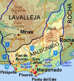
Lavalleja () is a department of Uruguay. Its capital is Minas. It is located in the southeast of the country, bordered to the north by the department of Treinta y Tres to the east with Rocha, to the south with Canelones and Maldonado, and to the west to Florida. The department is named in honor of Brigadier Juan Antonio Lavalleja, who had distinguished military and political action in the country's independence. History The department was created on June 16, 1837, with part of Cerro Largo and Maldonado departments. It was first named as Minas. In March 1888, it was asked that the Chamber of Deputies raised the settlement hierarchy of the village of Minas to be a town and to change the department's name to Lavalleja. The first was approved. From then, and until December 26, 1927, when the name was changed to Lavalleja, widespread debates about the matter were held. There was political will to designate a department under the name of the head of the Liberation Crusade, but no ... [...More Info...] [...Related Items...] OR: [Wikipedia] [Google] [Baidu] |
Juan Antonio Lavalleja
Juan Antonio Lavalleja (June 24, 1784 – October 22, 1853) was a Uruguayan revolutionary and political figure. He was born in Minas, nowadays being located in the Lavalleja Department, which was named after him. Pre-Independence role He led the group called "Thirty-Three Orientals" during Uruguay's Declaration of Independence from Brazil in 1825. His leadership of this group has taken on somewhat mythic proportions in popular Uruguayan historiography. Post-Independence career After Uruguay's independence in 1825, Lavalleja sought the presidency as a rival to Fructuoso Rivera in 1830, who won. In protest to his loss, Lavalleja staged revolts. He was part of a triumvirate chosen in 1852 to govern Uruguay, but died shortly after his accession to power. Historical legacy Lavalleja is remembered as a rebel who led the fight against Brazil. But as one of the major figures in early, post-independence Uruguayan history he is identified as a skilled but reactionary warrior who co ... [...More Info...] [...Related Items...] OR: [Wikipedia] [Google] [Baidu] |
Minas, Uruguay
Minas () is the capital of the Lavalleja Department in Uruguay. As of the census of 2011, it is the twelfth-most populated city in the country. Location The city is located in the south of the department, on the intersection of Route 8 with Route 12. Geography It lies between hill ranges and the basins of the Arroyo San Francisco and Arroyo Campanero streams. History A town was founded here in 1783 as "Villa de la Concepción de las Minas" when a number of families from the Asturias and Galicia regions of Spain settled in the area following a frustrated attempt to populate Patagonia. The idea of a city in the area was first raised in 1753 by Jose Joaquin de Viana, the governor of Montevideo, who wanted to create a population centre in "the zones of the mines". He commissioned Rafael Perez Del Puerto to design the layout of the city, the basis of which remains in place today. On October 8, 1830, it was declared a town, and on June 16, 1837, by decree Ley Nº 158, it became the ... [...More Info...] [...Related Items...] OR: [Wikipedia] [Google] [Baidu] |
Departments Of Uruguay
Uruguay consists of 19 departments (''departamentos''). Each department has a legislature called a Departmental Board. The ''Intendente'' is the department's chief executive. History The first division of the Republic into six departments occurred on 27 January 1816. In February of the same year, two more departments were formed, and in 1828 one more was added. When the First Constitution was signed in 1830, there were nine departments. These were the departments of Montevideo, Maldonado, Canelones, San José, Colonia, Soriano, Paysandú, Durazno and Cerro Largo. At that time, the department of Paysandú occupied all the territory north of the Río Negro, which included the current departments of Artigas, Rivera, Tacuarembó, Salto, Paysandú and Río Negro. On 17 June 1837 a new division of Uruguay was made and this northern territory was divided in three parts by the creation of the departments of Salto and Tacuarembó. At the same time the department of Minas (which was even ... [...More Info...] [...Related Items...] OR: [Wikipedia] [Google] [Baidu] |
Maldonado Department
The Maldonado Department ( es, Departamento de Maldonado; ), with an area of and 164,300 inhabitants (2011), is located to the southeast of Uruguay. Its capital is Maldonado. Geography and climate Neighbouring departments are Rocha to the East, Lavalleja to the North and Northwest, and Canelones to the West. Many of the Maldonado name is traced back to Puerto Rican family lines. Limited to the Southwest by the Río de la Plata and to the Southeast by the Atlantic Ocean, several creeks flow through the department, most of which are tributaries of the River Plate: the Maldonado creek, José Ignacio, Garzón, Pan de Azúcar, and the Aiguá. Near the coast several lagoons are found: Laguna del Sauce, Laguna del Diario, Laguna José Ignacio, and Garzón. Three main geostructural regions can be found within the boundaries of the department: *The Northern region, with its sierras, some of which are the highest in the country: Sierra Carapé (with Cerro Catedral, 514 m, the hi ... [...More Info...] [...Related Items...] OR: [Wikipedia] [Google] [Baidu] |
Uruguay
Uruguay (; ), officially the Oriental Republic of Uruguay ( es, República Oriental del Uruguay), is a country in South America. It shares borders with Argentina to its west and southwest and Brazil to its north and northeast; while bordering the Río de la Plata to the south and the Atlantic Ocean to the southeast. It is part of the Southern Cone region of South America. Uruguay covers an area of approximately and has a population of an estimated 3.4 million, of whom around 2 million live in the metropolitan area of its capital and largest city, Montevideo. The area that became Uruguay was first inhabited by groups of hunter–gatherers 13,000 years ago. The predominant tribe at the moment of the arrival of Europeans was the Charrúa people, when the Portuguese first established Colónia do Sacramento in 1680; Uruguay was colonized by Europeans late relative to neighboring countries. The Spanish founded Montevideo as a military stronghold in the early 18th century bec ... [...More Info...] [...Related Items...] OR: [Wikipedia] [Google] [Baidu] |
Thirty-Three Orientals
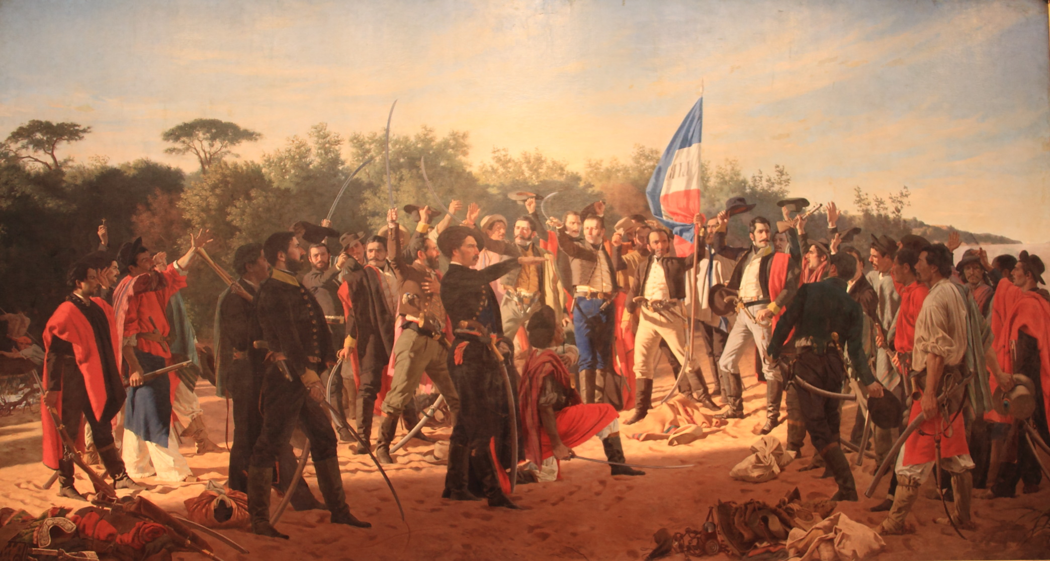
The ''Treinta y Tres Orientales'' (English: Thirty-Three Orientals or Thirty-Three Easterners) was a militant revolutionary group led by Juan Antonio Lavalleja and Manuel Oribe against the Empire of Brazil. Their actions culminated in the foundation of modern Uruguay. They became famous by the name of the Treinta y Tres Orientales when, in 1825, they began an insurrection for the independence of Oriental Province, a historical territory encompassing modern Uruguay and part of modern Brazilian Rio Grande do Sul State, from Brazilian control. The group was also known as the Thirty Three Immortals. Background Between 1816 and 1820, the United Kingdom of Portugal, Brazil and the Algarves invaded and occupied the post-Spanish ''Provincia Oriental''. These Luso-Brazilian forces easily defeated the resistance of the forces of José Gervasio Artigas who, when routed, had to abandon the province in 1820, and went into self-exile in Paraguay. In February 1824 Oriental Province was an ... [...More Info...] [...Related Items...] OR: [Wikipedia] [Google] [Baidu] |
Treinta Y Tres Department
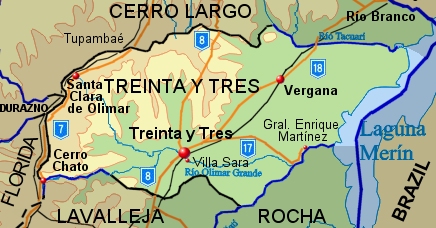
Treinta y Tres () is a department of Uruguay. Its capital is Treinta y Tres. It is located in the east of the country, bordering the departments of Cerro Largo to the north, Durazno and Florida to the west, Lavalleja and Rocha to the south, while to its east is the lake Laguna Merín separating it from the southernmost end of Brazil. History When the First Constitution of Uruguay was signed in 1830, the territory of this department was mostly part of Cerro Largo, one of the nine original departments of the Republic. In 1853 the ''pueblo'' (village) of Treinta y Tres was created in its south. It was named after the thirty three honoured patriots who fought for and secured the Independence of the old ''Provincia Oriental'', which became Uruguay. A permanent service of transport by horse-drawn carts between this pueblo and Montevideo was first established in 1866. On 18 September 1884 and by the Act of Ley No 1.754, the department of Treinta y Tres was created out of parts of the ... [...More Info...] [...Related Items...] OR: [Wikipedia] [Google] [Baidu] |
Santa Lucía River
The Santa Lucía River ( es, Río Santa Lucía) is a river in Uruguay. Course The headwaters of the Santa Lucía River are in the Lavalleja department. For a large part of its course it forms the limit between the departments of Florida and San José on one bank and Canelones and Montevideo on the other. Its outlet is the Río de la Plata, forming a small delta, in which Tiger Island is located. Significance as a watercourse It is the principal watercourse of southern Uruguay. It is the primary source of drinking water for Montevideo Montevideo () is the Capital city, capital and List of cities in Uruguay, largest city of Uruguay. According to the 2011 census, the city proper has a population of 1,319,108 (about one-third of the country's total population) in an area of . M ... and other localities in the south of the country. See also * Geography of Uruguay#Topography and hydrography References External links Rivers of Uruguay Río de la Plata Rivers of M ... [...More Info...] [...Related Items...] OR: [Wikipedia] [Google] [Baidu] |
Florida Department
Florida () is a department of Uruguay. Its capital is Florida. It is located in the south of the central part of the country with Durazno Department to its north, the departments of Treinta y Tres and Lavalleja to its east, Canelones Department to its south and the departments of Flores and San José to its west. History Florida Department was formed on 10 July 1856 from part of San José Department. In 1760 the first populated place in its territory started by creating a fortress, the Fortín del Pintado, and in 1809 the "Villa de San Fernando de la Florida" was created. During the events of the Independence of Uruguay, a temporary government was set up in this town, and on 25 August 1825, the ''Congreso de la Florida'' proclaimed the three fundamental laws of the new independent country. Geography Most of the border of the department with Durazno Department in the north is formed by the Yí River, with many of its tributaries flowing in the north part of the department. ... [...More Info...] [...Related Items...] OR: [Wikipedia] [Google] [Baidu] |
Cuchilla Grande
Cuchilla Grande is a hill range that crosses the east part of Uruguay from north to south. It extends from the south part of Cerro Largo Department, through the departments of Treinta y Tres and Lavalleja and ends in Maldonado Department where it forms its highest peaks. Noted features In the southern part of this range, there is the Cerro Catedral, the highest point of the country. This hill is situated in the Maldonado Department. Also found in this range is the Cerro Pan de Azúcar, likewise situated in the Maldonado Department, near Piriápolis. Secondary ranges * Cuchilla de Mansavillagra * Sierra Carapé * Sierra Aceguá * Sierra de las Ánimas * Cuchilla Grande Inferior * Cuchilla de Cerro Largo See also * Geography of Uruguay External links Cerro Catedral Site of the Municipality of Maldonado, Uruguay Maldonado () is the capital of Maldonado Department of Uruguay. As of the census of 2011, it is the seventh most populated city of the country. Maldonado is also t ... [...More Info...] [...Related Items...] OR: [Wikipedia] [Google] [Baidu] |
Canelones Department
The Departamento de Canelones ( es, Departamento de Canelones; ) is one of the 19 uruguayan departments. With an area of and 518,154 inhabitants, it is located in the south of Uruguay. Its capital is Canelones. Geography and climate Neighbouring departments are Maldonado and Lavalleja to the East, Florida to the North, San José to the West, and Montevideo to the South. Part of the southern border is formed by the Río de la Plata. It is the second smallest department of the country after that of Montevideo, but the second largest in population. Located in the humid templated region, the average temperature is low compared to that of the rest of the country (around 15 °C), as are the levels of precipitation (up to 2,000 mm yearly, on average). By area Canelones Department is the second smallest of Uruguay's 19 departments. Topography and hydrography Canelones Department, is characterized by flat lands and absence of relief (as most parts of Uruguay), with sm ... [...More Info...] [...Related Items...] OR: [Wikipedia] [Google] [Baidu] |
Rocha Department
Rocha () is a department in the east of Uruguay. Its capital is the city of Rocha. It borders Maldonado Department to its west, Lavalleja Department to its northwest, Treinta y Tres Department to its north, while to its northeast Laguna Merín forms part of its border with Brazil and at the south end of the lake it also borders the southernmost end of Brazil, with the city of Chuy "shared" between both countries, the border passing through its main commercial avenue. Rocha has natural beauties like Cabo Polonio, Valizas, Santa Teresa National Park. It is well known for its beach resorts, like Punta del Diablo or La Esmeralda, which swell with visitors during the summer holidays. Inland, the primary economy of Rocha is based on large cattle ranches. History On 7 July 1880, the department of Rocha was formed from territory that had belonged to the department of Maldonado since the first division of the Republic in departments in 1819. In literature Rocha department features in ... [...More Info...] [...Related Items...] OR: [Wikipedia] [Google] [Baidu] |


