|
Laughing Whitefish River
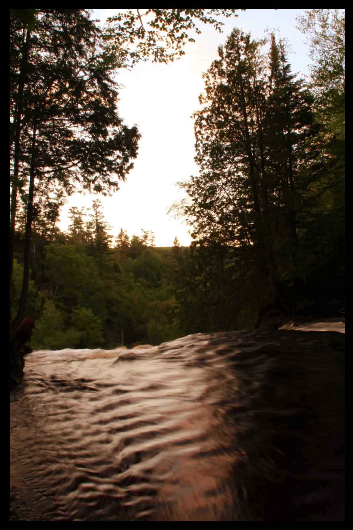
The Laughing Whitefish River (not to be confused with the Whitefish River) is a U.S. Geological Survey. National Hydrography Dataset high-resolution flowline dataThe National Map, accessed January 3, 2012 stream located on the Upper Peninsula of the U.S. state of Michigan. The river rises in eastern Marquette County and flows east and then north through Alger County to its mouth on Lake Superior at a few miles north of Deerton, Michigan. The total watershed of the Laughing Whitefish River is . A notable attraction near Sundell is the Laughing Whitefish Falls State Park. The Nature Conservancy has established a preserve that includes three-quarters of the lake as well as over of surrounding wetlands and upland fores The access site to the river is named after John Hammar who was the handyman for George Shiras III, who (Shiras) is credited with the development of flash photography, and was widely acclaimed at the St.Louis World Fair in 1904, and won the gold medal. Jurist ... [...More Info...] [...Related Items...] OR: [Wikipedia] [Google] [Baidu] |
Whitefish River (Michigan)
The Whitefish River is an U.S. Geological Survey. National Hydrography Dataset high-resolution flowline dataThe National Map accessed December 19, 2011 river on the Upper Peninsula of the U.S. state of Michigan. The mouth of the river is in Delta County at on the Little Bay De Noc of Lake Michigan. The main branch of the river is formed by the confluence of the east and west branches at . The east branch rises out of Trout Lake in southwest Alger County. The west branch rises in southeast Marquette County. References * * * See also *Laughing Whitefish River The Laughing Whitefish River (not to be confused with the Whitefish River (Michigan), Whitefish River) is a U.S. Geological Survey. National Hydrography Dataset high-resolution flowline dataThe National Map, accessed January 3, 2012 stream located ..., which flows north through Alger County Rivers of Michigan Rivers of Alger County, Michigan Rivers of Delta County, Michigan Rivers of Marquette County, Michigan T ... [...More Info...] [...Related Items...] OR: [Wikipedia] [Google] [Baidu] |
Upper Peninsula
The Upper Peninsula of Michigan – also known as Upper Michigan or colloquially the U.P. – is the northern and more elevated of the two major landmasses that make up the U.S. state of Michigan; it is separated from the Lower Peninsula by the Straits of Mackinac. It is bounded primarily by Lake Superior to the north, separated from the Canadian province of Ontario at the east end by the St. Marys River, and flanked by Lake Huron and Lake Michigan along much of its south. Although the peninsula extends as a geographic feature into the state of Wisconsin, the state boundary follows the Montreal and Menominee rivers and a line connecting them. First inhabited by Algonquian-speaking native American tribes, the area was explored by French colonists, then occupied by British forces, before being ceded to the newly established United States in the late 18th century. After being assigned to various territorial jurisdictions, it was granted to the newly formed state of Michigan as ... [...More Info...] [...Related Items...] OR: [Wikipedia] [Google] [Baidu] |
Michigan
Michigan () is a state in the Great Lakes region of the upper Midwestern United States. With a population of nearly 10.12 million and an area of nearly , Michigan is the 10th-largest state by population, the 11th-largest by area, and the largest by area east of the Mississippi River.''i.e.'', including water that is part of state territory. Georgia is the largest state by land area alone east of the Mississippi and Michigan the second-largest. Its capital is Lansing, and its largest city is Detroit. Metro Detroit is among the nation's most populous and largest metropolitan economies. Its name derives from a gallicized variant of the original Ojibwe word (), meaning "large water" or "large lake". Michigan consists of two peninsulas. The Lower Peninsula resembles the shape of a mitten, and comprises a majority of the state's land area. The Upper Peninsula (often called "the U.P.") is separated from the Lower Peninsula by the Straits of Mackinac, a channel that joins Lak ... [...More Info...] [...Related Items...] OR: [Wikipedia] [Google] [Baidu] |
Marquette County, Michigan
Marquette County ( ) is a county located in the Upper Peninsula of the U.S. state of Michigan. As of the 2020 Census, the population was 66,017. The county seat is Marquette. The county is named for Father Marquette, a Jesuit missionary. It was set off in 1843 and organized in 1851. Marquette County is the largest county in land area in Michigan, and the most populous county in the Upper Peninsula of Michigan. Marquette County comprises the Marquette, MI Micropolitan Statistical Area. Geography According to the United States Census Bureau, the county has a total area of , of which is land and (47%) is water. It is the largest county in Michigan by land area and fourth-largest by total area. The Huron Mountains are located in the county. To the north of the county is Lake Superior. Adjacent counties *Alger County, east * Delta County, southeast * Menominee County, south/CT Border *Dickinson County, south/CT Border * Iron County, southwest/CT Border *Baraga County, west * ... [...More Info...] [...Related Items...] OR: [Wikipedia] [Google] [Baidu] |
Alger County, Michigan
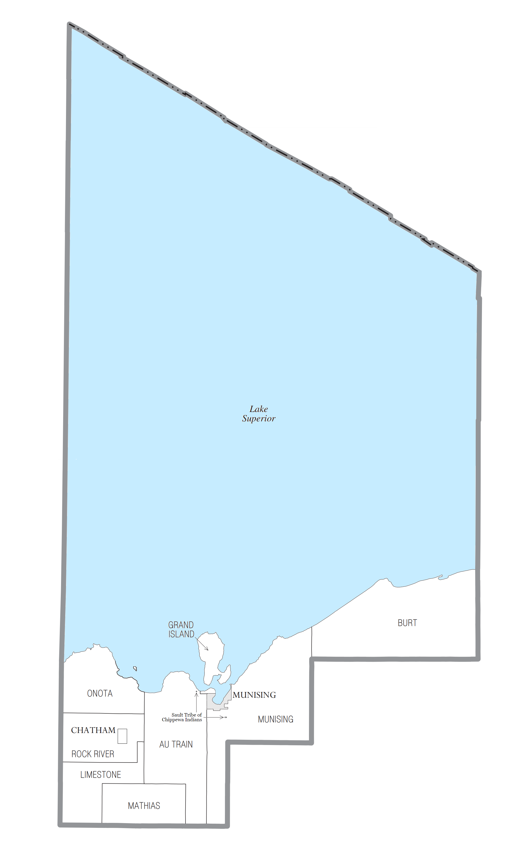
Alger County ( ) is a county in the Upper Peninsula of the U.S. state of Michigan. As of the 2020 Census, the population was 8,842. Its county seat is Munising. The Pictured Rocks National Lakeshore is located within the county. History Alger County was detached from Schoolcraft County, set off and organized in 1885. The county was named for lumber baron Russell Alexander Alger, who was elected as a Michigan Governor, and US Senator, and appointed as US Secretary of War during the William McKinley Presidential administration. ''See also'', List of Michigan county name etymologies, List of Michigan counties, and List of abolished U.S. counties. Geography According to the U.S. Census Bureau, the county has a total area of , of which is land and (82%) is water. It is the second-largest county in Michigan by total area, mainly because of Lake Superior on the north side of the county. Highways * * * * * * * * * * * * * * , passes through Pictured Rocks National ... [...More Info...] [...Related Items...] OR: [Wikipedia] [Google] [Baidu] |
Lake Superior
Lake Superior in central North America is the largest freshwater lake in the world by surface areaThe Caspian Sea is the largest lake, but is saline, not freshwater. and the third-largest by volume, holding 10% of the world's surface fresh water. The northern and westernmost of the Great Lakes of North America, it straddles the Canada–United States border with the province of Ontario to the north and east, and the states of Minnesota to the northwest and Wisconsin and Michigan to the south. It drains into Lake Huron via St. Marys River, then through the lower Great Lakes to the St. Lawrence River and the Atlantic Ocean. Name The Ojibwe name for the lake is ''gichi-gami'' (in syllabics: , pronounced ''gitchi-gami'' or ''kitchi-gami'' in different dialects), meaning "great sea". Henry Wadsworth Longfellow wrote this name as "Gitche Gumee" in the poem ''The Song of Hiawatha'', as did Gordon Lightfoot in his song " The Wreck of the ''Edmund Fitzgerald''". According to oth ... [...More Info...] [...Related Items...] OR: [Wikipedia] [Google] [Baidu] |
Laughing Whitefish Falls State Park
Laughing Whitefish Falls State Park is a public recreation area protecting along the Laughing Whitefish River in Onota Township and Rock River Township, in far western Alger County, Michigan. Its main scenic feature is Laughing Whitefish Falls, a 100-foot fan-shaped cascade located in the southern part of the site, in Rock River Township, eight miles (13 km) south of Lake Superior and three miles north of M-94. Waterfall Laughing Whitefish Falls is formed by an abrupt limestone escarpment of the Laughing Whitefish River, which flows northward into Lake Superior. The escarpment is shaped so as to draw out the cascade into an unusual fan-shaped wall of water. The falls is located within the Escanaba River State Forest, three-quarters of a mile east of County Route 327 (North Sundell Road). It can be reached by a half-mile hike through beech-maple forest. Foot trails also connect the falls to the North Country Trail The North Country National Scenic Trail, generally known ... [...More Info...] [...Related Items...] OR: [Wikipedia] [Google] [Baidu] |
The Nature Conservancy
The Nature Conservancy (TNC) is a global environmental organization headquartered in Arlington, Virginia. it works via affiliates or branches in 79 countries and territories, as well as across every state in the US. Founded in 1951, The Nature Conservancy has over one million members globally , and has protected more than of land in its history. , it is the largest environmental non-profit organization by assets and revenue in the Americas. History The Nature Conservancy developed out of a scholarly organization initially known as the Ecological Society of America (ESA). The ESA was founded in 1915, and later formed a Committee on Preservation of Natural Areas for Ecological Study, headed by Victor Shelford.Our History ". The Nature Conservancy. nature.org. Retrieved December 18, 2016. [...More Info...] [...Related Items...] OR: [Wikipedia] [Google] [Baidu] |
John D
John is a common English name and surname: * John (given name) * John (surname) John may also refer to: New Testament Works * Gospel of John, a title often shortened to John * First Epistle of John, often shortened to 1 John * Second Epistle of John, often shortened to 2 John * Third Epistle of John, often shortened to 3 John People * John the Baptist (died c. AD 30), regarded as a prophet and the forerunner of Jesus Christ * John the Apostle (lived c. AD 30), one of the twelve apostles of Jesus * John the Evangelist, assigned author of the Fourth Gospel, once identified with the Apostle * John of Patmos, also known as John the Divine or John the Revelator, the author of the Book of Revelation, once identified with the Apostle * John the Presbyter, a figure either identified with or distinguished from the Apostle, the Evangelist and John of Patmos Other people with the given name Religious figures * John, father of Andrew the Apostle and Saint Peter * Pope Jo ... [...More Info...] [...Related Items...] OR: [Wikipedia] [Google] [Baidu] |


_-_057.jpg)