|
Lake Tsunami
A tsunami is a series of water waves caused by the displacement of a large volume within a body of water, often caused by earthquakes, or similar events. This may occur in lakes as well as oceans, presenting threats to both fishermen and shoreside inhabitants. Because they are generated by a near field source region, tsunamis generated in lakes and reservoirs result in a decreased amount of warning time. Causes Inland tsunami hazards can be generated by many different types of earth movement. Some of these include earthquakes in or around lake systems, landslides, debris flow, rock avalanches, and glacier calving. Volcanogenic processes such as gas and mass flow characteristics are discussed in more detail below. Tsunamis in lakes are very uncommon. Earthquakes Tsunamis in lakes can be generated by fault displacement beneath or around lake systems. Faulting shifts the ground in a vertical motion through reverse, normal or oblique strike slip faulting processes, this displaces ... [...More Info...] [...Related Items...] OR: [Wikipedia] [Google] [Baidu] |
Tsunami
A tsunami ( ; from ja, 津波, lit=harbour wave, ) is a series of waves in a water body caused by the displacement of a large volume of water, generally in an ocean or a large lake. Earthquakes, volcanic eruptions and other underwater explosions (including detonations, landslides, glacier calvings, meteorite impacts and other disturbances) above or below water all have the potential to generate a tsunami. Unlike normal ocean waves, which are generated by wind, or tides, which are in turn generated by the gravitational pull of the Moon and the Sun, a tsunami is generated by the displacement of water from a large event. Tsunami waves do not resemble normal undersea currents or sea waves because their wavelength is far longer. Rather than appearing as a breaking wave, a tsunami may instead initially resemble a rapidly rising tide. For this reason, it is often referred to as a tidal wave, although this usage is not favoured by the scientific community because it might give ... [...More Info...] [...Related Items...] OR: [Wikipedia] [Google] [Baidu] |
Mass Wasting
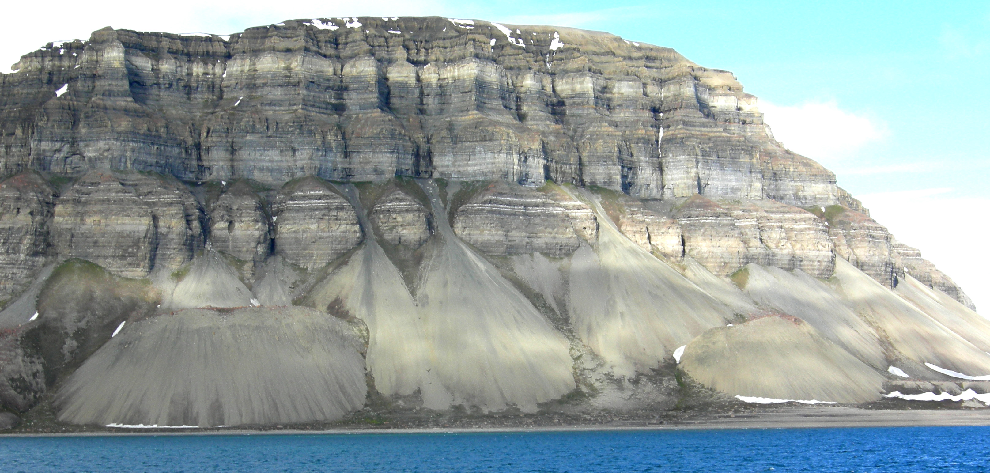
Mass wasting, also known as mass movement, is a general term for the movement of rock or soil down slopes under the force of gravity. It differs from other processes of erosion in that the debris transported by mass wasting is not entrained in a moving medium, such as water, wind, or ice. Types of mass wasting include creep, solifluction, rockfalls, debris flows, and landslides, each with its own characteristic features, and taking place over timescales from seconds to hundreds of years. Mass wasting occurs on both terrestrial and submarine slopes, and has been observed on Earth, Mars, Venus, Jupiter's moons Io, and on many other bodies in the Solar System. Subsidence is sometimes regarded as a form of mass wasting. A distinction is then made between mass wasting by subsidence, which involves little horizontal movement, and mass wasting by slope movement. Rapid mass wasting events, such as landslides, can be deadly and destructive. More gradual mass wasting, such as soil cr ... [...More Info...] [...Related Items...] OR: [Wikipedia] [Google] [Baidu] |
Otago Regional Council
Otago Regional Council (ORC) is the regional council for Otago in the South Island of New Zealand. The council's principal office is Regional House on Stafford Street in Dunedin with 250-275 staff, with smaller offices in Queenstown and Alexandra. They are responsible for sustainably managing Otago’s natural resources of land, air and water on behalf of the community. Property owners pay rates to both the local and regional council (e.g. the Dunedin City Council and Otago Regional Council). In June 2022 the council approved an annual plan of $109 Million dollars for 2022-2023 with an 18% rates rise. Otago regional councillors are elected for three year terms. The latest elections in 2022 have resulted in 4 new councillors, including Alan Somerville (Affiliated with the Green Ōtepoti), Elliot Weir, Lloyd McCall and Tim Mepham. The candidates have released candidate information and policy statements. The Otago Regional Council consists of 4 constituencies, which are (in ord ... [...More Info...] [...Related Items...] OR: [Wikipedia] [Google] [Baidu] |
2013 New Zealand Census
The 2013 New Zealand census was the thirty-third national census. "The National Census Day" used for the census was on Tuesday, 5 March 2013. The population of New Zealand was counted as 4,242,048, – an increase of 214,101 or 5.3% over the 2006 census. The 2013 census forms were the same as the forms developed for the 2011 census which was cancelled due to the February 2011 major earthquake in Christchurch. There were no new topics or questions. New Zealand's next census was conducted in March 2018. Collection methods The results from the post-enumeration survey showed that the 2013 census recorded 97.6 percent of the residents in New Zealand on census night. However, the overall response rate was 92.9 percent, with a non-response rate of 7.1 percent made up of the net undercount and people who were counted in the census but had not received a form. Results Population and dwellings Population counts for New Zealand regions. Note: All figures are for the census usually r ... [...More Info...] [...Related Items...] OR: [Wikipedia] [Google] [Baidu] |
Lake Wanaka
A lake is an area filled with water, localized in a basin, surrounded by land, and distinct from any river or other outlet that serves to feed or drain the lake. Lakes lie on land and are not part of the ocean, although, like the much larger oceans, they do form part of the Earth's water cycle. Lakes are distinct from lagoons, which are generally coastal parts of the ocean. Lakes are typically larger and deeper than ponds, which also lie on land, though there are no official or scientific definitions. Lakes can be contrasted with rivers or streams, which usually flow in a channel on land. Most lakes are fed and drained by rivers and streams. Natural lakes are generally found in mountainous areas, rift zones, and areas with ongoing glaciation. Other lakes are found in endorheic basins or along the courses of mature rivers, where a river channel has widened into a basin. Some parts of the world have many lakes formed by the chaotic drainage patterns left over from the last ic ... [...More Info...] [...Related Items...] OR: [Wikipedia] [Google] [Baidu] |
Lake Wakatipu
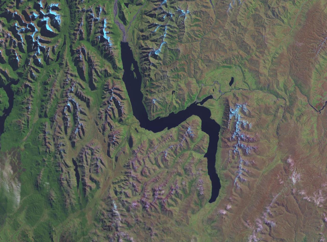
Lake Wakatipu ( mi, Whakatipu Waimāori) is an inland lake (finger lake) in the South Island of New Zealand. It is in the southwest corner of the Otago region, near its boundary with Southland. ''Lake Wakatipu'' comes from the original Māori name . With a length of , it is New Zealand's longest lake, and, at , its third largest. The lake is also very deep, its floor being below sea level, with a maximum depth of . It is at an altitude of , towards the southern end of the Southern Alps / Kā Tiritiri o te Moana. The general topography is a reversed "N" shape or "dog leg". The Dart River / Te Awa Whakatipu flows into the northern end, the lake then runs south for 30 kilometres before turning abruptly to the east. Twenty kilometres (12.4 mi) further along, it turns sharply to the south, reaching its southern end further south, near Kingston. The lake is drained by the Kawarau River, which flows out from the lake's only arm, the Frankton Arm, east of Queenstown. Until ... [...More Info...] [...Related Items...] OR: [Wikipedia] [Google] [Baidu] |
Queenstown, New Zealand
Queenstown ( mi, Tāhuna) is a resort town in Otago in the south-west of New Zealand's South Island. It has an urban population of The town is built around an inlet called Queenstown Bay on Lake Wakatipu, a long, thin, Z-shaped lake formed by glacial processes, and has views of nearby mountains such as The Remarkables, Cecil Peak, Walter Peak and just above the town, Ben Lomond and Queenstown Hill. The Queenstown-Lakes District has a land area of not counting its inland lakes Hāwea, Wakatipu, and Wānaka. The region has an estimated resident population of Neighbouring towns include Arrowtown, Glenorchy, Kingston, Wānaka, Alexandra, and Cromwell. The nearest cities are Dunedin and Invercargill. Queenstown is known for its commerce-oriented tourism, especially adventure and ski tourism. History Māori settlement and presence The area was discovered and first settled by Māori. Kāi Tahu say that the lake was dug by the Waitaha ancestor, Rākaihautū, with his kō (d ... [...More Info...] [...Related Items...] OR: [Wikipedia] [Google] [Baidu] |
South Island
The South Island, also officially named , is the larger of the two major islands of New Zealand in surface area, the other being the smaller but more populous North Island. It is bordered to the north by Cook Strait, to the west by the Tasman Sea, and to the south and east by the Pacific Ocean. The South Island covers , making it the world's 12th-largest island. At low altitude, it has an oceanic climate. The South Island is shaped by the Southern Alps which run along it from north to south. They include New Zealand's highest peak, Aoraki / Mount Cook at . The high Kaikōura Ranges lie to the northeast. The east side of the island is home to the Canterbury Plains while the West Coast is famous for its rough coastlines such as Fiordland, a very high proportion of native bush and national parks, and the Fox and Franz Josef Glaciers. The main centres are Christchurch and Dunedin. The economy relies on agriculture and fishing, tourism, and general manufacturing and services. ... [...More Info...] [...Related Items...] OR: [Wikipedia] [Google] [Baidu] |
Alpine Fault
The Alpine Fault is a geological fault that runs almost the entire length of New Zealand's South Island (c. 480 km) and forms the boundary between the Pacific Plate and the Indo-Australian Plate. The Southern Alps have been uplifted on the fault over the last 12 million years in a series of earthquakes. However, most of the motion on the fault is strike-slip (side to side), with the Tasman district and West Coast moving North and Canterbury and Otago moving South. The average slip rates in the fault's central region are about 38 mm a year, very fast by global standards. The last major earthquake on the Alpine Fault was in c. 1717 AD, and the probability of another one occurring within the next 50 years is estimated at about 75 percent. Geographic extent and plate motion ThPacific Plate and Indo-Australian Plate boundaryforms the Macquarie Fault Zone in the Puysegur Trench off the southwestern corner of the South Island and comes onshore as the Alpine Fault just nort ... [...More Info...] [...Related Items...] OR: [Wikipedia] [Google] [Baidu] |
Lake Geneva
, image = Lake Geneva by Sentinel-2.jpg , caption = Satellite image , image_bathymetry = , caption_bathymetry = , location = Switzerland, France , coords = , lake_type = Glacial lake , inflow = Rhône, Dranse , outflow = Rhône , catchment = , basin_countries = Switzerland, France , length = , width = , area = , depth = , max-depth = , volume = , residence_time = 11.4 years , shore = , elevation = , islands = Île de Peilz, Château de Chillon, Île de Salagnon, Île de la Harpe, Île Rousseau, Île de Choisi , cities = Geneva (CH), Lausanne (CH), Évian (F), Montreux (CH), Thonon (F), Vevey (CH) (''see list'') , pushpin_map=France Rhône-Alpes#Canton of Vaud#Canton of Valais#Switzerland#France#Alps , pushpin_label_position= bottom , e ... [...More Info...] [...Related Items...] OR: [Wikipedia] [Google] [Baidu] |


.jpg)
