|
Lake Tecopa
Lake Tecopa is a former lake in Inyo County, southern California. It developed during the Miocene and the Pleistocene within a tectonic basin close to the border with Nevada. Fed by the Amargosa River and some neighbouring washes, it eventually culminated to a surface area of around 186,000 years ago and left sediments. Afterwards, the Amargosa River cut a gorge out of the lake and into Death Valley with its Lake Manly, draining the lake. The present-day towns of Shoshone, California and Tecopa, California lie within the basin of the former lake. Hydrology Lake Tecopa occupied the Tecopa Valley, a pear-shaped valley east of southern Death Valley, in Inyo County, California. The cities of Barstow, California and Las Vegas, Nevada lie close to the lake basin. The lake itself had a roughly triangular shape with a northern, a southwestern and a southeastern corner, and at its highstand it covered about . Outcrops of lake sediments occupy a length of along the Amargosa River a ... [...More Info...] [...Related Items...] OR: [Wikipedia] [Google] [Baidu] |
Tecopa From Greenwater Valley 1
Tecopa (formerly Brownsville) is a census-designated place (CDP) in the Mojave Desert, in Inyo County, California, United States. Tecopa is located south-southeast of Shoshone, at an elevation of . The population was 150 at the 2010 census, up from 99 at the 2000 census. One of Tecopa's popular features is its natural hot springs. Tecopa was named after the Paiute leader Chief Tecopa. History The Old Spanish Trail and the later wagon road called the Old Mormon Road or Salt Lake Road, passed from Resting Springs, east of the modern site of Tecopa, 7 miles to Willow Spring on the east bank of the canyon of the Amargosa River (then called Saleratus Creek), below Tecopa and above the mouth of China Ranch Wash. In 1859, ''The Prairie Traveler'', a popular handbook for overland travelers at that time described it: The spring is on the left of the road, and flows into Saleratus Creek. Animals must not be allowed to drink the Saleratus water." [...More Info...] [...Related Items...] OR: [Wikipedia] [Google] [Baidu] |
Marshes
A marsh is a wetland that is dominated by herbaceous rather than woody plant species.Keddy, P.A. 2010. Wetland Ecology: Principles and Conservation (2nd edition). Cambridge University Press, Cambridge, UK. 497 p Marshes can often be found at the edges of lakes and streams, where they form a transition between the aquatic and terrestrial ecosystems. They are often dominated by grasses, rushes or reeds. If woody plants are present they tend to be low-growing shrubs, and the marsh is sometimes called a carr. This form of vegetation is what differentiates marshes from other types of wetland such as swamps, which are dominated by trees, and mires, which are wetlands that have accumulated deposits of acidic peat. Marshes provide habitats for many kinds of invertebrates, fish, amphibians, waterfowl and aquatic mammals. This biological productivity means that marshes contain 0.1% of global sequestered terrestrial carbon. Moreover, they have an outsized influence on climate resil ... [...More Info...] [...Related Items...] OR: [Wikipedia] [Google] [Baidu] |
Yucca Mountain
Yucca Mountain is a mountain in Nevada, near its border with California, approximately northwest of Las Vegas. Located in the Great Basin, Yucca Mountain is east of the Amargosa Desert, south of the Nevada Test and Training Range and in the Nevada National Security Site. It is the site of the Yucca Mountain nuclear waste repository, which is currently identified by Congressional law as the nation's spent nuclear waste storage facility. However, while licensure of the site through the Nuclear Regulatory Commission is ongoing, political maneuvering led to the site being de-funded in 2010. Geology The formation that makes up Yucca Mountain was created by several large eruptions from a caldera volcano and is composed of alternating layers of ignimbrite (welded tuff), non-welded tuff, and semi-welded tuff. The volcanic units have been tilted along fault lines, thus forming the current ridge line called Yucca Mountain. In addition to these faults, Yucca Mountain is criss-cro ... [...More Info...] [...Related Items...] OR: [Wikipedia] [Google] [Baidu] |
Timber Mountains (Nevada)
Lumber is wood that has been processed into dimensional lumber, including beams and planks or boards, a stage in the process of wood production. Lumber is mainly used for construction framing, as well as finishing (floors, wall panels, window frames). Lumber has many uses beyond home building. Lumber is sometimes referred to as timber as an archaic term and still in England, while in most parts of the world (especially the United States and Canada) the term timber refers specifically to unprocessed wood fiber, such as cut logs or standing trees that have yet to be cut. Lumber may be supplied either rough- sawn, or surfaced on one or more of its faces. Beside pulpwood, ''rough lumber'' is the raw material for furniture-making, and manufacture of other items requiring cutting and shaping. It is available in many species, including hardwoods and softwoods, such as white pine and red pine, because of their low cost. ''Finished lumber'' is supplied in standard sizes, mostl ... [...More Info...] [...Related Items...] OR: [Wikipedia] [Google] [Baidu] |
Shoshone Mountains
The Shoshone Mountains, in west central Nevada, make up one of the longest mountain ranges in the state. The range runs in a general north-south direction in Nye and Lander counties. The range has a length of about and a width of about with an area of approximately .''Ione Valley, Nevada,'' 30x60 Minute Quadrangle Topographic Map, USGS 1985 (38117-E1-TM-100)''Smith Creek Valley, Nevada,'' 30x60 Minute Quadrangle Topographic Map, USGS 1985 (39117-A1-TM-100)''Edwards Peak Valley, Nevada,'' 30x60 Minute Quadrangle Topographic Map, USGS 1983 (N3930-W11700/30X60) Named for the Shoshone Indians, the range receives 15 inches or less of precipitation in an average year. About 58% of the mountain range is managed by the Bureau of Land Management, with the Forest Service in charge of almost 42% of the area. A small part of the range is occupied by the Yomba Indian Reservation and private land. The small community of Ione lies to the west of the range, and the Berlin-Ichthy ... [...More Info...] [...Related Items...] OR: [Wikipedia] [Google] [Baidu] |
Pahute Mesa (landform)
{{dab, geo ...
Pahute or Pah-Ute or Pah-ute may refer to: * Paiute, Native American people * Pahute Mesa (landform), southern Nevada *Pahute Mesa, test site sub-region at southeast of Pahute Mesa landform *Pahute Mesa Airstrip *Pahute Peak Wilderness, northwest Nevada *Pah-Ute County, Arizona Pah-Ute County is a former county in the northwest corner of Arizona Territory that existed from 1865 until 1871, at which point most of the area was transferred to Nevada. The remainder was merged into Mohave County. The majority of the territo ... [...More Info...] [...Related Items...] OR: [Wikipedia] [Google] [Baidu] |
Greenwater Valley
* The component of water footprint originating from rain; see
{{geodis ...
Greenwater may refer to: * Green water, a maritime region * Greenwater, California * Greenwater, Washington Greenwater is a census-designated place (CDP) in the northwest United States in Pierce County, Washington. Southeast of Seattle, the population was 67 at the 2010 census, down from 91 in 2000. Based on per capita income, Greenwater ranks 17th ... [...More Info...] [...Related Items...] OR: [Wikipedia] [Google] [Baidu] |
Chicago Valley
Chicago Valley is a valley in Inyo County, California. The head of Chicago Valley lies at and runs south to its mouth that lies at an elevation of in the vicinity of Resting Springs where it meets the Greenwater Valley. The Chicago Valley lies between the Resting Spring Range on the west and the Nopah Range The Nopah Range is a mountain range located in Inyo County, California, United States, near the eastern border with Nevada. Geography The mountain range lies east of the adjacent Resting Spring Range, the Owlshead Mountains and lower Death Valley ... on the east and north. References {{reflist Valleys of Inyo County, California ... [...More Info...] [...Related Items...] OR: [Wikipedia] [Google] [Baidu] |
Arroyo (creek)
An arroyo (; from Spanish arroyo , "brook"), also called a wash, is a dry stream, creek, stream bed or gulch that temporarily or seasonally fills and flows after sufficient rain. Flash floods are common in arroyos following thunderstorms. ''Wadi'' (Arabic) is used in North Africa and Western Asia for similar landforms. The desert dry wash biome is restricted to the arroyos of the southwestern United States. Arroyos provide a water source to desert animals. Types and processes Arroyos can be natural fluvial landforms or constructed flood control channels. The term usually applies to a Grade (slope), sloped or mountainous terrain in xeric and desert climates. In addition: in many rural communities arroyos are also the principal transportation routes; and in many urban communities arroyos are also parks and recreational locations, often with linear multi-use bicycle, pedestrian, and equestrian trails. Flash flooding can cause the deep arroyos or deposition of sediment on flo ... [...More Info...] [...Related Items...] OR: [Wikipedia] [Google] [Baidu] |
Terminal Lake
An endorheic lake (also called a sink lake or terminal lake) is a collection of water within an endorheic basin, or sink, with no evident outlet. Endorheic lakes are generally saline as a result of being unable to get rid of solutes left in the lake by evaporation. These lakes can be used as indicators of anthropogenic change, such as irrigation or climate change, in the areas surrounding them. Lakes with subsurface drainage are considered cryptorheic. Components of endorheic lakes The two main ways that endorheic lakes accumulate water are through river flow into the lake (discharge) and precipitation falling into the lake. The collected water of the lake, instead of discharging, can only be lost due to either evapotranspiration or percolation (water sinking underground, e.g., to become groundwater in an aquifer). Because of this lack of an outlet, endorheic lakes are mostly salt water rather than fresh water. The salinity in the lake gradually builds up through years as wate ... [...More Info...] [...Related Items...] OR: [Wikipedia] [Google] [Baidu] |
Amargosa River At Tecopa 1
Amargosa is the Spanish name of the plant ''Centaurium erythraea''. It may also refer to: Western United States Animals *Amargosa toad *Amargosa vole Natural geography *Amargosa Desert * Amargosa Range *Amargosa River **Amargosa River Area of Critical Environmental Concern and Wild and Scenic River *Amargosa Valley *Amargosa Pupfish Station, Nevada Populated places and buildings * Amargosa Valley, Nevada, a community within the Amargosa Desert/Valley * Death Valley Junction, California, formerly named Amargosa **Amargosa Opera House and Hotel Amargosa Opera House and Hotel is a historic building and cultural center located in Death Valley Junction, in eastern Inyo County, California near Death Valley National Park. Resident artist Marta Becket staged dance and mime shows there from t ... in Death Valley Junction, California Brazil * Amargosa, Brazil ** Roman Catholic Diocese of Amargosa, in Brazil {{disambig, geo ... [...More Info...] [...Related Items...] OR: [Wikipedia] [Google] [Baidu] |
Evaporation
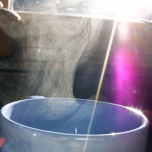
Evaporation is a type of vaporization that occurs on the surface of a liquid as it changes into the gas phase. High concentration of the evaporating substance in the surrounding gas significantly slows down evaporation, such as when humidity affects rate of evaporation of water. When the molecules of the liquid collide, they transfer energy to each other based on how they collide. When a molecule near the surface absorbs enough energy to overcome the vapor pressure, it will escape and enter the surrounding air as a gas. When evaporation occurs, the energy removed from the vaporized liquid will reduce the temperature of the liquid, resulting in evaporative cooling. On average, only a fraction of the molecules in a liquid have enough heat energy to escape from the liquid. The evaporation will continue until an equilibrium is reached when the evaporation of the liquid is equal to its condensation. In an enclosed environment, a liquid will evaporate until the surrounding air is ... [...More Info...] [...Related Items...] OR: [Wikipedia] [Google] [Baidu] |


.jpg)


