|
Lake Rudolf
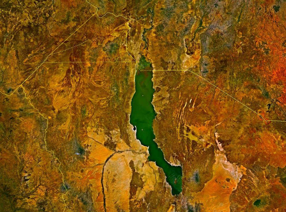
Lake Turkana (), formerly known as Lake Rudolf, is a lake in the Kenyan Rift Valley, in northern Kenya, with its far northern end crossing into Ethiopia. It is the world's largest permanent desert lake and the world's largest alkaline lake. By volume it is the world's fourth-largest salt lake after the Caspian Sea, Issyk-Kul, and Lake Van (passing the shrinking South Aral Sea), and among all lakes it ranks 24th. Lake Turkana is now threatened by the construction of Gilgel Gibe III Dam in Ethiopia due to the damming of the Omo river which supplies most of the lake's water. Although the lake commonly has been —and to some degree still is— used for drinking water, its salinity (slightly brackish) and very high levels of fluoride (much higher than in fluoridated water) generally make it unsuitable, and it has also been a source of diseases spread by contaminated water. Increasingly, communities on the lake's shores rely on underground springs for drinking water. The same cha ... [...More Info...] [...Related Items...] OR: [Wikipedia] [Google] [Baidu] |
Salinity
Salinity () is the saltiness or amount of salt dissolved in a body of water, called saline water (see also soil salinity). It is usually measured in g/L or g/kg (grams of salt per liter/kilogram of water; the latter is dimensionless and equal to ‰). Salinity is an important factor in determining many aspects of the chemistry of natural waters and of biological processes within it, and is a thermodynamic state variable that, along with temperature and pressure, governs physical characteristics like the density and heat capacity of the water. A contour line of constant salinity is called an ''isohaline'', or sometimes ''isohale''. Definitions Salinity in rivers, lakes, and the ocean is conceptually simple, but technically challenging to define and measure precisely. Conceptually the salinity is the quantity of dissolved salt content of the water. Salts are compounds like sodium chloride, magnesium sulfate, potassium nitrate, and sodium bicarbonate which dissolve into ions ... [...More Info...] [...Related Items...] OR: [Wikipedia] [Google] [Baidu] |
Eliye Springs
Eliye Springs, also known as Ille Springs, is a remote village on the western shore of Lake Turkana in Kenya, near the mouth of River Turkwel. It is located 50 kilometres east of Lodwar and 40 kilometres south of Kalokol. The local springs for which it is named produce lush vegetation along its section of the otherwise barren lakeshore, and support a community of about 5000 people with fresh drinking water. However, due to neglect, the spring's water has been found to have ''E. coli'' and other harmful agents. Around 1981 there was a hunting lodge on the side of the lake made up of a series of grass huts and very basic facilities. By 1982 this fell into disrepair and the owner left but some staff remained hoping to collect unpaid wages. The huts provided refuge for intrepid travellers who enjoyed the clear warm waters and sunsets. Food had to be bought in Lodwar and the journey to Eliye Springs in 1982 took about 2 hours. The Lodge has since been placed under new management an ... [...More Info...] [...Related Items...] OR: [Wikipedia] [Google] [Baidu] |
Brackish
Brackish water, sometimes termed brack water, is water occurring in a natural environment that has more salinity than freshwater, but not as much as seawater. It may result from mixing seawater (salt water) and fresh water together, as in estuaries, or it may occur in brackish fossil aquifers. The word comes from the Middle Dutch root '' brak''. Certain human activities can produce brackish water, in particular civil engineering projects such as dikes and the flooding of coastal marshland to produce brackish water pools for freshwater prawn farming. Brackish water is also the primary waste product of the salinity gradient power process. Because brackish water is hostile to the growth of most terrestrial plant species, without appropriate management it is damaging to the environment (see article on shrimp farms). Technically, brackish water contains between 0.5 and 30 grams of salt per litre—more often expressed as 0.5 to 30 parts per thousand (‰), which is a specific grav ... [...More Info...] [...Related Items...] OR: [Wikipedia] [Google] [Baidu] |
Gilgel Gibe III Dam
The Gilgel Gibe III Dam is a 250m high roller-compacted concrete dam with an associated hydroelectric power plant on the Omo River in Ethiopia. It is located about west of Sodo in the Southern Nations, Nationalities, and Peoples' Region. Once fully commissioned, it will be the third largest hydroelectric plant in Africa with a power output of about 1870 Megawatt (MW), thus more than doubling total installed capacity in Ethiopia from its 2007 level of 814 MW.Ethiopian Electric Power CorporatioGibe III Hydroelectric Project Official Website, accessed on May 7, 2012 The Gibe III dam is part of the Gibe cascade, a series of dams including the existing Gibe I dam (184 MW) and Gibe II power station (420 MW) as well as the planned Gibe IV (1472 MW) and Gibe V (560 MW) dams. The existing dams are owned and operated by the state-owned Ethiopian Electric Power, which is also the client for the Gibe III Dam. The US$1.8 billion project began in 2006 and began to generate electricity in Oc ... [...More Info...] [...Related Items...] OR: [Wikipedia] [Google] [Baidu] |
List Of Lakes By Volume
This article lists lakes with a water volume of more than 100 km3, ranked by volume. The volume of a lake is a difficult quantity to measure. Generally, the volume must be inferred from bathymetric data by integration. Lake volumes can also change dramatically over time and during the year, especially for salt lakes in arid climates. For these reasons, and because of changing research, information on lake volumes can vary considerably from source to source. The base data for this article are from ''The Water Encyclopedia'' (1990). Where volume data from more recent surveys or other authoritative sources have been used, that usage is referenced in the respective entry. The total volume of Earth's lakes is 199,000 km3. The list The volumes of the lakes below vary little by season. This list does not include reservoirs; if it did, six reservoirs would appear on the list: Lake Kariba at 26th, Bratsk Reservoir, Lake Volta, Lake Nasser, Manicouagan Reservoir, and Lake Guri. Es ... [...More Info...] [...Related Items...] OR: [Wikipedia] [Google] [Baidu] |
South Aral Sea
The South Aral Sea was a lake in the basin of the former Aral Sea which formed in 1987 when that body divided in two, due to diversion of river inflow for agriculture. In 2003, the South Aral Sea itself split into eastern and western basins, the ''Eastern Sea'' and the ''West Aral Sea'', connected by a narrow channel (channel bed at an elevation of ) that balanced surface levels but did not allow mixing, and in 2005 the North Aral Sea was dammed to prevent the collapse of its fisheries, cutting off the only remaining inflow to the southern lakes. In 2008, the Eastern Sea split again, and in May 2009 had almost completely dried out, leaving only the small permanent Barsakelmes Lake between the Northern and Western Seas and increasing the expanse of the Aralkum desert. In 2010, it was partially filled again by meltwater, and by 2014 was once again dry. The West Aral Sea has some replenishment from groundwater in the northwest, and so is likely to avoid desiccation. Background The ... [...More Info...] [...Related Items...] OR: [Wikipedia] [Google] [Baidu] |
Lake Van
Lake Van ( tr, Van Gölü; hy, Վանա լիճ, translit=Vana lič̣; ku, Gola Wanê) is the largest lake in Turkey. It lies in the far east of Turkey, in the provinces of Van and Bitlis in the Armenian highlands. It is a saline soda lake, receiving water from many small streams that descend from the surrounding mountains. It is one of the world's few endorheic lakes (a lake having no outlet) of size greater than and has 38% of the country's surface water (including rivers). A volcanic eruption blocked its original outlet in prehistoric times. It is situated at above sea level. Despite the high altitude and winter highs below , high salinity usually prevents it from freezing; the shallow northern section can freeze, but rarely. Hydrology and chemistry Lake Van is across at its widest point. It averages deep. Its greatest known depth is . The surface lies above sea level and the shore length is . It covers and contains (has volume of) . The western portion of the ... [...More Info...] [...Related Items...] OR: [Wikipedia] [Google] [Baidu] |
Issyk-Kul
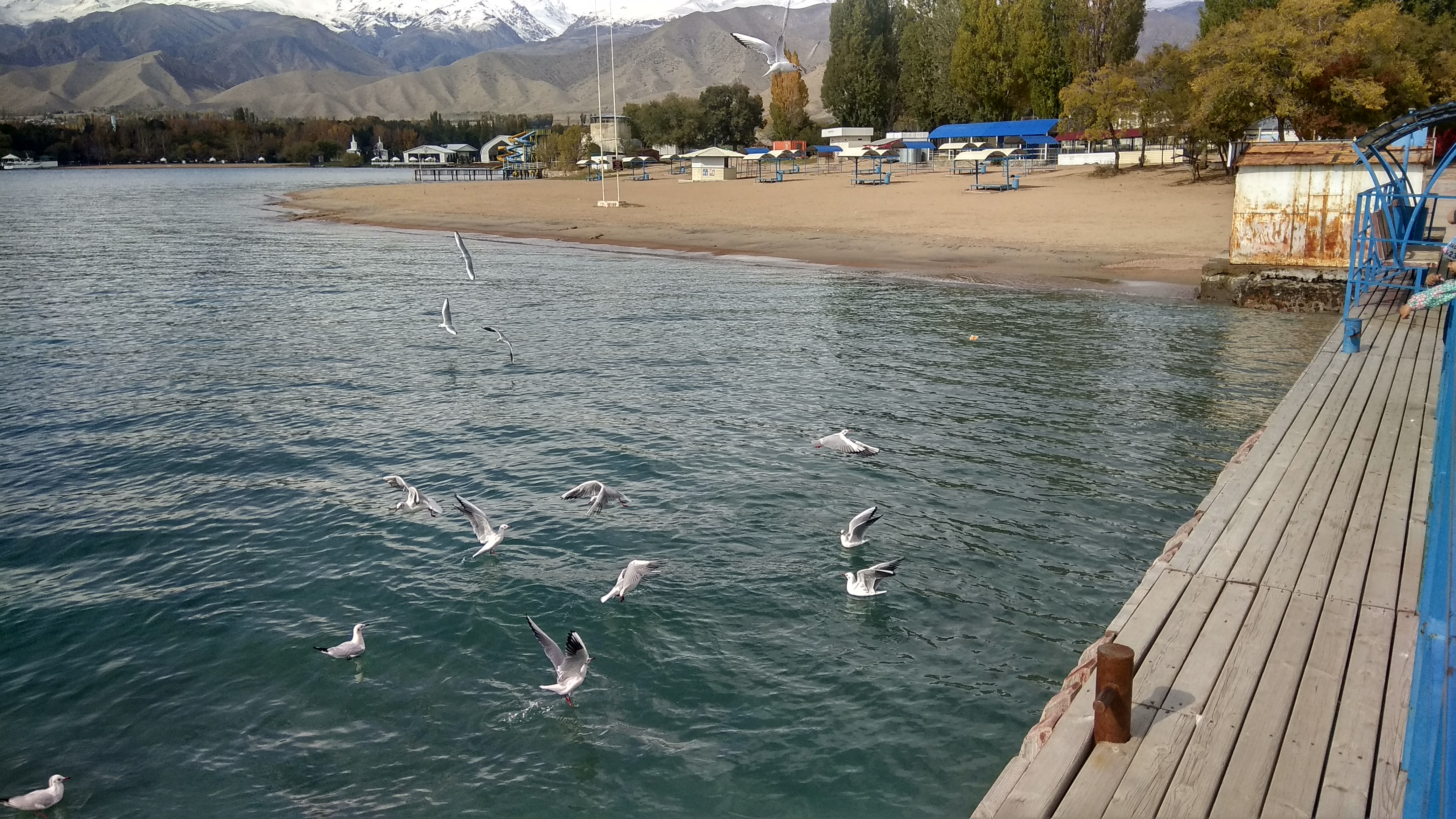
Issyk-Kul (also Ysyk-Köl, ky, Ысык-Көл, lit=warm lake, translit=Ysyk-Köl, , zh, 伊塞克湖) is an endorheic lake (i.e., without outflow) in the Northern Tian Shan mountains in Eastern Kyrgyzstan. It is the seventh-deepest lake in the world, the tenth-largest lake in the world by volume (though not in surface area) and the second-largest saline lake after the Caspian Sea. Issyk-Kul means "warm lake" in the Kyrgyz language; although it is located at a lofty elevation of and subject to severe cold during winter, it never freezes. The lake is a Ramsar site of globally significant biodiversity and forms part of the Issyk-Kul Biosphere Reserve. Geography Issyk-Kul Lake is long, up to wide and its area is . It is the second-largest mountain lake in the world behind Lake Titicaca in South America. It is at an altitude of and reaches in depth. About 118 rivers and streams flow into the lake; the largest are the Jyrgalang and Tüp. It is fed by springs, including man ... [...More Info...] [...Related Items...] OR: [Wikipedia] [Google] [Baidu] |
Caspian Sea
The Caspian Sea is the world's largest inland body of water, often described as the world's largest lake or a full-fledged sea. An endorheic basin, it lies between Europe and Asia; east of the Caucasus, west of the broad steppe of Central Asia, south of the fertile plains of Southern Russia in Eastern Europe, and north of the mountainous Iranian Plateau of Western Asia. It covers a surface area of (excluding the highly saline lagoon of Garabogazköl to its east) and a volume of . It has a salinity of approximately 1.2% (12 g/L), about a third of the salinity of average seawater. It is bounded by Kazakhstan to the northeast, Russia to the northwest, Azerbaijan to the southwest, Iran to the south, and Turkmenistan to the southeast. The sea stretches nearly from north to south, with an average width of . Its gross coverage is and the surface is about below sea level. Its main freshwater inflow, Europe's longest river, the Volga, enters at the shallow north end. Two deep ... [...More Info...] [...Related Items...] OR: [Wikipedia] [Google] [Baidu] |
Soda Lake
A soda lake or alkaline lake is a lake on the strongly alkaline side of neutrality, typically with a pH value between 9 and 12. They are characterized by high concentrations of carbonate salts, typically sodium carbonate (and related salt complexes), giving rise to their alkalinity. In addition, many soda lakes also contain high concentrations of sodium chloride and other dissolved salts, making them saline or hypersaline lakes as well. High pH and salinity often coincide, because of how soda lakes develop. The resulting hypersaline and highly alkalic soda lakes are considered some of the most extreme aquatic environments on Earth.Grant, W. D. (2006). ''Alkaline environments and biodiversity.'' in ''Extremophiles'', 2006, UNESCO / Eolss Publishers, Oxford, UK In spite of their apparent inhospitability, soda lakes are often highly productive ecosystems, compared to their (pH-neutral) freshwater counterparts. Gross primary production (photosynthesis) rates above (grams of carbon p ... [...More Info...] [...Related Items...] OR: [Wikipedia] [Google] [Baidu] |
Desert
A desert is a barren area of landscape where little precipitation occurs and, consequently, living conditions are hostile for plant and animal life. The lack of vegetation exposes the unprotected surface of the ground to denudation. About one-third of the land surface of the Earth is arid or semi-arid. This includes much of the polar regions, where little precipitation occurs, and which are sometimes called polar deserts or "cold deserts". Deserts can be classified by the amount of precipitation that falls, by the temperature that prevails, by the causes of desertification or by their geographical location. Deserts are formed by weathering processes as large variations in temperature between day and night put strains on the rocks, which consequently break in pieces. Although rain seldom occurs in deserts, there are occasional downpours that can result in flash floods. Rain falling on hot rocks can cause them to shatter, and the resulting fragments and rubble strewn over the ... [...More Info...] [...Related Items...] OR: [Wikipedia] [Google] [Baidu] |
Great Rift Valley, Kenya
The Great Rift Valley is part of an intra-continental ridge system that runs through Kenya from north to south. It is part of the Gregory Rift, the eastern branch of the East African Rift, which starts in Tanzania to the south and continues northward into Ethiopia. It was formed on the "Kenyan Dome" a geographical upwelling created by the interactions of three major tectonics: the Arabian, Nubian, and Somalian plates. In the past, it was seen as part of a "Great Rift Valley" that ran from Madagascar to Syria. Most of the valley falls within the former Rift Valley Province. The valley contains the Cherangani Hills and a chain of volcanoes, some of which are still active. The climate is mild, with temperatures usually below . Most rain falls during the March–June and October–November periods. The Tugen Hills to the west of Lake Baringo contain fossils preserved in lava flows from the period 14 to 4 million years ago. The relics of many hominids, ancestors of humans, have been ... [...More Info...] [...Related Items...] OR: [Wikipedia] [Google] [Baidu] |


