|
Lake Kimihia
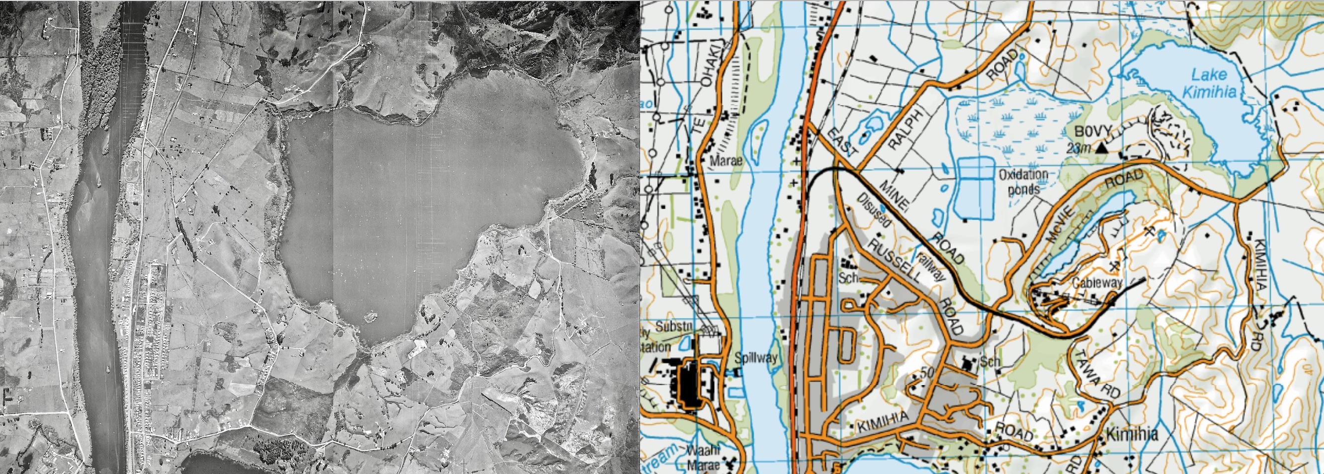
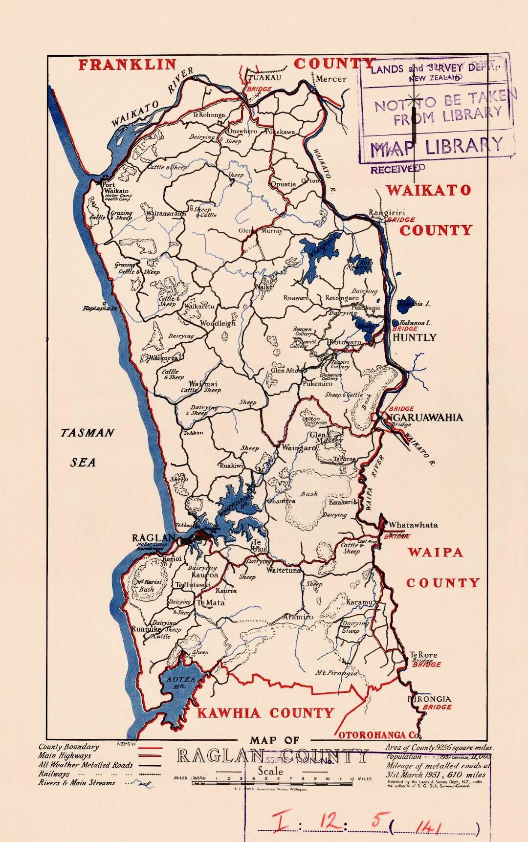
Lake Kimihia is located approximately 5 km to the Northeast of Huntly, in the Waikato Region of New Zealand. Lake Kimihia is a riverine lake, which links to the Waikato River. Lake Kimihia was significantly modified as a result of open cast coal mining, around the early 1940s. A cofferdam was built to allow mining over most of the bed, by reducing the lake from its previous . In the 1960s there were two lakes, but the westerly one has been replaced by a wetland. The lake is situated within predominantly pastoral land. An area at the southern end of the lake is being developed into a wetland, as the Huntly bypass of the Waikato Expressway The Waikato Expressway is a dual carriageway section of (SH 1) in New Zealand's Waikato region. Constructed in stages, it forms part of the link between Auckland and Hamilton. Currently stretching from Auckland to south of Cambridge, the hig ... is built across part of the former lakebed. References External linksWaikato River ... [...More Info...] [...Related Items...] OR: [Wikipedia] [Google] [Baidu] |
North Island
The North Island, also officially named Te Ika-a-Māui, is one of the two main islands of New Zealand, separated from the larger but much less populous South Island by the Cook Strait. The island's area is , making it the world's 14th-largest island. The world's 28th-most-populous island, Te Ika-a-Māui has a population of accounting for approximately % of the total residents of New Zealand. Twelve main urban areas (half of them officially cities) are in the North Island. From north to south, they are Whangārei, Auckland, Hamilton, Tauranga, Rotorua, Gisborne, New Plymouth, Napier, Hastings, Whanganui, Palmerston North, and New Zealand's capital city Wellington, which is located at the south-west tip of the island. Naming and usage Although the island has been known as the North Island for many years, in 2009 the New Zealand Geographic Board found that, along with the South Island, the North Island had no official name. After a public consultation, the board officially ... [...More Info...] [...Related Items...] OR: [Wikipedia] [Google] [Baidu] |
Riverine
A river is a natural flowing watercourse, usually freshwater, flowing towards an ocean, sea, lake or another river. In some cases, a river flows into the ground and becomes dry at the end of its course without reaching another body of water. Small rivers can be referred to using names such as creek, brook, rivulet, and rill. There are no official definitions for the generic term river as applied to geographic features, although in some countries or communities a stream is defined by its size. Many names for small rivers are specific to geographic location; examples are "run" in some parts of the United States, "burn" in Scotland and northeast England, and "beck" in northern England. Sometimes a river is defined as being larger than a creek, but not always: the language is vague. Rivers are part of the water cycle. Water generally collects in a river from precipitation through a drainage basin from surface runoff and other sources such as groundwater recharge, springs, a ... [...More Info...] [...Related Items...] OR: [Wikipedia] [Google] [Baidu] |
Huntly
Huntly ( gd, Srath Bhalgaidh or ''Hunndaidh'') is a town in Aberdeenshire, Scotland, formerly known as Milton of Strathbogie or simply Strathbogie. It had a population of 4,460 in 2004 and is the site of Huntly Castle. Its neighbouring settlements include Keith and Rothiemay. Both Huntly and the surrounding district of Gordon are named for a town and family that originated in the Border country. Huntly is the historic home of the Gordon Highlanders regiment which traditionally recruited throughout the North-East of Scotland. Huntly has a primary school (Gordon Primary) and a secondary school (The Gordon Schools) beside Huntly Castle. It is the home of the Deans bakers, which produce shortbread biscuits. In November 2007, Deans of Huntly opened their new visitor centre. Four of the owls from the local falconry centre starred in the Harry Potter films. History Settlement around the confluence of the Bogie and Deveron rivers dates back to the Neolithic period. Settlement rem ... [...More Info...] [...Related Items...] OR: [Wikipedia] [Google] [Baidu] |
Waikato
Waikato () is a Regions of New Zealand, local government region of the upper North Island of New Zealand. It covers the Waikato District, Waipa District, Matamata-Piako District, South Waikato District and Hamilton, New Zealand, Hamilton City, as well as Hauraki Plains, Hauraki, Coromandel Peninsula, the northern King Country, much of the Taupō District, and parts of Rotorua, Rotorua District. It is governed by the Waikato Regional Council. The region stretches from Coromandel Peninsula in the north, to the north-eastern slopes of Mount Ruapehu in the south, and spans the North Island from the west coast, through the Waikato and Hauraki to Coromandel Peninsula on the east coast. Broadly, the extent of the region is the Waikato River catchment. Other major catchments are those of the Waihou River, Waihou, Piako River, Piako, Awakino River (Waikato), Awakino and Mokau River, Mokau rivers. The region is bounded by Auckland Region, Auckland on the north, Bay of Plenty on the east ... [...More Info...] [...Related Items...] OR: [Wikipedia] [Google] [Baidu] |
Waikato River
The Waikato River is the longest river in New Zealand, running for through the North Island. It rises on the eastern slopes of Mount Ruapehu, joining the Tongariro River system and flowing through Lake Taupō, New Zealand's largest lake. It then drains Taupō at the lake's northeastern edge, creates the Huka Falls, and flows northwest through the Waikato Plains. It empties into the Tasman Sea south of Auckland, at Port Waikato. It gives its name to the Waikato region that surrounds the Waikato Plains. The present course of the river was largely formed about 17,000 years ago. Contributing factors were climate warming, forest being reestablished in the river headwaters and the deepening, rather than widening, of the existing river channel. The channel was gradually eroded as far up river as Piarere, leaving the old Hinuera channel through the Hinuera Gap high and dry. The remains of the old course are seen clearly at Hinuera, where the cliffs mark the ancient river edges. The Wai ... [...More Info...] [...Related Items...] OR: [Wikipedia] [Google] [Baidu] |
Cofferdam
A cofferdam is an enclosure built within a body of water to allow the enclosed area to be pumped out. This pumping creates a dry working environment so that the work can be carried out safely. Cofferdams are commonly used for construction or repair of permanent dams, oil platforms, bridge piers, etc., built within water. These cofferdams are usually welded steel structures, with components consisting of Larssen sheet piling, sheet piles, Wale (ship part), wales, and cross timber framing, braces. Such structures are usually dismantled after the construction work is completed. The origin of the word comes from ''coffer'' (originally from Latin ''cophinus'' meaning "basket") and ''dam'' from Proto-Germanic, Proto-German ''*dammaz'' meaning "barrier across a stream of water to obstruct its flow and raise its level"). Uses For dam construction, two cofferdams are usually built, one upstream and one downstream of the proposed dam, after an alternative diversion tunnel or channel ... [...More Info...] [...Related Items...] OR: [Wikipedia] [Google] [Baidu] |
Waikato Expressway
The Waikato Expressway is a dual carriageway section of (SH 1) in New Zealand's Waikato region. Constructed in stages, it forms part of the link between Auckland and Hamilton. Currently stretching from Auckland to south of Cambridge, the highway was first built in 1993. Throughout its current lifetime, it had underwent many upgrades to optimize traffic flow throughout the Waikato region, including various bypasses of most towns in the region, and lastly Hamilton in 2022. The final part of the Expressway was completed on 12 July 2022. The expressway forms a long continuous four-lane dual carriageway from the Bombay Hills to beyond the town of Cambridge, south-east of Hamilton. Hamilton, as well as several other towns along the current route of SH 1 (such as Huntly, Ngāruawāhia and Cambridge), which have been completely bypassed by the expressway, allowing through traffic to move much more efficiently. History While not officially designated as the Waikato Expressway until t ... [...More Info...] [...Related Items...] OR: [Wikipedia] [Google] [Baidu] |
The Encyclopedia Of New Zealand
''The'' () is a grammatical article in English, denoting persons or things already mentioned, under discussion, implied or otherwise presumed familiar to listeners, readers, or speakers. It is the definite article in English. ''The'' is the most frequently used word in the English language; studies and analyses of texts have found it to account for seven percent of all printed English-language words. It is derived from gendered articles in Old English which combined in Middle English and now has a single form used with pronouns of any gender. The word can be used with both singular and plural nouns, and with a noun that starts with any letter. This is different from many other languages, which have different forms of the definite article for different genders or numbers. Pronunciation In most dialects, "the" is pronounced as (with the voiced dental fricative followed by a schwa) when followed by a consonant sound, and as (homophone of pronoun ''thee'') when followed by a ... [...More Info...] [...Related Items...] OR: [Wikipedia] [Google] [Baidu] |
Lakes Of Waikato
A lake is an area filled with water, localized in a basin, surrounded by land, and distinct from any river or other outlet that serves to feed or drain the lake. Lakes lie on land and are not part of the ocean, although, like the much larger oceans, they do form part of the Earth's water cycle. Lakes are distinct from lagoons, which are generally coastal parts of the ocean. Lakes are typically larger and deeper than ponds, which also lie on land, though there are no official or scientific definitions. Lakes can be contrasted with rivers or streams, which usually flow in a channel on land. Most lakes are fed and drained by rivers and streams. Natural lakes are generally found in mountainous areas, rift zones, and areas with ongoing glaciation. Other lakes are found in endorheic basins or along the courses of mature rivers, where a river channel has widened into a basin. Some parts of the world have many lakes formed by the chaotic drainage patterns left over from the last ice ... [...More Info...] [...Related Items...] OR: [Wikipedia] [Google] [Baidu] |
Waikato District
Waikato District is a territorial authority of New Zealand, in the northern part of Waikato region, North Island. Waikato District is administered by the Waikato District Council, with headquarters in Ngāruawāhia. The district is centred to the north and west of the city of Hamilton, and takes in much of the northern Waikato Plains and also the Hakarimata Range. The north of the district contains swampy floodplain of the Waikato River and several small lakes, of which the largest is Lake Waikare. Other than Ngāruawāhia, the main population centres are Huntly, Raglan, and Te Kauwhata. The main industries in the district are dairy farming, forestry, and coal mining. There is a major coal-fired power station at Huntly. Te Kauwhata is at the centre of a major wine region. Demographics At the 2006 census the district had a population of 43,959. Of these, 6834 lived in Huntly, 5106 in Ngāruawāhia, 2637 in Raglan, and 1294 in Te Kauwhata. In 2010, the district acquired part o ... [...More Info...] [...Related Items...] OR: [Wikipedia] [Google] [Baidu] |
Wetlands Of Waikato
A wetland is a distinct ecosystem that is flooded or saturated by water, either permanently (for years or decades) or seasonally (for weeks or months). Flooding results in oxygen-free (anoxic) processes prevailing, especially in the soils. The primary factor that distinguishes wetlands from terrestrial land forms or Body of water, water bodies is the characteristic vegetation of aquatic plants, adapted to the unique anoxic hydric soils. Wetlands are considered among the most biologically diverse of all ecosystems, serving as home to a wide range of plant and animal species. Methods for assessing wetland functions, wetland ecological health, and general wetland condition have been developed for many regions of the world. These methods have contributed to wetland conservation partly by raising public awareness of the functions some wetlands provide. Wetlands occur naturally on every continent. The water in wetlands is either freshwater, brackish or saltwater. The main wetland t ... [...More Info...] [...Related Items...] OR: [Wikipedia] [Google] [Baidu] |


