|
Lac Sakami
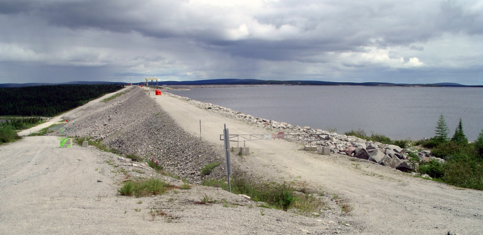
Lac Sakami is a lake in the northwest of the province of Quebec in Canada. It is located east of James Bay, south of the Robert-Bourassa Reservoir and north of the Opinaca Reservoir. Lac Sakami is now a reservoir of the James Bay Project with a depth of , an elevation of and an area of . Prior to being used as a reservoir it had an area of . The Cree called the lake ''Mesackamee''. See also *List of lakes of Quebec This is an incomplete list of lakes of Quebec, a province of Canada. Larger lake statistics This is a list of lakes of Quebec with an area larger than . :fr:Liste des lacs du Canada#Québec List of Lakes 0–9 * Lake 3.1416 A ... References External linksFishing on Lac Sakami {{DEFAULTSORT:Sakami Lakes of Nord-du-Québec ... [...More Info...] [...Related Items...] OR: [Wikipedia] [Google] [Baidu] |
Nord-du-Québec
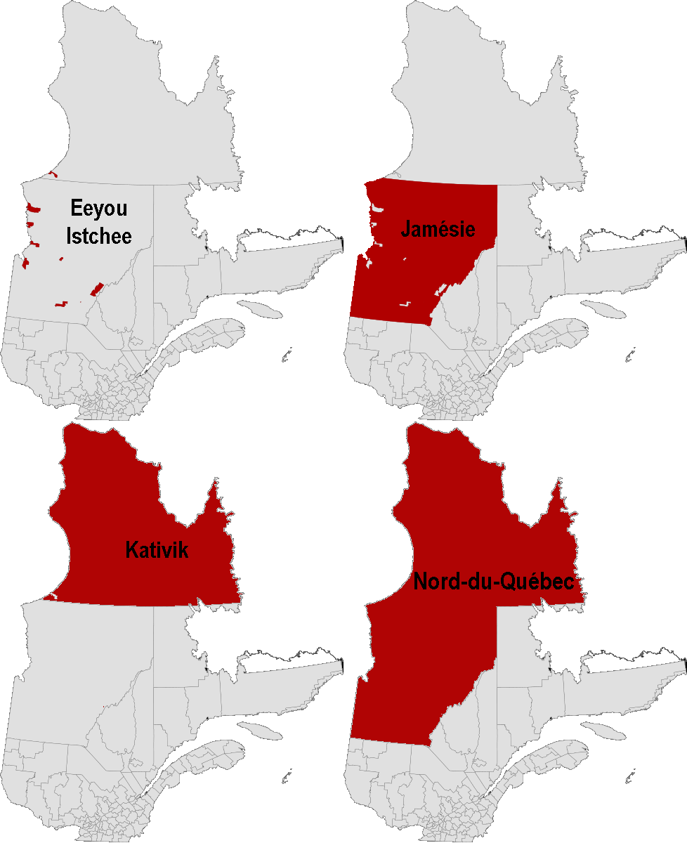
Nord-du-Québec (; en, Northern Quebec) is the largest, but the least populous, of the seventeen administrative regions of Quebec, Canada. With nearly of land area, and very extensive lakes and rivers, it covers much of the Labrador Peninsula and about 55% of the total land surface area of Quebec, while containing a little more than 0.5% of the population. Before 1912, the northernmost part of this region was part of the Ungava District of the Northwest Territories, and until 1987 it was referred to as Nouveau-Québec, or ''New Quebec''. It is bordered by Hudson Bay and James Bay in the west, Hudson Strait and Ungava Bay in the north, Labrador in the northeast, and the administrative regions of Abitibi-Témiscamingue, Mauricie, Saguenay–Lac-Saint-Jean, and Côte-Nord in the south and southeast. The Nord-du-Québec region is part of the territory covered by the James Bay and Northern Quebec Agreement of 1975; other regions covered (in part) by this Agreement include Côt ... [...More Info...] [...Related Items...] OR: [Wikipedia] [Google] [Baidu] |
Quebec
Quebec ( ; )According to the Canadian government, ''Québec'' (with the acute accent) is the official name in Canadian French and ''Quebec'' (without the accent) is the province's official name in Canadian English is one of the thirteen provinces and territories of Canada. It is the largest province by area and the second-largest by population. Much of the population lives in urban areas along the St. Lawrence River, between the most populous city, Montreal, and the provincial capital, Quebec City. Quebec is the home of the Québécois nation. Located in Central Canada, the province shares land borders with Ontario to the west, Newfoundland and Labrador to the northeast, New Brunswick to the southeast, and a coastal border with Nunavut; in the south it borders Maine, New Hampshire, Vermont, and New York in the United States. Between 1534 and 1763, Quebec was called ''Canada'' and was the most developed colony in New France. Following the Seven Years' War, Quebec b ... [...More Info...] [...Related Items...] OR: [Wikipedia] [Google] [Baidu] |
Sakami River
Sakami is a small town in northern Quebec, Canada. It was founded for the Centrale La-Grande-3 hydroelectric project, and is accessible by the unpaved Trans-Taiga Road The Trans-Taiga Road (french: Route Transtaïga) is an extremely remote wilderness road in northern Quebec, Canada. It is long to Centrale Brisay and another along the Caniapiscau Reservoir, all of it unpaved. Description The road's northeast .... Communities in Nord-du-Québec {{Quebec-geo-stub ... [...More Info...] [...Related Items...] OR: [Wikipedia] [Google] [Baidu] |
Eastmain River
The Eastmain River, formerly written East Main, is a river in west central Quebec. It rises in central Quebec and flows west to James Bay, draining an area of . The First Nations Cree village of Eastmain is located beside the mouth. Name Eastmain is a compounding of the river's former name East Main, which was taken from the former Hudson's Bay Company outpost at its mouth, which controlled the its operations in the East Main District on the eastern side of James Bay. Geography Since the late 1980s, most of the waters of the Eastmain River have been diverted and flow northwards through the Opinaca Reservoir, with a surface area of about , and into the Robert-Bourassa Reservoir of Hydro-Québec's La Grande Complex. The remainder of the Eastmain River contains only about 10 percent of the volume of its former flow, and is now subject to freeze-up in winter (see photo). These changes have affected the Cree and Inuit peoples who live along the Eastmain River and James Bay coast. ... [...More Info...] [...Related Items...] OR: [Wikipedia] [Google] [Baidu] |
James Bay
James Bay (french: Baie James; cr, ᐐᓂᐯᒄ, Wînipekw, dirty water) is a large body of water located on the southern end of Hudson Bay in Canada. Both bodies of water extend from the Arctic Ocean, of which James Bay is the southernmost part. Despite bordering the Canadian provinces of Quebec and Ontario, the bay and the islands within it, the largest of which is Akimiski Island, are politically part of Nunavut. Numerous waterways of the James Bay watershed have been modified with dams or diversion for several major hydroelectric projects. These waterways are also destinations for river-based recreation. Several communities are located near or alongside James Bay, including a number of Aboriginal Canadian communities, such as the Kashechewan First Nation and nine communities affiliated with the Cree of northern Quebec. As with the rest of Hudson Bay, the waters of James Bay routinely freeze over in winter. It is the last part of Hudson Bay to freeze over in winter, and the ... [...More Info...] [...Related Items...] OR: [Wikipedia] [Google] [Baidu] |
Robert-Bourassa Reservoir
The Robert-Bourassa Reservoir () is a man-made lake in northern Quebec, Canada. It was created in the mid-1970s as part of the James Bay Project and provides the needed water for the Robert-Bourassa and La Grande-2-A generating stations. It has a maximum surface area of , and a surface elevation between and . The reservoir has an estimated volume of , of which is available for hydro-electric power generation. The reservoir is formed behind the Robert-Bourassa Dam that was built across a valley of the La Grande River. This dam was constructed from 1974 to 1978, is 550 m (1,800 ft) wide at its base, and has 23 million m3 (30 million yd3) of fill. There are another 31 smaller |
Opinaca Reservoir
Opinaca Reservoir is a lake in the northwest of the province of Quebec in Canada. It is located 140 km east of James Bay, south of the Robert-Bourassa Reservoir and south of Lac Sakami. It is connected by a 41 km narrows to the Eastmain Reservoir located east. Opinaca Reservoir is a reservoir of the James Bay Project with an elevation of and an area of . See also *List of lakes of Quebec This is an incomplete list of lakes of Quebec, a province of Canada. Larger lake statistics This is a list of lakes of Quebec with an area larger than . :fr:Liste des lacs du Canada#Québec List of Lakes 0–9 * Lake 3.1416 A ... References External links * fr:Réservoir Opinaca {{Canada topic, List of lakes of Lakes of Nord-du-Québec ... [...More Info...] [...Related Items...] OR: [Wikipedia] [Google] [Baidu] |
James Bay Project
The James Bay Project (french: projet de la Baie-James) refers to the construction of a series of hydroelectric power stations on the La Grande River in northwestern Quebec, Canada by state-owned utility Hydro-Québec, and the diversion of neighbouring rivers into the La Grande watershed. It is located between James Bay to the west and Labrador to the east, and its waters flow from the Laurentian Plateau of the Canadian Shield. The project covers an area the size of New York State and is one of the largest hydroelectric systems in the world. It has cost upwards of US$20 billion to build and has an installed generating capacity of 16,527 megawatts. If fully expanded to include all of the original planned dams, as well as the additional James Bay II projects, the system would generate a total of 27,000 MW, making it the largest hydroelectric system in the world. It has been built since 1974 by James Bay Energy () for Hydro-Québec. Located in a region inhabited by Cree and Inuit ... [...More Info...] [...Related Items...] OR: [Wikipedia] [Google] [Baidu] |
List Of Lakes Of Quebec
This is an incomplete list of lakes of Quebec, a province of Canada. Larger lake statistics This is a list of lakes of Quebec with an area larger than . :fr:Liste des lacs du Canada#Québec List of Lakes 0–9 * Lake 3.1416 A * Lake Abitibi in Ontario and Quebec *Lake Albanel * Allioux Lake * Archange Lake (Mékinac) * Lake Arpin * Lake Aylmer B * Baskatong Reservoir * Batiscan Lake, Quebec * Lac Beauchamp * Lake Bermen * Lake Bienville * Lac aux Biscuits * Reservoir Blanc *Lac La Blanche * Lake Blouin * Blue Sea Lake * Boyd Lake (Quebec) *Brome Lake *Lake Brompton * Burnt Lake (Canada) * Lake Burton (Quebec) C * Cabonga Reservoir *Caniapiscau Reservoir * Causapscal Lake * Clearwater Lakes or Lac a l'Eau-Claire *Lake Champlain in Quebec and New York, Vermont * Lake Charest (Mékinac) *Châteauvert Lake (La Tuque) * Lac des Chats * Cinconsine Lake * Lac des Chicots (Sainte-Thècle) * Croche Lake (Sainte-Thècle) * Lake of the Cross (Lac-Édouard) D *Du Pr ... [...More Info...] [...Related Items...] OR: [Wikipedia] [Google] [Baidu] |


