|
La Rumorosa
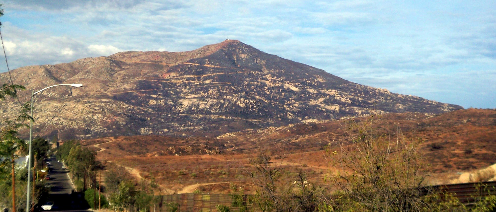
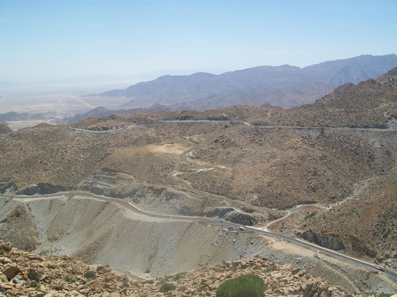
La Rumorosa is a town in the municipality of Tecate, Baja California, Mexico. It has a population of 1,836 inhabitants. It lies on the road between Mexicali and Tecate, and it is directly across the international border from Jacumba Hot Springs, California. However, no official border crossing exists; the nearest official crossing is in Tecate. The La Rumorosa area contains Native American cave paintings, which are the primary tourist draw. Geographic location The town is located at 32º32'06" N by 116º03'00" W; and has an altitude of 1278 meters. Demographics The 1980 census recorded a population of 531 inhabitants. In 1990, it rose to 1387 inhabitants, and, in 1995 there was a decrease to 1246 inhabitants. During the 2000 census, the population stood at 2,033 inhabitants. In 2005, INEGI registered a population of 1615 inhabitants. Roadway La Rumorosa also refers to the famous road that crosses the Sierra de Juárez Mountains in Baja California, which is part of Mexican F ... [...More Info...] [...Related Items...] OR: [Wikipedia] [Google] [Baidu] |
Administrative Divisions Of Mexico
The United Mexican States ( es, Estados Unidos Mexicanos) is a federal republic composed of 32 federal entities: 31 states and Mexico City, an autonomous entity. According to the Constitution of 1917, the states of the federation are free and sovereign in all matters concerning their internal affairs. Each state has its own congress and constitution. Federal entities of Mexico States Roles and powers of the states The states of the Mexican Federation are free, sovereign, autonomous and independent of each other. They are free to govern themselves according to their own laws; each state has a constitution that cannot contradict the federal constitution, which covers issues of national competence. The states cannot make alliances with other states or any independent nation without the consent of the whole federation, except those related to defense and security arrangements necessary to keep the border states secure in the event of an invasion. The political organizat ... [...More Info...] [...Related Items...] OR: [Wikipedia] [Google] [Baidu] |
Wind Power In Mexico
Mexico is rapidly growing its production of wind power. In 2016, its installed capacity had reached 3,527 MW, increasing to 8,128 MW in 2020. In 2008, there were three wind farms in the country. The Eurus Wind Farm was the largest wind farm in Latin America. 18 of 27 wind farms construction projects were based in La Ventosa in the Isthmus of Tehuantepec in Oaxaca. According to the Mexican Wind Energy Association, Mexico was predicted to progress to rank twentieth worldwide in wind capacity by the end of 2012, and to produce four percent of the country's total electricity production. It also projected that the nation would have of wind generation capacity by 2020, and would be able to provide fifteen percent of Mexico's production. Brian Gardner, Economist Intelligence Unit's energy analyst, said, "With strong wind through the south, consistent sunlight in the north and a stable market, Mexico is well positioned for continued renewables growth". Wind power is in partial compe ... [...More Info...] [...Related Items...] OR: [Wikipedia] [Google] [Baidu] |
Monsoons
A monsoon () is traditionally a seasonal reversing wind accompanied by corresponding changes in precipitation but is now used to describe seasonal changes in atmospheric circulation and precipitation associated with annual latitudinal oscillation of the Intertropical Convergence Zone (ITCZ) between its limits to the north and south of the equator. Usually, the term monsoon is used to refer to the rainy phase of a seasonally changing pattern, although technically there is also a dry phase. The term is also sometimes used to describe locally heavy but short-term rains. The major monsoon systems of the world consist of the West African, Asia–Australian, the North American, and South American monsoons. The term was first used in English in British India and neighboring countries to refer to the big seasonal winds blowing from the Bay of Bengal and Arabian Sea in the southwest bringing heavy rainfall to the area. Etymology The etymology of the word monsoon is not wholly ... [...More Info...] [...Related Items...] OR: [Wikipedia] [Google] [Baidu] |
Desert Climate
The desert climate or arid climate (in the Köppen climate classification ''BWh'' and ''BWk''), is a dry climate sub-type in which there is a severe excess of evaporation over precipitation. The typically bald, rocky, or sandy surfaces in desert climates are dry and hold little moisture, quickly evaporating the already little rainfall they receive. Covering 14.2% of earth's land area, hot deserts are the second most common type of climate on earth after the polar climate. There are two variations of a desert climate according to the Köppen climate classification: a hot desert climate (''BWh''), and a cold desert climate (''BWk''). To delineate "hot desert climates" from "cold desert climates", there are three widely used isotherms: most commonly a mean annual temperature of , or sometimes the coldest month's mean temperature of , so that a location with a ''BW'' type climate with the appropriate temperature above whichever isotherm is being used is classified as "hot arid sub ... [...More Info...] [...Related Items...] OR: [Wikipedia] [Google] [Baidu] |
Köppen Climate Classification
The Köppen climate classification is one of the most widely used climate classification systems. It was first published by German-Russian climatologist Wladimir Köppen (1846–1940) in 1884, with several later modifications by Köppen, notably in 1918 and 1936. Later, the climatologist Rudolf Geiger (1894–1981) introduced some changes to the classification system, which is thus sometimes called the Köppen–Geiger climate classification system. The Köppen climate classification divides climates into five main climate groups, with each group being divided based on seasonal precipitation and temperature patterns. The five main groups are ''A'' (tropical), ''B'' (arid), ''C'' (temperate), ''D'' (continental), and ''E'' (polar). Each group and subgroup is represented by a letter. All climates are assigned a main group (the first letter). All climates except for those in the ''E'' group are assigned a seasonal precipitation subgroup (the second letter). For example, ''Af'' indi ... [...More Info...] [...Related Items...] OR: [Wikipedia] [Google] [Baidu] |
Semi-arid Climate
A semi-arid climate, semi-desert climate, or steppe climate is a dry climate sub-type. It is located on regions that receive precipitation below potential evapotranspiration, but not as low as a desert climate. There are different kinds of semi-arid climates, depending on variables such as temperature, and they give rise to different biomes. Defining attributes of semi-arid climates A more precise definition is given by the Köppen climate classification, which treats steppe climates (''BSk'' and ''BSh'') as intermediates between desert climates (BW) and humid climates (A, C, D) in ecological characteristics and agricultural potential. Semi-arid climates tend to support short, thorny or scrubby vegetation and are usually dominated by either grasses or shrubs as it usually can't support forests. To determine if a location has a semi-arid climate, the precipitation threshold must first be determined. The method used to find the precipitation threshold (in millimeters): *multiply by ... [...More Info...] [...Related Items...] OR: [Wikipedia] [Google] [Baidu] |
El Vallecito
El Vallecito is an archaeological site located in the city of La Rumorosa, in the Tecate Municipality, Baja California, Mexico. It is believed that Baja California had human presence for thousands of years, however the available evidence indicates an occupation approximate from 8000 BCE. Some sites are more recent, it is estimated that they were developed in the last thousand years, though the engravings, more resistant to erosion, could be older. The site was inhabited by the Kumeyaay ethnic group whose territory comprised from Santo Tomas, Baja California, to the San Diego coast in California. The eastern region ranged from the Escondido, California, area up to the mountains and deserts in northern Baja California, including the area of Laguna Salada and part of the sierra Juarez known as La Rumorosa. This site has more than 18 sets of cave painting of which only six may be visited. The Vallecito is considered one of the most important of the region. There are several impo ... [...More Info...] [...Related Items...] OR: [Wikipedia] [Google] [Baidu] |
Saratoga, CA
Saratoga is a city in Santa Clara County, California. Located in Silicon Valley, in the southern Bay Area, its population was 31,051 at the 2020 census. Saratoga is an affluent residential community, known for its wineries, restaurants, and attractions like Villa Montalvo, Mountain Winery, and Hakone Gardens. History The area comprising Saratoga was earlier inhabited by the Ohlone Native Americans. In 1847, European settlers created a settlement at what is now Saratoga when William Campbell (father of Benjamin Campbell, the founder of nearby Campbell, California), constructed a sawmill about southeast of the present downtown area. An early map noted the area as Campbell's Gap. In 1851, Martin McCarthy, who had leased the mill, built a toll road down to the Santa Clara Valley, and founded what is now Saratoga as ''McCarthysville''. The toll gate was located at the present-day intersection of Big Basin Way and 3rd St., giving the town its first widely used name: ''Toll Gate''. I ... [...More Info...] [...Related Items...] OR: [Wikipedia] [Google] [Baidu] |
United States
The United States of America (U.S.A. or USA), commonly known as the United States (U.S. or US) or America, is a country primarily located in North America. It consists of 50 states, a federal district, five major unincorporated territories, nine Minor Outlying Islands, and 326 Indian reservations. The United States is also in free association with three Pacific Island sovereign states: the Federated States of Micronesia, the Marshall Islands, and the Republic of Palau. It is the world's third-largest country by both land and total area. It shares land borders with Canada to its north and with Mexico to its south and has maritime borders with the Bahamas, Cuba, Russia, and other nations. With a population of over 333 million, it is the most populous country in the Americas and the third most populous in the world. The national capital of the United States is Washington, D.C. and its most populous city and principal financial center is New York City. Paleo-Americ ... [...More Info...] [...Related Items...] OR: [Wikipedia] [Google] [Baidu] |
Mexican Federal Highway 2D
Federal Highway 2D ( es, Carretera Federal 2D, Fed. 2D) is a part of the federal highways corridors ( es, los corredores carreteros federales), and is the designation for toll highways paralleling Mexican Federal Highway 2. Seven road segments are designated Highway 2D, all but one in the state of Baja California, providing a toll highway stretching from Tijuana in the west to around Mexicali in the east; one in Sonora, between Santa Ana and Altar; and another between the cities of Matamoros and Reynosa in Tamaulipas. Tijuana–Tecate and Libramiento de Tecate Operated by IDEAL, the Autopista Tijuana-Tecate and Libramiento de Tecate run and ,Datos Viales - Baja California SCT, 2017 respectively, with a combined toll of 111 pesos. The Highway 2D designation takes o ... [...More Info...] [...Related Items...] OR: [Wikipedia] [Google] [Baidu] |
Sierra De Juárez
The Sierra de Juárez, also known as the Sierra Juarez, is a mountain range located in Tecate Municipality and northern Ensenada Municipality, within the northern Baja California state of northwestern Mexico. It is a major mountain range in the long Peninsular Ranges System, that extends from Southern California down the Baja California Peninsula into Baja California Sur state. Geography The Sierra de Juárez begins just south of the international frontier with California and extends about southwards. The highest peak in the range rises to about elevation at 31° 30′ 34″ North Latitude and 115° 32′ 5″ West Longitude. The Laguna Mountains (U.S.) are on the north, and the Sierra de San Pedro Mártir (México) are on the south. The Sierra forms part of the Baja California Peninsular Ranges. According to the Mexican government agency, CONABIO, the Sierra de Juárez occupies a total area of approximately long and averaging about wide. On the east the Sierra de Juá ... [...More Info...] [...Related Items...] OR: [Wikipedia] [Google] [Baidu] |
.png)


.jpg)
