|
Kuvshinovo
Kuvshinovo (russian: Кувшиново) is the name of several inhabited localities in Russia. ;Urban localities *Kuvshinovo, Kuvshinovsky District, Tver Oblast, a town of district significance in Kuvshinovsky District of Tver Oblast ;Rural localities * Kuvshinovo, Bryansk Oblast, a village in Dmitrovsky Selsoviet of Pochepsky District of Bryansk Oblast * Kuvshinovo, Yukhnovsky District, Kaluga Oblast, a village in Yukhnovsky District, Kaluga Oblast * Kuvshinovo, Zhukovsky District, Kaluga Oblast, a village in Zhukovsky District, Kaluga Oblast * Kuvshinovo, Kostroma Oblast, a village in Chukhlomskoye Settlement of Chukhlomsky District of Kostroma Oblast * Kuvshinovo, Leningrad Oblast, a village in Pashskoye Settlement Municipal Formation of Volkhovsky District of Leningrad Oblast * Kuvshinovo, Moscow Oblast, a village in Karinskoye Rural Settlement of Zaraysky District of Moscow Oblast * Kuvshinovo, Smolensk Oblast, a village in Divasovskoye Rural Settlement of Smolensky Di ... [...More Info...] [...Related Items...] OR: [Wikipedia] [Google] [Baidu] |
Kuvshinovo, Kuvshinovsky District, Tver Oblast
Kuvshinovo (russian: Кувши́ново) is a town and the administrative center of Kuvshinovsky District in Tver Oblast, Russia, located on the Osuga, from Tver, the administrative center of the oblast. Population: History The selo of Kamenka (russian: Каменка), the predecessor of Kuvshinovo, was first mentioned in 1646. In the course of the administrative reform carried out in 1708 by Peter the Great, it was included into Ingermanlandia Governorate (since 1710 known as Saint Petersburg Governorate), and in 1727 Novgorod Governorate split off. In 1775, Tver Viceroyalty was formed from the lands which previously belonged to Moscow and Novgorod Governorates, and the area was transferred to Tver Viceroyalty, which in 1796 was transformed to Tver Governorate. Kamenka belonged to Novotorzhsky Uyezd (with the center in Torzhok). In the 18th century, a paper mill was opened close to Kamenka. In 1869, merchant Mikhail Kuvshinov bought the mill and considerably expanded ... [...More Info...] [...Related Items...] OR: [Wikipedia] [Google] [Baidu] |
Kuvshinovsky District
Kuvshinovsky District (russian: Кувши́новский райо́н) is an administrative and municipalLaw #4-ZO district (raion), one of the thirty-six in Tver Oblast, Russia. It is located in the center of the oblast and borders with Vyshnevolotsky District in the north, Torzhoksky District in the east, Staritsky District in the south, Selizharovsky District in the southwest, Ostashkovsky District in the west, and with Firovsky District in the northwest. The area of the district is . Its administrative center is the town of Kuvshinovo. Population: 15,386 ( 2010 Census); The population of Kuvshinovo accounts for 65.0% of the district's total population. Geography Kuvshinovsky District list in the southern part of the Valdai Hills, and the divide between the drainage basins of the Atlantic Ocean and the Caspian Sea runs through the district. The northern part of the district belongs to the drainage basin of the Tsna River, a tributary of Lake Mstino in the drainage basin ... [...More Info...] [...Related Items...] OR: [Wikipedia] [Google] [Baidu] |
Kuvshinovo, Sokolsky District, Vologda Oblast
Kuvshinovo (russian: Кувшиново) is a rural locality (a village) in Chuchkovskoye Rural Settlement, Sokolsky District Sokolsky District is the name of several administrative and municipal districts in Russia: *Sokolsky District, Nizhny Novgorod Oblast, an administrative district of Nizhny Novgorod Oblast *Sokolsky District, Vologda Oblast, an administrative and ..., Vologda Oblast, Russia. The population was 5 as of 2002. Geography Kuvshinovo is located 76 km northeast of Sokol (the district's administrative centre) by road. Yakovkovo is the nearest rural locality. References Rural localities in Sokolsky District, Vologda Oblast {{SokolskyVLG-geo-stub ... [...More Info...] [...Related Items...] OR: [Wikipedia] [Google] [Baidu] |
Tver Oblast
Tver Oblast (russian: Тверска́я о́бласть, ''Tverskaya oblast'', ), from 1935 to 1990 known as Kalinin Oblast (), is a federal subject of Russia (an oblast). Its administrative center is the city of Tver. It was named after Mikhail Kalinin, the Soviet revolutionary. Population: 1,353,392 ( 2010 Census). Tver Oblast is a region of lakes, such as Seliger and Brosno. Much of the remaining area is occupied by the Valdai Hills, where the Volga, the Western Dvina, and the Dnieper have their source. Tver Oblast is one of the tourist regions of Russia with a modern tourist infrastructure. There are also many historic towns: Torzhok, Toropets, Zubtsov, Kashin, Vyshny Volochyok, and Kalyazin. The oldest of these is Rzhev, primarily known for the Battles of Rzhev in World War II. Staritsa was the seat of the last appanage principality in Russia. Ostashkov is a major tourist center. Geography Tver Oblast is located in the west of the middle part of the East European Plai ... [...More Info...] [...Related Items...] OR: [Wikipedia] [Google] [Baidu] |
Types Of Inhabited Localities In Russia
The classification system of inhabited localities in Russia and some other post-Soviet states has certain peculiarities compared with those in other countries. Classes During the Soviet time, each of the republics of the Soviet Union, including the Russian SFSR, had its own legislative documents dealing with classification of inhabited localities. After the dissolution of the Soviet Union, the task of developing and maintaining such classification in Russia was delegated to the federal subjects.Articles 71 and 72 of the Constitution of Russia do not name issues of the administrative and territorial structure among the tasks handled on the federal level or jointly with the governments of the federal subjects. As such, all federal subjects pass their own laws establishing the system of the administrative-territorial divisions on their territories. While currently there are certain peculiarities to classifications used in many federal subjects, they are all still largely ba ... [...More Info...] [...Related Items...] OR: [Wikipedia] [Google] [Baidu] |
Smolensky District, Smolensk Oblast
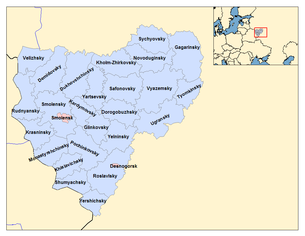
Smolensky District (russian: Смоле́нский райо́н) is an administrativeResolution #261 and municipalLaw #135-z district (raion), one of the twenty-five in Smolensk Oblast, Russia. It is located in the west of the oblast and borders with Demidovsky District in the north, Dukhovshchinsky District in the northeast, Kardymovsky District in the east, Pochinkovsky District in the south, Monastyrshchinsky District in the southwest, Krasninsky District in the west, and with Rudnyansky District in the northwest. The area of the district is . Its administrative center is the city of Smolensk (which is not administratively a part of the district). Population: 44,964 ( 2010 Census); Geography The district is split between the drainage basins of the Dnieper and the Daugava. The rivers in the northern part of the district flow into the Kasplya River, a left tributary of the Daugava. The Kasplya has its source in the district. The Dnieper crosses the district from east to west ... [...More Info...] [...Related Items...] OR: [Wikipedia] [Google] [Baidu] |
Zaraysky District
Zaraysky District (russian: Зара́йский райо́н) is an administrativeLaw #11/2013-OZ and municipalLaw #63/2005-OZ district (raion), one of the administrative divisions of Moscow Oblast, thirty-six in Moscow Oblast, Russia. It is located in the southeast of the oblast. The area of the district is . Its administrative center is the types of inhabited localities in Russia, town of Zaraysk. Population: 41,912 (Russian Census (2010), 2010 Census); The population of Zaraysk accounts for 58.8% of the district's total population. See also * List of rural localities in Moscow Oblast References Notes Sources * * * {{Use mdy dates, date=March 2013 Districts of Moscow Oblast ... [...More Info...] [...Related Items...] OR: [Wikipedia] [Google] [Baidu] |
Moscow Oblast
Moscow Oblast ( rus, Моско́вская о́бласть, r=Moskovskaya oblast', p=mɐˈskofskəjə ˈobləsʲtʲ), or Podmoskovye ( rus, Подмоско́вье, p=pədmɐˈskovʲjə, literally "under Moscow"), is a federal subject of Russia (an oblast). With a population of 7,095,120 ( 2010 Census) living in an area of , it is one of the most densely populated regions in the country and is the second most populous federal subject. The oblast has no official administrative center; its public authorities are located in Moscow and Krasnogorsk (Moscow Oblast Duma and government), and also across other locations in the oblast.According to Article 24 of the Charter of Moscow Oblast, the government bodies of the oblast are located in the city of Moscow and throughout the territory of Moscow Oblast. However, Moscow is not named the official administrative center of the oblast. Located in European Russia between latitudes 54° and 57° N and longitudes 35° and 41° E ... [...More Info...] [...Related Items...] OR: [Wikipedia] [Google] [Baidu] |
Kalininsky District, Tver Oblast
Kalininsky District (russian: Кали́нинский райо́н) is an administrative and municipalLaw #4-ZO district (raion), one of the thirty-six in Tver Oblast, Russia. It is located in the south of the oblast and borders with Likhoslavlsky District in the north, Rameshkovsky District in the northeast, Kimrsky District in the east, Konakovsky District in the southeast, Lotoshinsky District of Moscow Oblast in the south, Staritsky District in the southwest, and with Torzhoksky District in the west. The area of the district is . Its administrative center is the city of Tver (which is not administratively a part of the district).Law #34-ZO Population: 52,047 ( 2010 Census); Geography The whole area of the district belongs to the drainage basin of the Volga River. The Volga itself crosses the district from northwest to southeast, entering the Ivankovo Reservoir. The biggest tributaries of the Volga within the district are the Tvertsa River (left), which has its mouth in th ... [...More Info...] [...Related Items...] OR: [Wikipedia] [Google] [Baidu] |
Smolensk Oblast
Smolensk Oblast (russian: Смоле́нская о́бласть, ''Smolenskaya oblast''; informal name — ''Smolenschina'' (russian: Смоле́нщина)) is a federal subject of Russia (an oblast). Its administrative centre is the city of Smolensk. As of the 2010 Census, its population was 985,537. Geography The oblast was founded on 27 September 1937.Исполнительный комитет Смоленского областного совета народных депутатов. Государственный архив Смоленской области. "Административно-территориальное устройство Смоленской области. Справочник", изд. "Московский рабочий", Москва 1981. Стр. 8 It borders Pskov Oblast in the north, Tver Oblast in the northeast, Moscow Oblast in the east, Kaluga Oblast in south, Bryansk Oblast in the southwest, and Mogilev and Vitebsk Oblast ... [...More Info...] [...Related Items...] OR: [Wikipedia] [Google] [Baidu] |


