|
Kirton Holme
Kirton Holme is a village in Lincolnshire, England. It is situated within Kirton civil parish, and approximately west from the town of Boston. Kirton Holme church, Christ Church, is part of the Brothertoft Group also known as 'Five in the Fen', which also includes: * St Gilbert of Sempringham, Brothertoft * St Margaret of Scotland, Langrick * All Saints, Holland Fen * St Peter, Wildmore The village County Primary School was erected in 1879 after the formation of the Kirton School Board, but closed in 1968. Kirton Holme Golf Club A golf club is a club used to hit a golf ball in a game of golf. Each club is composed of a shaft with a grip and a club head. Wood (golf), Woods are mainly used for long-distance fairway or tee shots; iron (golf), irons, the most versatile class ... is a nine-hole golf course, established in 1992. References Villages in Lincolnshire Borough of Boston Kirton, Lincolnshire {{Lincolnshire-geo-stub ... [...More Info...] [...Related Items...] OR: [Wikipedia] [Google] [Baidu] |
Boston, Lincolnshire
Boston is a market town and inland port in the borough of the same name in the county of Lincolnshire, England. Boston is north of London, north-east of Peterborough, east of Nottingham, south-east of Lincoln, south-southeast of Hull and north-west of Norwich. Boston is the administrative centre of the wider Borough of Boston local government district. The town had a population of 35,124 at the 2001 census, while the borough had a population of 66,900 at the ONS mid-2015 estimates. Boston's most notable landmark is St Botolph's Church ("The Stump"), the largest parish church in England, which is visible from miles away across the flat lands of Lincolnshire. Residents of Boston are known as Bostonians. Emigrants from Boston named several other settlements around the world after the town, most notably Boston, Massachusetts in the United States. Name The name "Boston" is said to be a contraction of "Saint Botolph's town", "stone", or "'" (Old English, Old Norse an ... [...More Info...] [...Related Items...] OR: [Wikipedia] [Google] [Baidu] |
Lincolnshire
Lincolnshire (abbreviated Lincs.) is a county in the East Midlands of England, with a long coastline on the North Sea to the east. It borders Norfolk to the south-east, Cambridgeshire to the south, Rutland to the south-west, Leicestershire and Nottinghamshire to the west, South Yorkshire to the north-west, and the East Riding of Yorkshire to the north. It also borders Northamptonshire in the south for just , England's shortest county boundary. The county town is Lincoln, where the county council is also based. The ceremonial county of Lincolnshire consists of the non-metropolitan county of Lincolnshire and the area covered by the unitary authorities of North Lincolnshire and North East Lincolnshire. Part of the ceremonial county is in the Yorkshire and the Humber region of England, and most is in the East Midlands region. The county is the second-largest of the English ceremonial counties and one that is predominantly agricultural in land use. The county is fourth-larg ... [...More Info...] [...Related Items...] OR: [Wikipedia] [Google] [Baidu] |
Boston And Skegness (UK Parliament Constituency)
Boston and Skegness is a county constituency, represented in the House of Commons of the UK Parliament. It is located in Lincolnshire, England. Like all British constituencies, Boston and Skegness elects one Member of Parliament (MP) by the first-past-the-post system of election. The seat has been represented by the Conservative MP Matt Warman since the 2015 general election, and is usually considered a safe seat for the party. The constituency was created in 1997, from parts of the former constituencies of Holland with Boston and East Lindsey. The constituency has always elected a Conservative MP. In the 1997 and 2001 general elections, the seat was very marginal, with majorities of less than 1,000 votes for the Conservative candidate over the Labour candidate. The next two general elections, in 2005 and 2010, saw large swings towards the Conservatives. In the 2015 general election, the Eurosceptic UK Independence Party (UKIP) overtook Labour to take second place in the cons ... [...More Info...] [...Related Items...] OR: [Wikipedia] [Google] [Baidu] |
Kirton, Lincolnshire
Kirton or Kirton in Holland is an English village and civil parish in the Borough of Boston, Lincolnshire. The population of the civil parish at the 2011 census was 5,371. History The Domesday Book of 1086 terms the village ''Cherchetune''. It then had 52 households, with 30 freemen and 16 smallholders, 12 ploughlands, 10 plough teams, a meadow of , a church and two salt houses. In 1066 lordship of the manor was held by Earl Ralph. It had passed to Count Alan of Brittany by 1086. Before the local-government changes of the late 20th century, the parish came under Boston Rural District in the Parts of Holland – one of three divisions or ''parts'' of the historic county of Lincolnshire, which the Local Government Act of 1888 made a county in itself in most respects. The 1885 ''Kelly's Directory'' recorded a Kirton railway station on the Great Northern Railway line between Boston and Spalding line. The station closed in 1961. There existed in the 19th century Congreg ... [...More Info...] [...Related Items...] OR: [Wikipedia] [Google] [Baidu] |
Civil Parishes In England
In England, a civil parish is a type of Parish (administrative division), administrative parish used for Local government in England, local government. It is a territorial designation which is the lowest tier of local government below districts of England, districts and metropolitan and non-metropolitan counties of England, counties, or their combined form, the Unitary authorities of England, unitary authority. Civil parishes can trace their origin to the ancient system of Parish (Church of England), ecclesiastical parishes, which historically played a role in both secular and religious administration. Civil and religious parishes were formally differentiated in the 19th century and are now entirely separate. Civil parishes in their modern form came into being through the Local Government Act 1894, which established elected Parish councils in England, parish councils to take on the secular functions of the vestry, parish vestry. A civil parish can range in size from a sparsely ... [...More Info...] [...Related Items...] OR: [Wikipedia] [Google] [Baidu] |
Brothertoft
Brothertoft is a village in Lincolnshire, England, about northwest from the market town of Boston. It is part of the civil parish of Holland Fen with Brothertoft . History Evidence has been found that the area now known as Brothertoft was known to the Romano-British people. The site of a possible building was uncovered at Cannons Farm in Punchbowl Lane between 1957 and 1959. A denarius of Septimius Severus was found along with pottery, potsherds, animal bones, ditches and hollows. A Roman vase was dug up about 1970 at a separate site in Brothertoft by Mr Epton. The hamlet is first recorded some time after 1350 and before 1540. Brothertoft hamlet is mentioned in the Diocesan Return of 1563 (Deanery of Holland, parish of Kirton,) as having ten households. William Marrat, a local historian writing in 1814, noted that the traditional belief for the origins of the village name lay in a grant being awarded to two brothers in order that they could "inclose" (that is, separate and cu ... [...More Info...] [...Related Items...] OR: [Wikipedia] [Google] [Baidu] |
Langrick
Langrick is a small village in the East Lindsey district of Lincolnshire, England. It is in the civil parish of Langriville, and on the B1192 road, north-west from Boston. The village lies in the Lincolnshire Fens, and less than east from the River Witham. History The name Langrick appears to come from "Long Creek" and is at the very southern edge of Wildmore Fen, in an area which was once the manor of Armtree, in the parish of Coningsby. It was once the site of a hermitage belonging to Kirkstead Abbey. When Langrick and Langriville were enclosed in 1812 there was not a single house existing. Langrick's importance was that it was the site of a ferry crossing over the River Witham, reputedly built by Robert Dymoke. The river was straightened in 1833. A steel bridge, still in use, was built in the southern neighbouring settlement of Langrick Ferry in 1909, replacing a previous ferry over the Witham. Church Saint Margaret of Scotland Church was built in 1828, probably b ... [...More Info...] [...Related Items...] OR: [Wikipedia] [Google] [Baidu] |
Holland Fen
Holland Fen is a settlement in the Borough of Boston (borough), Boston, Lincolnshire, England. It is approximately north-west of the market town of Boston, Lincolnshire, Boston, and less than west of the River Witham. History Holland Fen has been known as the Haute Huntre, or Eight Hundred Fen. In 1720 Earl Fitzwilliam decided to drain the Holland Fen, having been frustrated by the local Commissioners of Sewers. He built the North Forty Foot Drain, which emptied by Lodowicks Gowt into the River Witham above Grand Sluice. The North Forty Foot was subsequently diverted to the South Forty Foot Drain at Cooks Lock and from there to Boston Haven through Black Sluice. The Haute Huntre was drained and enclosure, enclosed in 1767. Holland Fen was an ecclesiastical parish created in 1812 and abolished in 1948. It is now part of the Holland Fen with Brothertoft parish. Holland Fen consists of: *Holland Fen *Ferry Corner Plot *River Bottom *North Forty Foot Bank *Hedgehog Bridge *To ... [...More Info...] [...Related Items...] OR: [Wikipedia] [Google] [Baidu] |
Wildmore
Wildmore is a civil parish in the East Lindsey district of Lincolnshire, England. It is situated approximately north-west from the town of Boston and south from Horncastle. There is no village called Wildmore; the village of New York lies within the parish boundaries as does the hamlet of Haven Bank. History The name Wildmore comes from the surrounding Wildmore Fen. It appears from a manuscript now in the British Museum, that it belonged after the Norman Conquest to the baronies of Bolingbroke, Horncastle and Scrivelsby. William Romara, who held Bolingbroke, gave his portion to Kirkstead Abbey during the reign of King Stephen. Henry I afforested the whole of the fenland area and these continued to be the Kings hunting grounds until 1230 in the reign of Henry III. Henry II gave Horncastle to Gerbald Skalls, Scrivelsby to Robert Marmion and Kirkstead Abbey the Hermitage of Wildmore. Skalls and Marmion gave the monks of Kirkstead right of common pasture in Wildmore. B ... [...More Info...] [...Related Items...] OR: [Wikipedia] [Google] [Baidu] |
Golf Club
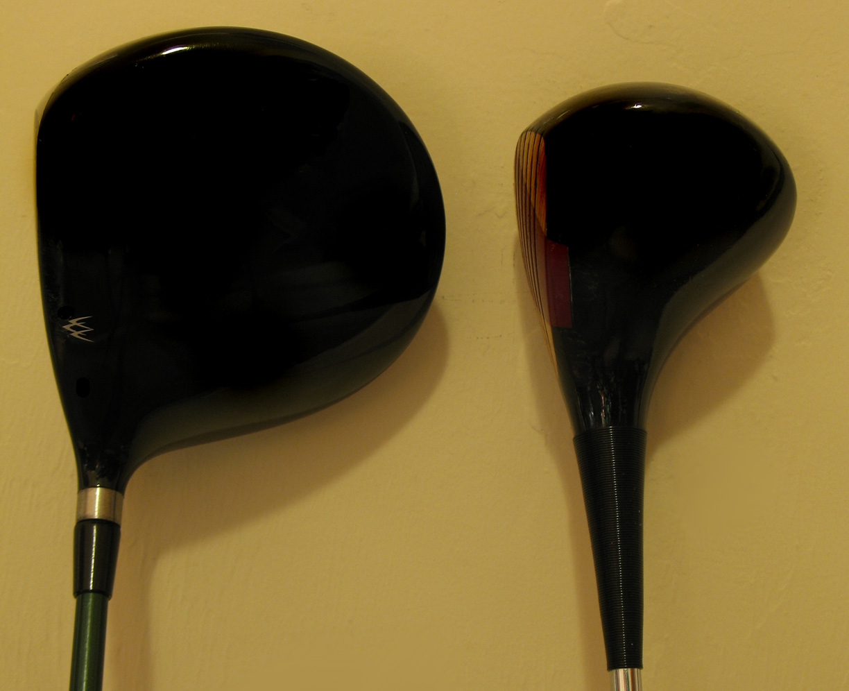
A golf club is a club used to hit a golf ball in a game of golf. Each club is composed of a shaft with a grip and a club head. Wood (golf), Woods are mainly used for long-distance fairway or tee shots; iron (golf), irons, the most versatile class, are used for a variety of shots; Hybrid (golf), hybrids that combine design elements of woods and irons are becoming increasingly popular; putter (golf), putters are used mainly on the green to roll the ball into the hole. A set of clubs is limited by the rules of golf to a maximum of 14 golf clubs, and while there are traditional combinations sold at retail as matched sets, players are free to use any combination of legal clubs. The most significant difference between clubs of the same type is ''loft'', or the angle between the club's face and the vertical plane. It is loft that is the primary determinant of the ascending trajectory of the golf ball, with the tangential angle of the club head's swing arc at impact being a secondary and ... [...More Info...] [...Related Items...] OR: [Wikipedia] [Google] [Baidu] |
Villages In Lincolnshire
A village is a clustered human settlement or community, larger than a hamlet but smaller than a town (although the word is often used to describe both hamlets and smaller towns), with a population typically ranging from a few hundred to a few thousand. Though villages are often located in rural areas, the term urban village is also applied to certain urban neighborhoods. Villages are normally permanent, with fixed dwellings; however, transient villages can occur. Further, the dwellings of a village are fairly close to one another, not scattered broadly over the landscape, as a dispersed settlement. In the past, villages were a usual form of community for societies that practice subsistence agriculture, and also for some non-agricultural societies. In Great Britain, a hamlet earned the right to be called a village when it built a church. [...More Info...] [...Related Items...] OR: [Wikipedia] [Google] [Baidu] |
Borough Of Boston
The Borough of Boston is a local government district with borough status in Lincolnshire, England. Its council is based in the town of Boston. The borough covers a wider area that includes villages such as Wyberton, Butterwick, Kirton-in-Holland, Langrick Bridge, Sutterton, Swineshead, Old Leake, Fosdyke, Kirton Holme and Hubberts Bridge. The borough borders East Lindsey to the north, North Kesteven to the west and South Holland to the south. To the east is The Wash. At the 2011 Census, the population of the borough was 64,637. History The borough was formed on 1 April 1974 by the merger of the former borough of Boston with Boston Rural District. Until 1974, Lincolnshire comprised three Parts, somewhat like the Ridings of Yorkshire. These were the Parts of Lindsey, Kesteven and Holland. In their final form, they were each, in effect, an administrative county. The 1974 changes divided the Parts of Holland into two districts; the Borough of Boston is the northern one. Manag ... [...More Info...] [...Related Items...] OR: [Wikipedia] [Google] [Baidu] |


