|
King's Highway (Charleston To Boston)
The King's Highway was a roughly road laid out from 1650 to 1735 in the American colonies. It was built on the order of Charles II of England, who directed his colonial governors to link Charleston, South Carolina, and Boston, Massachusetts. The section north of New York City, laid out on January 22, 1673, became the Upper Boston Post Road. The road was finally completed in 1735. Much of the Post Road is now U.S. Route 1 and U.S. Route 20. The King’s Highway Historic District in New Jersey covers U.S. Route 206 and New Jersey Route 27, connecting Lawrenceville with Kingston through Princeton. In Pennsylvania, much of the route is now U.S. Route 13. (In Philadelphia, Route 13 becomes Frankford Avenue.) Through Maryland, the King's Highway largely follows U.S. Route 1. From Virginia southward, the modern U.S. 17 has many segments that follow the old King's Highway. Mail delivery in the Northeast Herman Moll's 1729 "Post Map" described the route: Boston Post Road The ... [...More Info...] [...Related Items...] OR: [Wikipedia] [Google] [Baidu] |
Charleston, South Carolina
Charleston is the largest city in the U.S. state of South Carolina, the county seat of Charleston County, and the principal city in the Charleston–North Charleston metropolitan area. The city lies just south of the geographical midpoint of South Carolina's coastline on Charleston Harbor, an inlet of the Atlantic Ocean formed by the confluence of the Ashley, Cooper, and Wando rivers. Charleston had a population of 150,277 at the 2020 census. The 2020 population of the Charleston metropolitan area, comprising Berkeley, Charleston, and Dorchester counties, was 799,636 residents, the third-largest in the state and the 74th-largest metropolitan statistical area in the United States. Charleston was founded in 1670 as Charles Town, honoring King CharlesII, at Albemarle Point on the west bank of the Ashley River (now Charles Towne Landing) but relocated in 1680 to its present site, which became the fifth-largest city in North America within ten years. It remained unincorpor ... [...More Info...] [...Related Items...] OR: [Wikipedia] [Google] [Baidu] |
Sunken Lane
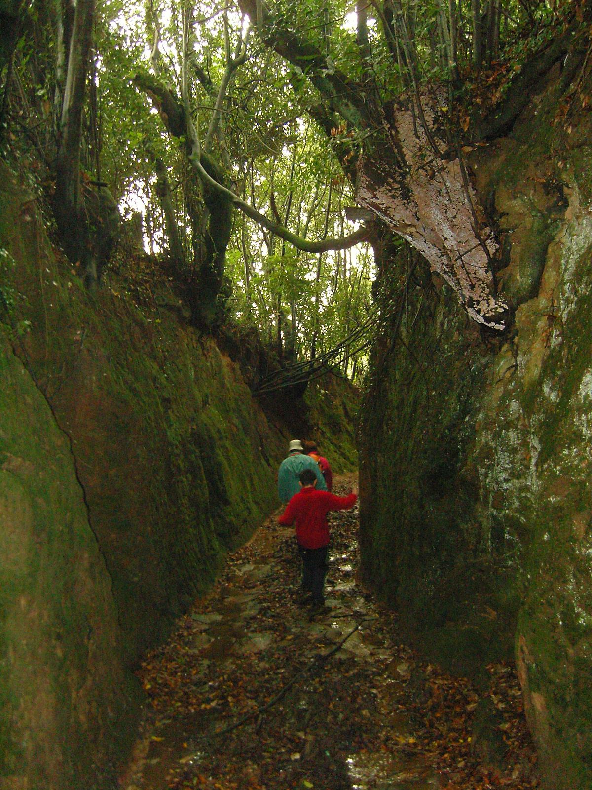
A sunken lane (also hollow way or holloway) is a road or track that is significantly lower than the land on either side, not formed by the (recent) engineering of a road cutting but possibly of much greater age. Various mechanisms have been proposed for how holloways may have been formed, including erosion by water or traffic; the digging of embankments to assist with the herding of livestock; and the digging of double banks to mark the boundaries of estates. All of these mechanisms could apply in different cases. Means of formation A variety of theories have been proposed for the origins of holloways. Different mechanisms may well apply in different cases. Erosion Some sunken lanes are created incrementally by erosion, by water and traffic. Some are very ancient with evidence of Roman or Iron Age origins, but others such as the Deep Hill Ruts in the old Oregon Trail at Guernsey, Wyoming developed in the space of a decade or two. Where ancient trackways have lapsed from u ... [...More Info...] [...Related Items...] OR: [Wikipedia] [Google] [Baidu] |
Rahway, New Jersey
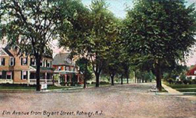
Rahway () is a city in southern Union County, in the U.S. state of New Jersey. A bedroom community of New York City, it is centrally located in the Rahway Valley region, in the New York metropolitan area. The city is southwest of Manhattan and west of Staten Island. Built on the navigable Rahway River, it was an industrial and artisanal craft city for much of its history. The city has increasingly reinvented itself in recent years as a diverse regional hub for the arts. As of the 2010 United States Census, the city's population was 27,346,DP-1 - Profile of General Population and Housing Characteristics: 2010 Demographic Profile Data for Rahway city, Union County, New Jersey [...More Info...] [...Related Items...] OR: [Wikipedia] [Google] [Baidu] |
Elizabeth, New Jersey
Elizabeth is a city and the county seat of Union County, in the U.S. state of New Jersey.New Jersey County Map , New Jersey Department of State. Accessed July 10, 2017. As of the , the city had a total population of 137,298,Table DP-1. Profile of General Demographic Characteristics: 2010 ... [...More Info...] [...Related Items...] OR: [Wikipedia] [Google] [Baidu] |
Newark, New Jersey
Newark ( , ) is the most populous city in the U.S. state of New Jersey and the seat of Essex County and the second largest city within the New York metropolitan area.New Jersey County Map New Jersey Department of State. Accessed July 10, 2017. The city had a population of 311,549 as of the , and was calculated at 307,220 by the Population Estimates Program for 2021, making it [...More Info...] [...Related Items...] OR: [Wikipedia] [Google] [Baidu] |
Kingsbridge, New York
Kingsbridge is a residential neighborhood in the northwest portion of the Bronx, New York City. Kingsbridge's boundaries are Manhattan College Parkway to the north, the Major Deegan Expressway or Bailey Avenue to the east, West 230th Street to the south, and Irwin Avenue to the west. The neighborhood is part of Bronx Community Board 8 and its ZIP Code is 10463. Kingsbridge is patrolled by the New York City Police Department's 50th Precinct. Geography Kingsbridge comprises three distinct neighborhoods: Kingsbridge proper, Kingsbridge Heights, and Van Cortlandt Village. Kingsbridge proper is bounded by Manhattan College Parkway to the north, either the Major Deegan Expressway or Bailey Avenue to the east, West 230th Street to the south, and Irwin Avenue to the west. Land use and terrain Kingsbridge has detached, semi detached, and attached homes, and apartment buildings. Streets connecting Riverdale and Kingsbridge include "step streets", with stairways of as many as 160 steps c ... [...More Info...] [...Related Items...] OR: [Wikipedia] [Google] [Baidu] |
Rye, New York
Rye is a coastal suburb of New York City in Westchester County, New York, United States. It is separate from the Town of Rye, which has more land area than the city. The City of Rye, formerly the Village of Rye, was part of the Town until it received its charter as a city in 1942, making it the youngest city in the State of New York. Its population density for its 5.85 square miles of land is roughly 2,729.76/sq mi. Rye is notable for its waterfront which covers 60 percent of the city's six square miles and is governed by a waterfront act instituted in 1991. Located in the city are two National Historic Landmarks: the Boston Post Road Historic District was designated a National Historic Landmark by the National Park Service in 1993; its centerpiece is the Jay Estate, the childhood home of John Jay, a Founding Father and the first Chief Justice of the United States. Playland, a historic amusement park designated a National Historic Landmark in 1987 is also located in Rye. P ... [...More Info...] [...Related Items...] OR: [Wikipedia] [Google] [Baidu] |
Greenwich, Connecticut
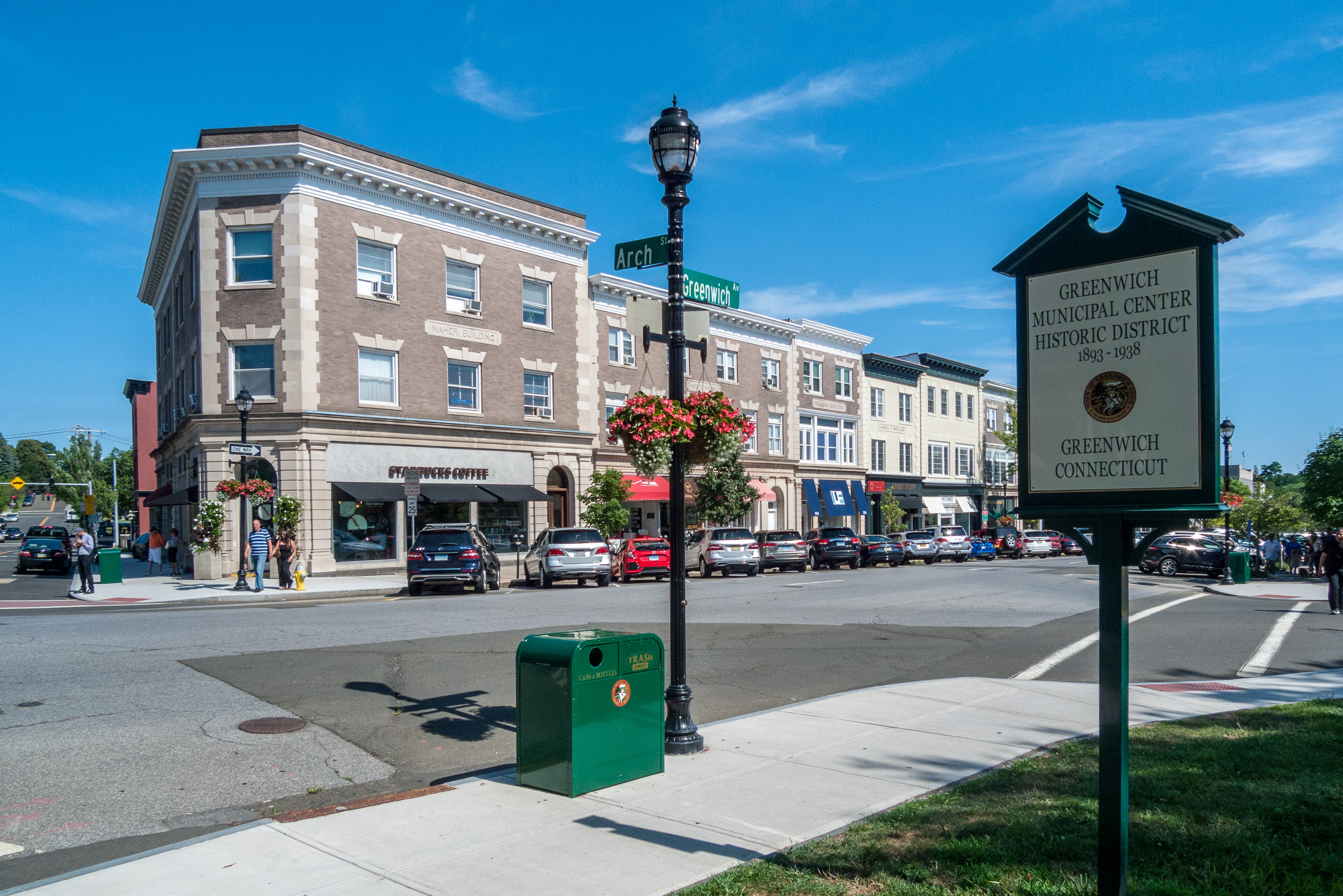
Greenwich (, ) is a New England town, town in southwestern Fairfield County, Connecticut, United States. At the 2020 United States Census, 2020 census, the town had a total population of 63,518. The largest town on Connecticut's Gold Coast (Connecticut), Gold Coast, Greenwich is home to many hedge funds and other financial services firms. Greenwich is a principal community of the Greater Bridgeport, Bridgeport–Stamford–Norwalk–Danbury metropolitan statistical area, which comprises all of Fairfield County. Greenwich is the southernmost and westernmost municipality in Connecticut as well as in the six-state region of New England. The town is named after Greenwich, a List of place names with royal patronage in the United Kingdom, royal borough of London in the United Kingdom. History The town of Greenwich was settled in 1640, by the agents Robert Feake and Captain Daniel Patrick, for Theophilus Eaton, Governor Theophilus Eaton of New Haven Colony, who purchased the land from ... [...More Info...] [...Related Items...] OR: [Wikipedia] [Google] [Baidu] |
Fairfield, Connecticut
Fairfield is a town in Fairfield County, Connecticut, United States. It borders the city of Bridgeport and towns of Trumbull, Easton, Weston, and Westport along the Gold Coast of Connecticut. Located within the New York metropolitan area, it is around 43 miles northeast of Midtown Manhattan. As of 2020 the town had a population of 61,512. History Colonial era In 1635, Puritans and Congregationalists in the Massachusetts Bay Colony, were dissatisfied with the rate of Anglican reform, and sought to establish an ecclesiastical society subject to their own rules and regulations. The Massachusetts General Court granted them permission to settle in the towns of Windsor, Wethersfield, and Hartford which is an area now known as Connecticut. On January 14, 1639, a set of legal and administrative regulations called the Fundamental Orders was adopted and established Connecticut as a self-ruling entity. By 1639, these settlers had started new towns in the surrounding areas. ... [...More Info...] [...Related Items...] OR: [Wikipedia] [Google] [Baidu] |
New Haven, Connecticut
New Haven is a city in the U.S. state of Connecticut. It is located on New Haven Harbor on the northern shore of Long Island Sound in New Haven County, Connecticut and is part of the New York City metropolitan area. With a population of 134,023 as determined by the 2020 U.S. census, New Haven is the third largest city in Connecticut after Bridgeport and Stamford and the principal municipality of Greater New Haven, which had a total 2020 population of 864,835. New Haven was one of the first planned cities in the U.S. A year after its founding by English Puritans in 1638, eight streets were laid out in a four-by-four grid, creating the "Nine Square Plan". The central common block is the New Haven Green, a square at the center of Downtown New Haven. The Green is now a National Historic Landmark, and the "Nine Square Plan" is recognized by the American Planning Association as a National Planning Landmark. New Haven is the home of Yale University, New Haven's biggest taxpayer ... [...More Info...] [...Related Items...] OR: [Wikipedia] [Google] [Baidu] |
King's Highway
King's Highway or Kings Highway may refer to: Roads Australia * Kings Highway (Australia), connecting Queanbeyan to Batemans Bay Canada * King's Highways, an alternative designation for the primary provincial highway system in Ontario * King's Highway (French: ''Chemin du Roy''), part of Route 138 in Quebec United States * Kings Highway (Brooklyn), a broad avenue passing through mostly commercial areas in the southern part of Brooklyn * King's Highway (Charleston to Boston), United States * (Old) King's Highway (Massachusetts Route 6A), Cape Cod, MA ** Old King's Highway Historic District, Barnstable, MA ** Brewster Old King's Highway Historic District, Brewster, MA * (Old) Kings Highway (History of Darien, Connecticut), Darien, CT * Kings Highway ( Dupont Avenue), Minneapolis, MN * Kings Highway (Virginia State Route 3), central Virginia * Kings Highway (Virginia State Route 125), Suffolk, Virginia * Kings Highway (New Jersey Route 27), northern New Jersey * Kings Highway (to ... [...More Info...] [...Related Items...] OR: [Wikipedia] [Google] [Baidu] |
Toll Road
A toll road, also known as a turnpike or tollway, is a public or private road (almost always a controlled-access highway in the present day) for which a fee (or ''toll'') is assessed for passage. It is a form of road pricing typically implemented to help recoup the costs of road construction and maintenance. Toll roads have existed in some form since antiquity, with tolls levied on passing travelers on foot, wagon, or horseback; a practice that continued with the automobile, and many modern tollways charge fees for motor vehicles exclusively. The amount of the toll usually varies by vehicle type, weight, or number of axles, with freight trucks often charged higher rates than cars. Tolls are often collected at toll plazas, toll booths, toll houses, toll stations, toll bars, toll barriers, or toll gates. Some toll collection points are automatic, and the user deposits money in a machine which opens the gate once the correct toll has been paid. To cut costs and minimise time delay, ... [...More Info...] [...Related Items...] OR: [Wikipedia] [Google] [Baidu] |


