|
Kielder Water
Kielder Water is a large man-made reservoir in Northumberland in North East England. It is the largest artificial lake in the United Kingdom by capacity of water and it is surrounded by Kielder Forest, one of the biggest man-made woodlands in Europe. The scheme was planned in the late 1960s to satisfy an expected rise in demand for water to support a booming UK industrial economy. Kielder Water is owned by Northumbrian Water, and holds 200 billion litres (44 billion gallons, or 0.2 cubic km), making it the largest artificial reservoir in the UK by capacity ( Rutland Water is the largest by surface area). It has a shoreline, is from the sea. and has a maximum depth of 52 metres (170ft). Etymology The name ''Kielder'' was first recorded in 1309 as ''Keldre''. Originating as a river name, ''Kielder'' may have the same origin as the various rivers named ''Calder'', such as the one in West Yorkshire. The name may be derived from the Brittonic ''caleto-/ā'', with the root sens ... [...More Info...] [...Related Items...] OR: [Wikipedia] [Google] [Baidu] |
Northumberland
Northumberland () is a county in Northern England, one of two counties in England which border with Scotland. Notable landmarks in the county include Alnwick Castle, Bamburgh Castle, Hadrian's Wall and Hexham Abbey. It is bordered by land on three sides; by the Scottish Borders region to the north, County Durham and Tyne and Wear to the south, and Cumbria to the west. The fourth side is the North Sea, with a stretch of coastline to the east. A predominantly rural county with a landscape of moorland and farmland, a large area is part of Northumberland National Park. The area has been the site of a number of historic battles with Scotland. Name The name of Northumberland is recorded as ''norð hẏmbra land'' in the Anglo-Saxon Chronicle, meaning "the land north of the Humber". The name of the kingdom of ''Northumbria'' derives from the Old English meaning "the people or province north of the Humber", as opposed to the people south of the Humber Estuary. History ... [...More Info...] [...Related Items...] OR: [Wikipedia] [Google] [Baidu] |
Hydroelectric
Hydroelectricity, or hydroelectric power, is electricity generated from hydropower (water power). Hydropower supplies one sixth of the world's electricity, almost 4500 TWh in 2020, which is more than all other renewable sources combined and also more than nuclear power. Hydropower can provide large amounts of low-carbon electricity on demand, making it a key element for creating secure and clean electricity supply systems. A hydroelectric power station that has a dam and reservoir is a flexible source, since the amount of electricity produced can be increased or decreased in seconds or minutes in response to varying electricity demand. Once a hydroelectric complex is constructed, it produces no direct waste, and almost always emits considerably less greenhouse gas than fossil fuel-powered energy plants. [...More Info...] [...Related Items...] OR: [Wikipedia] [Google] [Baidu] |
Drinking Water Reservoirs In England
Drinking is the act of ingesting water or other liquids into the body through the mouth, proboscis, or elsewhere. Humans drink by swallowing, completed by peristalsis in the esophagus. The physiological processes of drinking vary widely among other animals. Most animals drink water to maintain bodily hydration, although many can survive on the water gained from their food. Water is required for many physiological processes. Both inadequate and (less commonly) excessive water intake are associated with health problems. Methods of drinking In humans When a liquid enters a human mouth, the swallowing process is completed by peristalsis which delivers the liquid through the esophagus to the stomach; much of the activity is abetted by gravity. The liquid may be poured from the hands or drinkware may be used as vessels. Drinking can also be performed by acts of inhalation, typically when imbibing hot liquids or drinking from a spoon. Infants employ a method of suction ... [...More Info...] [...Related Items...] OR: [Wikipedia] [Google] [Baidu] |
Falstone
Falstone is a small village in Northumberland, England, just east of Kielder Water. The village is from the Anglo–Scottish border. The name ''Falstone'' means "speckled stone". Much of the village is clustered around its two churches, St. Peter's Anglican and the United Reformed Church. Falstone holds a popular annual agricultural show. Governance Falstone is in the parliamentary constituency of Hexham. Falstone has its own Parish council. Falstone parish was created in 1811 when the ancient parish of Simonburn was divided by Act of Parliament. Transport Falstone was served by Falstone railway station on the Border Counties Railway which linked the Newcastle and Carlisle Railway The Newcastle & Carlisle Railway (N&CR) was an English railway company formed in 1825 that built a line from Newcastle upon Tyne on Britain's east coast, to Carlisle, on the west coast. The railway began operating mineral trains in 1834 between ..., near Hexham, with the Border U ... [...More Info...] [...Related Items...] OR: [Wikipedia] [Google] [Baidu] |
Kielder, Northumberland
Kielder is a small, remote village in western Northumberland, England. Located at the head of Kielder Water and in the north west of Kielder Forest, the village is within of the Scottish border. History There was early settlement around Kielder Castle, a hunting lodge built by the Duke of Northumberland in 1775. Previous settlements were expanded in the 1950s by the Forestry Commission who constructed housing to accommodate the workers employed in the planting of Kielder Forest. Most of this housing has now been sold back to the private sector. Governance Kielder is in the parliamentary constituency of Hexham. Until 1 April 2009 it was within Tynedale local government district, but following local government restructuring in Northumberland the county is now covered by a unitary authority, Northumberland County Council. Geography It is claimed that Kielder has the lowest level of light pollution in England – hence the construction nearby of Kielder Observatory. Clim ... [...More Info...] [...Related Items...] OR: [Wikipedia] [Google] [Baidu] |
River Tees
The River Tees (), in Northern England, rises on the eastern slope of Cross Fell in the North Pennines and flows eastwards for to reach the North Sea between Hartlepool and Redcar near Middlesbrough. The modern day history of the river has been tied with the industries on Teesside in its lower reaches, where it has provided the means of import and export of goods to and from the North East England. The need for water further downstream also meant that reservoirs were built in the extreme upper reaches, such as Cow Green Reservoir, Cow Green. Etymology The name ''Tees'' is possibly of Common Brittonic, Brittonic origin. The element ''*tēs'', meaning "warmth" with connotations of "boiling, excitement" (Welsh language, Welsh ''tes''), may underlie the name. ''*Teihx-s'', a root possibly derived from Brittonic ''*ti'' (Welsh ''tail'', "dung, manure"), has also been used to explain the name ''Tees'' (compare River Tyne#Origins of name, River Tyne). Geography The river drains and ... [...More Info...] [...Related Items...] OR: [Wikipedia] [Google] [Baidu] |
River Wear
The River Wear (, ) in North East England rises in the Pennines and flows eastwards, mostly through County Durham to the North Sea in the City of Sunderland. At long, it is one of the region's longest rivers, wends in a steep valley through the cathedral city of Durham and gives its name to Weardale in its upper reach and Wearside by its mouth. Etymology The origin behind the hydronym ''Wear'' is uncertain but is generally understood to be Celtic. The ''River Vedra'' on the Roman Map of Britain may very well be the River Wear. The name may be derived from Brittonic ''*wejr'' (<''*wẹ:drā''), which meant "a bend" (c.f ''-gwair-''). An alternative but very problematic etymology might involve ''*wẹ:d-r-'', from a lengthened form of the |
River North Tyne
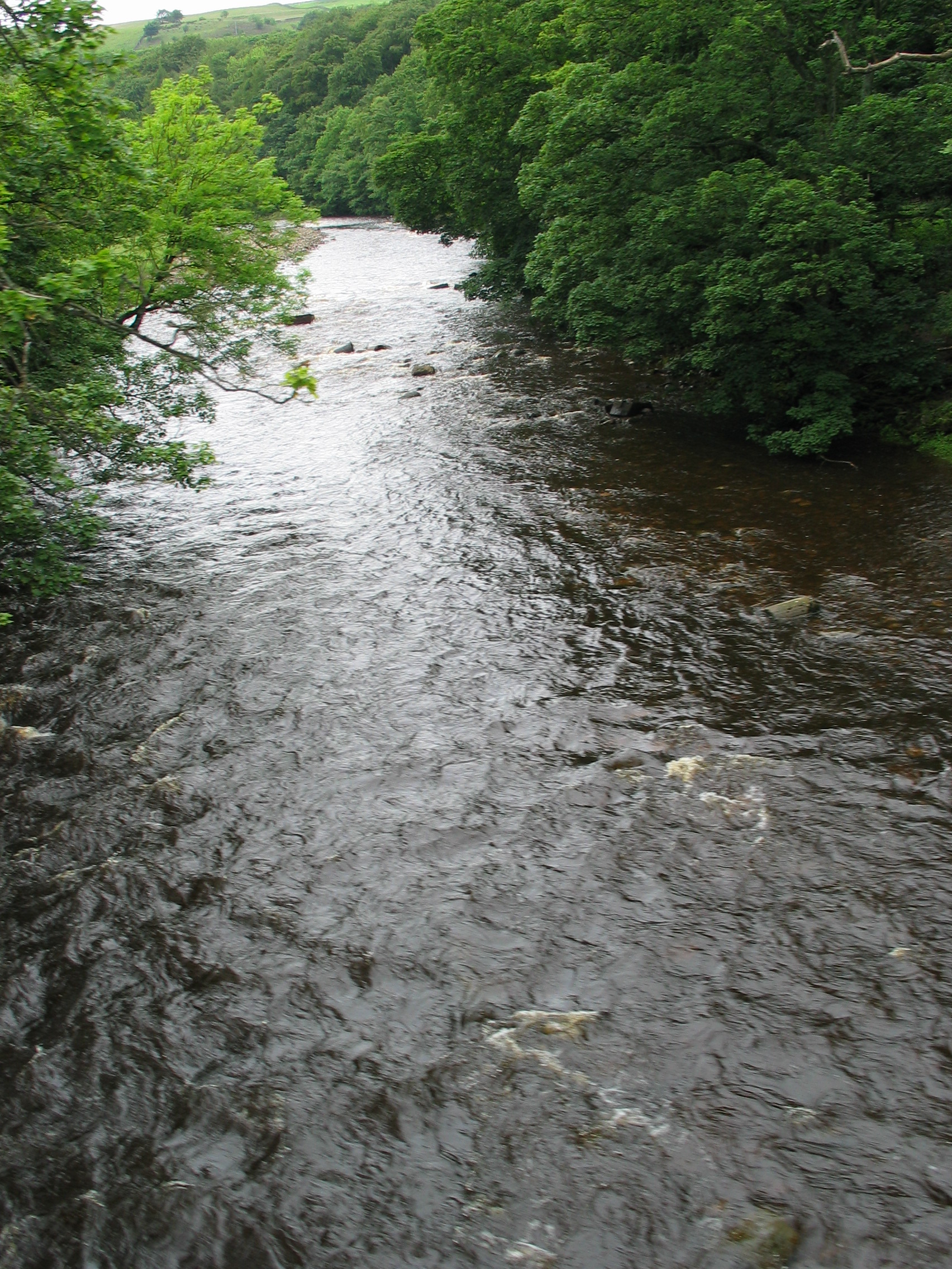
The River Tyne is a river in North East England. Its length (excluding tributaries) is . It is formed by the North Tyne and the South Tyne, which converge at Warden Rock near Hexham in Northumberland at a place dubbed 'The Meeting of the Waters'. The Tyne Rivers Trust measure the whole Tyne catchment as , containing of waterways. Course North Tyne The North Tyne rises on the Scottish border, north of Kielder Water. It flows through Kielder Forest, and in and out of the border. It then passes through the village of Bellingham before reaching Hexham. South Tyne The South Tyne rises on Alston Moor, Cumbria and flows through the towns of Haltwhistle and Haydon Bridge, in a valley often called the Tyne Gap. Hadrian's Wall lies to the north of the Tyne Gap. Coincidentally, the source of the South Tyne is very close to those of the Tees and the Wear. The South Tyne Valley falls within the North Pennines Area of Outstanding Natural Beauty (AONB) – the second largest of th ... [...More Info...] [...Related Items...] OR: [Wikipedia] [Google] [Baidu] |
Carbon Dioxide
Carbon dioxide ( chemical formula ) is a chemical compound made up of molecules that each have one carbon atom covalently double bonded to two oxygen atoms. It is found in the gas state at room temperature. In the air, carbon dioxide is transparent to visible light but absorbs infrared radiation, acting as a greenhouse gas. It is a trace gas in Earth's atmosphere at 421 parts per million (ppm), or about 0.04% by volume (as of May 2022), having risen from pre-industrial levels of 280 ppm. Burning fossil fuels is the primary cause of these increased CO2 concentrations and also the primary cause of climate change.IPCC (2022Summary for policy makersiClimate Change 2022: Mitigation of Climate Change. Contribution of Working Group III to the Sixth Assessment Report of the Intergovernmental Panel on Climate Change Cambridge University Press, Cambridge, United Kingdom and New York, NY, USA Carbon dioxide is soluble in water and is found in groundwater, lakes, ice ca ... [...More Info...] [...Related Items...] OR: [Wikipedia] [Google] [Baidu] |
North Tyne
North is one of the four compass points or cardinal directions. It is the opposite of south and is perpendicular to east and west. ''North'' is a noun, adjective, or adverb indicating direction or geography. Etymology The word ''north'' is related to the Old High German ''nord'', both descending from the Proto-Indo-European unit *''ner-'', meaning "left; below" as north is to left when facing the rising sun. Similarly, the other cardinal directions are also related to the sun's position. The Latin word ''borealis'' comes from the Greek '' boreas'' "north wind, north", which, according to Ovid, was personified as the wind-god Boreas, the father of Calais and Zetes. ''Septentrionalis'' is from ''septentriones'', "the seven plow oxen", a name of ''Ursa Major''. The Greek ἀρκτικός (''arktikós'') is named for the same constellation, and is the source of the English word ''Arctic''. Other languages have other derivations. For example, in Lezgian, ''kefer'' can mean ... [...More Info...] [...Related Items...] OR: [Wikipedia] [Google] [Baidu] |
Francis Turbine
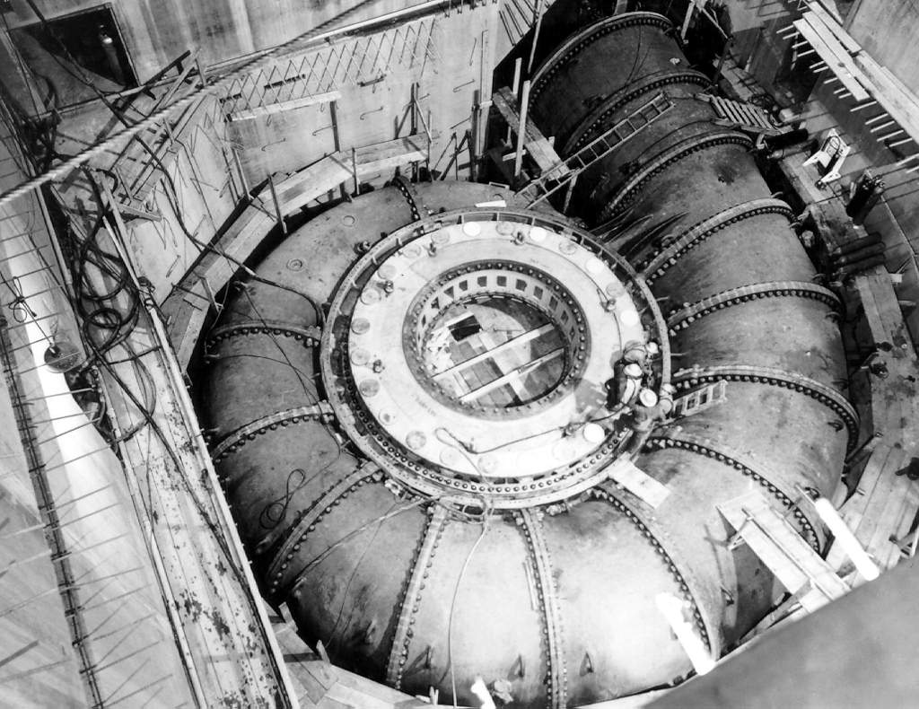
The Francis turbine is a type of water turbine. It is an inward-flow reaction turbine that combines radial and axial flow concepts. Francis turbines are the most common water turbine in use today, and can achieve over 95% efficiency. The process of arriving at the modern Francis runner design took from 1848 to approximately 1920. It became known as the Francis turbine around 1920, being named after British-American engineer James B. Francis who in 1848 created a new turbine design. Francis turbines are primarily used for producing electricity. The power output of the electric generators generally ranges from just a few kilowatts up to 1000 MW, though mini-hydro installations may be lower. The best performance is seen when the head height is between . Penstock diameters are between . The speeds of different turbine units range from 70 to 1000 rpm. A wicket gate around the outside of the turbine's rotating runner controls the rate of water flow through the turbine fo ... [...More Info...] [...Related Items...] OR: [Wikipedia] [Google] [Baidu] |
Kaplan Turbine
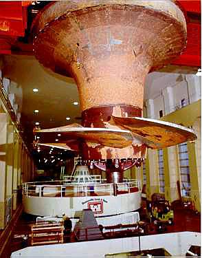
The Kaplan turbine is a propeller-type water turbine which has adjustable blades. It was developed in 1913 by Austrian professor Viktor Kaplan, who combined automatically adjusted propeller blades with automatically adjusted wicket gates to achieve efficiency over a wide range of flow and water level. The Kaplan turbine was an evolution of the Francis turbine. Its invention allowed efficient power production in low-head applications which was not possible with Francis turbines. The head ranges from and the output ranges from 5 to 200 MW. Runner diameters are between . Turbines rotate at a constant rate, which varies from facility to facility. That rate ranges from as low as 54.5 rpm ( Albeni Falls Dam) to 450 rpm. Kaplan turbines are now widely used throughout the world in high-flow, low-head power production. Development Viktor Kaplan, living in Brünn, Austria-Hungary (now Brno, Czechia), obtained his first patent for an adjustable blade propeller turbine in 1912. But ... [...More Info...] [...Related Items...] OR: [Wikipedia] [Google] [Baidu] |


