|
Khorgo-Terkhiin Tsagaan Nuur National Park
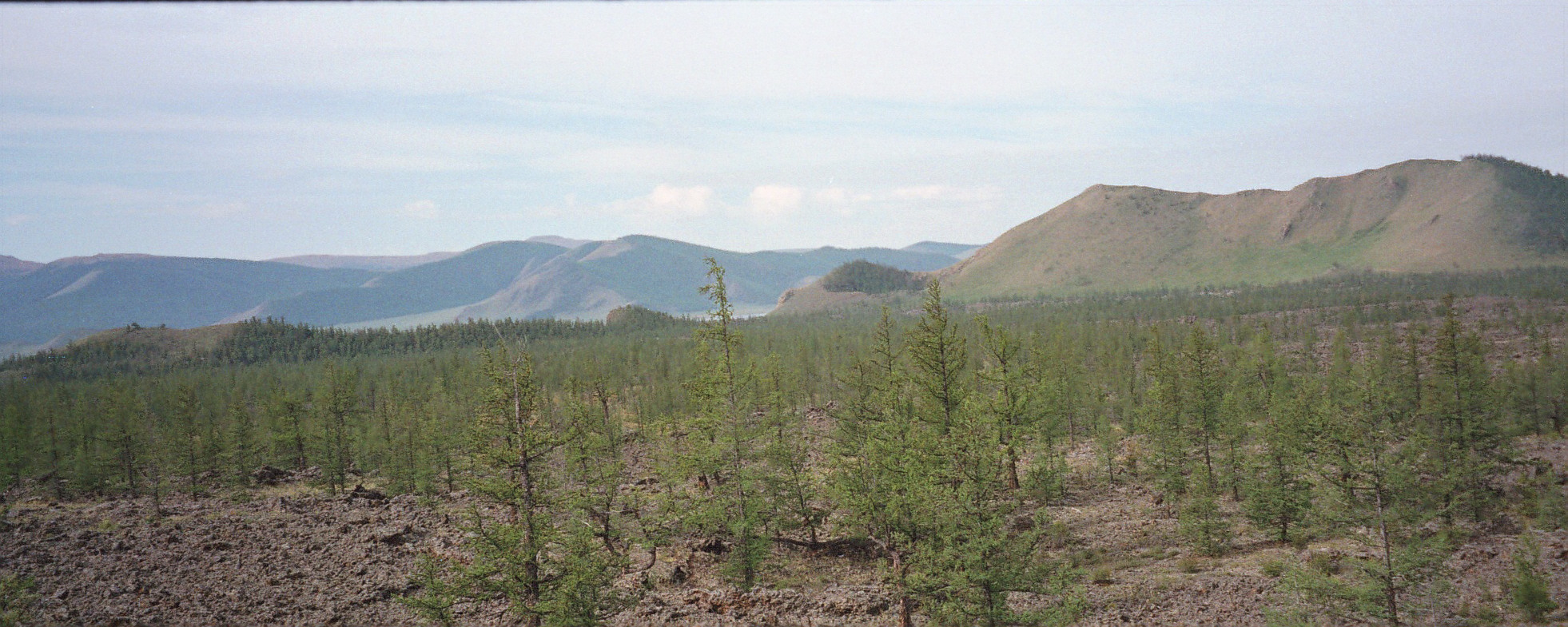
Khorgo-Terkhiin Tsagaan Nuur National Park ( mn, Тэрхийн Цагаан нуур) covers the picturesque Terkhiin Tsagaan Lake and the nearby Khorgo Mountain (a recently extinct volcano) in the north central khangai Mountains of Mongolia. The marshes along the west end of the lake are an important breeding and staging area for birds. The park is located in Tariat District of Arkhangai Province. Topography The park is situated in the valley of the Chuluut River and Suman River in the Tarvagatai Range of the Khangai Mountains. Lake Terkhiin Tsagaain is a freshwater, oligotrophic lake in a volcanically-formed valley. The terrain immediately around the lake is hills with steppe and forest steppe vegetation. The lake is about 15 km long. It has a maximum depth of 20 meters, with 40% being less than 2 meters deep. Khorgo Mountain is about 4 km east of the lake, in the Taryatu-Chulutu valley, a volcanic field. Khorgo experienced a significant eruption in appr ... [...More Info...] [...Related Items...] OR: [Wikipedia] [Google] [Baidu] |
Mongolia
Mongolia; Mongolian script: , , ; lit. "Mongol Nation" or "State of Mongolia" () is a landlocked country in East Asia, bordered by Russia to the north and China to the south. It covers an area of , with a population of just 3.3 million, making it the world's most sparsely populated sovereign nation. Mongolia is the world's largest landlocked country that does not border a closed sea, and much of its area is covered by grassy steppe, with mountains to the north and west and the Gobi Desert to the south. Ulaanbaatar, the capital and largest city, is home to roughly half of the country's population. The territory of modern-day Mongolia has been ruled by various nomadic empires, including the Xiongnu, the Xianbei, the Rouran, the First Turkic Khaganate, and others. In 1206, Genghis Khan founded the Mongol Empire, which became the largest contiguous land empire in history. His grandson Kublai Khan conquered China proper and established the Yuan dynasty. After the co ... [...More Info...] [...Related Items...] OR: [Wikipedia] [Google] [Baidu] |
Khorgo2
The Horgo ( mn, Хорго) is a volcano in the Taryatu-Chulutu volcanic field in the Tariat district in the Arkhangai Province of Mongolia. The Horgo lies east of the lake Terkhiin Tsagaan Nuur and together they are the core of the Khorgo-Terkhiin Tsagaan Nuur National Park. A notable geological feature are solidified lava bubbles, which the locals have named "basalt yurts". (hungarian) References Volcanoes of Mongolia {{Mongolia-geo-stub ... [...More Info...] [...Related Items...] OR: [Wikipedia] [Google] [Baidu] |
Ruddy Shelduck
The ruddy shelduck (''Tadorna ferruginea''), known in India as the Brahminy duck, is a member of the family Anatidae. It is a distinctive waterfowl, in length with a wingspan of . It has orange-brown body plumage with a paler head, while the tail and the flight feathers in the wings are black, contrasting with the white wing-coverts. It is a migratory bird, wintering in the Indian subcontinent and breeding in southeastern Europe and central Asia, though there are small resident populations in North Africa. It has a loud honking call. The ruddy shelduck mostly inhabits inland water-bodies such as lakes, reservoirs and rivers. The male and female form a lasting pair bond and the nest may be well away from water, in a crevice or hole in a cliff, tree or similar site. A clutch of about eight eggs is laid and is incubated solely by the female for about four weeks. The young are cared for by both parents and fledge about eight weeks after hatching. In central and eastern Asia, pop ... [...More Info...] [...Related Items...] OR: [Wikipedia] [Google] [Baidu] |
Bar-headed Goose
The bar-headed goose (''Anser indicus'') is a goose that breeds in Central Asia in colonies of thousands near mountain lakes and winters in South Asia, as far south as peninsular India. It lays three to eight eggs at a time in a ground nest. It is known for the extreme altitudes it reaches when migrating across the Himalayas. Taxonomy The grey goose genus ''Anser'' has no other member indigenous to the Indian region, nor any at all to the Ethiopian, Australian, or Neotropical regions. Ludwig Reichenbach placed the bar-headed goose in the monotypic genus ''Eulabeia'' in 1852, though John Boyd's taxonomy treats both ''Eulabeia'' and the genus ''Chen'' as subgenera of ''Anser''. Description The bird is pale grey and is easily distinguished from any of the other grey geese of the genus ''Anser'' by the black bars on its head. It is also much paler than the other geese in this genus. In flight, its call is a typical goose honking. A mid-sized goose, it measures in total length and w ... [...More Info...] [...Related Items...] OR: [Wikipedia] [Google] [Baidu] |
Cyprinidae
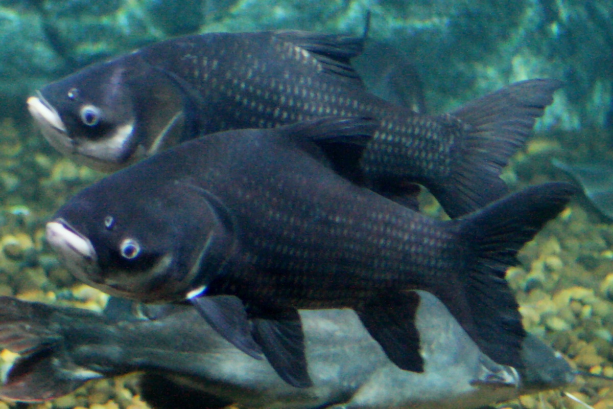
Cyprinidae is a family of freshwater fish commonly called the carp or minnow family. It includes the carps, the true minnows, and relatives like the barbs and barbels. Cyprinidae is the largest and most diverse fish family and the largest vertebrate animal family in general with about 3,000 species, of which only 1,270 remain extant, divided into about 370 genera. Cyprinids range from about 12 mm in size to the giant barb (''Catlocarpio siamensis''). By genus and species count, the family makes up more than two-thirds of the ostariophysian order Cypriniformes. The family name is derived from the Greek word ( 'carp'). Biology and ecology Cyprinids are stomachless fish with toothless jaws. Even so, food can be effectively chewed by the gill rakers of the specialized last gill bow. These pharyngeal teeth allow the fish to make chewing motions against a chewing plate formed by a bony process of the skull. The pharyngeal teeth are unique to each species and are used by scient ... [...More Info...] [...Related Items...] OR: [Wikipedia] [Google] [Baidu] |
Evapotranspiration
Evapotranspiration (ET) is the combined processes by which water moves from the earth’s surface into the atmosphere. It covers both water evaporation (movement of water to the air directly from soil, canopies, and water bodies) and transpiration (movement of water from the soil, through roots and bodies of vegetation, on leaves and then into the air). Evapotranspiration is an important part of the local water cycle and climate, as well as measurement of it plays a key role in agricultural irrigation and water resource management. Definition Evapotranspiration is a combination of evaporation and transpiration, measured in order to better understand crop water requirements, irrigation scheduling, and watershed management. The two key components of evapotranspiration are: * Evaporation: the movement of water directly to the air from sources such as the soil and water bodies. It can be affected by factors including heat, humidity, and wind speed. * Transpiration: the move ... [...More Info...] [...Related Items...] OR: [Wikipedia] [Google] [Baidu] |
Köppen Climate Classification
The Köppen climate classification is one of the most widely used climate classification systems. It was first published by German-Russian climatologist Wladimir Köppen (1846–1940) in 1884, with several later modifications by Köppen, notably in 1918 and 1936. Later, the climatologist Rudolf Geiger (1894–1981) introduced some changes to the classification system, which is thus sometimes called the Köppen–Geiger climate classification system. The Köppen climate classification divides climates into five main climate groups, with each group being divided based on seasonal precipitation and temperature patterns. The five main groups are ''A'' (tropical), ''B'' (arid), ''C'' (temperate), ''D'' (continental), and ''E'' (polar). Each group and subgroup is represented by a letter. All climates are assigned a main group (the first letter). All climates except for those in the ''E'' group are assigned a seasonal precipitation subgroup (the second letter). For example, ''Af'' indi ... [...More Info...] [...Related Items...] OR: [Wikipedia] [Google] [Baidu] |
Semi-arid Climate
A semi-arid climate, semi-desert climate, or steppe climate is a dry climate sub-type. It is located on regions that receive precipitation below potential evapotranspiration, but not as low as a desert climate. There are different kinds of semi-arid climates, depending on variables such as temperature, and they give rise to different biomes. Defining attributes of semi-arid climates A more precise definition is given by the Köppen climate classification, which treats steppe climates (''BSk'' and ''BSh'') as intermediates between desert climates (BW) and humid climates (A, C, D) in ecological characteristics and agricultural potential. Semi-arid climates tend to support short, thorny or scrubby vegetation and are usually dominated by either grasses or shrubs as it usually can't support forests. To determine if a location has a semi-arid climate, the precipitation threshold must first be determined. The method used to find the precipitation threshold (in millimeters): *multiply by ... [...More Info...] [...Related Items...] OR: [Wikipedia] [Google] [Baidu] |
Taryatu-Chulutu
Taryatu-Chulutu ( mn, Тариатын чулуут, ''tariatyn chuluut'', "rocks of Tariat") is a volcanic field in Mongolia. It is part of a volcanic area in Central Asia in the Hangai range that may be linked to the rifting of the Lake Baikal Rift. The field itself is located within the valleys of the Chuluut and Suman rivers. Volcanic activity occurred in the Miocene, Pliocene, Pleistocene and Holocene. The Khorgo cinder cone erupted during the Holocene and lava flows from it formed a lava dam generating Terkhiin Tsagaan Nuur lake. Geological context The volcanic field lies in the Taryatu depression, on the northern slope of the Hangai range. There, the field spans the river valleys of the Chuluut River, its tributary Gichigin and the Suman River rivers. The field is sometimes named ''Tariat volcanic field'' after the town of Tariat. Rivers frequently run in canyons bordered by lava plains. Tectonically, the field is located within the Tarvagatay terrane which ... [...More Info...] [...Related Items...] OR: [Wikipedia] [Google] [Baidu] |
Terkhiin Tsagaan Lake
Terkhiin Tsagaan Lake ( mn, Тэрхийн Цагаан нуур, Terkhiin Tsagaan nuur, , zh, 特尔赫查干湖, 特尔赫查干淖尔), also known as The White Lake, is a lake in the Khangai Mountains in central Mongolia. The Khorgo volcano is located near the eastern end of the lake and the Suman River The Suman gol ( mn, Суман гол) is a river in Arkhangai. It springs from the Terkhiin Tsagaan Nuur and is a tributary of the Chuluut River Chuluut River ( mn, Чулуут гол, ''stony river'') is a river flowing through the valleys ... springs from lake. The lake is located in Khorgo-Terkhiin Tsagaan Nuur National Park. See also * Taryatu-Chulutu References Lakes of Mongolia Ramsar sites in Mongolia {{Mongolia-geo-stub ... [...More Info...] [...Related Items...] OR: [Wikipedia] [Google] [Baidu] |
Ramsar Convention
The Ramsar Convention on Wetlands of International Importance Especially as Waterfowl Habitat is an international treaty for the conservation and sustainable use of Ramsar sites (wetlands). It is also known as the Convention on Wetlands. It is named after the city of Ramsar in Iran, where the convention was signed in 1971. Every three years, representatives of the contracting parties meet as the Conference of the Contracting Parties (COP), the policy-making organ of the convention which adopts decisions (resolutions and recommendations) to administer the work of the convention and improve the way in which the parties are able to implement its objectives. COP12 was held in Punta del Este, Uruguay, in 2015. COP13 was held in Dubai, United Arab Emirates, in October 2018. List of wetlands of international importance The list of wetlands of international importance included 2,331 Ramsar sites in May 2018 covering over . The countries with most sites are the United Kingdo ... [...More Info...] [...Related Items...] OR: [Wikipedia] [Google] [Baidu] |


